The best walks and hikes in Carnegie State Vehicular Recreation Area
5.0
(1)
90
hikers
3
hikes
Hikes in Carnegie State Vehicular Recreation Area explore a landscape of rolling hills and steep canyons within the Diablo Range. The terrain is characterized by dry, rocky washes and fire roads, with elevations ranging from 600 to over 3,000 feet (180 to 915 m). While the area is primarily for off-highway vehicle use, these shared-use trails offer strenuous routes for hikers.
Best hiking trails in Carnegie State Vehicular Recreation Area
- The most popular hiking route is Cedar Mountain Trail loop — Del Valle Regional Park, a 4.5 mile (7.2 km) trail that takes around 2 hours to complete. This moderate route features ascents to viewpoints over the surrounding hills.
- Another top favourite among local hiking enthusiasts is Murietta Falls — Del Valle Regional Park, a difficult 12.5 mile (20.1 km) path. The trail involves a significant elevation gain of over 3,800 feet (1,160 m).
- Local hiking enthusiasts also love the Badger Cove loop from Del Valle Regional Park, a 3.0 mile (4.8 km) trail leading through open grasslands, often completed in about 1 hour 15 minutes.
- Hiking in Carnegie State Vehicular Recreation Area is defined by rugged canyons, rolling grasslands, and steep fire roads. The trail network provides options for different ability levels, from shorter loops to more demanding climbs.
- The routes in Carnegie State Vehicular Recreation Area are highly rated by the komoot community with an average score of 5.0 stars from a small number of reviews. More than 60 hikers have used komoot to explore Carnegie State Vehicular Recreation Area's varied terrain.
Last updated: October 11, 2026
3.43km
01:00
70m
130m
Easy hike. Great for any fitness level. Easily-accessible paths. Suitable for all skill levels.
3
hikers
7.22km
02:05
180m
180m
Moderate hike. Good fitness required. Easily-accessible paths. Suitable for all skill levels.

9
hikers
12.4km
03:38
340m
340m
Moderate hike. Good fitness required. Easily-accessible paths. Suitable for all skill levels.
7
hikers
15.6km
05:30
1,190m
290m
Hard hike. Very good fitness required. Easily-accessible paths. Suitable for all skill levels.
5
hikers
5.47km
01:32
100m
110m
Easy hike. Great for any fitness level. Easily-accessible paths. Suitable for all skill levels.
Our route recommendations are based on thousands of hikes, rides, and runs completed by other people on komoot.
Start today with a free account
Your next adventure awaits.
Popular around Carnegie State Vehicular Recreation Area

Tips from the Community

Rose Peak (3,817 feet) is the highest mountain of the East Bay Regional Parks system and together with nearby Discovery Peak is the highest legally accessible point in Alameda County. Although not tall by California standards, it is one of the tallest mountains in the Bay Area and high enough to receive dustings of snow several times a year. You can start from Del Valle on the Vallecitos Trail as an overnight hike with camping. If you’re hiking this as a day hike, park near the Rocky Ridge Visitor Center and start on the Sailor Camp Trail. You’ll need an Ohlone Wilderness Regional Trail Permit for each person in your party. They must possess and carry the permit, which actually doubles as a detailed map and is good for one year. You can get a permit at the Del Valle Regional Park, but your best bet is to order it in advance online: https://www.ebparks.org/parks/ohlone The Ohlone Wilderness Regional Trail Hiking Permit/Map is required for both day use and camping/backpacking for each person, ages 12 and over. The permit is valid for one year from the date of purchase: In-person Locations: Del Valle Park entrance kiosk, Sunol Visitor Center and/or Sunol entrance kiosk (when staffed), Coyote Hills Visitor Center (Fremont), or at the EBRPD Administration Offices (Oakland). Hours vary for each location. Online: Ohlone Wilderness Permit (1 Year) By Phone: call the Reservations Department at 1-888-327-2757, option 2. By Mail: Send your name, address, phone number and check payable to EBRPD to The Reservations Department, EBRPD, 2950 Peralta Oaks Court, Oakland, CA 94605-0381. If purchasing by phone, online or by mail, the Ohlone Wilderness Regional Trail Hiking Permit/Map should be purchased at least 7 days in advance of your planned trip to allow time for mailing. If under 7 days, you should plan to purchase your Ohlone Permit from one of the locations listed above. Fee for in-person purchase is $2/person/year; by mail/phone/online $4/person/year for first five permits and $3/person/year for each additional permit after five. Overnight camping is at designated campsites only, and requires a reservation. Call 1-888-EBPARKS or 1-888-327-2757, press option 2 to reserve a campsite. Backpacking tent campsites are $5 per person, plus $8 reservation fee per group. https://www.reserveamerica.com/explore/sunol/EB/110028/campsites
0
0

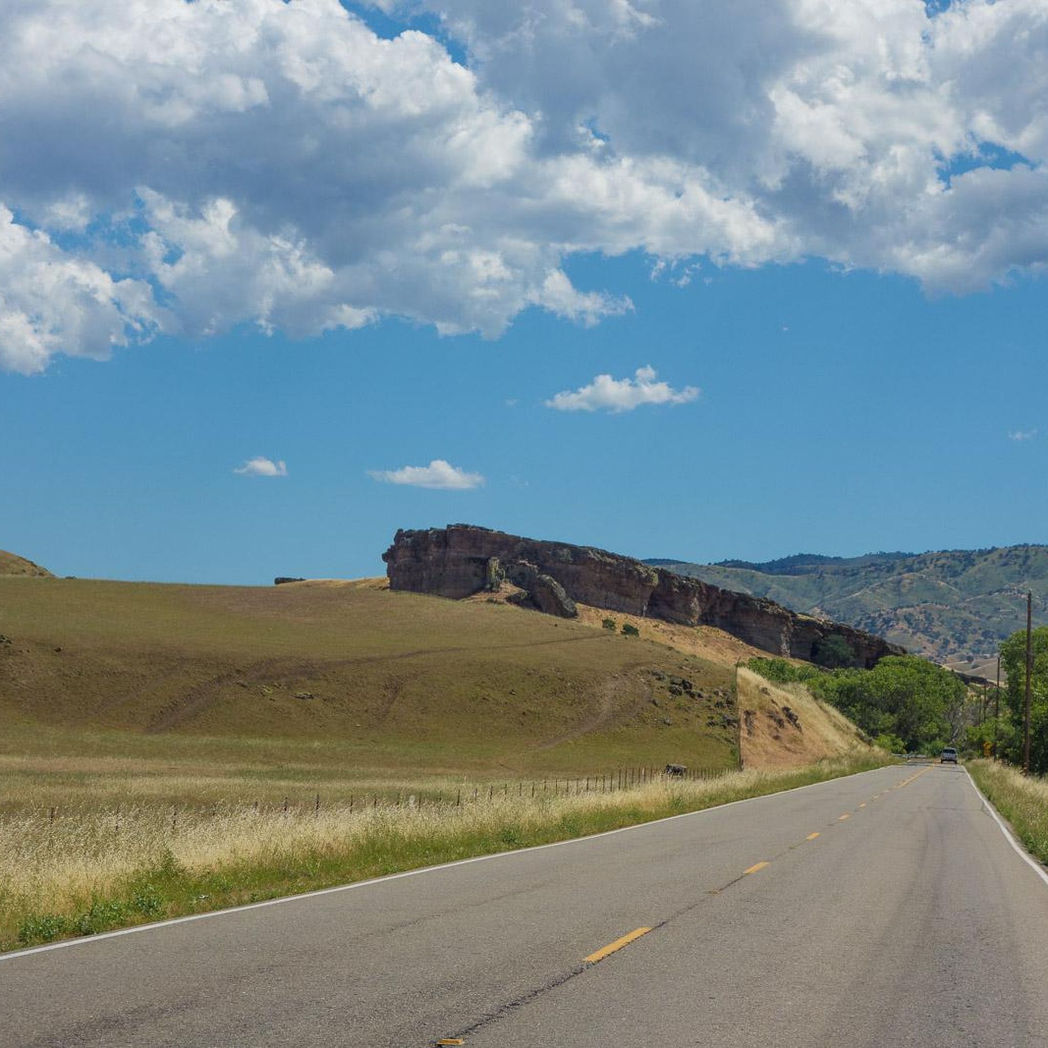
The shore of the Arroyo Valle offers splendid views of the surrounding desert hills and the watercourse.
0
0

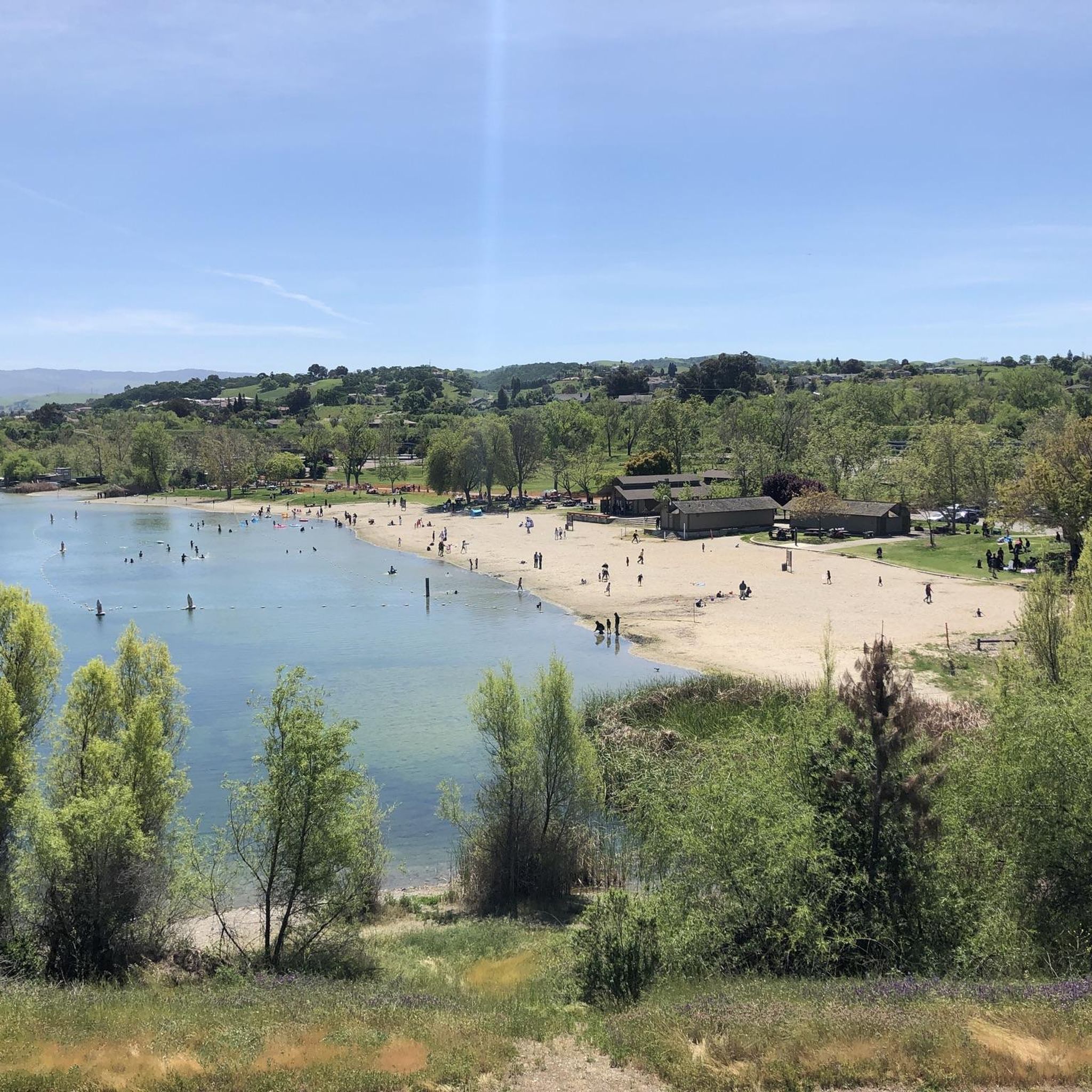
Badger Cove is a small bay on Lake Del Valle. The East Shore Trail is one of the highlights of Del Valle State Recreation Area, and it offers views of the cove from between the trees. The Ridgeline Trail is another path on the property that offers great views of the cove and lake from a higher vantage point.
0
0
Badger Cove is a small bay on Lake Del Valle. The East Shore Trail is one of the highlights of Del Valle State Recreation Area, and it offers views of the cove from between the trees. The Ridgeline Trail is another path on the property that offers great views of the cove and lake from a higher vantage point.
0
0
Frequently Asked Questions
Can you hike at Carnegie State Vehicular Recreation Area?
Yes, hiking is permitted, but it's important to know that the park primarily serves off-highway vehicles (OHVs). There are currently no dedicated hiking-only trails, so you will be sharing the paths with motorized traffic, which can travel in both directions. Always stay alert and be aware of your surroundings.
Are there any easy hikes for beginners?
Yes, the area offers some less strenuous options. While many trails are rugged, you can find routes suitable for an easier day out. For example, the Badger Cove loop from Del Valle Regional Park is a relatively flat 3-mile (4.8 km) trail through open grasslands that can be completed in about an hour.
What are the rules for hikers in the park?
Hikers must share multi-use trails with motorized vehicles and should exercise extreme caution. It's recommended to visit on weekdays when there is less vehicle traffic. For the most current park regulations, trail closures, and safety information, it is best to check the official Carnegie SVRA website before your visit.
Where can I find a trail map for hiking?
You can find a detailed map of the park's trail system on the official California Parks website. This map shows the layout of the trails, which is essential for planning your hike and navigating the shared-use environment. You can download it here: Carnegie SVRA Trail Map.
Are dogs allowed on the trails?
Yes, dogs are permitted in the park but must be kept on a leash no longer than six feet at all times. Due to the presence of off-highway vehicles and rugged terrain, you should ensure your dog is comfortable in this type of environment and always keep them close to you for their safety.
Is there a challenging hike for experienced hikers?
Absolutely. The terrain in the Diablo Range offers significant challenges. For a strenuous outing, consider the Murietta Falls — Del Valle Regional Park trail. This is a demanding 12.5-mile (20.1 km) hike with an elevation gain of over 3,800 feet (1,160 m), requiring a high level of fitness.
What is the terrain like for hiking?
The landscape is defined by the rolling hills and steep, rugged canyons of the Diablo Range. Trails are often dry, rocky fire roads and washes. Elevations range from around 600 to over 3,000 feet, so be prepared for strenuous climbs and descents on most routes.
Are there any circular walks available?
Yes, there are several loop trails that bring you back to your starting point. A good moderate option is the Ridgeline Trail loop — Del Valle Regional Park. It's a 5.3-mile (8.5 km) loop that offers great views from the ridges.
What is the best time of year to see wildflowers?
Spring is the most vibrant season in Carnegie SVRA. During this time, the park's grassy hills and canyons are often decorated with a variety of wildflowers, adding beautiful color to the rugged landscape. Cooler temperatures also make for more pleasant hiking conditions.
Is camping available at the park?
Yes, Carnegie SVRA has a campground with sites available on a first-come, first-served basis. It's a popular option for those wanting to spend a full weekend exploring the area. For more details on amenities and fees, you can visit the official camping information page.
Are there any areas specifically for non-motorized activities?
While most of the park is open to OHVs, the 'Limited Recreation Overlay — Waterfall Canyon' area has restrictions on vehicle use for water quality management. This makes it a quieter area for hiking. Additionally, the adjacent Alameda-Tesla property is being developed into a new park focused on low-impact recreation like hiking.
Most popular routes in Carnegie State Vehicular Recreation Area

Get inspired with the komoot mobile app


Explore more
Browse the best Hikes in other regions.
