The best road cycling routes in Farny State Park
4.6
(21)
154
riders
17
rides
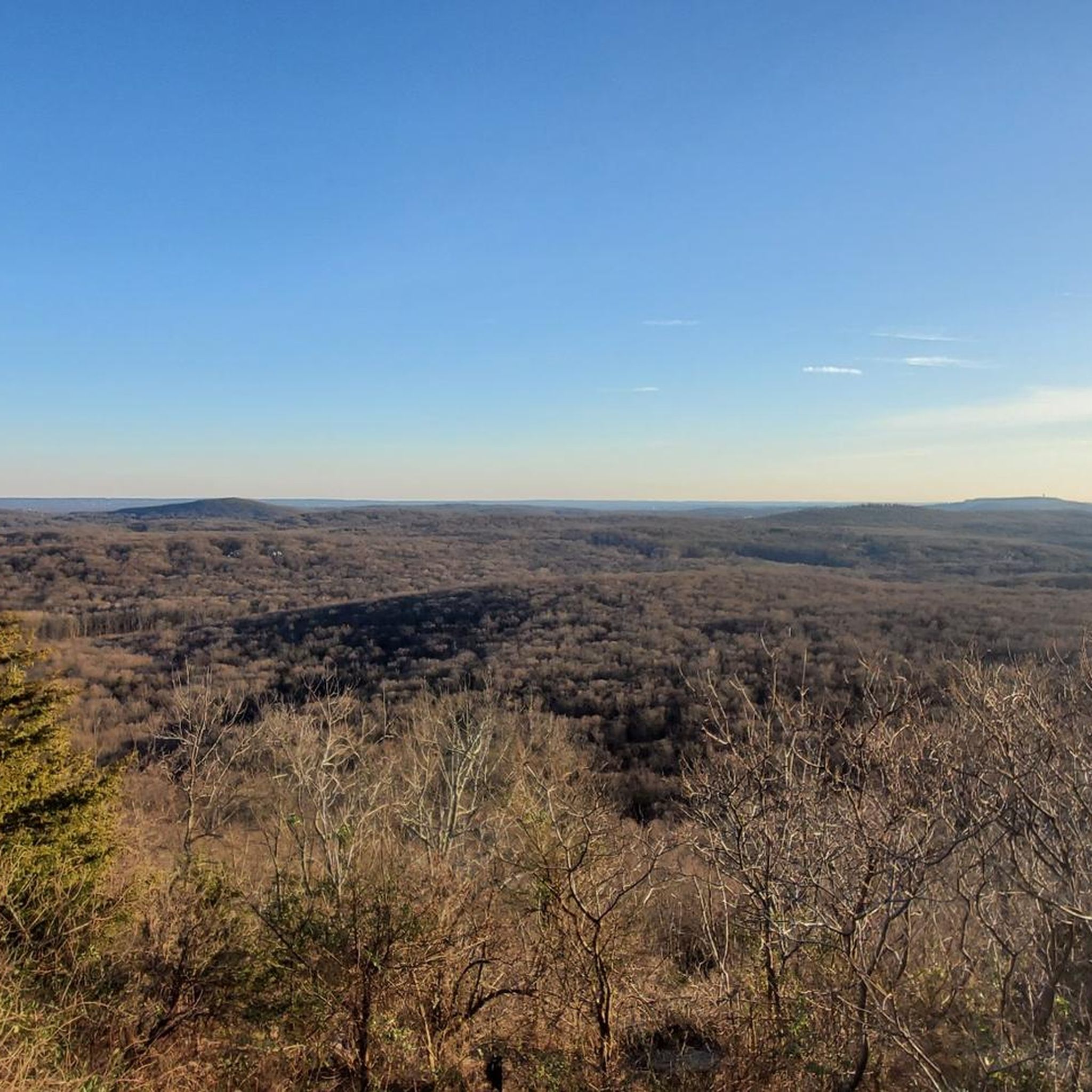
Road cycling routes in Farny State Park navigate a region characterized by hilly terrain, mixed oak hardwood forests, and large rock outcrops. While the park itself contains rugged, unpaved wilderness, the surrounding area offers paved roads suitable for road cycling. Routes often feature elevation changes and pass by natural features like reservoirs and streams. The landscape provides a varied backdrop for road cyclists.
Best road cycling routes in Farny State Park
- The most popular road cycling route is Fitzgerald Falls – Greenwood Lake loop from Wide Dirt Pulloff, a 55.2 miles (88.9 km) trail that takes 4 hours 12 minutes to complete. This moderate route features significant elevation gain.
- Another top favourite among local road cyclists is Upper Greenwood Lake – Holland Mountain Road Climb (Brutal but awesome) loop from Wide Dirt Pulloff, a moderate 42.8 miles (68.8 km) path. This route includes challenging climbs and scenic views around Upper Greenwood Lake.
- Local road cyclists also love the Taylortown Reservoir – Rockaway River loop from Tourne County Park, a 34.4 miles (55.3 km) trail leading through forested areas and past water bodies, often completed in about 2 hours 33 minutes.
- Road cycling in Farny State Park is defined by hilly terrain, mixed forests, and routes that often skirt reservoirs. The network offers options for different ability levels, from easier loops to more challenging climbs.
- The routes in Farny State Park are highly rated by the komoot community with an average score of 4.4 stars from over 16 reviews. More than 200 road cyclists have used komoot to explore Farny State Park's varied terrain.
Last updated: July 12, 2026
6
riders
The Upper Greenwood Lake – Holland Mountain Road Climb loop is a demanding road cycling adventure that lives up to its "Brutal but awesome" name. You'll traverse a mix of rolling hills and significant ascents, with roads winding through dense wooded areas and offering scenic views of Upper Greenwood Lake and the Monksville Reservoir. The route's defining feature is the Holland Mountain Road Climb, a sustained effort that tests your limits but delivers a rewarding experience through picturesque New Jersey landscapes.
This 42.8-mile (68.8 km) loop, with its 2039 feet (621 metres) of elevation gain, is rated moderate and typically takes around 3 hours and 4 minutes. The starting point at the Wide Dirt Pulloff implies a more informal access point, so plan for roadside parking. Given the challenging nature of the ride and the potential for steep grades, it's crucial to bring plenty of water and ensure your bike is in top condition. Spring and autumn are generally the best times to cycle, offering pleasant temperatures for tackling the climbs.
This route stands out among challenging road cycling climbs in the Upper Greenwood Lake area NJ, offering a rigorous workout for cyclists with very good fitness. The region is known for its diverse terrain, from lakeside paths to demanding ascents, making it a prime location for those seeking advanced road cycling routes near Upper Greenwood Lake. While specific details about the Holland Mountain Road Climb cycling profile are locally known, the area's reputation for significant elevation changes ensures a memorable and tough ride.
5
riders
64.7km
02:50
550m
550m
Moderate road ride. Good fitness required. Mostly well-paved surfaces and easy to ride.

Sign up for free
7
riders
55.3km
02:33
500m
500m
Moderate road ride. Good fitness required. Mostly well-paved surfaces and easy to ride.
7
riders
22.9km
00:57
120m
120m
The Dogwood Pond loop from Oak Ridge offers a pleasant road cycling experience, likely winding through forested areas with gentle rolling hills. You can expect a relaxing ride, perhaps catching glimpses of a pond or reservoir along the way, making it a great option for a leisurely outing. This route is designed for easy cruising, allowing you to soak in the natural surroundings without strenuous effort.
This easy road cycling route covers 14.3 miles (22.9 km) with a minimal 380 feet (116 metres) of elevation gain, taking approximately 57 minutes to complete. It's an ideal choice for beginner road cyclists or families looking for a comfortable ride. Parking access should be straightforward, and the route is generally suitable for cycling during most seasons, with spring and fall offering particularly scenic conditions.
Road cycling routes in the broader Oak Ridge area often feature well-paved surfaces and scenic backdrops of woodlands and water bodies, providing a refreshing escape into nature. While specific landmarks for this particular loop are not detailed, the region is known for its greenway systems and recreational opportunities, making it a popular spot for outdoor activities like cycling.
5
riders
44.4km
01:57
320m
320m
If you're looking for a pleasant road cycling experience in New Jersey, the Mount Laurel Lake loop from Oak Ridge offers a moderate 27.6-mile (44.4 km) ride. This route guides you along mostly paved surfaces, with the highlight being the scenic stretch beside Mount Laurel Lake. Here, you can enjoy picturesque views, spot local wildlife like deer and geese, and navigate gentle twists and turns, including a notable straightaway across a dam. While generally smooth, be prepared for a short half-mile section that has been reported as pitted.
Planning your visit is key to enjoying this popular bike route. To avoid crowds, especially around the lake, aim for a weekday ride before 5 PM. The route is well-suited for road bikes, and with 1056 feet (322 metres) of elevation gain, it's a manageable challenge that takes approximately 1 hour and 56 minutes. Parking is typically available in the Oak Ridge area, making it a convenient starting point.
This Mount Laurel Lake loop road cycling route is a great way to explore the local landscape, offering a mix of open roads and lakeside views. The presence of benches and picnic tables along the lake path suggests opportunities for short breaks. While the name includes "Oak Ridge" might suggest off-road trails, this specific Komoot route is designed for road cycling, providing a smooth experience distinct from the rugged mountain biking trails often found in other "Oak Ridge" areas.
Get access to more routes and recommendations from other explorers.
Sign up for free
Already have an account?
Our route recommendations are based on thousands of hikes, rides, and runs completed by other people on komoot.
Start today with a free account
Your next adventure awaits.
Login or Signup
Popular around Farny State Park


Tips from the Community

The border between New York and New Jersey runs to the middle of the 7-mile long Greenwood Lake. The area has been popular with tourists for decades, including Babe Ruth, who visited the area frequently in the 1930s and 40s. These days visitors will find many marinas and restaurants dotted along its shores, beckoning them to stop for a while.
0
0

Mount Laurel Lake is an extension of the much larger Upper Greenwood Lake. Mount Laurel Lake is connected to the larger lake at the southern end and can be viewed from the Warwick Turnpike as you bike by.
0
0

The Morris Canal runs under Main Road at the intersection of Valhalla Road and is marked with a humble sign. This canal was built in 1823, carried tons of raw materials, and was an important part of the local history here.
0
0
The Rockaway River, spanning about 35 miles, is a tributary of the Passaic River. In the 19th century, it played an important role as an industrial transportation link, connecting to the Morris Canal near Wharton, which was a big part of the shipping of coal and iron ore between Pennsylvania and New York City. While historically there were pollution issues, the isolated upper course of the river is now a popular site for smallmouth bass fishing.
0
0

Good view of the Rockaway River as you go over this bridge. The Rockaway River is a tributary of the Passaic River. The upper course of the river flows through these wooded areas, whereas the lower course flows through the populated New Jersey suburbs and former industrial areas.
0
0

Taylortown Reservoir is a public water supply system owned by the town of Boonton. Its beautiful surrounding nature and the Orange Trail leading along the western side of the reservoir make it a nice spot to visit in Pyramid Mountain Natural Historic Area.
0
0
Good view of the Rockaway River as you go over this bridge. The Rockaway River is a tributary of the Passaic River. The upper course of the river flows through these wooded areas, whereas the lower course flows through the populated New Jersey suburbs and former industrial areas.
0
0

On East Shore Road, you ride with nice views of the lake.
0
0
Frequently Asked Questions
What kind of terrain can I expect on road cycling routes around Farny State Park?
The road cycling routes in the area surrounding Farny State Park are characterized by hilly terrain, mixed oak hardwood forests, and large rock outcrops. While the park itself is rugged and unpaved, the routes utilize paved roads in the surrounding region, often featuring significant elevation changes and passing by natural features like reservoirs and streams.
How many road cycling routes are available in the Farny State Park area?
There are 23 road cycling routes available in the Farny State Park area, catering to various skill levels. This includes 9 easy routes and 14 moderate routes, ensuring options for different abilities.
Are there any easy road cycling routes suitable for beginners or a more relaxed ride?
Yes, there are 9 easy road cycling routes in the area. An example of a less challenging route is the Dogwood Pond loop from Oak Ridge, which is 14.3 miles (22.9 km) long and features less elevation gain.
What are some popular moderate road cycling routes with challenging climbs?
For those seeking more challenging rides, popular moderate routes include the Fitzgerald Falls – Greenwood Lake loop from Wide Dirt Pulloff, a 55.2-mile (88.9 km) trail with significant elevation gain. Another favorite is the Upper Greenwood Lake – Holland Mountain Road Climb (Brutal but awesome) loop from Wide Dirt Pulloff, known for its challenging climbs and scenic views.
Can I bring my dog on these road cycling routes?
While the routes themselves are on public roads, Farny State Park itself has regulations regarding pets. It's best to check specific local ordinances for any restrictions on pets on paved roads in the surrounding areas. Always ensure your dog is leashed and you clean up after them.
Are the road cycling routes suitable for families with children?
The suitability for families depends on the route's difficulty and traffic conditions. While there are 9 easy routes, the hilly terrain and potential for traffic on paved roads mean that routes should be chosen carefully. Consider shorter, less trafficked options if cycling with children. The Dogwood Pond loop from Oak Ridge might be a more manageable option for families.
What kind of views or natural features can I expect to see along the road cycling routes?
The routes often pass by natural features such as reservoirs and streams, offering scenic views of the mixed oak hardwood forests and large rock outcrops characteristic of the region. You might encounter views around Splitrock Reservoir or Upper Greenwood Lake, depending on your chosen route.
What do other road cyclists think about the routes in the Farny State Park area?
The road cycling routes in the Farny State Park area are highly rated by the komoot community, with an average score of 4.4 stars from over 16 reviews. Over 200 road cyclists have used komoot to explore the varied terrain, often praising the challenging climbs and scenic beauty of the region.
Is Farny State Park itself suitable for road cycling?
Farny State Park is primarily known for its rugged, unpaved wilderness, making its internal pathways unsuitable for traditional road cycling. The park's terrain is better suited for activities like hiking and mountain biking, with trails featuring steep rocky sections and variable surfaces. Road cycling is best enjoyed on the paved roads in the surrounding area.
Are there any loop routes available for road cycling?
Yes, many of the road cycling routes in the area are designed as loops. Examples include the popular Fitzgerald Falls – Greenwood Lake loop from Wide Dirt Pulloff and the Taylortown Reservoir – Rockaway River loop from Tourne County Park, which offers a 34.4-mile (55.3 km) ride through forested areas and past water bodies.
What is the best season for road cycling in the Farny State Park area?
The region's mixed oak hardwood forests suggest beautiful scenery during spring and fall, with vibrant foliage. Summer offers warmer temperatures, while winter might be suitable for cross-country skiing within the park, but road cycling conditions would depend on snow and ice. Spring through fall generally provides the most favorable conditions for road cycling.
Are there any specific permits required for road cycling in the area?
Road cycling on the paved public roads surrounding Farny State Park typically does not require special permits. However, if you plan to access any specific private lands or watershed areas that might intersect with a route, it's always advisable to check for any local permit requirements beforehand.
Most popular routes in Farny State Park

Get inspired with the komoot mobile app


Explore more
Browse the best Road cycling routes in other regions.
