The best road cycling routes in Teague Hill Open Space Preserve
4.6
(105)
6,058
riders
80
rides
Road cycling routes in Teague Hill Open Space Preserve traverse an area characterized by a mix of oak, madrone, and Douglas-fir woodlands, with some towering redwoods. The terrain includes varied forests and steep ravines, offering a diverse landscape for road cyclists. While the preserve itself is primarily for hiking, the surrounding roads provide access to these natural features. The region's topography includes ascents and descents through forested hillsides.
Best road cycling routes in Teague Hill Open Space Preserve
- The most…
Last updated: July 9, 2026
84
riders
60.2km
03:20
1,210m
1,210m
Hard road ride. Very good fitness required. Mostly well-paved surfaces and easy to ride.
25
riders
Moderate road ride. Good fitness required. Some segments of this route may be unpaved and difficult to ride.

Sign up for free
5.0
(1)
12
riders
If you're looking for challenging bike rides in the Woodside area, the Lower Kings Mountain Road – Woodside Store (Historic Site) loop delivers a rewarding experience. You'll pedal through majestic…
5.0
(5)
42
riders
27.9km
01:16
280m
280m
Easy road ride. Great for any fitness level. Mostly well-paved surfaces and easy to ride.
24
riders
19.6km
01:14
500m
500m
The Old La Honda Road loop from Woodside offers a quintessential Bay Area road cycling experience, renowned for its challenging yet rewarding climb. You'll pedal through a verdant tunnel of…
Get access to more routes and recommendations from other explorers.
Sign up for free
Already have an account?
Our route recommendations are based on thousands of hikes, rides, and runs completed by other people on komoot.
Start today with a free account
Your next adventure awaits.
Login or Signup


Tips from the Community

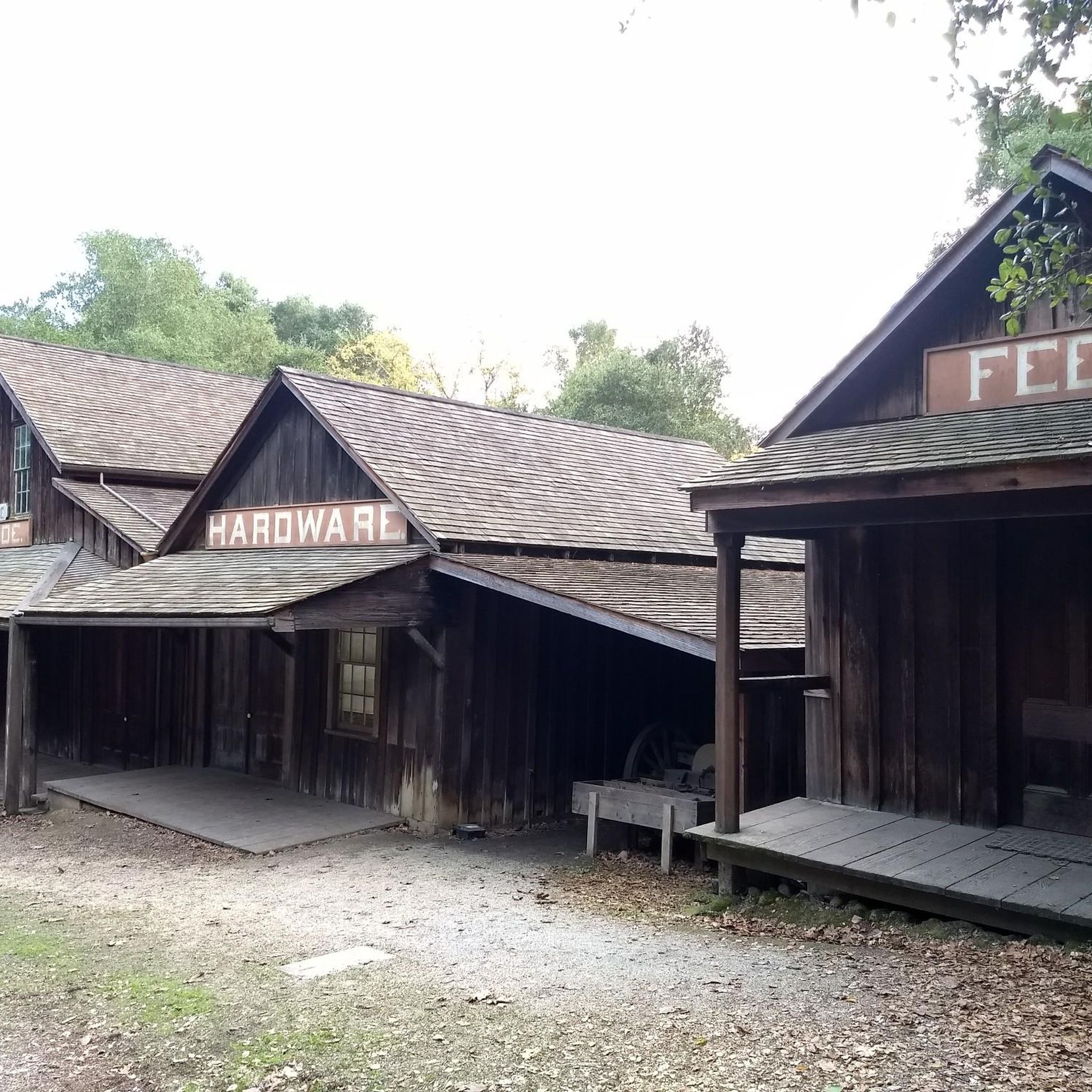
Once upon a time this was the only general store in this area, serving not only as a general-purpose retailer but also the post office, bank, and informal dentist's office. Nowadays it's a museum, staffed by docents ready to offer drop-in history lessons.
0
0

The Bike Hut is a small hut with fresh water, organic teas and coffee and a variety of snacks for cyclist passing by. It is self-serve and open 24/7. There is also a small picnic area, a bathroom and a message board for posting road conditions or notes to fellow cyclists.
0
0

Didn’t OLR used to turn into Dirt before reaching Skyline? Is it all pavement now?? Scott
0
0

Woodside Store was built back in the 1850s by two pioneers who came to California for the gold rush. At the time it was the only stagecoach stop between San Francisco and Santa Clara, and it carried all the essential items that travelers riding between cities might need. The store has been restored, inside and out, to look exactly as it did centuries ago. You can call the museum ahead of your trip to book tours.
0
0

This charming park is just 3.5 miles west of Highway 84. There are barbecue pits, a playground, spacious grassy meadows, and plenty of hiking and riding trails. It's an ideal destination for a picnic or a peaceful stroll through the enchanting redwood forest along the park's beautiful winding paths. Dogs are not allowed in the park, so you'll need to leave your pup at home.
0
0

Purisima Creek Trailhead features a fence separating the trail from the road and a small pit toilet at the base. Parking is available just 250 feet southeast along Skyline Boulevard. This trail offers everything, from stunning views to towering redwoods, fern-filled canyons, and creeks. Riding through the redwoods is a unique experience.
0
0
Skyline Boulevard, also known as State Route 35, offers a scenic drive through the majestic redwoods of the Santa Cruz Mountains and Bay Area. Winding through forests, open spaces, and mountains, this section passes by the Purisima Creek Redwoods. It's a breathtaking ride through where the redwoods meet the road.
0
0
Frequently Asked Questions
Can I road cycle directly within Teague Hill Open Space Preserve?
No, road cycling is not permitted within the boundaries of Teague Hill Open Space Preserve itself. The preserve is primarily designated for hiking and equestrian activities. However, the surrounding roads offer excellent road cycling opportunities that allow you to experience the region's natural beauty.
How many road cycling routes are available in the Teague Hill Open Space Preserve area?
There are over 80 road cycling routes available in the area surrounding Teague Hill Open Space Preserve, catering to various skill levels. This includes 31 easy routes, 41 moderate routes, and 11 difficult routes, ensuring options for every cyclist.
What kind of terrain can I expect on road cycling routes near Teague Hill Open Space Preserve?
The road cycling routes in this region feature a diverse landscape, characterized by oak, madrone, and Douglas-fir woodlands, with some towering redwoods. You can expect varied terrain with significant ascents and descents through forested hillsides and steep ravines.
Are there any challenging road cycling routes for experienced riders?
Yes, for experienced riders seeking a challenge, routes like the Lobitos Creek Road – Higgins Canyon Road loop from Skeggs Point offer extensive climbs and descents over 58.3 km, providing a demanding ride through varied landscapes and higher elevation views.
What are some moderate road cycling options in the area?
Moderate options include the Lower Kings Mountain Road – Kings Mountain Road loop from Teague Hill Open Space Preserve, which is 14.0 km with significant elevation gain through forested roads. Another popular choice is the Skyline Trailhead & Boulevard – Purisima Creek Trailhead loop from Phleger Estate (GGNRA), a 31.4 km route with consistent elevation changes through woodlands.
What do other road cyclists enjoy most about the routes around Teague Hill Open Space Preserve?
The road cycling routes in this area are highly rated by the komoot community, with an average score of 4.5 stars from over 90 reviews. Cyclists often praise the beautiful forested roads, the varied terrain, and the peaceful environment that allows for glimpses of local wildlife and diverse plant species.
Are there any notable natural features or landmarks visible from the road cycling routes?
While cycling is outside the preserve, the routes often pass through areas with similar natural beauty. You can expect to see beautiful oak and madrone woodlands, towering redwoods, and potentially spot the rare Kings Mountain Manzanita. The region's history, including its past logging industry, also adds to its character.
What is the best time of year to go road cycling near Teague Hill Open Space Preserve?
The region generally offers pleasant cycling conditions for much of the year. However, spring and fall often provide the most comfortable temperatures and vibrant scenery, with lush greenery and active wildlife. Summer can be warm, while winter might bring rain, so checking local weather is always recommended.
Are there any loop options for road cyclists?
Yes, many routes in the area are designed as loops. For instance, the Old La Honda Road loop from Woodside is a popular 19.8 km moderate route, offering a complete circular experience through the scenic landscape.
What are the elevation changes like on these road cycling routes?
The routes around Teague Hill Open Space Preserve are known for their significant elevation changes. You'll encounter both challenging ascents and rewarding descents, with some routes featuring over 1000 meters of climbing, providing a good workout and panoramic views.
Are there any routes that connect to other open spaces?
While the Bay Area Ridge Trail passes through Teague Hill Open Space Preserve itself (for hiking), the surrounding road network provides access to a broader regional cycling experience, connecting you to areas near other open spaces like San Mateo County's Wunderlich Park and Midpen's El Corte de Madera Open Space Preserve.
Most popular routes in Teague Hill Open Space Preserve

Get inspired with the komoot mobile app


Explore more
Browse the best Road cycling routes in other regions.
