The best cycling routes in Del Valle Regional Park
4.6
(32)
565
riders
62
rides
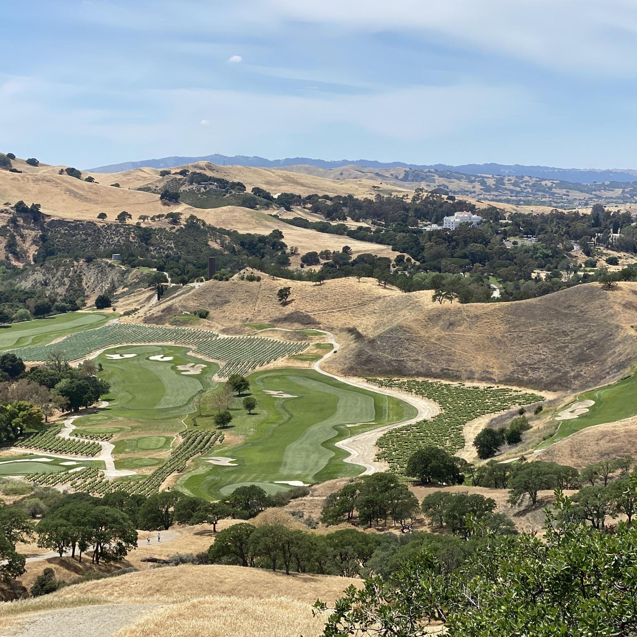
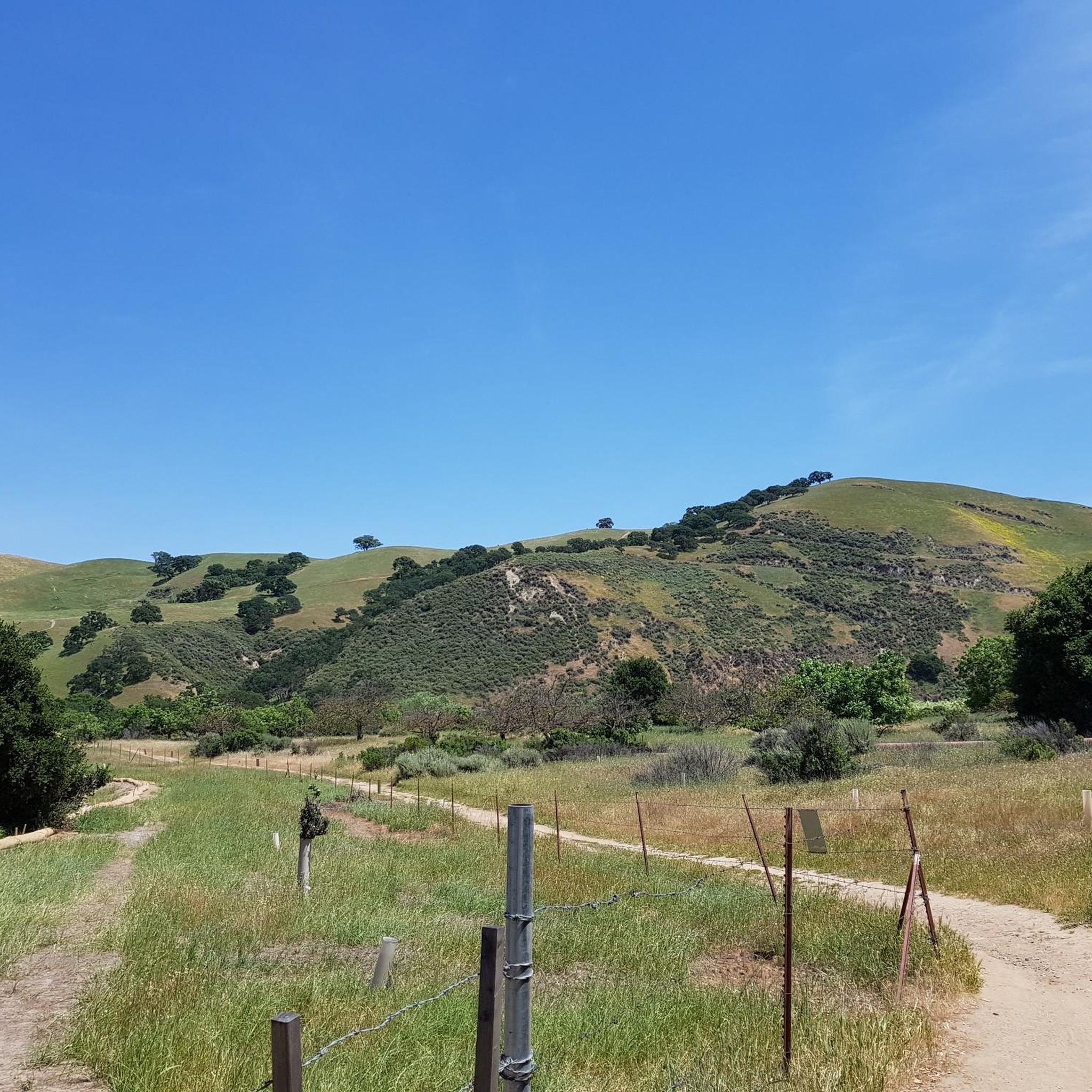
Touring cycling in Del Valle Regional Park features a diverse landscape centered around the 5-mile-long Lake Del Valle. The terrain includes chaparral-covered hills, oak woodlands, and varied elevations ranging from mostly flat sections around the lake to steep ridges and canyons. Sedimentary cliffs are also present, particularly along Arroyo Road, adding to the park's distinct geological features. The extensive trail network offers routes with both well-paved surfaces and challenging climbs.
Best touring cycling routes in Del Valle Regional Park
- The most popular touring cycling route is Lake Del Valle – Viewpoint on the Lake loop from Del Valle Regional Park, a 14.4 miles (23.2 km) trail that takes 2 hours 29 minutes to complete. This difficult route offers extensive views of Lake Del Valle and the surrounding hills.
- Another top favourite among local touring cyclists is Sycamore Grove Park – Olivina Gate loop from Del Valle Regional Park, a difficult 23.8 miles (38.3 km) path. This longer route provides a challenging experience through varied terrain with significant elevation changes.
- Local touring cyclists also love the Badger Cove – Lake Del Valle loop from Vinsanto II, a 13.7 miles (22.0 km) trail leading through chaparral-covered hills and offering views of Badger Cove, often completed in about 2 hours 28 minutes.
- Touring cycling in Del Valle Regional Park is defined by Lake Del Valle, chaparral-covered hills, and oak woodlands. The network offers options for easy, moderate, and difficult routes, catering to various ability levels.
- The routes in Del Valle Regional Park are highly rated by the komoot community with an average score of 4.4 stars from over 10 reviews. More than 400 touring cyclists have used komoot to explore Del Valle Regional Park's varied terrain.
Last updated: July 8, 2026
25
riders
17.5km
01:55
500m
500m
The Ridgeline Trail loop from Del Valle Regional Park offers a truly rewarding touring cycling experience, especially if you appreciate expansive views and a good climb. You'll navigate primarily dirt and loose gravel fire roads, winding through sunny oak woodlands and past grazing cattle. The highlight is undoubtedly the panoramic vistas of Lake Del Valle from above, a stunning payoff for your efforts.
This difficult 10.9-mile (17.5 km) route involves a significant 1640 feet (500 metres) of elevation gain, which you can expect to complete in about 1 hour and 55 minutes. Be prepared for a steep initial ascent on the Ridgeline Trail itself. For the best experience, plan your ride during spring, fall, or winter to avoid the intense summer heat, as shade is limited along the route.
What makes this route stand out among popular cycling trails near Del Valle Regional Park is its combination of challenging terrain and consistently praised scenic beauty. While not overly technical, the unpaved surfaces and elevation profile make it ideal for gravel bikes and touring cyclists seeking a robust off-road adventure rather than a casual spin. It's a fantastic option for those looking for challenging cycling routes with a big visual reward.
25
riders
The Lake Del Valle – East Shore Trail Viewpoint loop offers a challenging touring cycling experience, taking you along the scenic eastern shore of Lake Del Valle. You'll navigate a mix of dirt roads and gravel, winding through chaparral-covered hills and past golden-brown grassy slopes, with picturesque views of the lake and surrounding Tri-Valley. Expect a demanding ride with significant elevation changes, including steep ascents that will test your endurance.
This difficult 18.8-mile (30.3 km) route involves 2378 feet (725 metres) of elevation gain and typically takes around 3 hours and 9 minutes. Due to limited shade and potentially very hot conditions, it's best to tackle this ride in spring, autumn, or winter. Be sure to carry ample water, as cell service can be limited in the park.
The trail's primary appeal lies in its stunning lake views and the natural beauty of the surrounding hills, offering a rewarding workout for experienced touring cyclists. While popular, the unpaved and often steep terrain makes it a less suitable option for beginners or those with traditional road bikes, but perfect if you're seeking a robust off-road challenge.

Sign up for free
4.8
(6)
20
riders
35.6km
02:16
210m
210m
The Sycamore Grove Park – Olivina Gate loop from Camp Arroyo Pool is a fantastic touring cycling route that immerses you in the diverse landscapes of south Livermore. You'll pedal through picturesque sycamore and oak woodlands, open grasslands, and alongside the Arroyo del Valle streambed. The route offers a mix of paved and unpaved paths, leading you past the historic ruins of the Olivina Winery and providing scenic vistas of the Diablo Range.
This moderate 22.1-mile (35.6 km) cycling route, with 698 feet (213 metres) of elevation gain, typically takes about 2 hours and 15 minutes to complete. While much of the ride is gentle, be prepared for some uneven terrain and small hills on the dirt sections. Always check the park's trail map for any specific cycling restrictions, especially on singletrack paths, and consider an early start to secure parking and enjoy cooler temperatures.
Sycamore Grove Park is renowned for its preserved sycamore alluvial woodlands, a vital California ecosystem, and its rich biodiversity, including deer and various bird species. The park's blend of natural beauty and historical elements, like the Olivina Winery ruins, makes this loop a notable and engaging experience for touring cyclists exploring the Livermore area.
5.0
(2)
27
riders
38.2km
03:10
610m
610m
The Sycamore Grove Park – Olivina Gate loop from Del Valle Regional Park offers a diverse touring cycling experience, blending paved and dirt trails through California's native sycamore and oak woodlands. You'll cycle along the Arroyo del Valle streambed, pass the historical ruins of the old Olivina Winery, and climb to vistas offering views of the Diablo Range. This route provides a rewarding journey through varied terrain, perfect for cyclists who appreciate both natural beauty and a good challenge.
Planning your ride requires a bit of foresight, as there is a parking fee for Sycamore Grove Park, payable at kiosks. The connection to Del Valle Regional Park allows for a broader exploration, but be ready for some steep sections on the unpaved trails. It's wise to carry plenty of water, especially on this difficult 23.7-mile (38.2 km) route with 1988 feet (606 metres) of elevation gain, which typically takes around 3 hours and 10 minutes.
This area is notable for preserving one of the few remaining sycamore alluvial woodlands in the East Bay, supporting a rich array of wildlife like deer and various birds. The historical significance of the Olivina Winery ruins adds another layer to your ride. The flexibility to choose between easier paved paths and more demanding off-road sections makes this a versatile option for touring cyclists in the Livermore area.
22
riders
The Southern Livermore Hills – East Shore Trail Viewpoint loop offers a dynamic touring cycling experience, winding through diverse terrain that transitions from dirt and gravel fire roads to narrower single-track. You'll be treated to stunning clear blue views of Lake Del Valle, set against a backdrop of golden-brown hills and green oak trees, making for a truly scenic ride over its 15.3 miles (24.6 km).
Prepare for a challenging ride with significant elevation changes, including an initial steep climb from the Camp Arroyo Pool area, which can hit grades over 20%. Given the varied surfaces, this difficult route is best tackled on a touring bike with robust tires, like a gravel or mountain bike. Remember to download offline maps, as cell service can be spotty in Del Valle Regional Park, and be mindful of potential mud, cows, and rattlesnakes, especially in warmer weather.
Part of the larger Del Valle Regional Park system, this loop provides expansive panoramic vistas of the Tri-Valley and distant Mount Diablo from its elevated sections. Keep an eye out for wildlife, including bald eagles, adding to the natural charm of the area. The mix of wide fire roads and technical single-track ensures a varied and engaging ride for experienced cyclists.
Get access to more routes and recommendations from other explorers.
Sign up for free
Already have an account?
Our route recommendations are based on thousands of hikes, rides, and runs completed by other people on komoot.
Start today with a free account
Your next adventure awaits.
Login or Signup
Tips from the Community

Paved trail suitable for cycling through Sycamore Grove Park. Runs from the main entrance on Wetmore Road to Arroyo Road - though there appears to be no exit into the road. The trail continues into Veterans Park.
0
0
Ruins of the old Olivina Winery. Julius Paul Smith build the estate and started growing wines in the area. From the late 1880s to 1904 Olivina was the largest wine producer in der area.
0
0
There is a paved foot & bike path that runs straight through the park to Arroyo Road, though I am not sure if it actually has an exit onto the road. It continues further into Veterans Park. Of the gravel trails some are closed to bikes for nature preservation reasons. Others allow for a (mostly) easy gravel ride.
0
0
Great bike trail away from the road, taking you from Marina Ave through Holdener Park to Arroyo Rd.
0
0
Section of the Arroyo Mocho Trail between Holmes Street and South L Street. Nice ride away from car traffic. Trail continues both directions.
0
0

At this point on Del Valle Lake, you can relax on its beach and even take a refreshing dip in the lake (always with caution). Additionally, there's a picnic area where you can recharge your energy while enjoying the surroundings
0
0
At this point on Del Valle Lake, you can relax on its beach and even take a refreshing dip in the lake (always with caution). Additionally, there's a picnic area where you can recharge your energy while enjoying the surroundings.
1
0

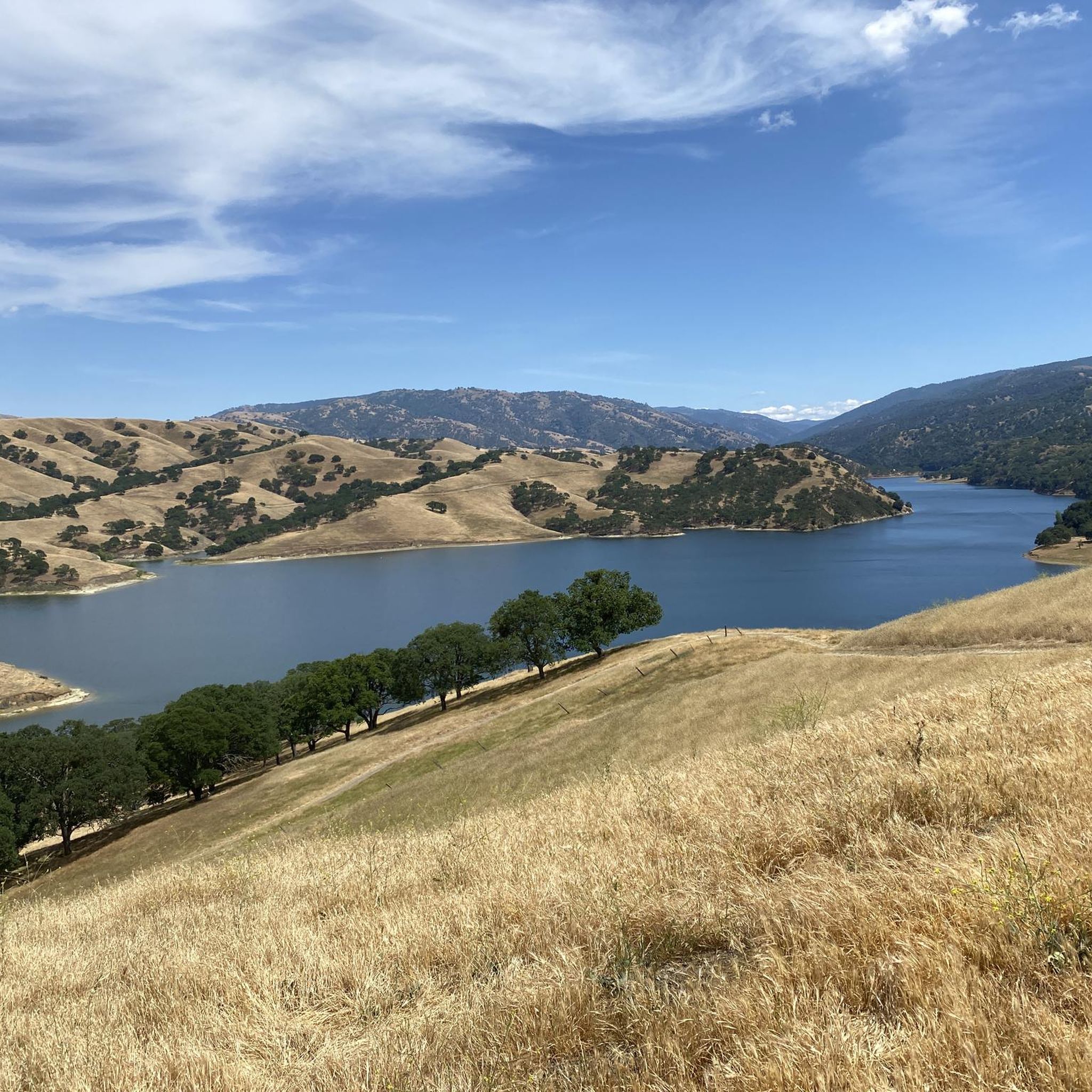
Del Valle Lake was formed by Del Valle Dam, completed in 1968. The lake, about 5 miles long, has trails meandering along it, offering stunning views along the way. As the name suggests, the lake is tucked in a valley, with plenty of higher vantage points to enjoy the views.
0
0
Frequently Asked Questions
How many touring cycling routes are available in Del Valle Regional Park?
You'll find over 50 touring cycling routes in Del Valle Regional Park, catering to various skill levels. Approximately half of these are considered easy, with a good selection of moderate and difficult options as well.
What kind of terrain can I expect on touring cycling routes in Del Valle Regional Park?
Del Valle Regional Park offers a diverse landscape for touring cyclists. You can expect chaparral-covered hills, oak woodlands, and varied elevations. Routes range from mostly flat sections around the 5-mile-long Lake Del Valle to steep ridges and canyons. Sedimentary cliffs, particularly along Arroyo Road, also add to the scenic variety.
Are there touring cycling routes suitable for beginners or families in Del Valle Regional Park?
Yes, there are plenty of options for beginners and families. Approximately 25 easy routes are available, many with well-paved surfaces. A good example is the Sycamore Grove Park – Olivina Gate loop from The Vineyard Table and Tasting Lounge, which offers a relatively flat ride with minimal elevation gain.
What are some challenging touring cycling routes in Del Valle Regional Park?
For experienced touring cyclists seeking a challenge, Del Valle Regional Park offers 13 difficult routes with significant elevation changes. The Lake Del Valle – Viewpoint on the Lake loop from Del Valle Regional Park features over 550 meters of ascent, while the Sycamore Grove Park – Olivina Gate loop from Del Valle Regional Park includes over 600 meters of climbing, providing an excellent workout.
What scenic views or landmarks can I see along the touring cycling routes?
Many routes offer panoramic views of Lake Del Valle and the surrounding southern Livermore Hills. You can also explore specific points of interest like Badger Cove and the East Shore Trail Viewpoint. The Ridgeline Trail is particularly known for its sweeping vistas.
Are there any circular touring cycling routes in Del Valle Regional Park?
Yes, many touring cycling routes in Del Valle Regional Park are loops, allowing you to start and end at the same point without retracing your path. Examples include the Badger Cove loop from Village II and the Badger Cove – Lake Del Valle loop from Vinsanto II.
What is the best time of year for touring cycling in Del Valle Regional Park?
Spring is particularly beautiful, as the rolling hills are blanketed with vibrant wildflowers. However, the park is generally accessible year-round. Summers can be warm, so early mornings or late afternoons are often preferred. Fall offers pleasant temperatures and changing foliage.
Can I bring my dog on the touring cycling trails in Del Valle Regional Park?
Del Valle Regional Park generally welcomes dogs on trails, but they must be on a leash. It's always best to check the specific regulations for any trail you plan to ride, as some areas might have restrictions or require dogs to be on shorter leashes.
Are there any cafes or pubs near Del Valle Regional Park for after a ride?
While the park itself is primarily natural, the nearby Livermore Valley wine country offers various options. You can find cafes, breweries, and wineries in the surrounding areas, particularly in Livermore, which is a short drive from the park.
What do other touring cyclists enjoy the most about touring cycling in Del Valle Regional Park?
The area is highly rated by the komoot community, with an average score of 4.4 stars from more than 10 reviews. Reviewers often praise the extensive views of Lake Del Valle, the varied terrain that caters to different skill levels, and the natural beauty of the chaparral-covered hills and oak woodlands.
Are permits required for biking on trails in Del Valle Regional Park?
Generally, no special permits are required for recreational biking on the designated trails within Del Valle Regional Park. However, standard park entrance fees may apply for vehicles. It's always a good idea to check the official East Bay Regional Park District website for the most current information on fees and any specific trail regulations.
Is public transport available to Del Valle Regional Park for cyclists?
Public transport options directly to Del Valle Regional Park can be limited. It is primarily accessed by car, with parking available at various trailheads. Cyclists often drive to the park and then begin their rides. Check local transit authority websites for any bus routes that might serve the general area, though direct access with a bike might require planning.
Most popular routes in Del Valle Regional Park
Most popular attractions in Del Valle Regional Park

Get inspired with the komoot mobile app


Explore more
Browse the best Cycling routes in other regions.
