The best cycling routes in Mount Madonna County Park
3.5
(3)
28
riders
3
rides
Touring cycling routes in Mount Madonna County Park traverse a landscape characterized by rolling hills and forested areas, offering diverse terrain for cyclists. The park's proximity to the coast means some routes feature views of the Pacific Ocean and access to state beaches. Elevations are generally moderate, with no peaks exceeding 200m, making it suitable for various cycling abilities. The region provides a mix of paved roads and designated trails, ideal for touring cyclists seeking scenic journeys.
Best touring cycling routes in Mount Madonna County Park
- The most popular touring cycling route is Manresa State Beach loop, a 28.5 miles (45.9 km) trail that takes 2 hours 50 minutes to complete. This moderate route offers coastal views and varied terrain.
- Another top favourite among local touring cyclists is Bike loop from Amesti, a moderate 19.3 miles (31.1 km) path. This route winds through inland areas with a mix of open and wooded scenery.
- Local touring cyclists also love the Manresa State Beach – Sunset State Beach loop from Corralitos, a 24.2 miles (39.0 km) trail leading through coastal landscapes and state beaches, often completed in about 2 hours 32 minutes.
- Touring cycling in Mount Madonna County Park is defined by rolling hills, forested sections, and coastal views. The network offers options for different ability levels, primarily featuring moderate routes.
- The routes in Mount Madonna County Park are highly rated by the komoot community with an average score of 2.5 stars from over 2 reviews. More than 30 touring cyclists have used komoot to explore Mount Madonna County Park's varied terrain.
Last updated: July 8, 2026
7
riders
25.8km
01:35
240m
240m
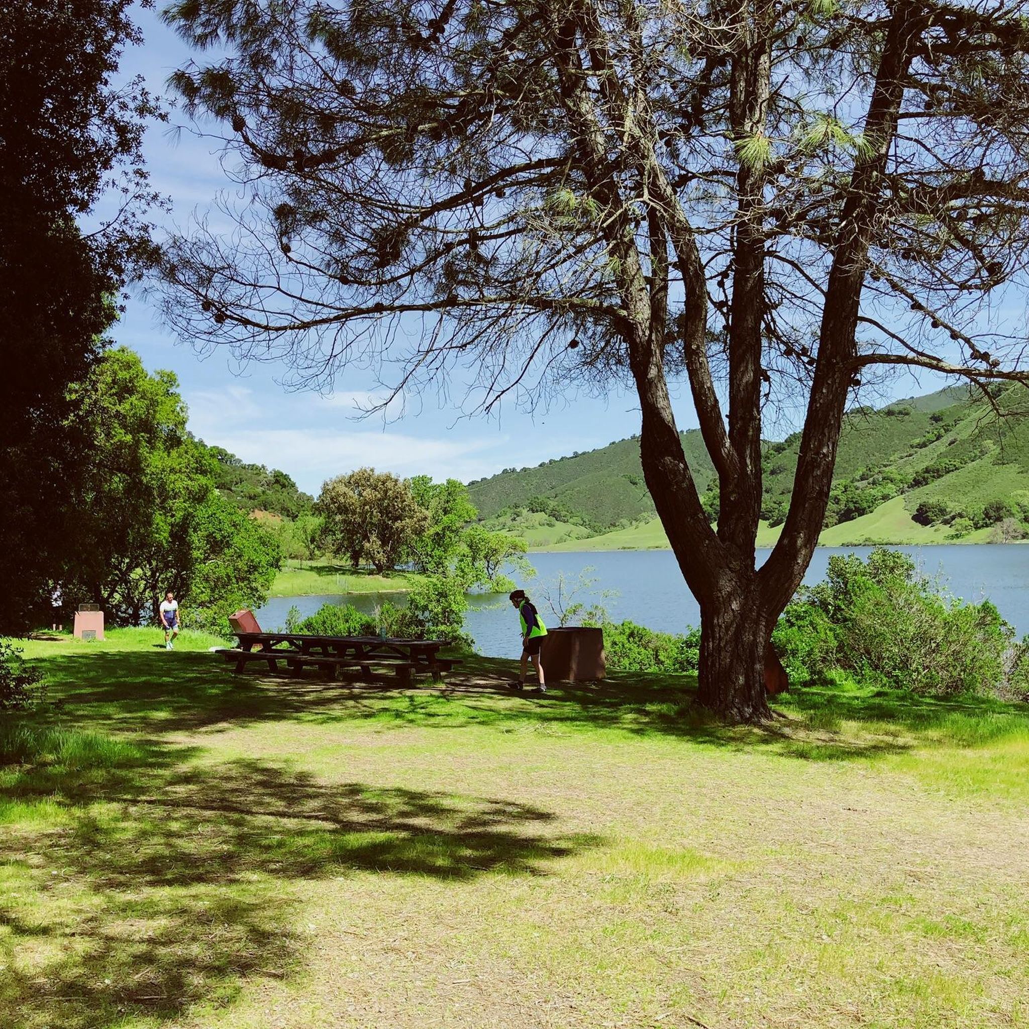
The Chesbro Reservoir – View of Chesbro Reservoir loop from Uvas Reservoir offers a delightful touring cycling experience through rolling grasslands and oak woodlands, providing consistent views of both Uvas and Chesbro Reservoirs. You'll find a pleasant backcountry atmosphere as you navigate mostly paved surfaces, with some unpaved sections adding to the adventure. This moderate 16.1-mile (25.8 km) route, featuring 803 feet (245 metres) of elevation gain, is a great option for cyclists seeking scenic beauty and a good workout.
Planning your ride is straightforward, with parking available at recreational lots near either Uvas or Chesbro reservoirs. While the route is enjoyable year-round, aim for spring or fall to experience the most comfortable temperatures and vibrant natural scenery. Be prepared for a few noticeable climbs, including a short, steep section on Sycamore Drive, and always carry sufficient water for the 1 hour and 34 minutes estimated duration.
These reservoirs, created in the mid-1950s to secure water supplies, offer more than just a cycling path; they provide a sense of natural escape close to urban areas. The varied route options in the region, including longer loops from Morgan Hill or Gilroy, allow you to tailor your ride. This trail is perfect for those who appreciate a blend of moderate challenge and picturesque reservoir views, making it one of the popular bike loops around Uvas and Chesbro Reservoirs.
4.0
(1)
5
riders
45.9km
02:50
420m
420m
Cycle the moderate 28.5-mile Manresa State Beach loop, gaining 1370 feet with sweeping views of the Monterey Bay coastline.

Sign up for free
4
riders
31.1km
01:53
290m
290m
Moderate bike ride. Good fitness required. Mostly paved surfaces. Suitable for all skill levels.
3.0
(2)
3
riders
16.9km
01:08
240m
240m
Moderate bike ride. Good fitness required. Mostly paved surfaces. Suitable for all skill levels.
5.0
(1)
3
riders
24.0km
01:35
340m
340m
Moderate bike ride. Good fitness required. Mostly paved surfaces. Suitable for all skill levels.
Our route recommendations are based on thousands of hikes, rides, and runs completed by other people on komoot.
Start today with a free account
Your next adventure awaits.
Login or Signup
Popular around Mount Madonna County Park


Tips from the Community

Chesbro Reservoir County Park is a 232-acre park that surrounds Chesbro Reservoir and is known for catch-and-release fishing. There is no swimming or boating allowed in the lake.
0
0

La Selva Beach is a small community north of Watsonville. It is mostly known as home to Manresa State Beach, but it also has a post office, corner store, fire department, library, and a few shops.
0
0
Manresa State Beach is known for its sweeping views of bluff-backed sand and sea. Visitors can enjoy surfing, boogie boarding, flying kites, walking the beach, or sunbathing.
0
0
Chesbro Reservoir County Park is a 232-acre park that surrounds Chesbro Reservoir and is known for catch-and-release fishing. There is no swimming or boating allowed in the lake.
0
0

This is a nice quiet area, with lots of shade. There are not many facilities, but you can park on the side of the road. Scott County Park is also on the other side of the road which has a playground and restrooms.
1
0

Uvas Creek was dammed in 1957 to create this reservoir, which is used to provide water for the residents and industry in the area. The reservoir and surrounding area form the Uvas Reservoir County Park.
0
0
Dammed in 1965 Chesbro Reservoir is used for water management and recreation. The lake and surrounding area is managed as Chesbro Reservoir County Park. The road along the northern shore is a nice ride.
0
0

The Corralitos town square is a nice shady place to pause and refresh. There's a market nearby with food and drinks, and even has porta-potty nearby.
1
0
Frequently Asked Questions
How many touring cycling routes are available in Mount Madonna County Park?
Mount Madonna County Park offers a selection of touring cycling routes. There are 6 routes documented, with 4 considered moderate and 2 rated as difficult, providing options for various skill levels.
What are the typical distances for touring cycling routes in Mount Madonna County Park?
The touring cycling routes in Mount Madonna County Park vary in length. For example, the Manresa State Beach loop is approximately 28.5 miles (45.9 km), while the Manresa State Beach – La Selva Beach loop from Freedom is around 14.9 miles (24 km).
Are there family-friendly touring cycling routes in Mount Madonna County Park?
While the park's touring cycling routes are generally rated as moderate to difficult, families with older children or those comfortable with some elevation gain might enjoy sections of the routes. The park's rolling hills and forested areas offer scenic rides, but direct 'easy' family routes are not specifically highlighted for touring cyclists. Consider routes with less elevation for a more relaxed experience.
Can I bring my dog on touring cycling routes in Mount Madonna County Park?
Mount Madonna County Park generally allows dogs on leash in most areas, including trails. However, it's always best to check the latest park regulations directly with Santa Clara County Parks for any specific restrictions on cycling trails or in certain areas to ensure a smooth visit with your pet.
Where can I park when touring cycling in Mount Madonna County Park?
Mount Madonna County Park provides several parking areas for visitors. You can typically find parking near the main entrances and trailheads. Specific parking availability can vary, so it's advisable to check the park's official website or maps for designated parking lots before your visit.
Are permits or fees required for touring cycling in Mount Madonna County Park?
Mount Madonna County Park is part of the Santa Clara County Parks system. While there isn't a specific permit required for cycling, there may be day-use fees or parking fees depending on the entrance and facilities used. It's recommended to check the Santa Clara County Parks website for current fee information.
When is the best time of year for touring cycling in Mount Madonna County Park?
The best time for touring cycling in Mount Madonna County Park is generally during the spring and fall. These seasons offer milder temperatures and less chance of extreme heat or heavy rain. Summer can be pleasant, especially in the mornings, but can get warm. Winter rides are possible, but be prepared for cooler temperatures and potentially wet conditions.
What kind of weather conditions should I expect when touring cycling in Mount Madonna County Park?
Mount Madonna County Park experiences a Mediterranean climate. Expect warm, dry summers and mild, wet winters. Due to its proximity to the coast, some routes may experience coastal fog, especially in the mornings, which can keep temperatures cooler. Always check the local forecast before heading out.
What should I wear for touring cycling in Mount Madonna County Park?
Given the varied terrain and potential for coastal influence, layering is key. Wear moisture-wicking base layers, a cycling jersey, and bring a light jacket or windbreaker, especially for descents or cooler mornings. Helmets are always recommended, and appropriate cycling shoes will enhance your ride.
What do other touring cyclists enjoy the most about touring cycling in Mount Madonna County Park?
The area is highly rated by the komoot community, with an average score of 2.5 stars from over 2 reviews. Reviewers often praise the diverse terrain, which includes rolling hills and forested sections, as well as the scenic coastal views available on routes like the Manresa State Beach – Sunset State Beach loop from Corralitos.
Are there any routes that offer coastal views or access to state beaches?
Yes, several touring cycling routes in Mount Madonna County Park provide stunning coastal views and access to state beaches. The Manresa State Beach loop and the Manresa State Beach – Sunset State Beach loop from Corralitos are excellent choices for experiencing the Pacific Ocean scenery and visiting state beaches.
What kind of terrain can I expect on touring cycling routes in Mount Madonna County Park?
The touring cycling routes in Mount Madonna County Park are characterized by rolling hills and forested areas. You'll encounter a mix of paved roads and designated trails, with moderate elevations. The terrain offers a good balance of climbs and descents, suitable for touring cyclists seeking varied landscapes.
Most popular routes in Mount Madonna County Park

Get inspired with the komoot mobile app


Explore more
Browse the best Cycling routes in other regions.
