The best MTB trails in O'Neill Regional Park
4.0
(59)
838
riders
44
rides
Mountain biking in O'Neill Regional Park offers a diverse landscape characterized by canyons, oak woodlands, and rolling hills within Orange County. The park's terrain provides a mix of challenging ascents and flowing descents, suitable for various skill levels. Riders can expect to navigate through natural chaparral and riparian habitats, with routes often following creek beds and ridge lines. The area features well-maintained dirt paths and singletrack, making it a popular destination for mountain bike enthusiasts.
Best mountain bike trails in O'Neill Regional Park
- The most popular mountain bike trail is Los Pinos Peak and Bell Ridge Loop, a 19.5 miles (31.3 km) trail that takes 3 hours 38 minutes to complete. This difficult route features significant elevation gain and panoramic views.
- Another top favourite among local mountain bikers is Trabuco Creek loop from Robinson Ranch, an easy 13.2 miles (21.3 km) path. This trail offers a more relaxed ride through scenic creek areas.
- Local mountain bikers also love the Waterworks Flow Trail loop from Rancho Santa Margarita, a 16.2 miles (26.1 km) trail leading through varied terrain, often completed in about 2 hours 13 minutes.
- Mountain biking in O'Neill Regional Park is defined by canyons, oak woodlands, and rolling hills. The network offers options for different ability levels, from easy loops to challenging climbs.
- The routes in O'Neill Regional Park are highly rated by the komoot community with an average score of 4.4 stars from over 50 reviews. More than 800 mountain bikers have used komoot to explore O'Neill Regional Park's varied terrain.
Last updated: July 7, 2026
31.3km
03:39
1,180m
1,190m
The Los Pinos Peak and Bell Ridge Loop offers an intense mountain biking experience through the Santa Ana Mountains, delivering some of the most expansive panoramic views in Orange County. As you climb towards Los Pinos Peak and traverse the Bell Ridge, you'll be treated to vistas of inland giants like San Jacinto and Gorgonio, and on clear days, even the Pacific Ocean and Catalina Island. Expect a rugged journey with steep, loose, and rocky terrain that truly tests your skills and endurance.
This expert-level route is rated difficult, covering 19.5 miles (31.3 km) with a significant 3886 feet (1184 metres) of elevation gain, typically taking around 3 hours and 38 minutes. Due to its remote and challenging nature, including sections that may require hike-a-biking, it's essential to be well-prepared and check for any trail closures before heading out. The area is fire-prone, so always confirm conditions, possibly via the USDA Forest Service website, to ensure a safe ride.
What sets this loop apart is its combination of technical challenge and isolated beauty, appealing to advanced riders seeking a true backcountry adventure. The Los Pinos Trail portion alone is known for its demanding climbs and descents, making the entire loop a formidable undertaking. This route is a standout for those who crave a demanding mountain bike trail that rewards effort with unparalleled natural features and a sense of accomplishment.
8
riders
45.0km
03:54
830m
830m
Moderate mountain bike ride. Good fitness required. Advanced riding skills necessary.

Sign up for free
4.0
(1)
40
riders
32.7km
02:47
330m
330m
The Trabuco Creek loop from Rancho Santa Margarita offers a fantastic mountain biking escape into nature, making you feel miles away from urban Orange County. You'll ride through diverse terrain, from sandy washes and rocky outcrops to serene oak woodlands and past towering sycamores, with the picturesque Trabuco Creek as your constant companion. The route features multiple creek crossings, adding a fun, splashy element to your ride, and provides ample opportunities to spot local wildlife.
This moderate 20.3-mile (32.7 km) mountain biking trail involves 1091 feet (333 metres) of elevation gain and typically takes around 2 hours and 47 minutes to complete. Parking is often available at spots like the Rancho Santa Margarita Water Works, making access straightforward. While many sections are generally easy, be prepared for intermediate segments with river rocks and potentially wet creek crossings, especially during wetter seasons. It's a great choice for riders seeking a varied and engaging ride without extreme technical challenges.
The Trabuco Creek trail system is celebrated for its natural beauty and its ability to connect riders with the local environment. It's a prime example of the best mountain biking trails near Rancho Santa Margarita, offering a refreshing mix of fire roads, doubletrack, and singletrack. The canyon sections provide welcome shade, even on hot days, and the varied landscape ensures a dynamic experience that keeps things interesting from start to finish.
14
riders
69.6km
06:05
1,040m
1,040m
Hard mountain bike ride. Very good fitness required. Suitable for all skill levels.
12
riders
The O'Neill Regional Park – Live Oak Canyon Trail loop from Rancho Santa Margarita offers a dynamic mountain biking experience, weaving through lush oak woodlands and past towering sycamore trees. You'll navigate well-maintained dirt paths and singletrack, with the scenery shifting from shaded riparian habitats to open hillsides adorned with native chaparral. Keep an eye out for wildlife as you explore the diverse terrain, which includes both flowing sections and some more challenging climbs.
This easy 12.6-mile (20.3 km) loop involves 901 feet (275 metres) of elevation gain and typically takes about 1 hour and 37 minutes to complete. The park operates from 7 a.m. to sunset year-round, providing ample time for your ride. While no permits are needed, it's a popular spot, so consider an early start to beat any crowds and ensure a smooth experience.
This trail is a local favorite, highly rated by the mountain biking community for its varied terrain and picturesque views. It also serves as a gateway to other extensive trail systems like Limestone Canyon and Whiting Ranch Wilderness Park, making it a great starting point for longer adventures. Just remember that you'll be sharing the path with hikers and horseback riders, so courtesy is key.
Get access to more routes and recommendations from other explorers.
Sign up for free
Already have an account?
Our route recommendations are based on thousands of hikes, rides, and runs completed by other people on komoot.
Start today with a free account
Your next adventure awaits.
Login or Signup
Tips from the Community

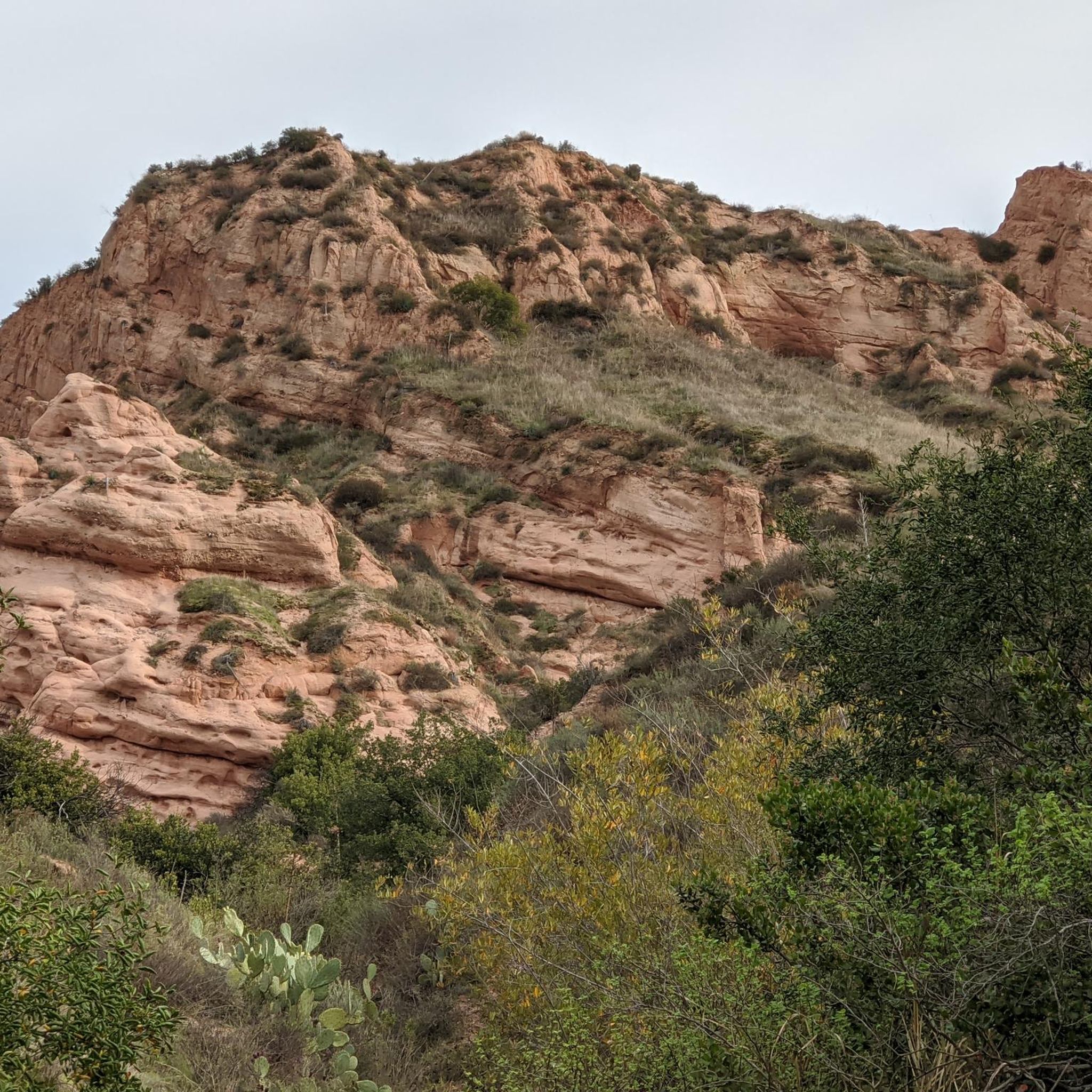
You can explore a variety of singletrack and wide gravel paths through the park. Some trails are shaded while others take you out above the canyon with vistas of Orange County. There are restrooms, picnic tables, and camping available. The park charges a $3 fee.
0
0

The Arroyo Trabuco Trail crosses the Trabuco Creek here (and a good number of times along the route). Depending on the season and conditions, you may well find that bombing through is not an option, so just be prepared for some wet feet.
0
0

Trabuco Creek Road is a rough forest service road that is lined with some of the most popular trailheads for hikes in Cleveland National Forest. There are also double-track and singletrack trails open to bikes, so you can create lots of different loops using Trabuco Creek Road as a jumping-off point.
0
0
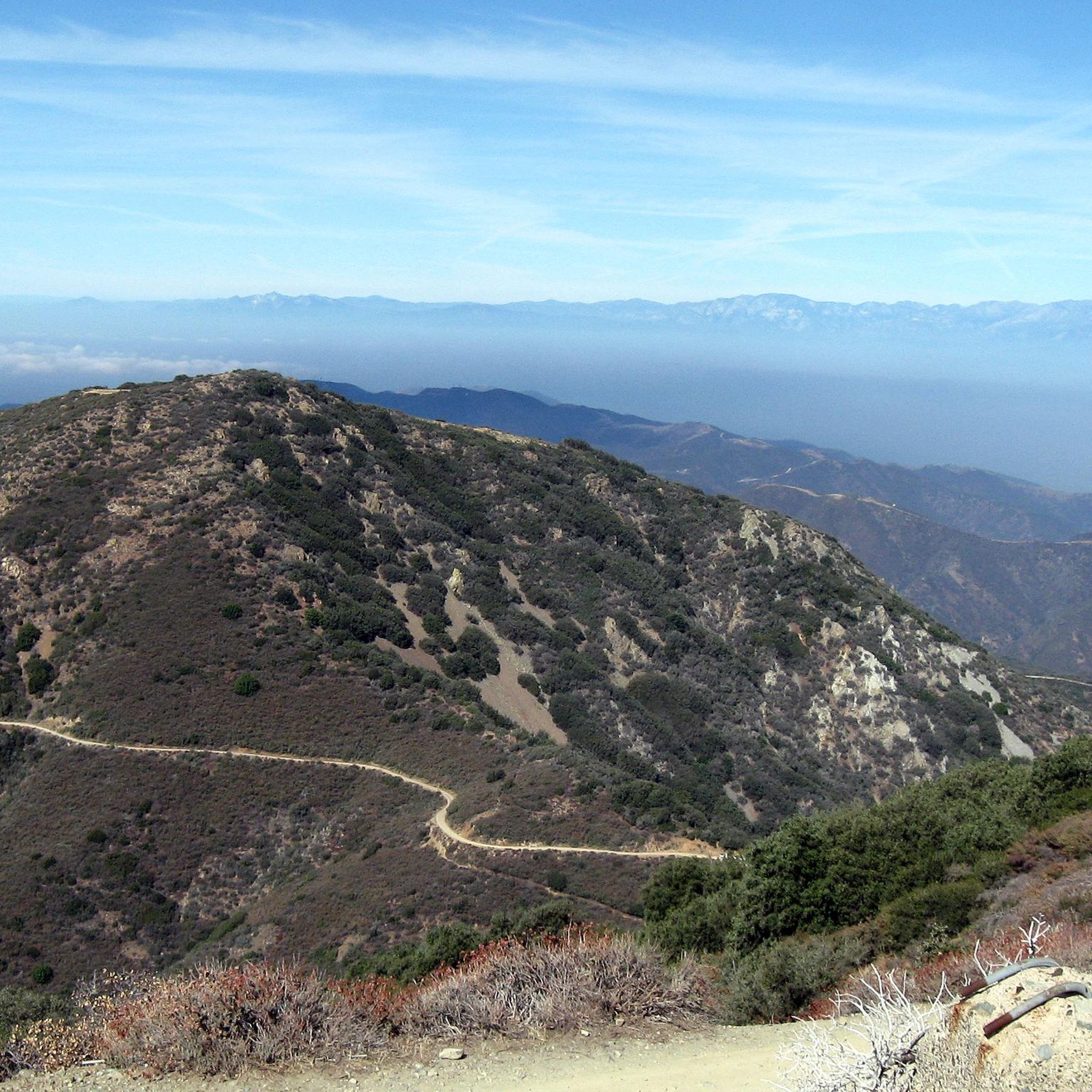
Bell Ridge crests out here, and you get sweeping views of the Santa Ana Mountains as well as glimpses of the ocean. This is a great landmark if you are venturing on to Los Pinos Peak.
1
0
Los Pinos Peak is the fourth highest peak in the county, after Santiago, Modjeska, and Trabuco Peak. There are a few different trails you can explore that take you to the summit, though some trailheads in the Trabuco Creek Valley have been closed in recent years so it is best to check the Forest Service website before you go.
0
0
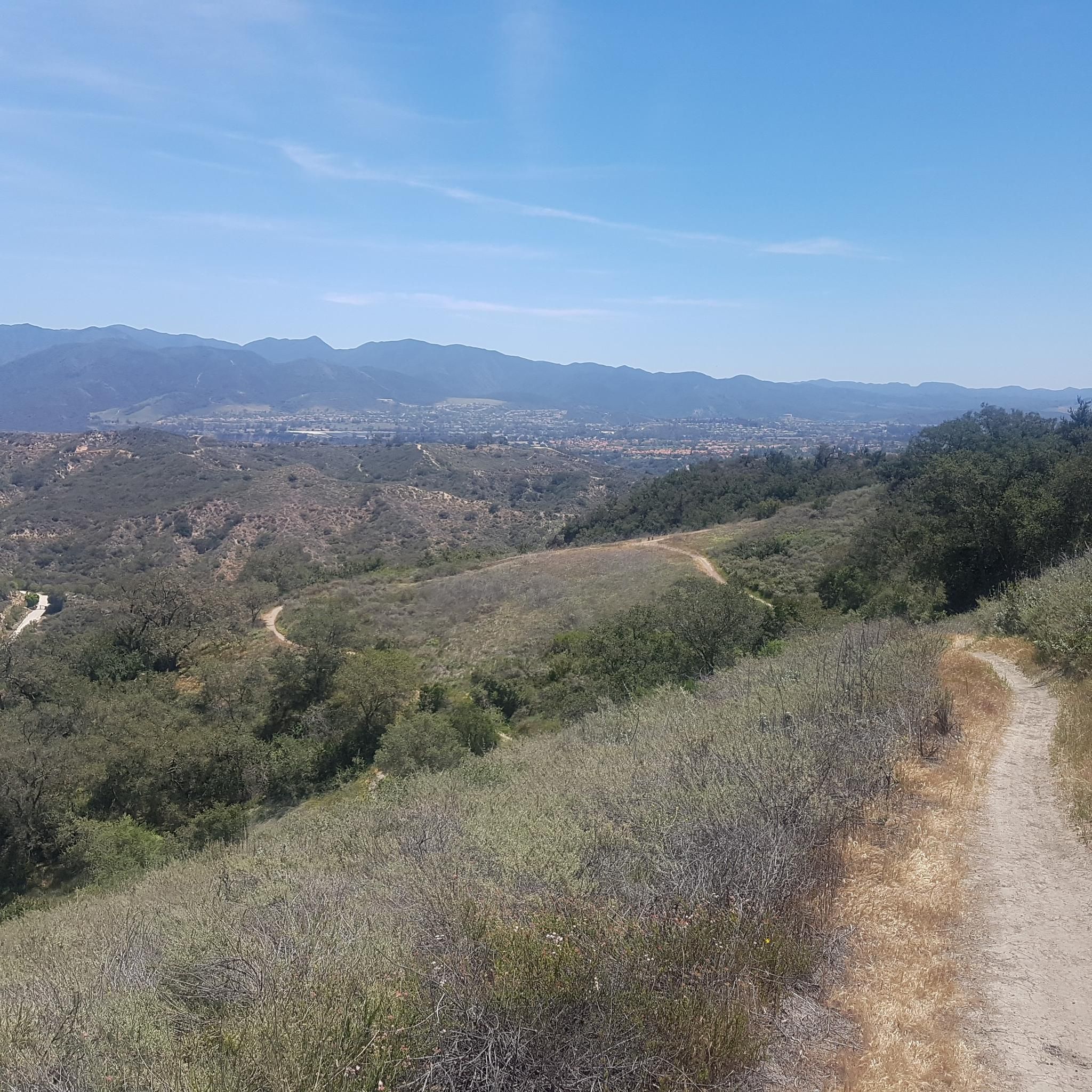
There is a picnic area here with sweeping views south toward the Pacific. There are a number of good popular local connecting trails to explore. The trails to the north lead up by neighborhoods, while the Bell View Trail south of here lends a greater feeling of being out in nature as it descends the ridge.
0
0
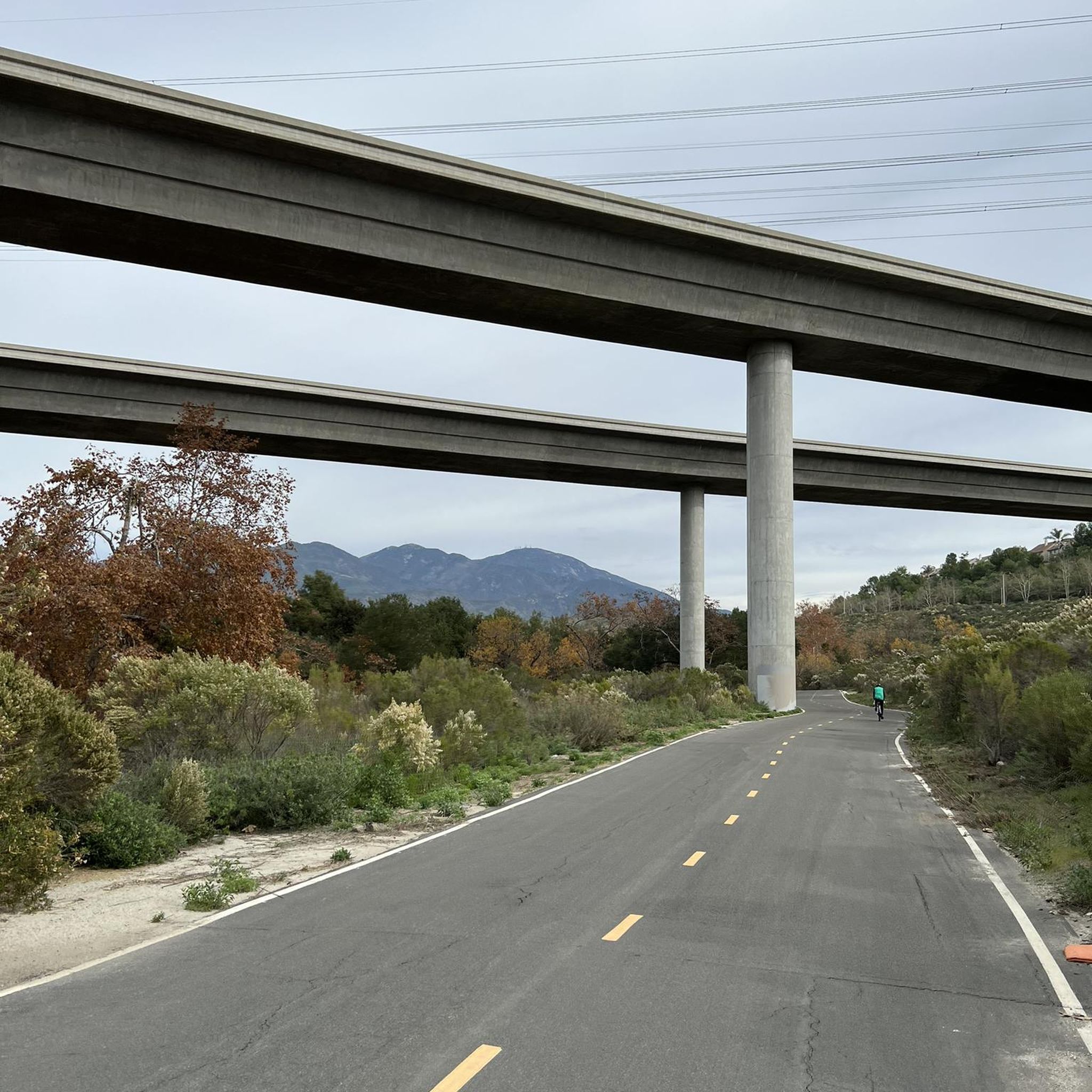
Here the trail crosses under the Antonio Pkwy bridge. Much of the trail is doubletrack, though you will find some singletrack segments between the trailhead and Trabuco Creek.
0
0
The Arroyo Trabuco Trail crosses the Trabuco Creek here (and a good number of times along the route). Depending on the season and conditions, you may want to be prepared for some wet feet.
0
0
Frequently Asked Questions
How many mountain bike trails are available in O'Neill Regional Park?
O'Neill Regional Park offers a wide selection of mountain bike trails, with over 40 routes documented on komoot. These trails cater to various skill levels, from easy scenic rides to challenging climbs.
What are the typical trail lengths and durations for mountain biking in O'Neill Regional Park?
Trail lengths in O'Neill Regional Park vary significantly. You can find shorter loops, like the 13.2-mile (21.3 km) Trabuco Creek loop from Robinson Ranch, which takes around 1 hour 45 minutes. Longer, more challenging routes, such as the 19.5-mile (31.3 km) Los Pinos Peak and Bell Ridge Loop, can take over 3 hours 30 minutes to complete.
Are there beginner-friendly mountain bike trails in O'Neill Regional Park?
Yes, O'Neill Regional Park has several easy trails suitable for beginners. The Trabuco Creek loop from Robinson Ranch is a great option, offering a relaxed 13.2-mile ride through scenic creek areas. Another easy choice is the 12.6-mile (20.2 km) O'Neill Regional Park – Live Oak Canyon Trail loop from Rancho Santa Margarita.
What kind of terrain can I expect on mountain bike trails in O'Neill Regional Park?
The park's terrain is characterized by canyons, oak woodlands, and rolling hills. Riders will encounter a mix of well-maintained dirt paths and singletrack, navigating through natural chaparral and riparian habitats. Routes often follow creek beds and ridge lines, providing both challenging ascents and flowing descents.
Are there any challenging mountain bike trails for experienced riders?
Absolutely. Experienced riders looking for a challenge can tackle routes like the Los Pinos Peak and Bell Ridge Loop. This difficult 19.5-mile (31.3 km) trail features significant elevation gain and rewards riders with panoramic views.
What do other mountain bikers enjoy most about O'Neill Regional Park?
The area is highly rated by the komoot community, with an average score of 4.4 stars from over 50 reviews. Reviewers often praise the park's diverse landscape, well-maintained trails, and the variety of options available for different skill levels, from scenic creek rides to challenging climbs with great views.
Are there any loop mountain bike trails in O'Neill Regional Park?
Yes, many of the mountain bike trails in O'Neill Regional Park are designed as loops, offering a continuous riding experience. Examples include the Trabuco Creek loop from Robinson Ranch, the Waterworks Flow Trail loop from Rancho Santa Margarita, and the Los Pinos Peak and Bell Ridge Loop.
What is the best time of year for mountain biking in O'Neill Regional Park?
While O'Neill Regional Park is generally accessible year-round, the cooler months from fall through spring (October to May) are often preferred for mountain biking. Temperatures are more moderate, making for a more comfortable ride. Summers can be hot, so early morning rides are recommended during those months.
What kind of wildlife might I encounter while mountain biking in O'Neill Regional Park?
O'Neill Regional Park is home to diverse wildlife within its chaparral and riparian habitats. Riders might spot various bird species, rabbits, squirrels, and occasionally deer. It's always advisable to be aware of your surroundings and respect the natural environment.
Are there any moderate difficulty mountain bike trails in the park?
Yes, there are several moderate trails for riders looking for a bit more challenge than easy routes but less intensity than difficult ones. The Waterworks Flow Trail loop from Rancho Santa Margarita, at 16.2 miles (26.1 km), is a popular moderate option. Another is the 23.9-mile (38.5 km) O'Neill Regional Park – Santiago Canyon Road loop from Rancho Santa Margarita.
What should I wear for mountain biking in O'Neill Regional Park?
Given the varied terrain and potential for sun exposure, it's recommended to wear moisture-wicking athletic clothing, appropriate for the weather conditions. Layers are often a good idea, especially during cooler mornings or evenings. Always wear a helmet, and consider gloves, protective eyewear, and knee/elbow pads for added safety.
Most popular routes in O'Neill Regional Park

Get inspired with the komoot mobile app


Explore more
Browse the best MTB trails in other regions.
