The best running trails in Cuyamaca Mountain State Wilderness
130
runners
25
runs
Jogging in Cuyamaca Mountain State Wilderness offers diverse landscapes and an extensive trail network. The region features a mix of oak and pine forests, sprawling meadows, and rolling hills. Prominent peaks like Cuyamaca Peak and Stonewall Peak provide challenging climbs and panoramic views. Year-round waterfalls, creeks, and Lake Cuyamaca add to the natural features.
Best jogging routes in Cuyamaca Mountain State Wilderness
- The most popular jogging route is Eastside Trail – Upper Descanso Creek Trail loop from Pam-mum Am-wah,…
Last updated: June 2, 2026
6
runners
17.3km
02:14
380m
390m
Hard run. Very good fitness required. Mostly paved surfaces. Suitable for all skill levels.
5
runners
Hard run. Very good fitness required. Mostly paved surfaces. Suitable for all skill levels.

Sign up for free
3
runners
29.4km
03:53
850m
850m
Hard run. Very good fitness required. Mostly paved surfaces. Suitable for all skill levels.
11
runners
6.38km
00:52
220m
220m
Moderate run. Good fitness required. Mostly paved surfaces. Suitable for all skill levels.
7
runners
25.4km
03:08
400m
400m
Hard run. Very good fitness required. Mostly paved surfaces. Suitable for all skill levels.
Get access to more routes and recommendations from other explorers.
Sign up for free
Already have an account?
Our route recommendations are based on thousands of hikes, rides, and runs completed by other people on komoot.
Start today with a free account
Your next adventure awaits.
Login or Signup
Popular around Cuyamaca Mountain State Wilderness
Tips from the Community

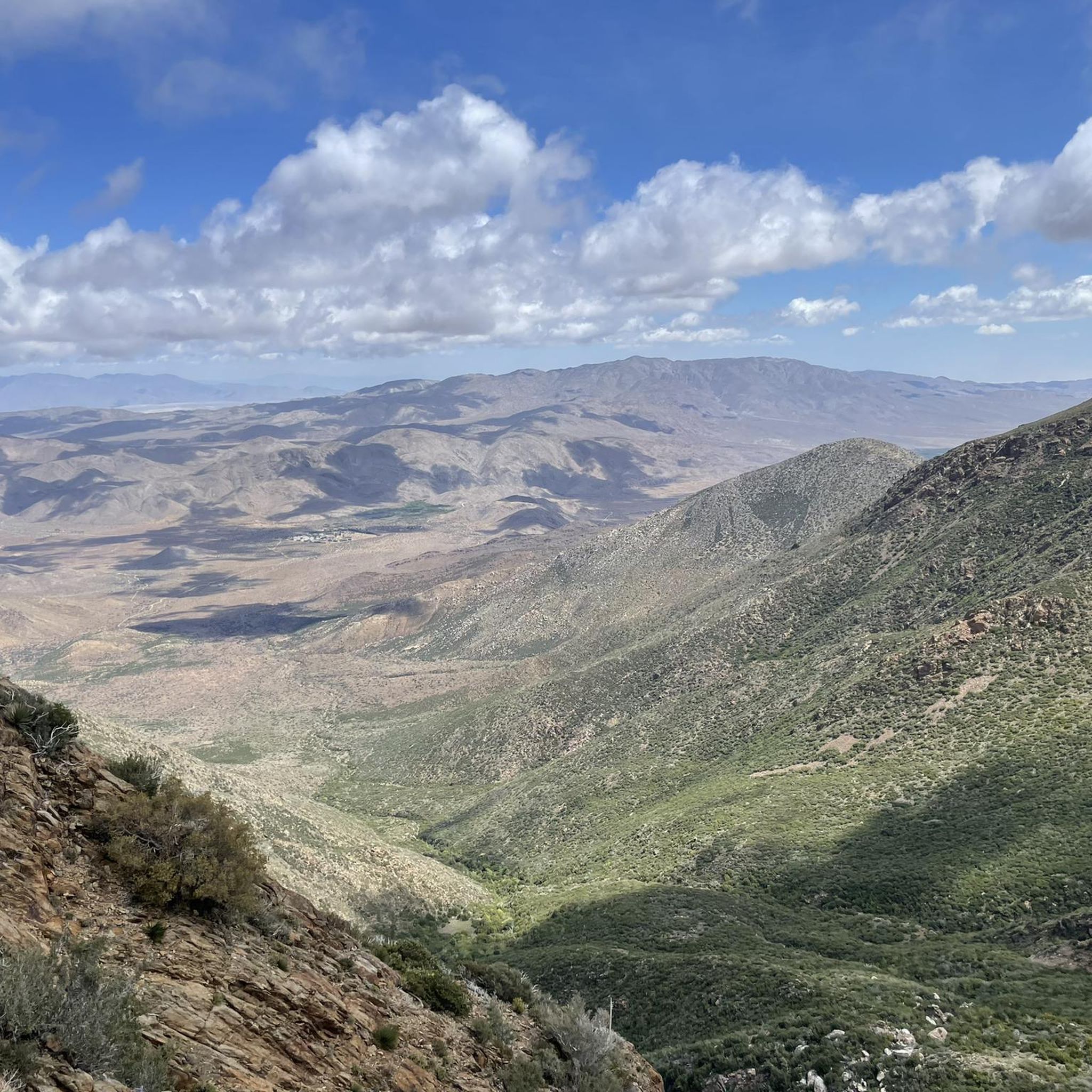
Along the Conejos Trail, you'll encounter a breathtaking view of Cuyamaca Rancho State Park and the surrounding mountains. It’s an ideal spot to pause and take a break.
0
0
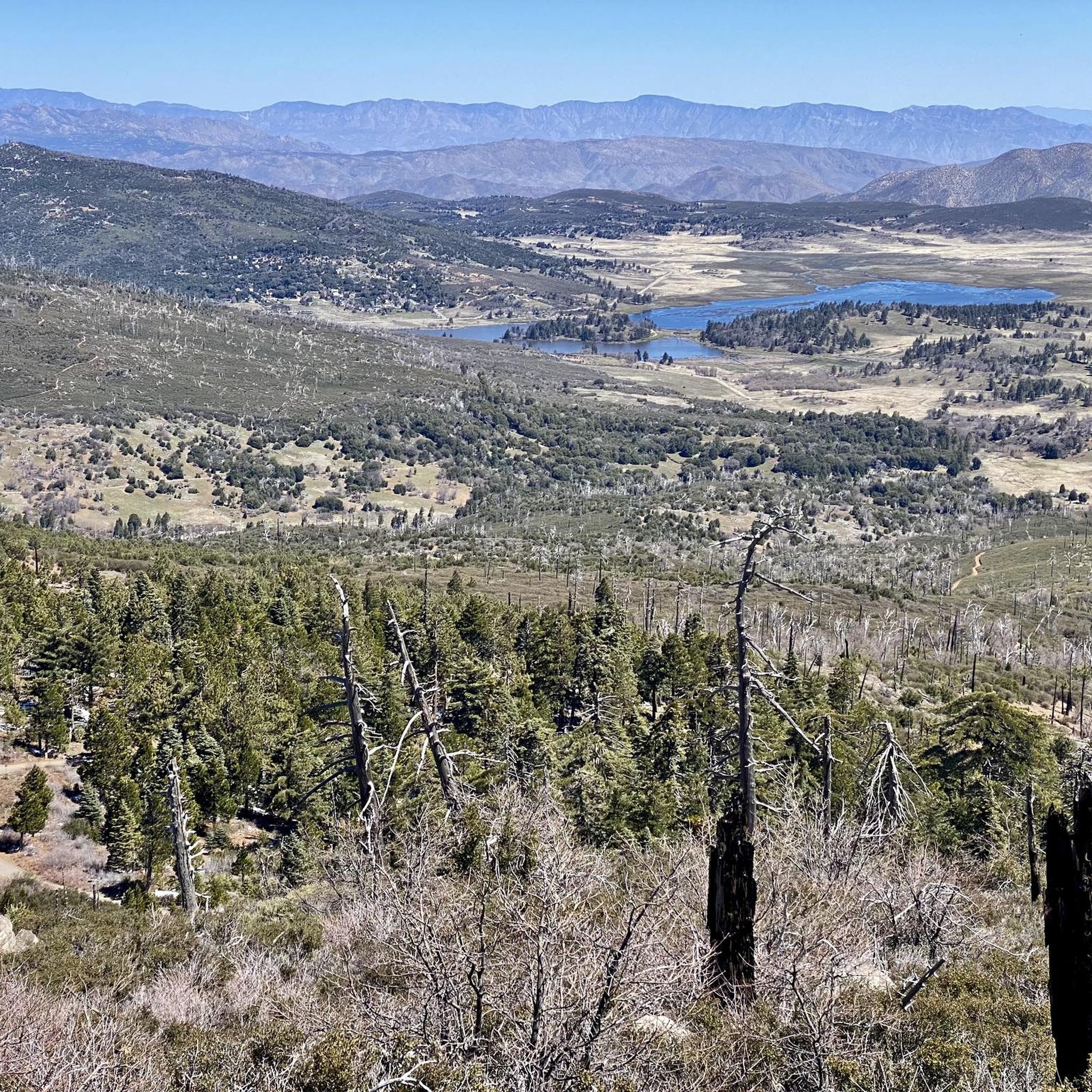
The trail to Cuyamaca Peak offers beautiful scenery, winding through single-track paths and fire roads. Remnants of the 2003 Cedar Fire, like standing dead trees, serve as stark reminders along the way. However, the area has undergone notable regrowth, aided by controlled burns and replanting over the years.
0
0

Clear to cloudy. Short pants and rain jacket.
0
0
There is no drinking hall here, so take water with you
0
0

This trail is incredibly lush and picturesque, featuring some shaded areas along the way. Beyond this section, the incline becomes steeper, and the hike becomes a bit more challenging. However, the tranquility of the surroundings makes the effort well worth it.
0
0

You really get the feeling, going down, that there is a real big gate materialize by two huge rocks on each side of the trail.
0
0
I recommend to do the loop opposite clockwise : directly go up the for the descend take the trail on the right just after the summit, to discover a wild area which deserve the detour.
0
0
Frequently Asked Questions
How many running routes are available in Cuyamaca Mountain State Wilderness?
Komoot offers a selection of over 30 running routes in Cuyamaca Mountain State Wilderness. These routes cater to various fitness levels, with 1 easy, 10 moderate, and 19 difficult options, ensuring there's a trail for every runner.
What kind of terrain can I expect on the jogging trails?
The trails in Cuyamaca Mountain State Wilderness offer a diverse range of terrain. You'll find everything from dense oak woodlands and pine forests to open, sprawling meadows. Some paths may be paved, while others are uneven with roots and rocks, providing a varied and engaging experience for runners.
Are there any family-friendly running routes in the area?
Yes, there is at least one easy running route suitable for families in Cuyamaca Mountain State Wilderness. While specific family-friendly routes aren't detailed, the extensive network includes paths that are less strenuous, perfect for a leisurely jog with children. The Green Valley Falls Loop (4.0 miles) is known for its gentle terrain and scenic waterfalls, making it a good option for families.
Can I bring my dog on the running trails?
Many trails within Cuyamaca Rancho State Park, which encompasses much of the wilderness, are dog-friendly, though dogs must typically be on a leash. It's always best to check specific trail regulations before heading out. For detailed park rules, you can visit the California State Parks website.
What are some notable natural features or landmarks I might see while running?
Cuyamaca Mountain State Wilderness is rich in natural beauty. You can encounter diverse forests, sprawling meadows, and prominent peaks like Cuyamaca Peak and Stonewall Peak, which offer panoramic views. The area also features year-round waterfalls and creeks, including the headwaters of the San Diego and Sweetwater Rivers, and the scenic Lake Cuyamaca. You might also spot remnants of historical sites like the Stonewall Mine.
Are there any circular running routes available?
Yes, many of the routes in Cuyamaca Mountain State Wilderness are circular, offering varied scenery without retracing your steps. Examples include the challenging Eastside Trail – Upper Descanso Creek Trail loop from Pam-mum Am-wah and the scenic Stonewall Peak – Stonewall Peak Trail loop from Cuyamaca Meadow Natural Preserve. The Stonewall Peak – Stonewall Peak loop from Stonewall Peak is a moderate circular option.
What is the best time of year to go jogging in Cuyamaca Mountain State Wilderness?
The park offers distinct experiences across the seasons. Spring brings vibrant wildflowers, summer is ideal for lakeside activities, fall transforms the forests with golden colors, and winter can provide a unique experience with snow on the peaks. Each season offers its own charm for runners, depending on your preference for scenery and weather conditions.
Are there challenging running routes for experienced runners?
Absolutely. Cuyamaca Mountain State Wilderness is home to 19 difficult running routes. For instance, the Cuyamaca Peak – Azalea Glen Trail loop from Pam-mum Am-wah is an 18.2-mile trail leading to the highest point in the region, offering significant elevation gain and a rewarding challenge for experienced runners.
Where can I find parking for the running trails?
Parking is generally available at various trailheads and within Cuyamaca Rancho State Park. Popular starting points often have designated parking areas. It's advisable to check specific trail information or park maps for the most convenient parking locations for your chosen route.
What do other runners enjoy most about jogging in Cuyamaca Mountain State Wilderness?
The komoot community highly values the diverse landscapes and extensive trail network. Runners often praise the mix of oak and pine forests, sprawling meadows, and rolling hills. The challenging climbs to prominent peaks like Cuyamaca Peak and Stonewall Peak, offering panoramic views, are also frequently highlighted as rewarding aspects of running in the area.
Are there any routes that feature water elements like waterfalls or lakes?
Yes, the region is known for its water features. You can find year-round waterfalls and creeks, a rarity in Southern California. The Green Valley Falls Loop features a series of small cascades, and Lake Cuyamaca provides opportunities for scenic lakeside runs. The headwaters of both the San Diego River and the Sweetwater River are also located here.
How can I access Cuyamaca Mountain State Wilderness using public transport?
Access to Cuyamaca Mountain State Wilderness primarily relies on personal vehicles, as public transportation options directly to the trailheads are limited. Planning your visit with a car is generally recommended for convenience and flexibility in exploring the extensive trail network.
Most popular routes in Cuyamaca Mountain State Wilderness

Get inspired with the komoot mobile app


Explore more
Browse the best Running Trails & Routes in other regions.
