The best road cycling routes in Contra Loma Regional Park
4.5
(16)
158
riders
15
rides
Road cycling routes in Contra Loma Regional Park traverse a 780-acre landscape centered around an 80-acre reservoir. The park features rolling hills and diverse open spaces, providing varied terrain for cyclists. Its trail system connects to broader regional trails, such as the Delta de Anza Trail and the Marsh Creek Regional Trail, offering extended, traffic-free paved routes. These connections allow for rides through wetlands, grasslands, and wooded areas, with some routes featuring elevation changes.
Best road cycling routes in Contra…
Last updated: August 26, 2026
4.5
(2)
3
riders
60.0km
02:40
420m
420m
Road cycling the Lake Alhambra/Byron loop offers a moderate 37.3-mile ride with 1365 feet of gain, taking about 2 hours 40 minutes.
15
riders
46.0km
02:10
410m
410m
Moderate road ride. Good fitness required. Mostly well-paved surfaces and easy to ride.

Sign up for free
13
riders
56.1km
03:02
500m
500m
Moderate road ride. Good fitness required. Mostly well-paved surfaces and easy to ride.
3
riders
60.8km
02:53
700m
700m
Moderate road ride. Good fitness required. Mostly well-paved surfaces and easy to ride.
5.0
(4)
9
riders
31.6km
01:13
80m
80m
Easy road ride. Great for any fitness level. Mostly well-paved surfaces and easy to ride.
Get access to more routes and recommendations from other explorers.
Sign up for free
Already have an account?
Our route recommendations are based on thousands of hikes, rides, and runs completed by other people on komoot.
Start today with a free account
Your next adventure awaits.
Login or Signup
Popular around Contra Loma Regional Park
Tips from the Community

The excellent long distance trail is interrupted a few yards west from here by a road.
0
0

The lake offers some facilities to Los Vaqueros visitors, with fishing docks, a boat rental marina, and some beaches along it. This is a famous spot for fishing in northern California; here, you can find trout, catfish, and stripers, among other species of fish.
0
0

Lake Alhambra is an 18-acre lake located in the Lake Alhambra Estates neighborhood. The use of the lake is restricted to members of the Lake Alhambra Estates Homeowners Association members only.
0
0
Brentwood is located 55 miles east of San Francisco and is still renowned for its agricultural products, including cherries, corn, and peaches. The backdrop of Mount Diablo adds scenic beauty of this charming town.
0
0
Three Springs Rd climbs on paved grade south from Marsh Creek Rd to a short gravel connector into the paved Diablo mine roads, that drop onto Morgan Territory Rd
0
0
Partly paved up to the Divide Reservoir, partly smooth hard pack gravel trail, going from Marsh Creek Rd over the ridge into Briones valley to the east
0
0
Rural road with wide open sky, rolling terrain, little traffic, and an excellent bike lane.
0
0
Pleasant park with benches, playground, restrooms and water for a rest along Delta De Anza Trail on the banks of the Contra Costa Canal
1
0
Frequently Asked Questions
How many road cycling routes are available in Contra Loma Regional Park?
Contra Loma Regional Park offers 14 dedicated road cycling routes. These routes cater to various skill levels, with 2 easy and 12 moderate options, ensuring a suitable ride for most cyclists.
What kind of terrain and elevation can I expect on road cycling routes in Contra Loma Regional Park?
The park features rolling hills and diverse open spaces, providing varied terrain. While many routes offer paved surfaces, especially those connecting to regional trails like the Delta de Anza Trail and Marsh Creek Regional Trail, some routes include significant elevation changes. For example, the Lake Alhambra/Byron loop has over 400 meters of elevation gain, offering a moderate challenge.
Are there any easy road cycling routes suitable for beginners or families in Contra Loma Regional Park?
Yes, there are easy road cycling routes available. The park's trail system includes paved paths and loops that are less challenging, ideal for beginners or families looking for a more relaxed ride. These routes often provide scenic views without demanding significant effort.
What are the best times of year to go road cycling in Contra Loma Regional Park?
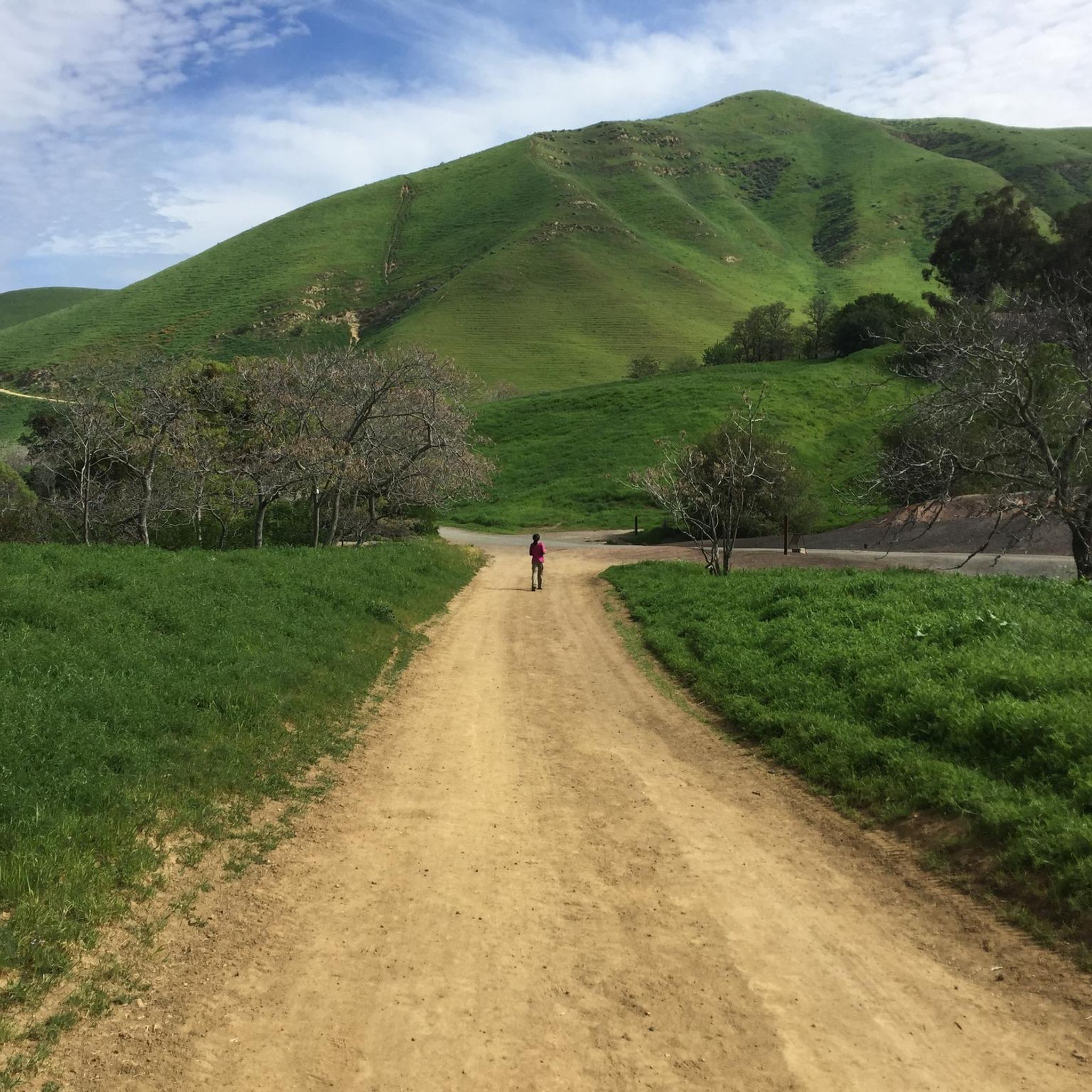
Spring is particularly beautiful for road cycling in Contra Loma Regional Park, as the hillsides come alive with vibrant wildflowers and lush greenery. While much of the park is exposed, offering wide-open vistas, some sections provide shade. It's always advisable to check local weather conditions, especially during warmer months, and plan rides for cooler parts of the day.
What natural features and viewpoints can I discover along the road cycling routes?
The park's centerpiece is the 80-acre Contra Loma Reservoir, which provides stunning views and a picturesque setting for cycling. From higher points within the park, cyclists can enjoy expansive views of the surrounding mountains and, on clear days, even Mount Diablo. The regional trail connections also lead through wetlands, grasslands, and wooded areas, offering diverse natural scenery.
Are there any specific landmarks or attractions to look out for while cycling?
Beyond the scenic reservoir, you might encounter the Antioch Community Park Trail to Contra Loma Reservoir, which offers a pleasant connection. The park also features the Delta - DeAnza - Trail, a significant regional connection, and the Contra-Loma Reservoir Dam at Contra Costa Canal, an interesting man-made structure.
What do other road cyclists enjoy most about road cycling in Contra Loma Regional Park?
The area is highly rated by the komoot community, with an average score of 4.8 stars from over 15 reviews. Reviewers often praise the diverse terrain, the extensive network of regional trail connections that allow for longer, traffic-free rides, and the scenic views of the reservoir and surrounding hills.
How do the road cycling routes in Contra Loma Regional Park connect to broader regional trails?
A significant advantage for road cyclists is the park's integration with extensive regional trails. Routes seamlessly connect to the Delta de Anza Trail, which extends over 15 miles, and the Marsh Creek Regional Trail. These connections provide opportunities for long-distance cycling through varied landscapes, safely separated from road traffic. An example is the Marsh Creek Regional Trail – Big Break Regional Shoreline loop from Antioch.
Are there any loop trails for road cycling in Contra Loma Regional Park?
Yes, many of the road cycling routes in and around Contra Loma Regional Park are designed as loops, offering a convenient way to explore the area without retracing your steps. For instance, the Marsh Creek Regional Trail – Los Vaqueros Reservoir loop from Antioch is a popular option, covering over 70 kilometers.
Is there parking available for road cyclists at Contra Loma Regional Park?
Yes, Contra Loma Regional Park offers parking facilities for visitors. It's advisable to check the park's official website or signage upon arrival for specific parking areas and any potential fees.
Can I access Contra Loma Regional Park's road cycling trails using public transport?
While the park is primarily accessed by car, some public transport options may get you close to the vicinity. For detailed information on public transport routes and stops near Contra Loma Regional Park, it's best to consult local transit authority websites.
Are there picnic areas available for a break during a road cycling trip?
Yes, Contra Loma Regional Park provides numerous picnic areas throughout the park. Some of these are reservable, offering ideal spots for cyclists to take a break, refuel, and enjoy the scenic surroundings during their ride.
Most popular routes in Contra Loma Regional Park
Most popular attractions in Contra Loma Regional Park

Get inspired with the komoot mobile app


Explore more
Browse the best Road cycling routes in other regions.
