The best running trails in White Hill Open Space Preserve
3.5
(2)
254
runners
35
runs
Jogging in White Hill Open Space Preserve offers a network of trails through varied terrain. The region features a mix of natural landscapes, including hills, lakes, and forested areas, providing diverse running experiences. Trails often traverse open spaces with views and lead past water features like falls and reservoirs. The elevation changes on many routes present a challenge for runners.
Best jogging routes in White Hill Open Space Preserve
- The most popular jogging route is Little Carson Falls & Kent Lake loop, a 7.6 miles (12.2 km) trail that takes 1 hour 41 minutes to complete. This difficult route explores scenic falls and the shores of Kent Lake.
- Another top favourite among local runners is Bon Tempe Lake, Alpine Lake & Cataract Trail loop, a difficult 11.1 miles (17.9 km) path. This route offers extensive views of multiple lakes and follows a notable trail.
- Local runners also love the Bald Hill loop from Fairfax, a 6.0 miles (9.6 km) trail leading through hilly terrain, often completed in about 1 hour 16 minutes.
- Jogging in White Hill Open Space Preserve is defined by hills, lakes, and natural trails. The network offers options for different ability levels, from moderate to difficult.
- The routes in White Hill Open Space Preserve are highly rated by the komoot community with an average score of 4.0 stars from over 5 reviews. More than 350 runners have used komoot to explore White Hill Open Space Preserve's varied terrain.
Last updated: July 8, 2026
1
runners
12.2km
01:41
470m
470m
The Little Carson Falls & Kent Lake loop is a fantastic option if you're seeking a challenging jogging experience that blends lush redwood forests with expansive views. This difficult 7.6-mile (12.2 km) route, which takes about 1 hour and 41 minutes to complete, guides you through a diverse landscape, from the serene Kent Lake to the impressive cascades of Carson Falls, especially vibrant after rainfall. You'll encounter sections with a
2
runners
17.9km
02:25
530m
530m
This challenging 11.1-mile (17.9 km) jogging loop takes you through the heart of the Mount Tamalpais Watershed, offering a diverse and demanding experience. You'll traverse serene lake shores around Bon Tempe Lake and Alpine Lake before diving into the lush redwood groves of the Cataract Trail, where a series of impressive waterfalls await. With 1730 feet (527 metres) of elevation gain and an estimated duration of 2 hours and 24 minutes, this route is ideal for fit joggers seeking a rewarding workout amidst stunning natural beauty.
To make the most of your visit, consider tackling this route in late winter or spring, when the Cataract Trail Waterfalls are at their most spectacular after seasonal rains. While specific parking information isn't detailed, trailheads in this popular area can get busy, so an early start is always a good idea. Be sure to wear sturdy shoes and carry enough water, as sections of the Cataract Trail are very rugged and demanding, featuring steep ascents and many stairs.
The Mount Tamalpais Watershed is not just a recreational haven; it's also a vital source of water for Marin County, underscoring the pristine nature of the environment you'll be jogging through. Beyond the waterfalls, keep an eye out for local wildlife, including various bird species and even newts. This loop offers a fantastic blend of open lake views and shaded forest paths, providing a true escape into nature.

Sign up for free
6
runners
12.2km
01:30
250m
250m
Moderate run. Good fitness required. Mostly paved surfaces. Suitable for all skill levels.
11
runners
11.9km
01:38
400m
400m
If you're ready for a challenging jogging experience, the Big Rock Ridge Trail delivers a difficult 7.4-mile (11.9 km) route. You'll gain 1312 feet (400 metres) in elevation, typically completing the journey in about 1 hour and 37 minutes. The path winds through scenic oak-studded hillsides, offering a chance to see spring wildflowers. As you climb, you'll be treated to spectacular 360-degree views of the Bay Area, including Lucas Valley, the Richmond-San Rafael Bridge, and San Francisco; on clear days, you can even spot the Pacific Ocean and Mount Diablo.
When you plan your visit, remember that many sections of the trail are exposed to full sun. This can make it scorching hot and dusty during warmer months, so be sure to carry plenty of water and wear sun protection. It is also wise to keep an eye out for local wildlife, such as rattlesnakes and coyotes, which are common in the area.
This challenging route is located within the Lucas Valley Open Space Preserve and forms part of the larger Bay Area Ridge Trail system. It is particularly known for its impressive vistas, which make the effort of the climb truly worthwhile. The trail's unique position offers glimpses of landmarks like Skywalker Ranch, adding to its distinct character in the region.
2.0
(1)
3
runners
12.4km
01:45
610m
620m
The Mount Tamalpais East & Middle Peaks from Lake Lagunitas loop offers a dynamic jogging experience, starting in the serene, dense forests around Lake Lagunitas before climbing through chaparral to exposed peaks. You'll navigate varied terrain, from paved paths to fire roads and steep, rocky sections, all leading to spectacular 360-degree panoramic views from both East and Middle Peaks. On a clear day, you can see the San Francisco skyline, the Golden Gate Bridge, and the vast Pacific Ocean, making the challenging ascent truly worthwhile.
This difficult 7.7-mile (12.4 km) jogging route involves a significant 2015 feet (614 metres) of elevation gain, typically taking around 1 hour and 45 minutes. The trailhead at Lake Lagunitas provides picnic areas and restrooms, making it a convenient starting point. Given the popularity of Mount Tamalpais, arriving early is recommended to secure parking, especially on busy days.
Historically, the area has ties to the Mill Valley and Mt. Tamalpais Scenic Railway, with sections like the Railway Grade Fireroad following its former path. This route showcases Mount Tamalpais' diverse ecosystems, transitioning from lush forest to more arid chaparral, and is widely considered one of the best running routes for experienced joggers seeking both a physical test and expansive Bay Area vistas.
Get access to more routes and recommendations from other explorers.
Sign up for free
Already have an account?
Our route recommendations are based on thousands of hikes, rides, and runs completed by other people on komoot.
Start today with a free account
Your next adventure awaits.
Login or Signup
Tips from the Community

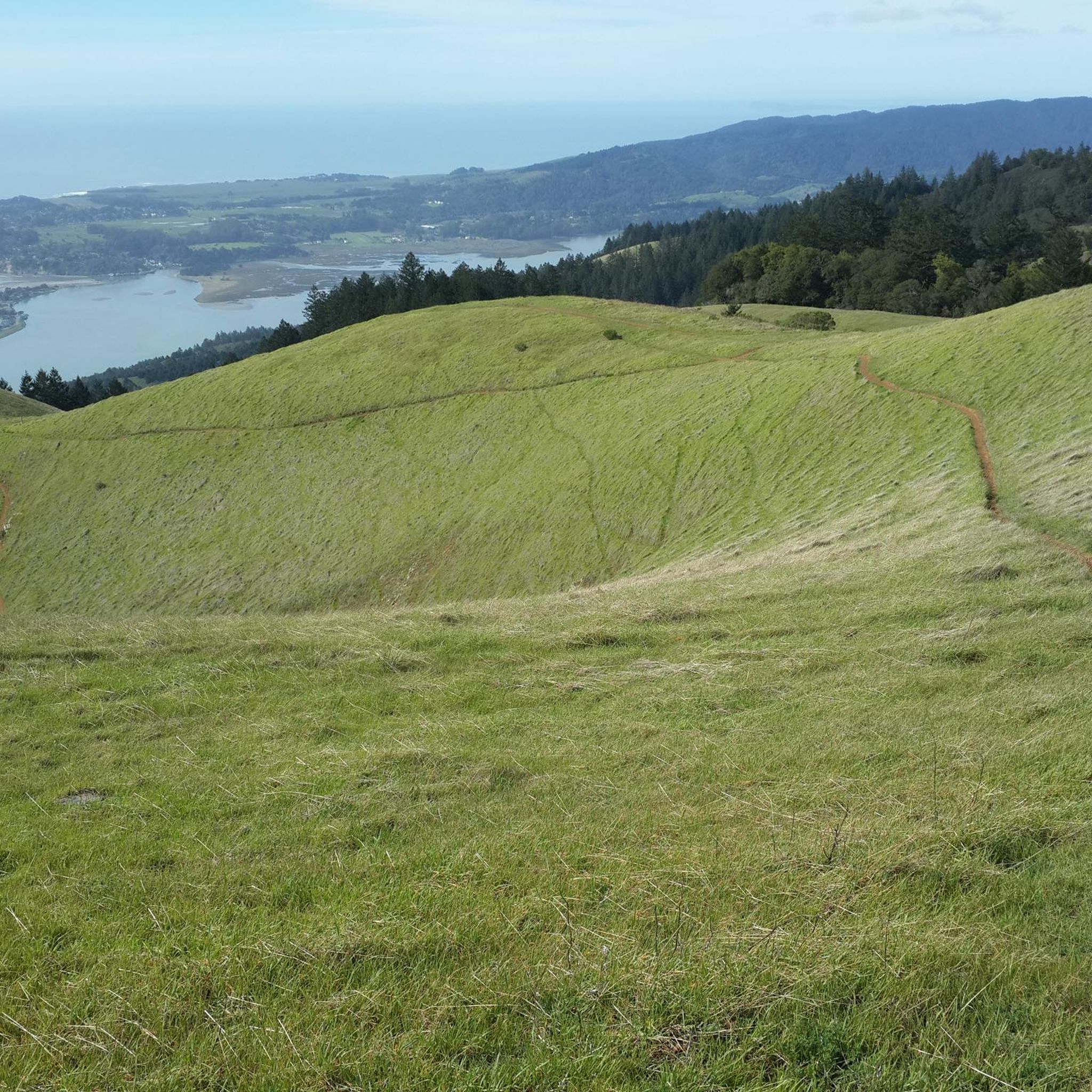
Mount Tam East Peak offers some of the most majestic views north of the bay. From this vantage point, you can see all of Marin, along with Point Reyes to the north and Oakland and San Francisco to the south. The stunning panoramic vistas make the journey well worth the effort. There are restrooms and picnic tables, ideal for a snack or lunch while you capture some incredible photos.
0
0

One of the best views in the entire Bay Area. No question.
0
0
Often busy on weekends, this is a great spot to take moment before/after summiting Mt Tam. There are spigots to fill up water and bathrooms that are open during park hours. The parking lot is very close for those that drive up. There is access to MANY trails for those on foot/bike.
0
0
Mount Tam East Peak offers some of the most majestic views north of the bay. From this vantage point, you can see all of Marin, along with Point Reyes to the north and Oakland and San Francisco to the south. The stunning panoramic vistas make the journey well worth the effort. There are restrooms and picnic tables, ideal for a snack or lunch while you capture some incredible photos.
1
0

Big Rock Ridge, a striking ridge near Novato, California, standing as Marin County's second-tallest peak. Spanning 5 miles from northwest to east, it creates a natural boundary for central and southern Marin County. Named after the rock at the base of Big Rock Trail, this ridge promises awe-inspiring views and invigorating trails.
0
0

Just before the last ascent of East Ridgecrest Blvd toward the East Peak of Mt Tamalpais is the Railway Grade Fireroad Trailhead on the south side, and a few dozen yards furthe south, the Eldridge Grade Fire Road down on the north side.
0
0
The Lagunitas Dam, completed 151 years ago, was built in less than four months and was 480 feet long with a crest of 20 feet. The purpose was to supply development in the San Rafael area. Its current capacity is 350 acre-feet or 114 million gallons. Lake Lagunitas is one of seven Marin Municipal County Reservoirs, and the combined rainfall collected from these reservoirs makes up around 75 % of the district's water supply.
0
0

Don't be fooled, 'Alpine Lake' is the name of this body of water, but the fact that it is an alpine lake is highly debatably at a lowly 768 feet. Irregardless, the views are still nice. You can look but not touch as there is no swimming or boating allowed in the lake.
0
0
Frequently Asked Questions
How many running routes are available in White Hill Open Space Preserve?
White Hill Open Space Preserve offers a wide selection of running routes, with over 35 trails to explore. These routes cater to various fitness levels, ranging from moderate to difficult.
Are there easy running trails suitable for beginners in White Hill Open Space Preserve?
While many routes in White Hill Open Space Preserve feature elevation changes, there are a few easier options. For instance, the area has 2 routes classified as easy, and 17 as moderate, providing good starting points for those new to trail running or looking for a less strenuous workout.
Are there challenging running routes in White Hill Open Space Preserve?
Yes, White Hill Open Space Preserve is known for its challenging terrain. Many routes feature significant elevation changes, making them ideal for experienced runners seeking a demanding workout. There are 20 routes classified as difficult, offering substantial climbs and descents.
Can I bring my dog on the running trails in White Hill Open Space Preserve?
White Hill Open Space Preserve is generally dog-friendly, but specific regulations may apply to certain trails or areas. It's always best to check local signage or the official park website for the most current rules regarding dogs, including leash requirements and restricted zones, to ensure a pleasant experience for everyone.
Are there any loop running trails in White Hill Open Space Preserve?
Yes, many of the running routes in White Hill Open Space Preserve are loops, offering varied scenery without retracing your steps. Popular loop options include the challenging Little Carson Falls & Kent Lake loop and the scenic Bon Tempe Lake, Alpine Lake & Cataract Trail loop.
What kind of viewpoints can I expect on the running trails?
The running trails in White Hill Open Space Preserve offer numerous scenic viewpoints. You can expect extensive views of multiple lakes, such as Kent Lake, Bon Tempe Lake, and Alpine Lake. Many routes also traverse open spaces and hills, providing panoramic vistas of the surrounding natural landscapes and forested areas.
Can I see waterfalls or lakes while running in White Hill Open Space Preserve?
Absolutely! The preserve features beautiful water features. Routes like the Little Carson Falls & Kent Lake loop will take you past scenic falls and along the shores of Kent Lake. Other trails, such as the Bon Tempe Lake & Dam loop from Fairfax, offer extensive views of the region's reservoirs.
Where can I park when visiting White Hill Open Space Preserve for a run?
Parking is available at various access points around White Hill Open Space Preserve. Specific parking areas can be found near popular trailheads. It's advisable to check the starting points of your chosen route on komoot for detailed parking information, as availability can vary.
What do other runners enjoy about the trails in White Hill Open Space Preserve?
The running routes in White Hill Open Space Preserve are highly rated by the komoot community, with an average score of 4.0 stars. Runners often praise the diverse terrain, the challenging elevation changes, and the beautiful natural landscapes, including the lakes and forested areas. The variety of routes ensures there's something for everyone.
What is the best time of year for running in White Hill Open Space Preserve?
White Hill Open Space Preserve offers good running conditions throughout much of the year. Spring brings lush greenery and wildflowers, while fall provides cooler temperatures and vibrant foliage. Summers can be warm, so early morning or late afternoon runs are often preferred. Winters are generally mild, though trails can be muddy after rain.
What are the typical trail conditions like for running in White Hill Open Space Preserve?
The trails in White Hill Open Space Preserve are primarily natural, ranging from well-maintained dirt paths to more rugged, rocky sections. Conditions can vary with weather; trails may be dusty in dry periods and muddy after rain. Runners should be prepared for uneven surfaces and some technical sections, especially on more difficult routes.
Are there cafes or places to get refreshments near White Hill Open Space Preserve after a run?
Yes, the preserve is located near several towns, such as Fairfax, which offer various options for refreshments. After your run, you can find cafes, restaurants, and local shops in these nearby communities to refuel and relax.
Most popular routes in White Hill Open Space Preserve

Get inspired with the komoot mobile app


Explore more
Browse the best Running Trails & Routes in other regions.
