The best MTB trails in Gunpowder Falls State Park Lost Lake Area
5.0
(2)
161
riders
11
rides
Mountain bike trails in Gunpowder Falls State Park Lost Lake Area traverse a diverse landscape of over 18,000 acres, characterized by dense forests, rivers, and varied terrain. The region features extensive multi-use trails with sections that include rocky areas, roots, and notable elevation changes. Riders can expect a mix of challenging and accessible paths, often following the scenic Gunpowder River. The park's topography ranges from tidal marshes to rugged interior slopes, providing a dynamic environment for mountain biking.
Best mountain…
Last updated: September 5, 2026
17
riders
Easy mountain bike ride. Great for any fitness level. Suitable for all skill levels.
16
riders
Moderate mountain bike ride. Good fitness required. Advanced riding skills necessary.

Sign up for free
5.0
(1)
6
riders
Moderate mountain bike ride. Great for any fitness level. Advanced riding skills necessary.
12
riders
18.3km
01:32
150m
150m
Get ready for an easy mountain biking adventure on the Little Gunpowder and Yellow Trail Loop, a route that winds for 11.4 miles (18.3 km) through varied terrain. You will…
41
riders
35.5km
02:59
430m
430m
Moderate mountain bike ride. Good fitness required. Suitable for all skill levels.
Get access to more routes and recommendations from other explorers.
Sign up for free
Already have an account?
Our route recommendations are based on thousands of hikes, rides, and runs completed by other people on komoot.
Start today with a free account
Your next adventure awaits.
Login or Signup


Tips from the Community

You can view the quarry from the top or from the bottom. From here you get great sweeping views off the ledge, and if you swing down below via the Little Gunpowder Trail you can look up to see its towering stone walls. The trail to this point from east is a little easier.
0
0

Jerusalem Mill Section is part of the vast Gunpowder Falls State Park. An endless network of trails will lead you to the discovery of this beautiful corner of Maryland.
0
0

As the Little Gunpowder Falls is divided into two parts at this spot, there is a very little island in the middle of the two river sections. After a very short distance, the two parts reunite again to continue flowing through the park.
0
0
There is ample parking at the trailhead and access to the trail system on both sides of the road. From here you can explore a network of peaceful singletrack trails that fork off of Little Gunpowder.
0
0
This is a wonderfully scenic singletrack trail that winds its way along the southern bank of Little Gunpowder Falls with continuous views of the river. The trail is packed dirt and only mildly technical.
0
0
The waterfall cascades down the length of the Waterfall Trail, which follows Dick Branch on both sides. There are stepping logs and stones to help you cross the creek.
0
0
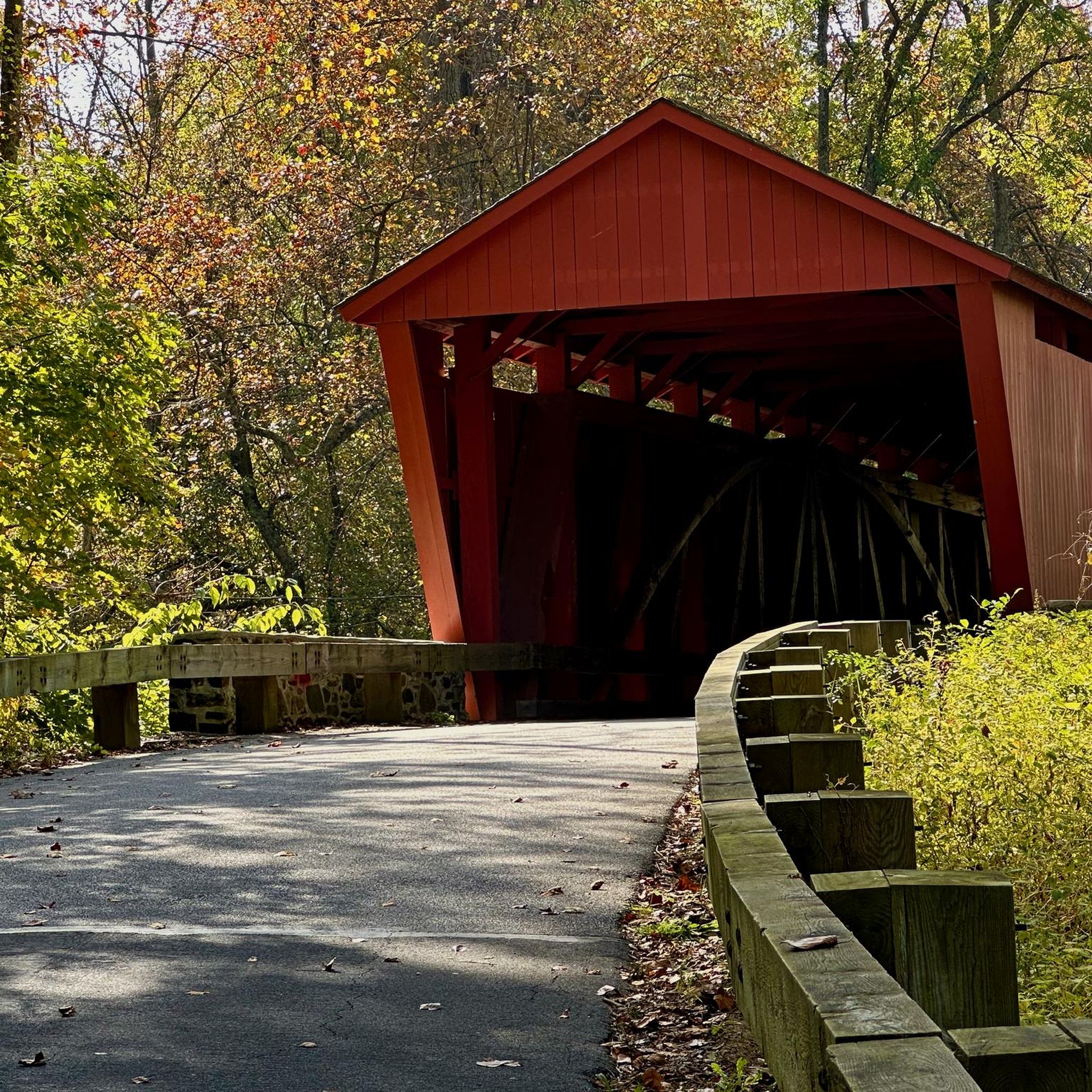
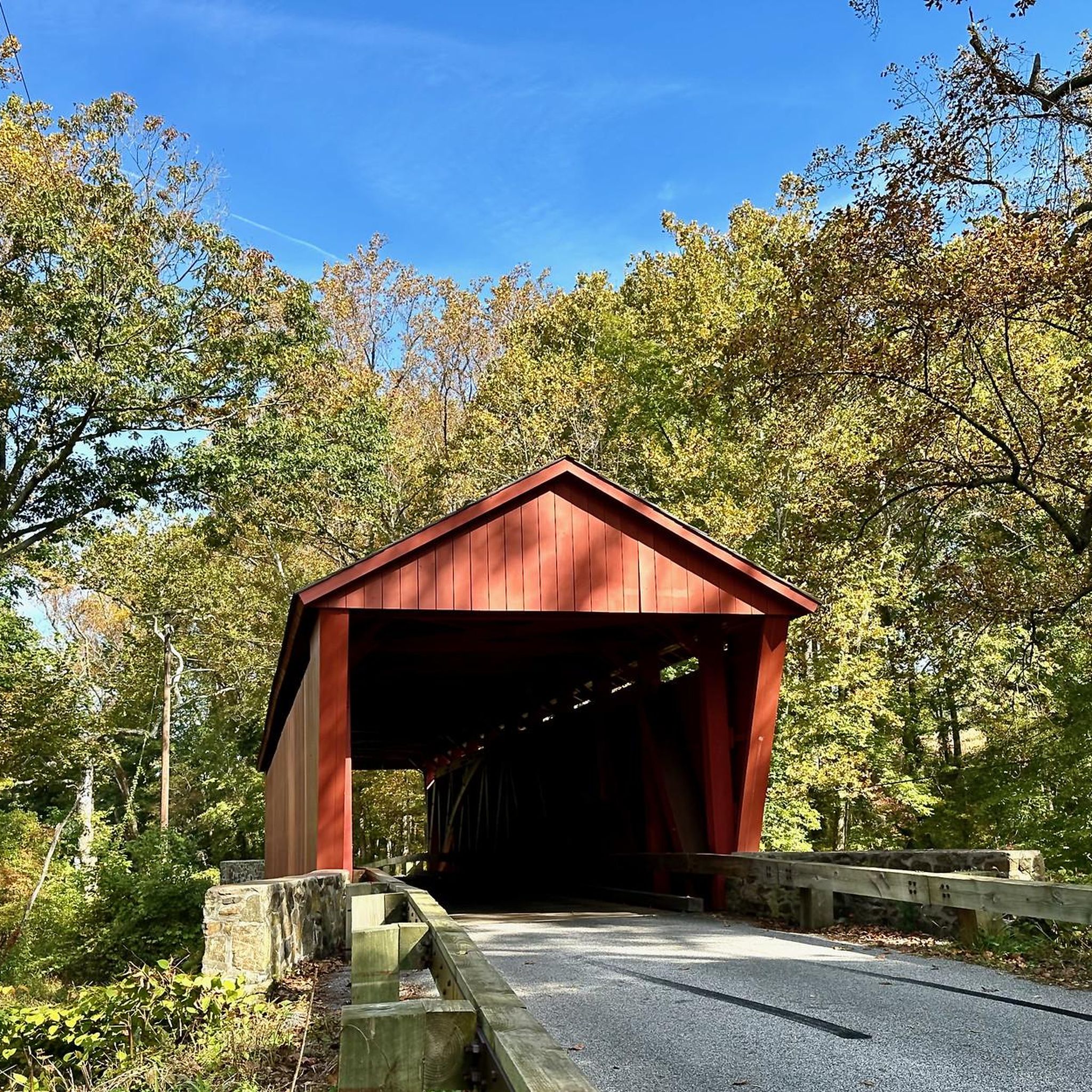
The iconic bridge here is beautiful and open to views of Little Gunpowder Falls. The bridge is narrow and you share the road with the cars while you cross.
0
0
This is an old segment of the Maryland & Pennsylvania Railroad. You can follow the MD & PA Trail for a few miles along the river and through the trees between Pleasantville Bridge and Bottom Road Bridge.
0
0
Frequently Asked Questions
What kind of terrain can I expect on mountain bike trails in Gunpowder Falls State Park Lost Lake Area?
The trails in Gunpowder Falls State Park Lost Lake Area offer a diverse experience, ranging from dense forests and riverside paths to more rugged sections. You can expect varied terrain including rocky areas, roots, and notable elevation changes, especially along the Big and Little Gunpowder Falls. Some trails feature short, steep climbs over rocks and roots, while others provide mostly flat and even paths.
Are there mountain bike trails suitable for beginners or families in the Lost Lake Area?
Yes, there are several easy mountain bike trails suitable for beginners and families. For example, the Little Gunpowder and Yellow Trail Loop is an easy 18.3 km path offering a mix of forest and riverside views. Another good option is the Bottom Road Steel Bridge – Pleasantville Area loop from Fallston, which is 13.7 km and also rated easy.
What are some notable natural features or landmarks I might see while mountain biking in Gunpowder Falls State Park Lost Lake Area?
While exploring the trails, you'll encounter the scenic Big and Little Gunpowder Falls, which characterize the park. A unique natural attraction is the 'Pot Rocks' along the Gunpowder River, which are smooth, water-carved depressions in the riverbed. You might also pass by historic sites like Jerusalem Mill Village, offering a glimpse into the region's past.
Are there any trails that feature waterfalls in the Lost Lake Area?
Yes, the Dick Branch waterfall – Little Gunpowder Trail loop from Fallston is a moderate 25.9 km trail that leads through forested areas and past natural features, including a waterfall.
How many mountain bike trails are available in Gunpowder Falls State Park Lost Lake Area?
There are 8 mountain bike trails available in Gunpowder Falls State Park Lost Lake Area, offering a variety of experiences for different skill levels. Four of these routes are rated easy, and four are rated moderate.
What is the best time of year to go mountain biking in Gunpowder Falls State Park Lost Lake Area?
The park's trails are generally enjoyable throughout the year, but spring and fall offer particularly pleasant conditions with milder temperatures and vibrant foliage. Summer can be warm and humid, while winter riding is possible but may require checking trail conditions for ice or snow.
Are dogs allowed on the mountain bike trails in Gunpowder Falls State Park Lost Lake Area?
Gunpowder Falls State Park generally allows leashed dogs on its multi-use trails. However, it's always recommended to check specific park regulations or signage at trailheads for any area-specific restrictions or requirements regarding pets.
Where can I park when visiting Gunpowder Falls State Park Lost Lake Area for mountain biking?
Parking is available at various access points throughout Gunpowder Falls State Park. For specific trailheads in the Lost Lake Area, you'll find designated parking lots. It's advisable to check the starting point of your chosen route for the most convenient parking options.
Are there any long-distance mountain bike loops in the Lost Lake Area?
Yes, there are several longer loop options. For instance, the Little Gunpowder Falls loop from Reckford is a moderate 25.2 km route that takes about 2 hours 13 minutes to complete, offering varied terrain along the river.
What is the typical elevation gain on mountain bike trails in Gunpowder Falls State Park Lost Lake Area?
The elevation gain varies depending on the specific trail. For example, the Little Gunpowder Falls loop from Reckford has an elevation gain of approximately 265 meters, while the Little Gunpowder and Yellow Trail Loop has about 147 meters of ascent. Trails often feature short, steep climbs over rocks and roots.
Are there any easy mountain bike trails that follow an old railroad line?
Yes, the Abandoned railroad – Little Gunpowder Falls loop from Gunpowder Falls State Park Pleasantville Area is an easy 17.6 km route that incorporates sections of an old railroad line, offering a unique riding experience.
Most popular routes in Gunpowder Falls State Park Lost Lake Area

Get inspired with the komoot mobile app


Explore more
Browse the best MTB trails in other regions.
