The best walks and hikes in Gunpowder Falls State Park Sweathouse Area
4.6
(32)
376
hikers
66
hikes
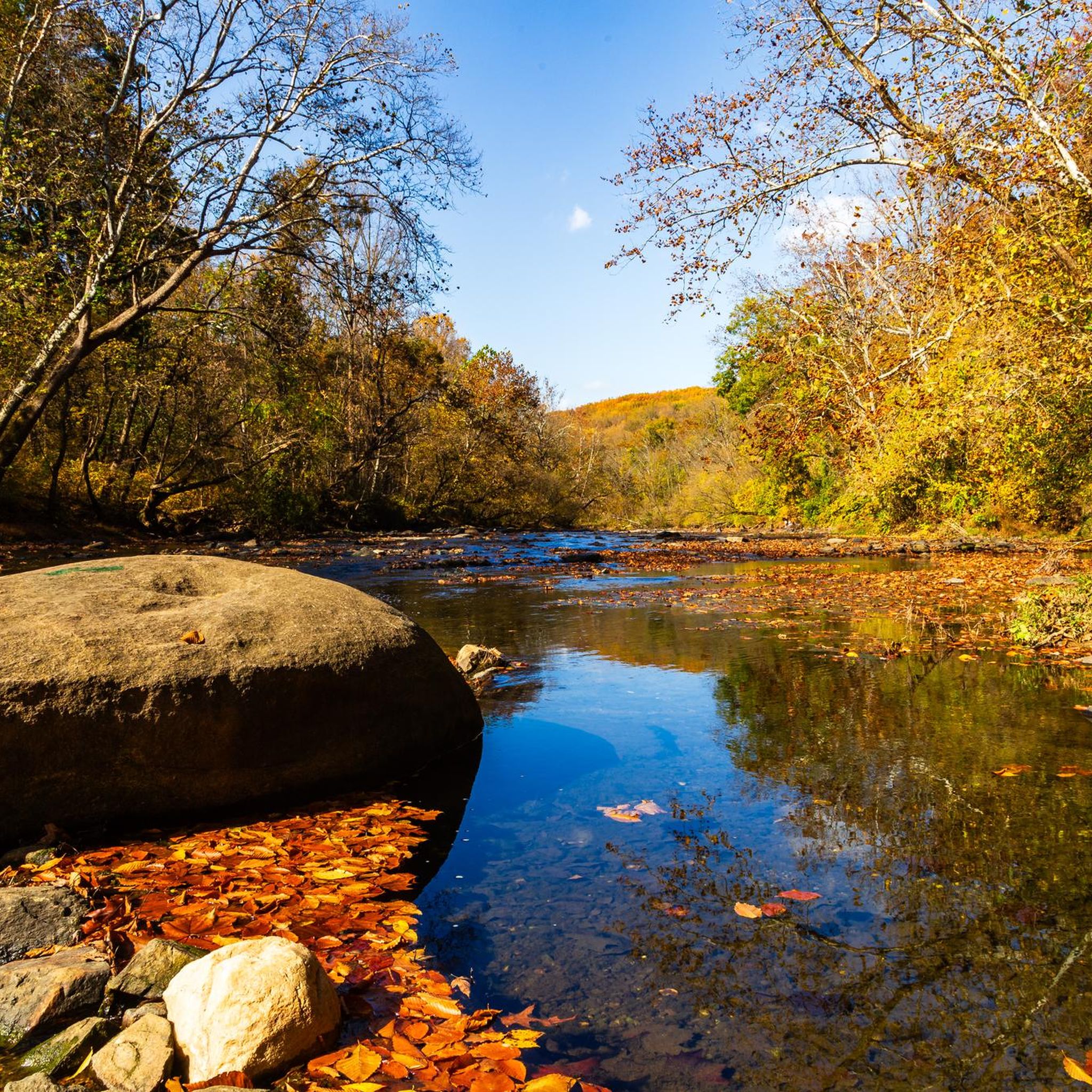
Hiking in Gunpowder Falls State Park Sweathouse Area offers a network of trails within a diverse landscape. This area, part of the larger Gunpowder Falls State Park, features varied topography ranging from forests and rolling hills to waterways like the Big Gunpowder Falls River and Sweathouse Branch. The terrain includes natural, unpaved paths with occasional roots and rocks, providing a range of experiences for hikers.
Best hiking trails in Gunpowder Falls State Park Sweathouse Area
- The most popular hiking route is Sweathouse Area Loop, a 4.1 miles (6.6 km) trail that takes 1 hour 48 minutes to complete. This easy route features riverside views and diverse forest scenery.
- Another top favourite among local hikers is Big Gunpowder Falls Trail, a moderate 9.2 miles (14.8 km) path. This trail follows the Big Gunpowder Falls River, offering views of the clear waters and surrounding woodlands.
- Local hikers also love the Graham Memorial Park Area loop, a 3.0 miles (4.9 km) trail leading through varied forest, often completed in about 1 hour 20 minutes.
- Hiking in Gunpowder Falls State Park Sweathouse Area is defined by diverse forests, rolling hills, and scenic waterways like the Big Gunpowder Falls River. The trail network offers options for easy to moderate ability levels.
- The routes in Gunpowder Falls State Park Sweathouse Area are highly rated by the komoot community with an average score of 4.6 stars from more than 30 reviews. More than 300 hikers have used komoot to explore Gunpowder Falls State Park Sweathouse Area's varied terrain.
Last updated: July 7, 2026
7.60km
02:00
60m
70m
Moderate hike. Good fitness required. Easily-accessible paths. Suitable for all skill levels.
4.4
(7)
28
hikers
6.65km
01:48
90m
90m
Easy hike. Great for any fitness level. Easily-accessible paths. Suitable for all skill levels.

Sign up for free
5.0
(3)
9
hikers
2.74km
00:45
40m
40m
Easy hike. Great for any fitness level. Easily-accessible paths. Suitable for all skill levels.
4.5
(2)
6
hikers
14.8km
03:52
100m
100m
Moderate hike. Good fitness required. Easily-accessible paths. Suitable for all skill levels.
4.88km
01:20
80m
80m
Easy hike. Great for any fitness level. Easily-accessible paths. Suitable for all skill levels.
Get access to more routes and recommendations from other explorers.
Sign up for free
Already have an account?
Our route recommendations are based on thousands of hikes, rides, and runs completed by other people on komoot.
Start today with a free account
Your next adventure awaits.
Login or Signup



Tips from the Community

The Big Gunpowder Falls Trail is a scenic pathway that follows the course of its name-giving river. Stretching through Gunpowder Falls State Park, the trail leads through wooded areas, meadows, and along riverbanks.
0
0
Jennifer Branch is one of the tributaries of Big Gunpowder Falls. The trail follows and crosses the branch multiple times and leads from Big Gunpowder Falls Trail down to Graham Memorial Park Area.
0
0
Graham Memorial Park Area is one of the less visited corners in Gunpowder Falls State Park. The area hosts the 'Graham Equestrian Center', which is a non-profit organization that provides the possibility to interact with horses. Besides that, there are some nice hiking trails all around the area.
0
0
Lost Pond Trail is located in the south of Kingsville and is part of Gunpowder Falls State Park. It follows the river 'Big Gunpowder Falls' and doesn't have any incline. Thanks to that and the fact, that the trail is quite short as well, it's a perfect hike for families along the water.
0
0
Sawmill Trail is an easy loop, starting and ending at different sections of Lost Pond Trail. The trail leads through the woods and offers some views of the nearby creek at some points.
0
0
Sweathouse Area is one of many areas of Gunpowder Falls State Park. It contains multiple hiking trails (Sweathouse Trail, Stocksdale Trail, Wildlands Trail), that lead through the forest and along creeks. The area is quite easy to hike and you don't need any special experience.
0
0
Sweathouse Trail is one of the trails leading through the area of the same name in Gunpowder Falls State Park. The trail follows Big Gunpowder Falls through the woods for some time and runs along Sweathouse Branch later.
0
0
Frequently Asked Questions
How many hiking trails are available in Gunpowder Falls State Park Sweathouse Area?
The Gunpowder Falls State Park Sweathouse Area offers a wide selection of hiking opportunities, with nearly 70 routes recorded on komoot. These range from easy strolls to more moderate treks, catering to various fitness levels.
Are there any easy, family-friendly hikes in the Sweathouse Area?
Yes, the area is well-suited for families and beginners. Many trails are considered easy, such as the Sweathouse Area Loop, which is a 4.1-mile path featuring pleasant riverside views and diverse forest scenery. The terrain generally includes rolling hills and natural paths, making it approachable for most.
Can I bring my dog on the trails in Gunpowder Falls State Park Sweathouse Area?
Yes, dogs are generally welcome on trails in Gunpowder Falls State Park, including the Sweathouse Area. It's always best to keep them on a leash and ensure you follow any specific park regulations regarding pets.
What kind of natural features can I expect to see while hiking?
Hikers can enjoy diverse natural features, including the Big Gunpowder Falls River and Sweathouse Branch, which trails often follow, offering pleasant riverside views and the sounds of rushing water. The area also features varied woodlands, including pine plantations, and rolling hills. In spring, you might spot wildflowers like Marsh Marigolds and Virginia Blue Bells.
Are there any circular hiking routes in the Sweathouse Area?
Yes, several circular routes are available. A popular option is the Lost Pond and Sawmill Trail Loop, an easy 2.7-mile hike. Another great choice is the Graham Memorial Park Area loop, which is 3.0 miles long and takes you through varied forest.
Where can I park when visiting the Sweathouse Area?
Convenient parking is available near Belair Road in Kingsville, providing easy access to the trailheads within the Sweathouse Area.
What is the best time of year to hike in Gunpowder Falls State Park Sweathouse Area?
The Sweathouse Area offers enjoyable hiking year-round. Spring is ideal for seeing wildflowers, while fall brings vibrant foliage. Even winter can be a peaceful time to visit, offering a chance for solitude on the trails. The clear waters of the Big Gunpowder Falls River are a highlight in any season.
Are there opportunities for swimming or cooling off during a hike?
Yes, some paths parallel shallow creeks where you can cool off. The Sweathouse Trail notably involves crossing Sweathouse Run, and there's a particularly good swimming hole located about a mile into the Sweathouse Trail after merging from the Stocksdale Trail.
What do other hikers enjoy most about the Gunpowder Falls State Park Sweathouse Area?
The area is highly rated by the komoot community, with an average score of 4.6 stars from over 30 reviews. Hikers often praise the diverse forest scenery, the pleasant riverside views along the Big Gunpowder Falls River, and the generally accessible nature of the trails.
Are there any longer, more challenging trails in the Sweathouse Area?
While many trails are easy, there are options for longer, moderate hikes. The Big Gunpowder Falls Trail is a moderate 9.2-mile path that follows the river, offering a more extended experience through the woodlands.
Is public transport available to reach the Sweathouse Area?
While direct public transport to the Sweathouse Area is limited, you might consider options like the MTA Light RailLink to nearby stations such as Perry Hall, and then arrange for a taxi or ride-share service to reach the park entrance near Belair Road in Kingsville.
Are there any cafes or restaurants near the Sweathouse Area for after a hike?
The Sweathouse Area is located near Kingsville, MD, where you can find local cafes, pubs, and restaurants to refuel and relax after your hike.
Most popular routes in Gunpowder Falls State Park Sweathouse Area

Get inspired with the komoot mobile app


Explore more
Browse the best Hikes in other regions.
