The best walks and hikes in Patapsco Valley State Park Freedom Area
4.4
(41)
331
hikers
47
hikes
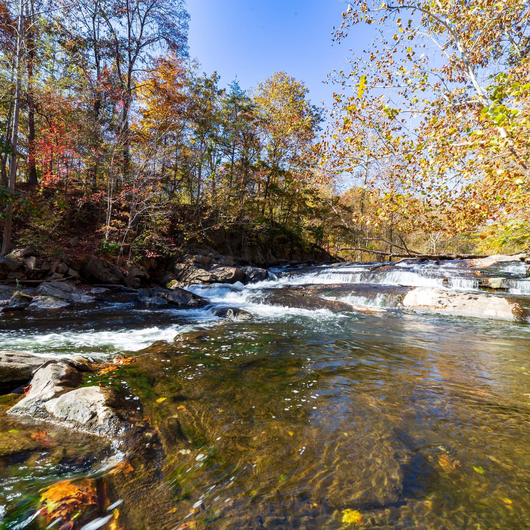
Hikes in Patapsco Valley State Park Freedom Area are characterized by varied landscapes that include serene riverside paths and rolling, hilly terrain. The region features the confluence of the North and South branches of the Patapsco River, creating a dynamic environment for hikers. The area is primarily covered in second-growth deciduous woodland, with trails winding through established tree canopies.
Best hiking trails in Patapsco Valley State Park Freedom Area
- The most popular hiking route is McKeldin Rapids Trail – Plantation Trail loop from Marriottsville, a 4.2 mile (6.8 km) trail that takes about 1 hour 45 minutes to complete. This route combines a path to the McKeldin Rapids with a walk through pine groves on the Plantation Trail.
- Another top favourite among local hiking enthusiasts is Switchback Trail loop — Patapsco Valley State Park, an easy 4.3 mile (7.0 km) path. The trail follows the south branch of the Patapsco River, offering pleasant waterside sections.
- Local hiking enthusiasts also love the Freedom Park loop — Patapsco Valley State Park, a 2.0 mile (3.3 km) trail leading through a paved park area, often completed in about 50 minutes.
- Hiking in Patapsco Valley State Park Freedom Area is defined by riverside paths, forested hills, and well-maintained trails. The network of Patapsco Valley State Park Freedom Area trails offers options suitable for different ability levels, from easy paved loops to more moderate woodland hikes.
- The routes in Patapsco Valley State Park Freedom Area are highly rated by the komoot community with an average score of 4.4 stars from more than 30 reviews. More than 250 hikers have used komoot to explore Patapsco Valley State Park Freedom Area's varied terrain.
Last updated: October 11, 2026
6
hikers
7.69km
02:06
110m
120m
Embark on the Colt 45 Trail for a moderate hike through the natural beauty of Patapsco Valley State Park. This route spans 4.8 miles (7.7 km) and involves an elevation gain of 373 feet (114 metres), typically taking about 2 hours and 5 minutes to complete. As you hike, you will find yourself on varied terrain, including sections with roots and ruts that add a touch of adventure. Keep an eye out for diverse flora and fauna that thrive in this scenic environment. It offers a balanced challenge, perfect for a solid workout without being overly strenuous. You will follow official trails like the Patapsco Alt HoCo Thru Trail and Patapsco Traverse.
Before you head out, plan your visit to Patapsco Valley State Park. Parking is generally available at trailheads within the park, but it is always wise to check for any specific fees or seasonal closures that might affect your trip. This ensures a smooth start to your hiking experience. While the trail is suitable for a leisurely hike, being prepared for park regulations will help you make the most of your time on the route.
The Colt 45 Trail is set within the immersive natural environment of Patapsco Valley State Park, known for its extensive network of trails. While this particular route is ideal for a more relaxed outing, the area itself is recognized for its use in ultra-marathon events, highlighting its robust and varied landscape. This makes the trail a great option if you are looking for a well-maintained path with a sense of regional significance.
1.47km
00:23
0m
30m
Embark on the Henryton Trail for an easy hike through a mature deciduous forest, offering ample shade and a chance to spot local wildlife. This short route, spanning just 0.9 miles (1.5 km), follows the South Branch Patapsco River, providing picturesque views of the water as you walk. You will gain a gentle 12 feet (4 metres) in elevation, making it a quick and accessible outdoor escape that takes approximately 23 minutes to complete. The terrain is generally easy, perfect for a relaxing stroll.
Before you set out on the Henryton Trail, be aware that while generally easy, some parts, particularly near the Patapsco River, might present moderate to steep slopes. These areas can sometimes be slippery or muddy, so wearing sturdy waterproof hiking boots is a good idea to ensure comfortable footing. A hiking stick can also be helpful for stability on any inclines you encounter. Remember that there are no public facilities directly on the trail, so plan your visit accordingly before you arrive at Patapsco Valley State Park.
Beyond its natural beauty, the Henryton Trail offers a glimpse into the past with unique historical ruins scattered along the path. As you hike, keep an eye out for remnants like a brick-lined stone chimney and hearth, which add a distinctive cultural layer to your outdoor experience. This blend of riverside scenery, forest tranquility, and historical intrigue makes the trail a notable short excursion within the wider Patapsco Valley State Park.

5.0
(2)
16
hikers
3.28km
00:52
30m
30m
The Freedom Park Loop offers an easy hiking experience through pleasant green spaces, perfect for a quick escape. You can expect to cover its 2.0 miles (3.3 km) distance with a gentle 104 feet (32 metres) of elevation gain in about 52 minutes. As you walk, keep an eye out for the distinctive Freedom Park Sign, which serves as a clear landmark along the route, enhancing your relaxed outing.
Planning your visit to this park is straightforward. Parking is generally available right at the trailhead, making it easy to begin your hike without delay. You won't need to worry about specific permits or fees to enjoy this loop, offering a hassle-free experience for anyone looking for a simple park walk. It's an ideal choice for a spontaneous outdoor activity.
This trail is situated within Smallwood-Freedom Park, providing a convenient natural setting for local residents and visitors alike. The route's design focuses on accessibility and ease, making it a great option if you are seeking a gentle introduction to hiking or a leisurely stroll. The presence of the Freedom Park Sign also adds a unique, identifiable feature to your journey through the park.
4
hikers
9.32km
02:32
140m
140m
Moderate hike. Good fitness required. Easily-accessible paths. Suitable for all skill levels.
12
hikers
13.4km
03:38
180m
190m
The McKeldin to Woodstock Area Loop offers a dynamic hiking experience within Patapsco Valley State Park, guiding you through a rich tapestry of landscapes. You will traverse riverside paths along the Patapsco River, wind through thick pine groves, and explore mature hardwood forests. Keep an eye out for the scenic McKeldin Rapids and the tranquil Old Quarry Lake, which adds a unique touch to the journey.
This moderate 8.4-mile (13.4 km) loop, with 591 feet (180 metres) of elevation gain, typically takes about 3 hours and 38 minutes. The terrain includes uneven ground, roots, and moderately steep slopes, so good fitness is recommended. While specific parking information is not detailed, arriving early at the trailhead is always a good idea, especially on busy days.
What makes this trail particularly notable is its comprehensive showcase of Patapsco Valley State Park's diverse ecosystems and varied challenge. It combines serene riverine landscapes with dramatic rapids and the tranquility of diverse forests. The broader park area also features historical structures built by the Civilian Conservation Corps (CCC) in the 1930s, adding a layer of historical context to your outdoor adventure.
Get access to more routes and recommendations from other explorers.
Already have an account?
Our route recommendations are based on thousands of hikes, rides, and runs completed by other people on komoot.
Start today with a free account
Your next adventure awaits.


Tips from the Community

The lake is small and fully encircled by the trail. The wall of the quarry stands high on the far side from the viewpoint. In the summer the vegetation crowding the water makes it feel like quite the lush watering hole.
0
0

As part of the Patapsco Valley State Park, the Woodstock Area is characterized by its scenic woodlands and riverbanks along the trails. While exploring the area you can enjoy a peaceful retreat.
0
0

The Marriottsville section of Patapsco Valley State Park features a bunch of great mountain biking trails. It has its own trailheads, parking lots, and facilities, so you don't have to try to experience the entirety of Patapsco Valley State Park in just one ride.
0
0
As part of the Patapsco Valley State Park, the Woodstock Area is characterized by its scenic woodlands and riverbanks along the hiking trails. While hiking through the area, nature enthusiasts can enjoy a peaceful retreat.
0
0

The Patapsco River is a 39-mile river that flows into the Chesapeake Bay, notably running through the city of Baltimore.
0
0
The Marriottsville section of Patapsco Valley State Park features a bunch of great hiking trails. It has its own trailheads, parking lots, and facilities, so you don't have to try to experience the entirety of Patapsco Valley State Park in just one hike.
0
0
The Patapsco River is a 39-mile river that flows into the Chesapeake Bay, notably running through the city of Baltimore.
0
0
The North Branch Patapsco River is a 20-mile tributary to the larger Patapsco River.
0
0
Frequently Asked Questions
Are dogs allowed on the trails in the Freedom Area?
Yes, dogs are welcome on the trails in Patapsco Valley State Park, including the Freedom and McKeldin Areas, as long as they are kept on a leash. The trails offer plenty of space for you and your four-legged friend to explore the woodlands and riverside paths.
Are there any easy, beginner-friendly hikes in the area?
Absolutely. The region has many accessible trails. For a very gentle walk, the Freedom Park loop is a paved 2-mile (3.3 km) path with benches, making it ideal for all fitness levels. It's a great choice for a relaxed stroll near Sykesville.
Can I see any waterfalls or rapids on the hikes?
Yes, the McKeldin Rapids are a highlight of the park. You can reach them via the McKeldin Rapids & Switchback Trail loop. This trail leads to a scenic cascade on the Patapsco River. Please be aware that swimming is not permitted in this area due to dangerous undercurrents.
What's a good circular hike that follows the river?
For a beautiful walk along the water, the Switchback Trail loop is an excellent choice. This 4.3-mile (7.0 km) trail is relatively flat and follows the south branch of the Patapsco River, offering lovely views and plenty of shade from the surrounding trees.
What do other hikers think of the trails in the Freedom Area?
The trails are highly regarded by the komoot community, with an average rating of 4.4 stars. Hikers often praise the varied scenery, from peaceful riverside paths to the forested hills, and appreciate the well-maintained trail network.
How many hiking trails are in the Patapsco Valley State Park Freedom Area?
There are over 30 hiking routes to explore in and around the Freedom Area. These range from short, easy walks to more challenging woodland trails, with the majority being easy or moderate in difficulty.
Is there a moderate hike for someone looking for more of a challenge?
Yes, if you're looking for a longer and more varied hike, the Wood Marr Trail loop from Marriottsville is a great option. This 5.8-mile (9.3 km) moderate loop involves more elevation change as it takes you through the area's rolling hills and forests.
What is the difference between the Freedom Area and the McKeldin Area?
The Freedom Area is a section of Patapsco Valley State Park, and the McKeldin Area is a specific, highly popular part within it. The McKeldin Area is known for features like the confluence of the Patapsco River branches, the McKeldin Rapids, and a disc golf course. Many of the best trails are located within the McKeldin Area.
Where can I find an official trail map?
For the most current and official trail information, it's always a good idea to check the Maryland Department of Natural Resources website. You can find official maps and trail details here: Patapsco Valley State Park Trail Maps.
Are there restrooms available near the trails?
Yes, facilities including restrooms are available within the main recreational sections of the park, such as the Patapsco Valley State Park - McKeldin Area. It's a good idea to use these facilities before heading out on longer trails that may not have them.
What are the parking options for the McKeldin Area trails?
The Patapsco Valley State Park - McKeldin Area has a designated parking lot located at 11676 Marriottsville Rd. This is the main access point for many popular trails, including those leading to the rapids. Be aware that the park can be popular, especially on weekends, so arriving earlier in the day is recommended.
Most popular routes in Patapsco Valley State Park Freedom Area

Get inspired with the komoot mobile app


Explore more
Browse the best Hikes in other regions.
