The best walks and hikes in Connetquot River State Park Preserve
4.3
(30)
184
hikers
37
hikes
Hiking in Connetquot River State Park Preserve offers a network of trails through woodlands and along the Connetquot River. The terrain is generally flat, with minimal elevation changes, making it accessible for various fitness levels. The preserve features a mix of forested paths and open areas, characteristic of a riverine state park. These natural features provide opportunities for observing local flora and fauna.
Best hiking trails in Connetquot River State Park Preserve
- The most popular hiking route is Green & Long Island Greenbelt Trail Loop – Connetquot River State Park Preserve, a 6.3 miles (10.2 km) trail that takes 2 hours 34 minutes to complete, winding through the preserve's forested areas.
- Another top favourite among local hikers is Blue Trail Loop – Connetquot River State Park Preserve, a moderate 8.3 miles (13.3 km) path. This route offers varied scenery along the Connetquot River and through dense woodlands.
- Local hikers also love the Fish Hatchery – Nicoll Grist Mill loop from Bayard Cutting Arboretum State Park, a 3.4 miles (5.5 km) trail leading through riverine landscapes, often completed in about 1 hour 23 minutes.
- Hiking in Connetquot River State Park Preserve is defined by river paths, dense woodlands, and flat terrain. The network offers options for both easy and moderate ability levels, catering to a range of hiking experiences.
- The routes in Connetquot River State Park Preserve are highly rated by the komoot community with an average score of 4.2 stars from more than 15 reviews. More than 100 hikers have used komoot to explore Connetquot River State Park Preserve's varied terrain.
Last updated: October 10, 2026
3.11km
00:47
10m
10m
The Blue and Madeline Farm Road Trail Loop offers a delightful, easy stroll through a landscape that likely blends peaceful woodlands with open farm fields. Imagine walking along old dirt roads or paths that once served agricultural purposes, now reclaimed by nature, providing a serene atmosphere. This 1.9-mile (3.1 km) loop is perfect for a quick nature fix, offering minimal elevation gain of just 18 feet (6 metres) and taking only about 47 minutes to complete.
Planning your visit to this easy hiking trail is straightforward. While specific details on parking or public transport aren't widely available, it's generally a good idea to check local resources before heading out, especially during peak seasons. This trail is suitable for most of the year, making it a flexible option for a spontaneous outing or a planned short walk.
This trail is likely part of a larger network, characteristic of areas with extensive trail systems that connect various natural and historical points of interest. Its
2.11km
00:32
0m
0m
The Lakeland Park section of the Long Island Greenbelt Trail offers a delightful, easy hike through a vibrant wetland environment. You'll traverse a winding wooden boardwalk that leads directly over the headwaters of the Connetquot River, providing unique perspectives on diverse vegetation and wildlife. Keep an eye out for turtles and various waterfowl as you make your way towards the scenic Honeysuckle Pond, a highlight of this accessible 1.3-mile (2.1 km) route.
This trail is designed for accessibility, making it an excellent choice for families or individuals with mobility considerations. With only 11 feet (3 metres) of elevation gain, it's a quick 31-minute walk that can be enjoyed at any time of day. Parking is available at Lakeland County Park, and no special permits are required for this section of the Greenbelt Trail.
As part of the larger 32-mile Long Island Greenbelt Trail, this 70-acre Lakeland County Park section is a prime spot for wildlife viewing, particularly for deer and various bird species. The fully accessible boardwalk ensures everyone can experience the beauty of this wetland area, making it a notable natural feature within Suffolk County.

4.68km
01:11
10m
10m
The Connetquot River State Park Preserve offers a delightful, easy hiking experience, perfect for a quick nature fix on Long Island. This 2.9-mile (4.7 km) loop takes you through varied terrain, from sandy pine barrens to wetlands and dense woodlands, all centered around the picturesque Connetquot River. With only 18 feet (6 metres) of elevation gain, it's a gentle stroll that can be completed in about 1 hour and 10 minutes, making it one of the best easy hiking trails in the area.
Planning your visit is straightforward; the park is generally accessible, though it's always wise to check for any specific permit requirements or seasonal hours on their official site. Parking is usually available, but arriving earlier in the day can help you secure a spot and enjoy the tranquility before it gets too busy. This trail is particularly family-friendly, offering a relaxed pace for all ages.
What truly sets this preserve apart is its rich biodiversity and historical significance. As you hike, you'll have opportunities for wildlife spotting, with deer, waterfowl, and even river otters frequently seen. The route also passes by landmarks like the historic Nicoll Grist Mill, providing a glimpse into the past amidst the natural beauty. It's a hidden gem for those seeking a peaceful escape and natural features on Long Island.
5.0
(1)
3
hikers
10.2km
02:34
10m
10m
This Long Island Greenbelt Trail Loop offers a delightful journey through varied terrain, showcasing the region's natural beauty without demanding a huge effort. You'll wander through peaceful wooded areas and encounter gently rolling hills, with the trail occasionally following the course of the Connetquot River. Keep an eye out for Bunce's Bridge, a charming landmark that provides a pleasant crossing over the water, adding a touch of character to your hike.
Planning your visit to this moderate 6.3-mile (10.2 km) loop, which typically takes around 2 hours and 34 minutes, is straightforward. The trail has a minimal elevation gain of 38 feet (12 metres), making it accessible for many. While the route is generally well-marked in its wooded sections, it's wise to stay attentive to trail markers, as the wider Greenbelt system can sometimes be tricky to navigate near roads. Check for any specific park entry requirements or hours before heading out.
This particular loop is a fantastic way to experience a segment of the larger 32-mile Long Island Greenbelt Trail, which holds the distinction of being a National Recreation Trail. It provides a unique opportunity to see a cross-section of Long Island's landscapes, from diverse ecosystems along river courses to glimpses of pine plains. The trail's connectivity to various state parks, like Connetquot River State Park Preserve, highlights its importance in preserving and showcasing the island's natural heritage.
4
hikers
13.3km
03:21
20m
20m
The Blue Trail Loop at Connetquot River State Park Preserve offers a delightful immersion into a peaceful, wooded landscape. You'll find yourself wandering through serene forest paths, with the occasional clearing providing a sense of openness. The trail's gentle nature, with its minimal undergrowth in many sections, allows for pleasant views through the trees, creating a calm and inviting atmosphere for your hike.
Planning your visit to this 8.3-mile (13.3 km) moderate loop is straightforward. With only 55 feet (17 metres) of elevation gain, it's a comfortable 3 hours and 20 minutes hike suitable for most fitness levels. It's always a good idea to check the preserve's website for current operating hours and any specific parking information, especially if you plan to visit during peak times.
This Blue Trail Loop is part of a larger network of trails, often connecting to other colored loops, which is a common feature of many
Get access to more routes and recommendations from other explorers.
Already have an account?
Our route recommendations are based on thousands of hikes, rides, and runs completed by other people on komoot.
Start today with a free account
Your next adventure awaits.
Popular around Connetquot River State Park Preserve
Tips from the Community

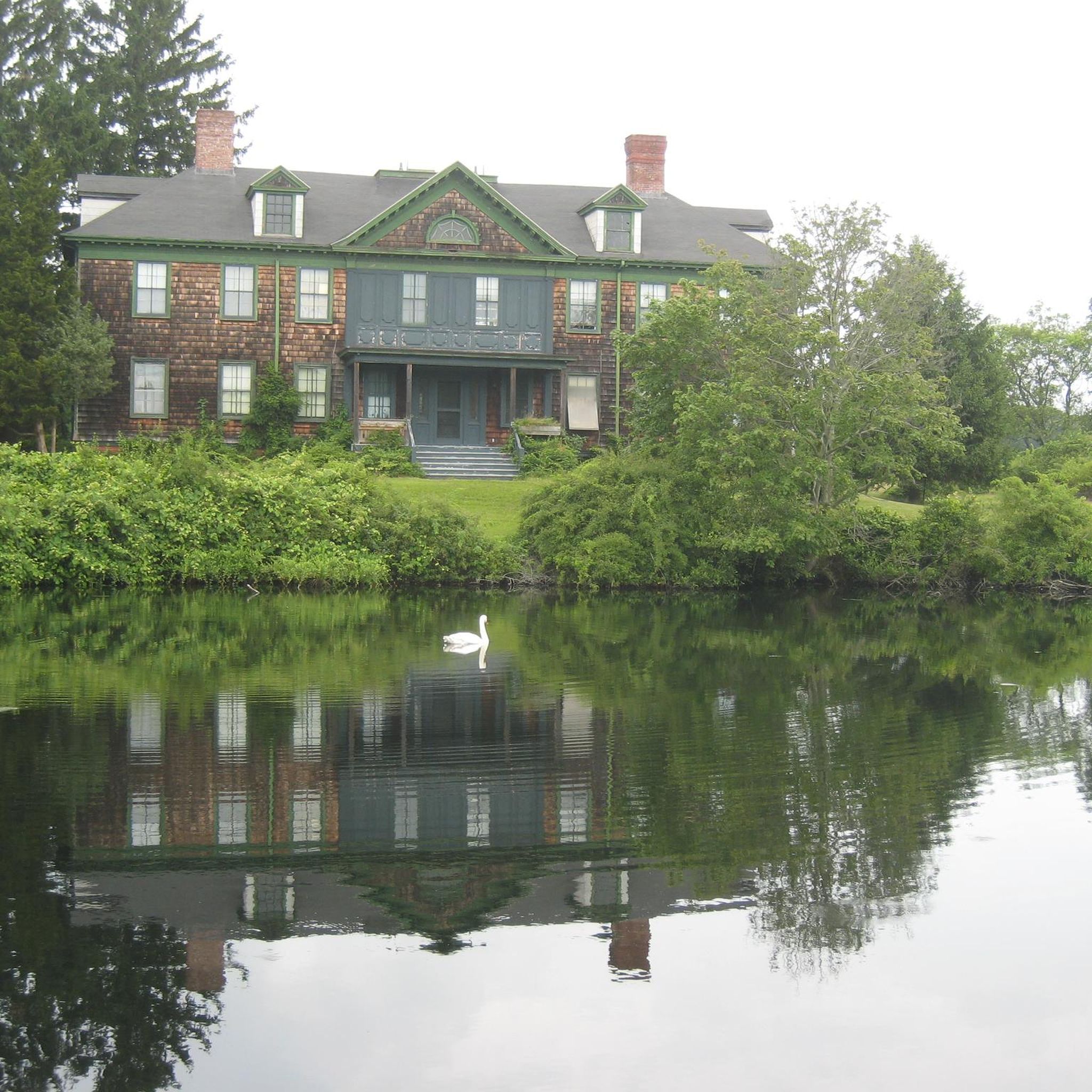
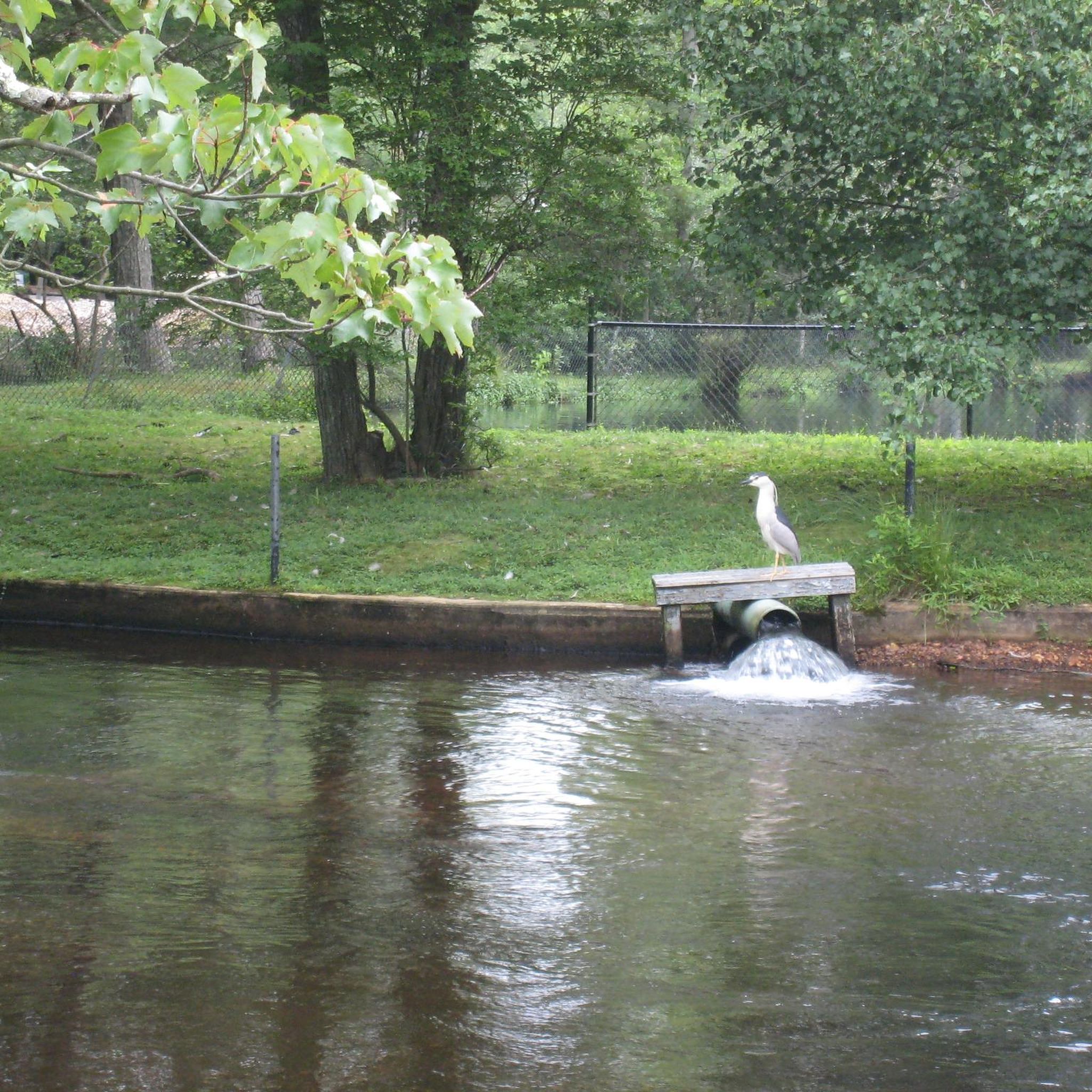
Connetquot River State Park Preserve is a 3,473-acre refuge of sandy pine barrens, wetlands, ponds, and woodlands. Visitors can find over 200 bird species and 300 plant species, along with other mammals, reptiles, amphibians, butterflies, and moths that once lived all over Long Island. This area was created as New York's first "State Park Preserve," and remains a protected area open to the public today.
0
0

This nearly 3,500-acre refuge of sandy pine barrens, wetlands, ponds and woodlands is nestled in central Long Island along the pristine, spring-fed Connetquot River. A wilderness surrounded by suburbs, the preserve provides excellent opportunities to see more than 200 bird and 300 plant species, as well as several mammal, reptile, amphibian, butterfly and moth species that once flourished throughout Long Island.
0
0

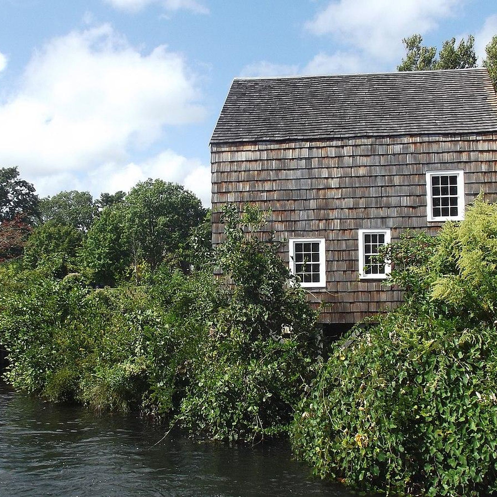
The mill was recently renovated and is open for tours. It sits on the Main Pond and was used to mill local grains, wheat and corn back in the 1700's.
0
0
Frequently Asked Questions
What is the general terrain like for hiking in Connetquot River State Park Preserve?
The terrain in Connetquot River State Park Preserve is generally flat, with minimal elevation changes. You'll find a network of trails winding through woodlands and along the Connetquot River, offering a mix of forested paths and open areas characteristic of a riverine state park.
What is the difficulty level of hiking trails in Connetquot River State Park Preserve?
Connetquot River State Park Preserve offers a range of trails suitable for various fitness levels. There are 13 easy routes and 13 moderate routes, with no difficult trails, making it accessible for most hikers.
Are there hiking trails suitable for beginners in Connetquot River State Park Preserve?
Yes, there are plenty of options for beginners. Approximately half of the trails, 13 routes in total, are classified as easy, featuring minimal elevation gain and generally flat paths. An example is the Fish Hatchery – Nicoll Grist Mill loop from Bayard Cutting Arboretum State Park, which is 3.4 miles (5.5 km) long.
Are there family-friendly hiking options in Connetquot River State Park Preserve?
Given the generally flat terrain and the presence of 13 easy routes, Connetquot River State Park Preserve is well-suited for family outings. These trails offer accessible paths for children and those looking for a relaxed walk in nature.
What do other hikers enjoy most about hiking in Connetquot River State Park Preserve?
The area is highly rated by the komoot community, with an average score of 4.2 stars from 17 reviews. Hikers often praise the quiet woodlands, the scenic river paths, and the well-maintained, accessible trails that make for an enjoyable outdoor experience.
Are there any loop trails in Connetquot River State Park Preserve?
Yes, many of the trails in the preserve are designed as loops, allowing you to experience varied scenery without retracing your steps. Popular loop options include the Green & Long Island Greenbelt Trail Loop and the Blue Trail Loop.
What kind of natural features can I expect to see along the trails?
Hiking in Connetquot River State Park Preserve will take you through diverse natural settings. You can expect to see the Connetquot River, dense woodlands, and open areas, providing opportunities to observe local flora and fauna.
How many hiking trails are available in Connetquot River State Park Preserve?
There are 26 hiking routes available in Connetquot River State Park Preserve, offering a variety of distances and experiences for hikers.
Are there any longer, moderate hikes available?
Yes, for those looking for a longer outing, there are 13 moderate routes. The Blue Trail Loop – Connetquot River State Park Preserve is a moderate 8.3 miles (13.3 km) path that offers varied scenery along the Connetquot River and through dense woodlands.
What is the longest hiking trail in Connetquot River State Park Preserve?
One of the longer trails you can explore is the Heckscher State Park loop via Long Island Greenbelt Trail, which spans approximately 9.5 miles (15.3 km) and is classified as moderate.
Is there parking available for hikers at Connetquot River State Park Preserve?
While specific parking details for hikers are not provided in the available data, state parks typically offer designated parking areas. It is advisable to check the official park website or signage upon arrival for current parking information and any potential fees.
Are permits or entrance fees required for hiking in Connetquot River State Park Preserve?
Information regarding specific permits or entrance fees for hiking in Connetquot River State Park Preserve is not available in the provided data. It is recommended to check the official New York State Parks website for the most up-to-date requirements before your visit.
Most popular routes in Connetquot River State Park Preserve

Get inspired with the komoot mobile app


Explore more
Browse the best Hikes in other regions.
