The best walks and hikes in Kittatinny Valley State Park
4.6
(22)
197
hikers
77
hikes
Hiking in Kittatinny Valley State Park features a landscape shaped by glacial history, encompassing freshwater wetlands, vernal pools, and four lakes, with Lake Aeroflex being the deepest natural lake in New Jersey. The park's terrain includes limestone outcroppings, sandstone ridges, and shale hills, alongside rock-ribbed hemlock and hardwood forests, and open fields. An extensive network of rail-trails, former railroad beds, provides accessible paths with gentle grades.
Best hiking trails in Kittatinny Valley State Park
- The most popular hiking route is Kittatinny Valley State Park loop — Sussex County, a 4.7 miles (7.6 km) moderate trail that takes 2 hours to complete, traversing varied park landscapes.
- Another top favourite among local hikers is Lake Aeroflex loop from Newton, an easy 2.3 miles (3.6 km) path. This route offers views of Lake Aeroflex and its surrounding natural features.
- Local hikers also love the Saffin Pond – Highest Point in Morris County loop from Andover Township, a 6.6 miles (10.7 km) trail leading through forested areas and offering elevation changes, often completed in about 2 hours 53 minutes.
- Hiking in Kittatinny Valley State Park is defined by extensive rail-trails, glacial lakes, and diverse forests, offering routes for various ability levels. The network includes both flat, accessible paths and more challenging single-track trails.
- The routes in Kittatinny Valley State Park are highly rated by the komoot community with an average score of 4.6 stars from over 10 reviews. More than 180 hikers have used komoot to explore Kittatinny Valley State Park's varied terrain.
Last updated: October 10, 2026
3
hikers
12.1km
03:19
210m
150m
The Pine Swamp Trail offers a refreshing escape into the diverse woodlands of Morris County, New Jersey. You'll traverse through varied forest terrain, from areas alongside a peaceful Forest Stream in Mahlon Dickerson Reservation to more rugged, rocky sections. The journey culminates with views from the Highest Point in Morris County before leading you to the tranquil shores of Saffin Pond, providing a well-rounded natural experience.
This moderate 7.5-mile (12.1 km) hike involves a respectable 689 feet (210 metres) of elevation gain, making it a good option for those seeking a solid half-day outing, typically completed in about 3 hours and 18 minutes. Plan to arrive early, especially on weekends, to ensure a good parking spot at the trailhead. Bringing enough water and wearing sturdy hiking shoes are always recommended for this kind of varied terrain.
What makes the Pine Swamp Trail stand out is its blend of natural features, from flowing streams to a county high point and a picturesque pond, all within a single route. It's an excellent choice if you're looking for a hike that combines a good physical challenge with the opportunity to experience several distinct natural landmarks in the Oak Ridge area.
4
hikers
5.91km
01:32
40m
40m
The New Wawayanda Lake and Sussex Branch Trail Loop offers a delightful blend of natural and historical landscapes, making it an excellent choice for an easy outing. You'll traverse a varied 3.7-mile (5.9 km) path, including sections of a former rail-trail and dense forests, with a gentle 138 feet (42 metres) of elevation gain. The route winds past the tranquil Wawayanda Lake and Whites Pond, and if you visit in late spring or early summer, you might catch the rhododendron thickets in full bloom, adding vibrant color to your 1 hour and 32 minutes hike.
When planning your visit, remember that Wawayanda State Park, where this loop is located, can attract crowds, especially during peak season. Arriving early is recommended to ensure you find parking. While the trail is considered easy, some sections can be muddy or rocky, particularly after rainfall, so be sure to wear appropriate footwear for comfort and safety. This trail is a great option for family friendly hiking in the New Wawayanda Lake area.
What makes this loop particularly notable is its unique combination of the rugged natural environment of Wawayanda State Park with the historical path of the Sussex Branch Trail. This blend provides a distinct experience, showcasing glacially-formed features and diverse terrain within a relatively short and accessible journey. It's a top rated trail in Wawayanda State Park for those seeking a gentle yet engaging exploration.

1
hikers
2.08km
00:39
100m
10m
The Milton State Fire Tower Trail offers a quick, rewarding hike through the Mahlon Dickerson Reservation, leading to an impressive historic landmark. You'll traverse woodland paths, including some gravel and dirt road sections, with a notable uphill push on Bowling Green Mountain before the trail levels out. The real highlight is the 80-foot Milton Fire Tower, which, when climbed, provides expansive 360-degree views over the New Jersey Highlands, a fantastic payoff for your effort.
This easy 1.3-mile (2.1 km) hike, with 344 feet (105 metres) of elevation gain, typically takes around 39 minutes, making it a perfect choice for a shorter outing. The trailhead is easily accessible, and dogs are welcome on a leash. While there's a steep section, it's manageable for most, and the views from the tower are well worth the climb. Consider visiting on a clear day to maximize your panoramic experience.
Built in 1937 by the Civilian Conservation Corps, the Milton Fire Tower is not just a historical site but also an active part of New Jersey's wildfire detection network. Standing at 1,341 feet above sea level, it's one of the highest towers in the state. This blend of history and function, coupled with the potential to glimpse New York City on a clear day, makes the trail a unique regional gem.
2.03km
00:33
30m
10m
Embark on an easy hike around Ryker Lake, a tranquil, man-made body of water nestled within the Sparta Mountain Wildlife Management Area. This gentle route spans 1.3 miles (2.0 km) and involves a minimal elevation gain of just 95 feet (29 metres), making it perfect for a quick outing. You can comfortably complete this scenic loop in about 32 minutes, enjoying the diverse landscape. As you walk, you will pass through upland deciduous forests and skirt significant wetlands, offering a peaceful natural escape. The trail provides a chance to observe the varied flora and fauna of this protected region. It is an ideal choice for those seeking a short, accessible nature walk.
When planning your visit to the Ryker Lake area, be aware that while parking is generally available at designated trailheads, the lake is part of a larger, interconnected trail system. There isn't one single, clearly marked "Ryker Lake Trail," so bringing a map is highly recommended to navigate the various paths. Some sections of the trails within the Sparta Mountain Wildlife Management Area may not be well-blazed, requiring a bit more attention to your route. This ensures you can fully enjoy your time without getting disoriented.
This area is not only known for its natural beauty but also holds a piece of history; you might spot remnants of Thomas Edison's old iron ore mining complex near the lake. The Sparta Mountain Wildlife Management Area itself is a prime birding territory, featuring diverse habitats like scrub-shrub areas and the significant Edison Bog. Keep an eye out for various birds and other wildlife as you explore. This blend of natural ecosystems and historical intrigue makes the Ryker Lake area a unique destination for a short, easy outdoor adventure.
7.55km
02:00
80m
80m
Hike the 4.7-mile Kittatinny Valley State Park loop in Sussex County, New Jersey, featuring lakes, forests, and varied terrain.
Get access to more routes and recommendations from other explorers.
Already have an account?
Our route recommendations are based on thousands of hikes, rides, and runs completed by other people on komoot.
Start today with a free account
Your next adventure awaits.

Tips from the Community

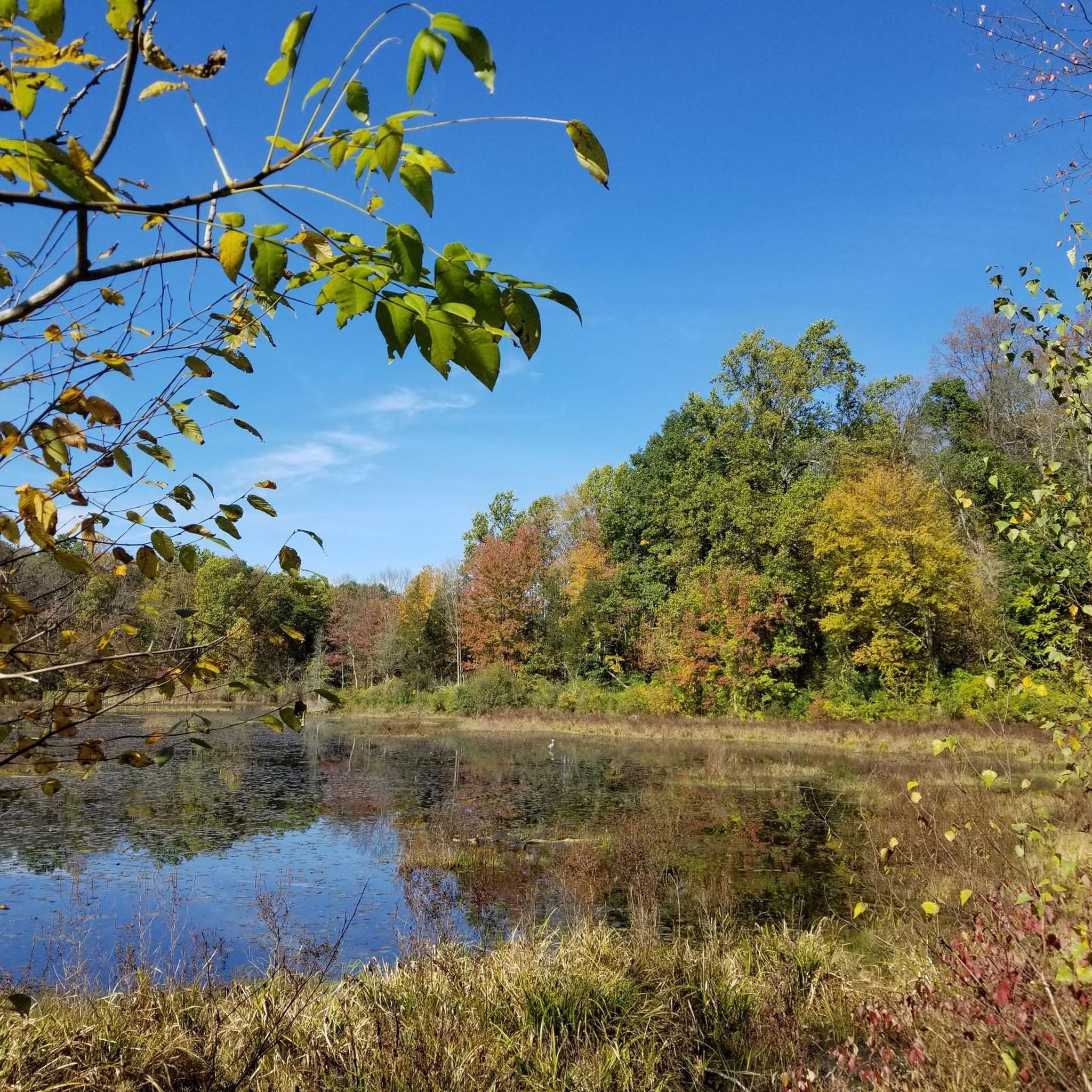
Kittatinny Valley Park is a popular outdoor recreation area. It has several lakes, including Lake Aeroflex, the deepest natural lake in New Jersey. There are several miles of hiking trails that run through the park, including the Sussex Branch Trail, a 21-mile rail trail that runs through several townships.
1
0
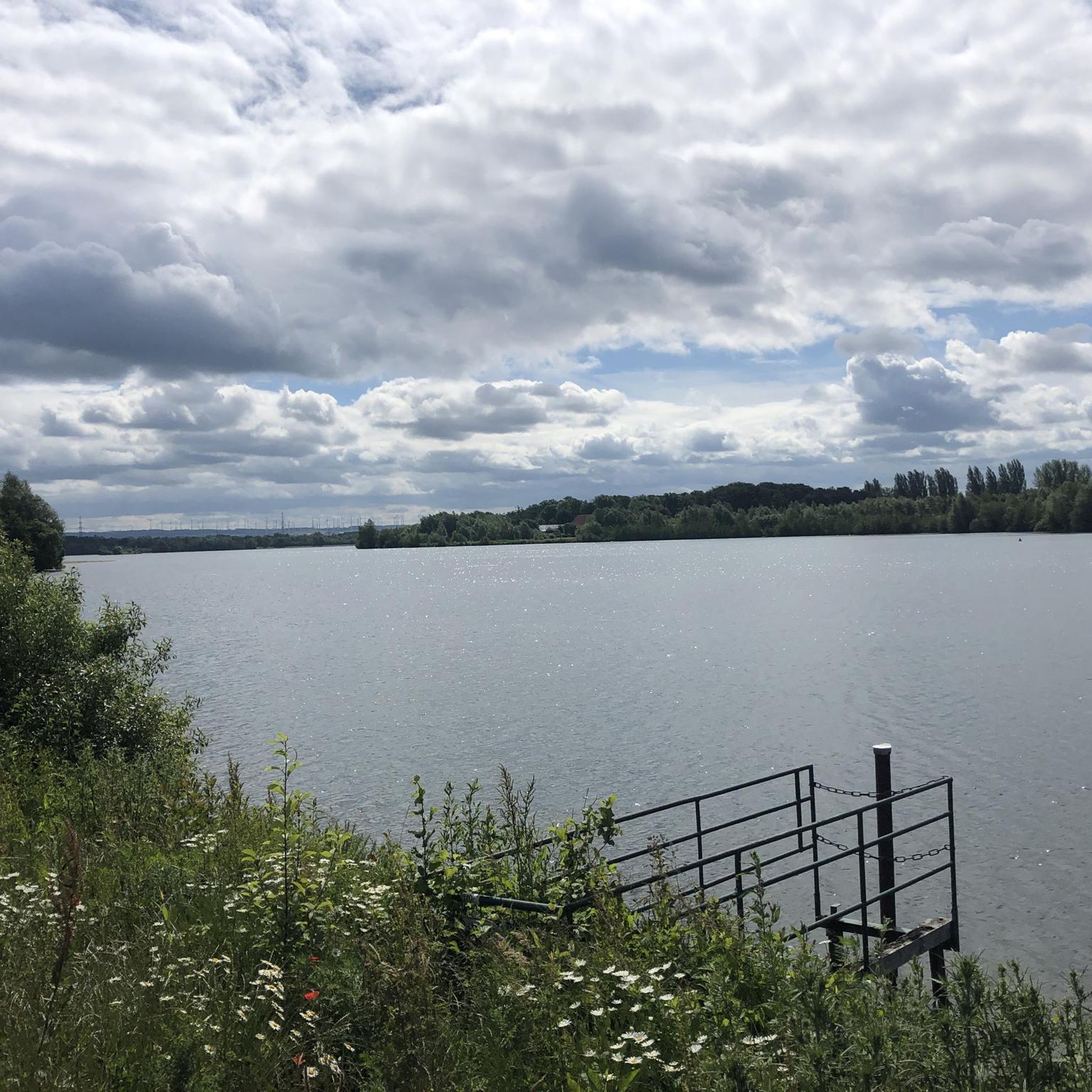
Lake Aeroflex is a 119-acre lake in Kittatiny Valley State Park. It is the deepest glacial lake in New Jersey. It is a popular place for kayaking and swimming. Several of the park's hiking trails run along the banks of the lake as well.
1
0

A tranquil escape for hikers, cyclists, and nature enthusiasts exploring the scenic Sussex Branch Trail. It's wildly popular for wildlife viewing and birding.
0
0

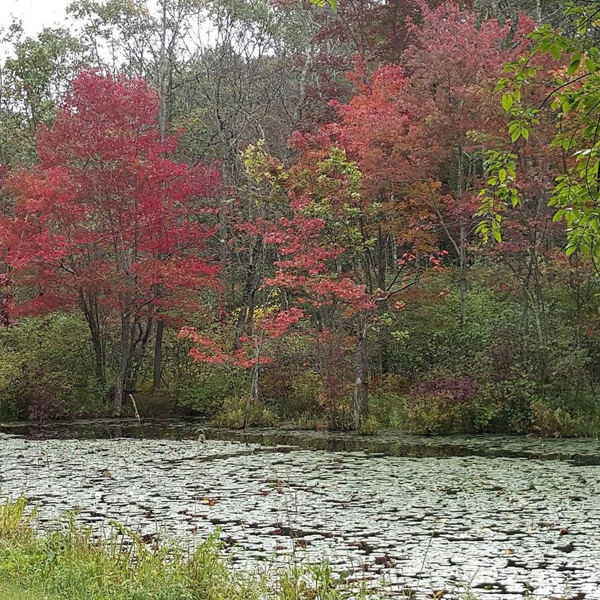
Saffin Pond is considered the most scenic part of the area, where you can enjoy stunning waterfront views on a trail that encircles the pond, providing numerous stopping points. This area is also very popular for fishing, so bring your pole along if you're interested.
0
0

The Mahlon Dickerson Reservation property features over 3,500 acres of hiking and biking trails that pass through different forest, mountain, and wetland ecosystems. There are a few different trailheads with different parking and recreation areas; it goes without saying that the Mahlon Dickerson Reservation has a lot to offer.
0
0
Saffin Pond is a small reservoir on the Mahlon Dickerson Reservation that has flat and easy hiking trails traveling around its banks. This is one of many spots on the property that is great for viewing wildlife.
0
0
The Mahlon Dickerson Reservation property features over 3,500 acres of hiking and biking trails that pass through different forest, mountain, and wetland ecosystems. There are a few different trailheads with different parking and recreation areas; it goes without saying that the Mahlon Dickerson Reservation has a lot to offer.
0
0
Frequently Asked Questions
How many hiking trails are available in Kittatinny Valley State Park?
Kittatinny Valley State Park offers a wide variety of hiking opportunities, with over 50 distinct routes recorded on komoot. These range from easy strolls to more challenging paths, ensuring options for all skill levels.
Are there easy or beginner-friendly hiking trails in Kittatinny Valley State Park?
Yes, the park is well-suited for beginners and those seeking easier walks. Over 25 easy routes are available, many of which utilize the park's extensive network of rail-trails. These former railroad beds, such as the Paulinskill Valley Trail and Sussex Branch Trail, feature gentle grades and cinder surfaces, making them very accessible. A good option is the Lake Aeroflex loop from Newton, an easy 2.3-mile path offering scenic views.
What kind of terrain can I expect on the trails in Kittatinny Valley State Park?
The park's terrain is quite varied, shaped by its glacial history. You'll find a mix of landscapes including freshwater wetlands, vernal pools, and four lakes. Geologically, the area features limestone outcroppings, sandstone ridges, and shale hills. Trails traverse rock-ribbed hemlock and hardwood forests, as well as open fields. Many paths are on former rail-beds with gentle grades, while others, like the Glacial Trail or Mount Nebo Trail, offer more natural, single-track experiences with elevation changes.
Are there any trails suitable for families with children?
Absolutely. The park's rail-trails are particularly family-friendly due to their flat, wide, and well-maintained surfaces. These trails are ideal for leisurely walks with children. Additionally, the park features attractions like the Butterfly and Hummingbird Garden, which can be a fun and educational stop for families. The Andover to Waterloo via Sussex Branch Trail is an easy 4-mile option that follows a historic rail line.
Can I bring my dog on the hiking trails?
Yes, dogs are generally welcome on the trails in Kittatinny Valley State Park, provided they are kept on a leash. The rail-trails, with their wide paths, are especially suitable for walking dogs. Always remember to clean up after your pet to help keep the park enjoyable for everyone.
Are there any circular or loop trails in the park?
Yes, the park offers several loop trails that allow you to start and end at the same point. A popular moderate option is the Kittatinny Valley State Park loop — Sussex County, which is about 4.7 miles and traverses varied park landscapes. Another notable loop is the Saffin Pond – Highest Point in Morris County loop from Andover Township, a 6.6-mile trail through forested areas.
What natural features or landmarks can I see while hiking?
Kittatinny Valley State Park is rich in natural features and unique landmarks. You can explore glacial lakes, such as Lake Aeroflex (New Jersey's deepest natural lake), Twin Lakes, and White's Pond. The park's geology includes limestone outcroppings and sandstone ridges. Beyond nature, you might spot the Aeroflex-Andover Airport, where you can watch planes, or visit the historic Hill-Hussey Stone House, which serves as the park's visitor center. The Paulinskill Valley Trail is particularly known for its abundant bird species and other wildlife.
What kind of wildlife might I encounter?
The park is a vibrant habitat for diverse wildlife. Keep an eye out for beaver, black bear, bobcat, fox, and whitetail deer. Birdwatchers will be delighted by over 200 bird species, including migratory birds like bald eagles, peregrine falcons, and hummingbirds. The Paulinskill Valley Trail is especially noted for its wildlife, including mink, muskrat, and otter.
Is there public transport available to reach Kittatinny Valley State Park?
While the park is primarily accessed by car, some of the rail-trails, like the Sussex Branch Trail, connect to nearby towns such as Newton and Andover. However, direct public transport routes specifically to the park's main entrances are limited. It's advisable to check local bus schedules for services to nearby communities if you plan to rely on public transportation.
What do other hikers enjoy most about hiking in Kittatinny Valley State Park?
The area is highly rated by the komoot community, with an average score of 4.6 stars from over 15 reviews. Reviewers often praise the park's diverse landscapes, the accessibility of its well-maintained rail-trails, and the peaceful atmosphere. Many appreciate the variety of routes available, from easy lakeside strolls to more challenging forested paths, and the opportunities for wildlife spotting.
Are there any long-distance trails that pass through or connect to the park?
Yes, the park's extensive rail-trail network provides significant connections. The Paulinskill Valley Trail and Sussex Branch Trail, among others, allow for nearly 50 miles of continuous hiking through Sussex and Warren counties. These trails also offer connections to the renowned Appalachian Trail and other trails within the Delaware Water Gap National Recreation Area, making it a great starting point for longer adventures.
What are the best times of year to hike in Kittatinny Valley State Park?
Kittatinny Valley State Park offers enjoyable hiking experiences year-round. Spring brings blooming wildflowers and active wildlife, while autumn showcases stunning fall foliage. Summer is popular for its lush greenery, though it can be warm. In winter, the rail-trails are often used for cross-country skiing and snowshoeing, providing a unique way to experience the park's serene beauty.
Most popular routes in Kittatinny Valley State Park

Get inspired with the komoot mobile app


Explore more
Browse the best Hikes in other regions.
