Routes

Planner

Features

Updates

App

Login or Signup

Get the App

Login or Signup

Routes
Hikes
United States
New Jersey
Hunterdon County

Spruce Run Recreation Area

The best walks and hikes in Spruce Run Recreation Area

5.0

(10)

93

hikers

16

hikes

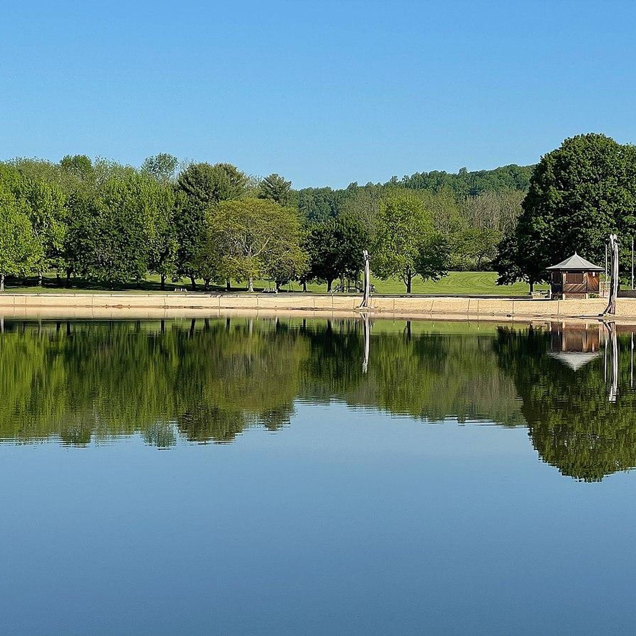
Hikes in Spruce Run Recreation Area are centered around the Spruce Run Reservoir in Hunterdon County, New Jersey. The region's terrain is characterized by rolling hills and mixed maple and pine forests. Trails follow the reservoir's shoreline and connect to the larger New Jersey Highlands trail network, offering routes with varied elevation.

Best hiking trails in Spruce Run Recreation Area

  • The most popular hiking route is Round Valley Reservoir – Cushetunk Mountain loop from Clinton, a 10.5 mile (16.9 km) trail that takes around 4 hours 53 minutes to complete. This is a moderately challenging route with significant elevation gain for the area.
  • Another top favourite among local hiking enthusiasts is Lake Solitude and Waterfall loop from High Bridge, a moderate 8.1 mile (13.0 km) path. The trail follows a varied course with sections along the water.
  • Local hiking enthusiasts also love the Round Valley Reservoir loop from Clinton, a 2.7 mile (4.4 km) trail leading along the reservoir, often completed in about 1 hour 11 minutes.
  • Hiking in Spruce Run Recreation Area is defined by reservoir shorelines, rolling hills, and dense woodlands. The trail system provides a mix of easy, shorter walks and more moderate routes suitable for most fitness levels.
  • The routes in Spruce Run Recreation Area are highly rated by the komoot community with an average score of 5.0 stars from more than 10 reviews. More than 100 hikers have used komoot to explore Spruce Run Recreation Area's varied terrain.

Last updated: July 9, 2026

5.0

(1)

10

hikers

#1.

Ken Lockwood Gorge – Columbia Trail loop from High Bridge

13.0km

03:28

140m

140m

The Ken Lockwood Gorge – Columbia Trail loop from High Bridge offers a delightful escape into nature, tracing the South Branch of the Raritan River through shaded woodlands. You'll enjoy wide, level paths of packed dirt and gravel, characteristic of its rail-trail heritage, with the stunning Ken Lockwood Gorge and its impressive trestle bridge as a scenic centerpiece. Keep an eye out for the quirky "gnome homes" near High Bridge, adding a touch of local charm to your journey.

Planning your visit is straightforward for this accessible route. The trail is largely shaded, making it a pleasant option even on warmer days. You can easily access the trail from High Bridge, which also connects to the New Jersey Transit Raritan Valley Line, offering public transport options. This moderate 8.1-mile (13.0 km) hike, with only 459 feet (140 metres) of elevation gain, typically takes around 3 hours and 28 minutes, making it a great choice for a half-day outing.

This trail is renowned for its natural beauty, particularly within the Ken Lockwood Gorge, often cited as one of New Jersey's most beautiful places. It's a designated Trout Conservation Area, popular for fly fishing, and its history includes remnants of the abandoned High Bridge Branch of the Central Railroad of New Jersey. The multi-use path welcomes hikers, bikers, and equestrians, providing a versatile outdoor experience for many.

Navigate with device

Send to Phone

Save

Moderate

The Columbia Trail from High Bridge offers a wonderfully accessible and scenic hiking experience, perfect for a relaxed day outdoors. You'll follow a wide, level path of packed dirt and gravel, winding through lush forests and alongside the South Branch of the Raritan River. A standout feature is the impressive trestle bridge crossing the Ken Lockwood Gorge, providing elevated views of the water below, and you might even spot whimsical "gnome homes" near the start. This 5.7-mile (9.1 km) route, with its gentle 253 feet (77 metres) of elevation gain, is rated moderate and takes about 2 hours and 23 minutes, making it an easy high-payoff win.

Planning your visit is straightforward, as the trail is an out-and-back, allowing you to choose your own distance. Parking is typically available near the High Bridge trailhead. The trail is multi-use, so expect to share the path with cyclists and horseback riders. It's a great option for families and beginners, and the ample shade makes it pleasant even on warmer days, though checking local conditions is always a good idea.

This trail is a prime example of a successful rail trail conversion, following an abandoned railroad corridor, which explains its consistently flat and straight path. Beyond the natural beauty, the route passes through small, historical communities and offers glimpses of Lake Solitude. Keep an eye out for local wildlife like deer, and enjoy the blend of natural scenery and historical context that makes this trail a local favorite.

Moderate
guide_signup
Let us show you the way with the komoot mobile app
With aΒ free komoot account, you can easily find, customize, and navigate endless outdoor adventures.

Sign up for free

6.97km

01:53

100m

70m

The Lost Bike Loop offers a serene escape into the local woodlands of High Bridge, New Jersey. This easy 4.3-mile (7.0 km) hiking trail is perfect for a relaxed outing, guiding you through gentle terrain that's likely to feature typical forest scenery. With minimal elevation changes, it's a pleasant journey for anyone looking to stretch their legs without a strenuous climb.

Planning your visit to The Lost Bike Loop is straightforward, as there are no complex permit requirements or seasonal access restrictions mentioned. The trail's easy difficulty and estimated duration of 1 hour and 52 minutes make it an excellent choice for a spontaneous afternoon hike. While specific parking details aren't provided, arriving earlier in the day is always a good strategy for any popular trail.

This loop is a great example of the accessible outdoor opportunities available in Hunterdon County. Its gentle nature makes it suitable for families or those new to hiking, providing a peaceful environment to connect with nature. The Lost Bike Loop offers a quiet alternative to more crowded trails, allowing for a tranquil experience in the New Jersey countryside.

Easy

5.0

(2)

17

hikers

9.27km

02:37

190m

200m

The Voorhees State Park Loop offers a delightful escape into the wooded hills of Hunterdon County, New Jersey, guiding you through diverse forests and along Willoughby Brook. You'll encounter a mix of dirt paths, roots, and moderately rocky sections, with the majority of the 615 feet (187 metres) of elevation gain concentrated in the park's southern reaches. Keep an eye out for seasonal overlooks that provide glimpses of Spruce Run and Round Valley Reservoirs, especially beautiful during the autumn foliage.

This moderate 5.8-mile (9.3 km) hiking route typically takes around 2 hours and 36 minutes to complete, making it an excellent option for a half-day outing. Parking is generally available, but consider arriving early, particularly on weekends or during the popular fall season. Dogs are welcome on the trails, though leash regulations are in effect.

Beyond the natural beauty, the park holds unique features like the educational Solar System Trail, marked with purple blazes near the New Jersey Astronomical Association Observatory. You might also discover "George's Thrones," thoughtfully arranged rock piles that serve as resting spots. The park's history as a Civilian Conservation Corps camp adds another layer of interest to your hike.

Moderate

6.38km

01:40

70m

10m

The Capoolong Creek Trail offers a peaceful journey through the Capoolong Creek Wildlife Management Area, closely following the creek itself. You will experience a mix of lush woodlands and open meadows, with the soothing sounds of the water accompanying you throughout. Keep an eye out for local wildlife like deer, foxes, and various bird species, including bald eagles, as you navigate the mostly flat terrain, which retains its historical cinder base from its days as a rail line. The trail's continuous proximity to the creek is a defining feature, providing scenic waterside views.

This easy 4.0-mile (6.4 km) hiking route involves a modest 237 feet (72 metres) of elevation gain and typically takes about 1 hour and 40 minutes to complete. While generally suitable for most, be aware that some sections, especially closer to Pittstown, might be overgrown or have downed trees, so sturdy footwear is advisable. Parking is usually available at the trailhead, and you can even visit the Pittstown Peach Exchange, a local farmers' market, right next to the start for fresh produce.

Beyond its natural beauty, the Capoolong Creek Trail holds historical significance as a former rail line, allowing you to imagine its past. It is managed by the Hunterdon Land Trust, dedicated to preserving the area's natural heritage. For those seeking a longer adventure, the trail connects with the nearby Landsdown Trail, offering extended exploration opportunities in this quiet corner of Hunterdon County.

Easy
Sign up for free to see 12 more hikes in Spruce Run Recreation Area.

Get access to more routes and recommendations from other explorers.

Sign up for free

Already have an account?

Our route recommendations are based on thousands of hikes, rides, and runs completed by other people on komoot.

Start today with a free account

Your next adventure awaits.

Login or Signup

Popular around Spruce Run Recreation Area

Running Trails in Spruce Run Recreation Area

Cycling in Spruce Run Recreation Area

Road Cycling Routes in Spruce Run Recreation Area

MTB Trails in Spruce Run Recreation Area

Tips from the Community

Zachary
September 25, 2024, Ken Lockwood Gorge

A packed dirt road takes you along the Raritan River at the sheltered base of the gorge. There are plenty of spots to park as you head in from Readingsburg, but most of the road is closed to vehicle traffic and makes for the perfect bike route. You are right next to the water and can bike along both sides of the gorge.

0

0

Matthew
February 2, 2024, Columbia Trail

The Columbia Trail is a 16.5-mile paved path consisting of dirt and packed gravel. Pretty much any tires can handle the smooth surface, and it's easy to cover a lot of miles with how flat the entire trail is.

0

0

Explore the captivating Ken Lockwood Gorge within the 500-acre Ken Lockwood Wildlife Management Area. This picturesque landscape, adorned with towering hemlocks along steep walls, creates an isolated and serene atmosphere. Immerse yourself in the beauty of the 2.5-mile stretch of the South Branch of the Raritan River, featuring cascading waters, small waterfalls, and tranquil poolsβ€”an enchanting experience, especially in the vibrant spring season.

0

0

AverieOutside
January 24, 2024, Columbia Trail

The Columbia Trail is a 16.5-mile paved multi-use trail that travels through Morris and Hunterdon counties along the South Branch Raritan River.

0

0

Voorhees State Park served as a camp for the Civilian Conservation Corps from 1933 to 1941, and much of the area is a testament to the work they accomplished. This region boasts miles of trails, and witnessing the trees changing color in the fall is an amazing sight.

0

0

Tyler Sanders
January 24, 2024, Lake Solitude

This stunning lake features a unique rock wall waterfall and is surrounded by lush trees. The sights are even more amazing in springtime when the leaves start to change colors.

0

0

Nestled in the heart of New Jersey, Voorhees State Park spans 1,400 acres, offering a captivating blend of nature and adventure.The well-maintained park, with its woodsy charm and hilly terrains, guarantees a refreshing workout.

0

0

This stunning lake features a unique rock wall waterfall and is surrounded by lush trees. The sights are even more amazing in springtime when the leaves start to change colors.

0

0

Frequently Asked Questions

Are dogs allowed on the hiking trails in Spruce Run Recreation Area?

Yes, dogs are generally permitted in Spruce Run Recreation Area, but they must be kept on a leash at all times. It's important to be a responsible owner by cleaning up after your pet and ensuring they do not disturb wildlife or other visitors. Always check the official park regulations for the most current rules before your visit.

Are there any easy, family-friendly hikes available?

Absolutely. The area offers several shorter, less strenuous trails perfect for a family outing. While many routes follow the rolling hills, there are flatter options along the reservoir shoreline. For a straightforward walk, consider the Round Valley Reservoir loop from Clinton, which is a relatively short and manageable path.

What is the terrain like on the trails around Spruce Run?

The terrain is quite varied. You'll find a mix of earthen footpaths through maple and pine forests, trails that follow the jagged shoreline of the reservoir, and paths that traverse the region's characteristic rolling hills. Some routes, like the local section of the Highlands Trail, are mostly woodland paths, while others involve more significant elevation changes.

Is there an entrance fee for Spruce Run Recreation Area?

Yes, there is typically an entrance fee per vehicle to enter Spruce Run Recreation Area, especially during the peak season from Memorial Day to Labor Day. Fees can vary, so it's always a good idea to check the official New Jersey State Park Service website for current rates and hours of operation before you go.

Can I go hiking at Spruce Run during the winter?

Yes, winter hiking is a great way to experience the park's serene landscape. The trails remain open, offering a different perspective of the frosted forests and the reservoir. When conditions permit, the area is also popular for cross-country skiing and ice fishing. Be sure to wear appropriate footwear for potentially icy or snowy conditions.

Are there any trails with waterfalls?

Yes, if you're looking for a hike that includes a waterfall, the Lake Solitude and Waterfall loop from High Bridge is an excellent choice. This trail offers varied scenery and features a lovely waterfall as one of its main attractions.

What do other hikers think of the trails in Spruce Run Recreation Area?

The trails are highly regarded by the komoot community, earning an average rating of 5.0 stars. Hikers often praise the beautiful views of the reservoir, the peaceful woodland sections, and the variety of trail options that connect to the larger Highlands Trail network.

How do the trails at Spruce Run compare to Round Valley?

Both areas offer excellent hiking centered around reservoirs. Spruce Run's trails are known for their connection to the broader Highlands Trail system and paths that wind through forests along the shoreline. Round Valley is famous for the more rugged and challenging Cushetunk Trail that encircles the reservoir. For a hike that combines views of both, consider the Round Valley Reservoir – Cushetunk Mountain loop from Clinton.

Are there restrooms and other facilities available at the park?

Yes, Spruce Run Recreation Area is well-equipped with facilities. You can find restrooms, designated picnic areas with tables and grills, and playgrounds near the main entrance and beach area. These amenities make it a convenient starting point for a day of hiking.

Where can I find a good scenic overlook?

Many trails offer picturesque views, especially those along the reservoir's 15-mile shoreline. The rolling topography means that climbs are often rewarded with beautiful vistas over the water and surrounding hills. The Round Valley Reservoir – Round Valley Reservoir loop from Clinton is a moderately challenging route that provides several opportunities to enjoy expansive views.

What kind of wildlife might I see while hiking?

The mixed maple and pine forests are home to a variety of common mammals. Keep an eye out for squirrels, rabbits, groundhogs, raccoons, and foxes. The reservoir also attracts numerous bird species, making it a good location for birdwatching.

Are there any challenging hikes for more experienced hikers?

Yes, while there are many easy and moderate trails, the area does offer more demanding routes. For a hike with more significant elevation gain, the Hiking loop from Glen Gardner provides a good challenge through the region's hilly landscape.

Most popular routes in Spruce Run Recreation Area

Easy hikes in Spruce Run Recreation Area

Store rating

Get inspired with the komoot mobile app

With aΒ free komoot account, you can easily find, customize, and navigate endless outdoor adventures.

or

Join komoot Now

Store rating

Explore more

Browse the best Hikes in other regions.

Delaware Canal State ParkCalifonHamptonGlen GardnerVoorhees State ParkClintonHigh BridgePottersvilleAnnandaleMilfordBloomsburyFrenchtownOldwickSouth County ParkStocktonRound Valley Recreation AreaLambertvilleRingoesWhite House StationLebanon

Nearby adventure guides

Things to Do around Clinton

background

Get ready to conquer new peaks

Sign up for Free

Explore
RoutesRoute plannerFeaturesHikesMTB TrailsRoad cycling routesBikepackingSitemap
Download the app
Follow Us on Socials

Β© komoot GmbH

Privacy Policy