Routes

Planner

Features

Updates

App

Login or Signup

Get the App

Login or Signup

Routes
Hikes
United States
Connecticut
South Central Connecticut Planning Region

Farm River State Park

The best walks and hikes in Farm River State Park

4.5

(10)

141

hikers

28

hikes

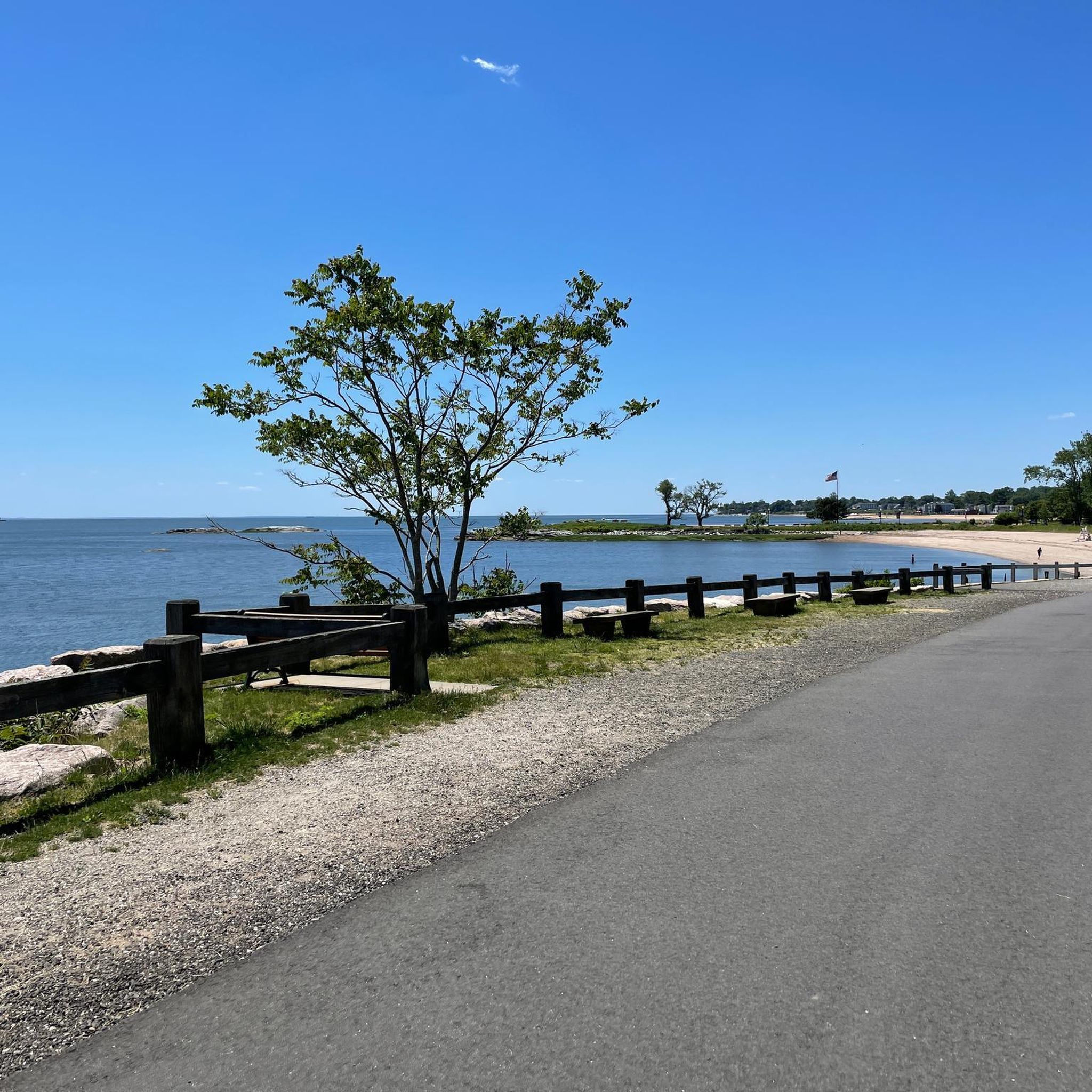
Hiking in Farm River State Park offers trails along the Farm River and coastal areas of South Central Connecticut. The terrain is generally flat, characterized by low elevations and natural preserves. The park's location provides access to riverfront paths and views of the Long Island Sound.

Best hiking trails in Farm River State Park

  • The most popular hiking route is Farm River State Park — East Haven, a 1.2 miles (1.9 km) trail that takes 30 minutes to complete. This easy path explores the park's general landscape.
  • Another top favourite among local hikers is Beacon Hill Preserve loop — Branford, an easy 1.8 miles (2.9 km) path. This route winds through a natural preserve with minimal elevation gain.
  • Local hikers also love the Lighthouse Point Park loop via Five Mile Point Light, a 1.4 miles (2.3 km) trail leading through a coastal park with a historic lighthouse, often completed in about 35 minutes.
  • Hiking in Farm River State Park is defined by riverfront paths, coastal views, and natural preserves. The network offers options for easy, moderate, and difficult ability levels.
  • The routes in Farm River State Park are highly rated by the komoot community with an average score of 4.3 stars from 8 reviews. More than 90 hikers have used komoot to explore Farm River State Park's varied terrain.

Last updated: July 6, 2026

#1.

Shoreline Greenway Trail

1.00km

00:15

0m

10m

Discover the easy Shoreline Greenway Trail, a short hike covering 0.6 miles (1.0 km) with a negligible elevation gain of just 1 foot (0 metres). This route is perfect for a quick outing, typically taking only 15 minutes to complete. You will wander through heavily wooded sections, observing various trees like hickory and tulip, and spot interesting glacial outcroppings along the way. The path provides a serene natural setting, offering a refreshing break from your day.

Finding specific parking for this particular short section of the Shoreline Greenway Trail can sometimes be tricky, as it is part of a larger network. General access points are usually available near its various segments. It is advisable to look for designated parking areas at nearby parks or trailheads that connect to the greenway. This trail is generally accessible year-round, making it a convenient option for a walk in most seasons.

The Shoreline Greenway Trail is an ongoing community project designed to connect various communities and parks. While hiking, you might encounter panoramic views of tidal wetlands, particularly at the Bradford Preserve, which is a notable highlight within Farm River State Park. This area is known for its diverse wildlife, including butterflies and various bird species, adding to the trail's appeal. It offers a chance to experience local ecology and community efforts firsthand.

Navigate with device

Send to Phone

Save

Easy

4.0

(1)

5

hikers

Embark on an easy hike along the Shoreline Greenway Trail, a pleasant route spanning 1.2 miles (1.9 km) within Farm River State Park. You will experience varied landscapes, from heavily wooded sections to tranquil tidal wetlands, offering a glimpse into coastal Connecticut's natural beauty. The trail is generally flat, with a gentle elevation gain of just 47 feet (14 metres), making it accessible for most. Expect to complete this scenic journey in about 30 minutes, enjoying the mix of paved paths, gravel, and crushed stone surfaces. Keep an eye out for interesting glacial outcroppings and a diverse array of trees, including mountain laurel and hickory, as you explore.

The Shoreline Greenway Trail is designed to be accessible for a wide range of visitors, including those using wheelchairs or pushing baby carriages, thanks to its generally flat terrain. You can bring your leashed dog along to enjoy the outing, making it a great option for pet owners. Located within Farm River State Park, the trail offers a convenient escape into nature. Consider visiting during daylight hours to fully appreciate the coastal scenery and wildlife.

This section of the Shoreline Greenway Trail is notable for its ecological diversity, showcasing both land-based and shorebird species, alongside various butterflies. The presence of glacial outcroppings adds a unique geological element to your hike. It provides an excellent opportunity to observe the rich natural environment of coastal Connecticut, from its varied flora to its abundant wildlife, all within a short and manageable distance.

Easy
guide_signup
Let us show you the way with the komoot mobile app
With a free komoot account, you can easily find, customize, and navigate endless outdoor adventures.

Sign up for free

2.85km

00:45

30m

30m

Embark on an easy hike along The Branford Trail, a pleasant 1.8-mile (2.9 km) route that takes approximately 45 minutes to complete. You will experience a gentle ascent of 86 feet (26 metres) as you wander through varied landscapes. The trail winds through peaceful inland woods, offering glimpses of granite ledges and leading you past serene salt marshes. Enjoy the quiet atmosphere and the changing scenery on this accessible outdoor adventure.

When planning your visit, you will generally find parking available at the trailheads for The Branford Trail. Be aware that certain sections of the route can become quite muddy, particularly after periods of rain or in wetland areas, so choose your footwear accordingly. If you plan to bring your dog, they are welcome to join you on the hike; however, please ensure they remain on a leash throughout your journey. This helps protect the local wildlife and ensures a pleasant experience for all trail users.

This particular section of The Branford Trail is nestled within the Beacon Hill Preserve, showcasing a rich diversity of ecosystems. As you hike, you will observe the transition from rocky inland woods to expansive salt marshes, highlighting the unique natural environment of the area. While the broader Branford Trail system extends to offer views of Long Island Sound, this specific route provides an intimate exploration of the preserve's varied habitats. It offers a distinct experience focused on the local flora and fauna.

Easy

Embark on the Forbes Bluff and Pardee Seawall Walk for an easy hiking experience with refreshing coastal views. This route spans 1.1 miles (1.7 km) and involves a gentle elevation gain of just 32 feet (10 metres), making it a quick outing you can complete in about 26 minutes. As you hike along the paved Pardee Seawall, you will enjoy clear sights of Morris Cove, New Haven Harbor, and the expansive Long Island Sound. The atmosphere is peaceful, especially during sunrise or sunset, offering a pleasant backdrop for your walk. You can also enjoy the surrounding greenery.

Planning your visit to the seawall is straightforward. You will find ample parking available, making access easy for drivers. This is a free attraction, so you do not need to worry about permits or fees. While there are comfortable benches and seating areas along the seawall, please note that there are no restrooms or facilities for swimming directly on the walk. It is a great spot for a picnic or sunbathing on the grassy areas.

The Forbes Bluff and Pardee Seawall Walk is situated within Nathan Hale Park, providing a scenic setting for your activity. This trail stands out for its accessible waterfront views, allowing you to connect with the natural environment of the Long Island Sound. It offers a unique opportunity to experience the local coastline without a strenuous effort. Consider combining your visit with other activities in the New Haven area for a full day out.

Easy

8.70km

02:19

90m

100m

Explore the Lake Saltonstall Trail, a moderate hiking route that offers year-round views of the lake, especially from scenic overlooks along Saltonstall Ridge and the Vista Trail. This 5.4-mile (8.7 km) journey takes you through diverse forests, including peaceful pine groves, where you can spot various birds and forest animals. With an elevation gain of 310 feet (95 metres), you can expect to complete this hike in about 2 hours and 19 minutes, enjoying the serene atmosphere and the sounds of nature.

Before you head out, remember that a permit is required for access to the Lake Saltonstall Trail, which you can obtain from the Regional Water Authority (RWA) recreation website. It is important to note that dogs are not permitted on these trails, and the area is designated for passive use only. While hiking is a primary activity, bicycling is allowed on specific trails during certain months, so check the RWA guidelines for current regulations.

This trail is part of a protected area managed by the Regional Water Authority, emphasizing conservation and responsible outdoor recreation. In spring, the route becomes particularly vibrant with wildflowers, adding to the natural beauty of the diverse forests. The focus on passive use ensures a tranquil experience, allowing you to immerse yourself in the natural environment and appreciate the local ecosystem.

Moderate
Sign up for free to see 24 more hikes in Farm River State Park.

Get access to more routes and recommendations from other explorers.

Sign up for free

Already have an account?

Our route recommendations are based on thousands of hikes, rides, and runs completed by other people on komoot.

Start today with a free account

Your next adventure awaits.

Login or Signup

Popular around Farm River State Park

Running Trails in Farm River State Park

Cycling in Farm River State Park

Road Cycling Routes in Farm River State Park

Tips from the Community

Matthew
January 12, 2024, Beacon Hill Preserve

Though Beacon Hill Preserve is small in terms of acreage, it packs a punch with what it has to offer. It features a few miles of trails with views of the Long Island Sound and the opportunity to run along some trail tracks.

0

0

Farm River State Park may not be the biggest park, but it certainly is one with a great view! Overlooking the Long Island Sound, it is beautifully located along the water and offers some short hiking trails along the marshland with great opportunities for birdwatching.

0

0

Beacon Hill Preserve has a size of 60 acres and overlooks the Farm River marshes. While hiking along the trails in the preserve, you can enjoy spectacular views of the Long Island Sound. One of the main hiking trails in the area, the Branford Trail, partially follows an active railroad, so use caution.

0

0

Frequently Asked Questions

What is the general difficulty level of hiking trails in Farm River State Park?

Hiking in Farm River State Park is generally easy, with most trails featuring low elevations and flat terrain. The park offers a variety of options, including 16 easy routes, 5 moderate routes, and 1 difficult route, catering to different experience levels.

Are there any family-friendly hiking options in Farm River State Park?

Yes, Farm River State Park is well-suited for families. Many trails are easy and relatively short, making them ideal for all ages. For example, the Farm River State Park — East Haven route is an easy 1.2-mile path that explores the park's landscape, perfect for a family outing.

Are dogs allowed on the hiking trails in Farm River State Park?

Farm River State Park is generally dog-friendly, allowing leashed dogs on its trails. It's always a good idea to check for any specific signage or regulations within the park upon arrival, especially concerning sensitive natural areas.

What kind of natural features or viewpoints can I expect to see while hiking?

Hikers can expect to see riverfront paths along the Farm River, coastal areas, and views of the Long Island Sound. The park is characterized by natural preserves and offers a chance to experience the coastal environment of South Central Connecticut. The Lighthouse Point Park loop via Five Mile Point Light, for instance, offers coastal views and a historic lighthouse.

Are there any circular hiking routes available in Farm River State Park?

Yes, there are several circular routes. A popular option is the Beacon Hill Preserve loop — Branford, an easy 1.8-mile path that winds through a natural preserve. Another is the East Shore Park loop — New Haven, which is also an easy circular trail.

What is the best time of year to go hiking in Farm River State Park?

The park can be enjoyed year-round, but spring and fall often offer the most pleasant hiking conditions with mild temperatures and beautiful scenery. Fall is particularly scenic with foliage changes. Summer can be warm, while winter hiking is possible, but conditions may vary.

Is parking available at Farm River State Park?

Yes, parking is available at Farm River State Park. Access points and parking areas are typically well-marked, providing convenient starting points for trails. It's advisable to arrive early during peak times to secure a spot.

What do other hikers enjoy most about Farm River State Park?

The area is highly rated by the komoot community, with an average score of 4.3 stars from 8 reviews. Hikers often praise the park's accessible riverfront paths, coastal views, and the peaceful natural preserves, highlighting its suitability for easy and enjoyable walks.

How many hiking trails are available in Farm River State Park?

There are over 20 hiking routes available in Farm River State Park, offering a variety of experiences from easy strolls to more challenging paths. In total, there are 22 tours recorded in the park.

Are there any longer trails for more experienced hikers?

While many trails are easy, there are options for longer walks. For example, the Supply Ponds Preserve — Branford route is an easy 2.2-mile (3.5 km) trail, offering a slightly longer experience through a natural setting.

Can Farm River State Park be accessed by public transport?

While direct public transport access to all trailheads within Farm River State Park might be limited, some areas or nearby towns may have bus services. It's recommended to check local public transport schedules and routes for the specific section of the park you plan to visit.

Most popular routes in Farm River State Park

Family-friendly hikes in Farm River State Park

Store rating

Get inspired with the komoot mobile app

With a free komoot account, you can easily find, customize, and navigate endless outdoor adventures.

or

Join komoot Now

Store rating

Explore more

Browse the best Hikes in other regions.

Sleeping Giant State ParkHeritage VillageNaugatuck State ForestSouthford Falls State ParkGeorge C. Waldo State ParkMeridenWest Rock Ridge State ParkCheshire VillageUniversité QuinnipiacWaterburyGuilford CenterFarmington Canal Line State Park TrailBranford CenterDerbyQuinnipiac River State ParkNorthfordMadison CenterAnsoniaOsbornedale State ParkEast HavenOrangeNorth HavenNaugatuckNaugatuck State Forest - Quillinan Reservoir BlockWolcott Recreation AreaWest HavenNew HavenWallingford CenterNaugatuck State Forest -East BlockWhittemore Glen State ParkWoodmontMilford City (Balance)Hammonasset Beach State Park

Nearby adventure guides

Things to Do around East Haven

background

Get ready to conquer new peaks

Sign up for Free

Explore
RoutesRoute plannerFeaturesHikesMTB TrailsRoad cycling routesBikepackingSitemap
Download the app
Follow Us on Socials

© komoot GmbH

Privacy Policy