The best cycling routes in Cochituate State Park
4.6
(93)
409
riders
60
rides
Touring cycling in Cochituate State Park offers routes primarily along converted rail trails and paths bordering water bodies. The landscape features flat, accessible sections suitable for various skill levels, often following the Cochituate Rail Trail. The area includes gentle hills and views of lakes and brooks, providing a mix of natural scenery and developed pathways. These routes are generally well-maintained, making them suitable for touring cyclists.
Best touring cycling routes in Cochituate State Park
- The most popular touring cycling route…
Last updated: October 18, 2026
6
riders
6.97km
00:25
30m
30m
Easy bike ride. Great for any fitness level. Mostly paved surfaces. Suitable for all skill levels.
2
riders
Easy bike ride. Great for any fitness level. Mostly paved surfaces. Suitable for all skill levels.

5.0
(9)
49
riders
Easy bike ride. Great for any fitness level. Mostly paved surfaces. Suitable for all skill levels.
5.0
(6)
43
riders
13.0km
00:46
60m
60m
Easy bike ride. Great for any fitness level. Mostly paved surfaces. Suitable for all skill levels.
7
riders
Easy bike ride. Great for any fitness level. Mostly paved surfaces. Suitable for all skill levels.
Get access to more routes and recommendations from other explorers.
Already have an account?
Our route recommendations are based on thousands of hikes, rides, and runs completed by other people on komoot.
Start today with a free account
Your next adventure awaits.

Tips from the Community

This covered bridge leads to the private community of Covered Bridge. It spans Pine Brook
1
0


This section of the Mass Central Rail Trail (MCRT) runs for three miles through Weston, and is part of a planned 25-mile trail stretching from Berlin to Waltham. The trail is accessible from Church Street, Town House Road, and Concord Road, here. The trail is a multi-use path that allows bicycles, joggers, walkers, dogs, and horseback riders. Dogs must be leashed on the trail, and all users should yield to horses. Unfortunately there are no garbage cans along the trail, so users should take their trash with them to help keep this great recreational resource clean.
0
0
I would prefer to have a stop in this park, take the backpack and walk through the wonderful forest
0
0
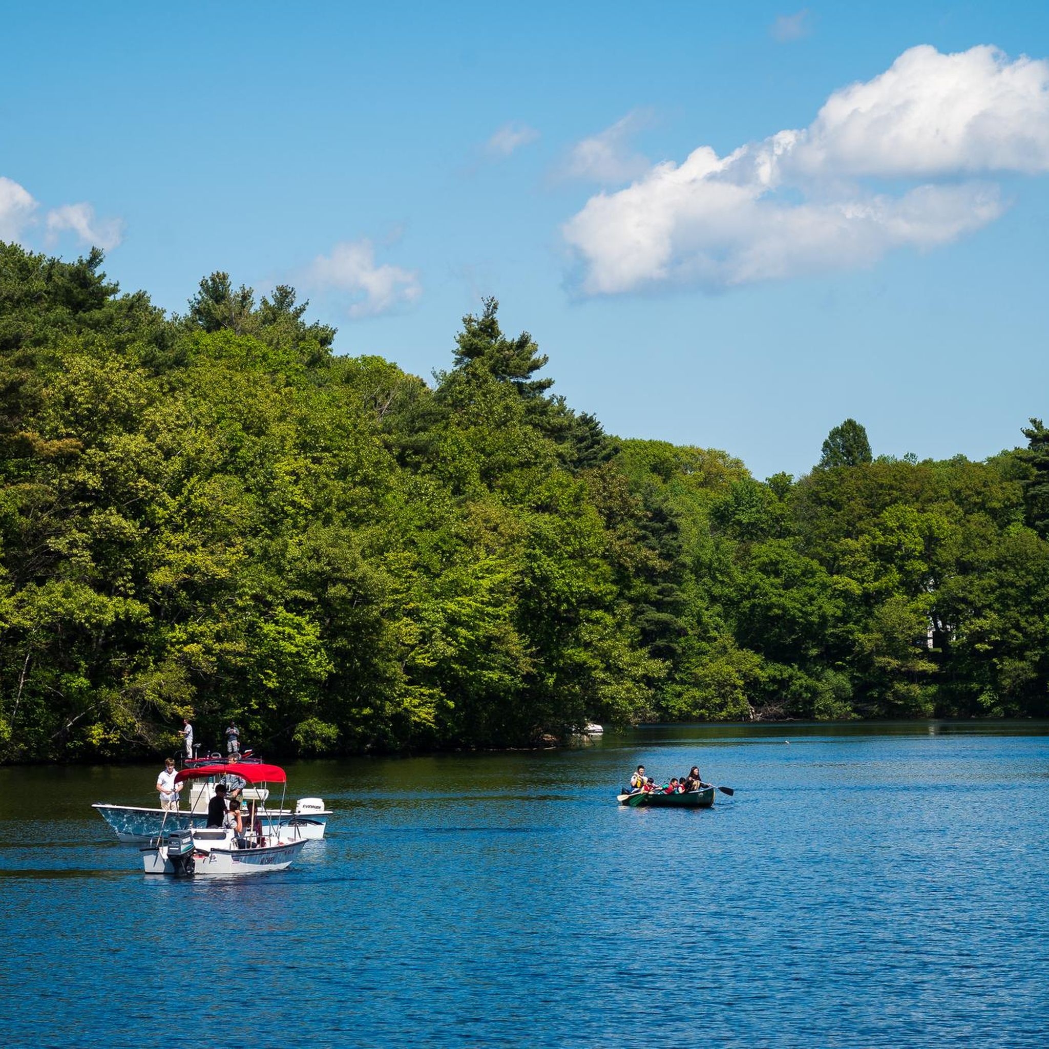
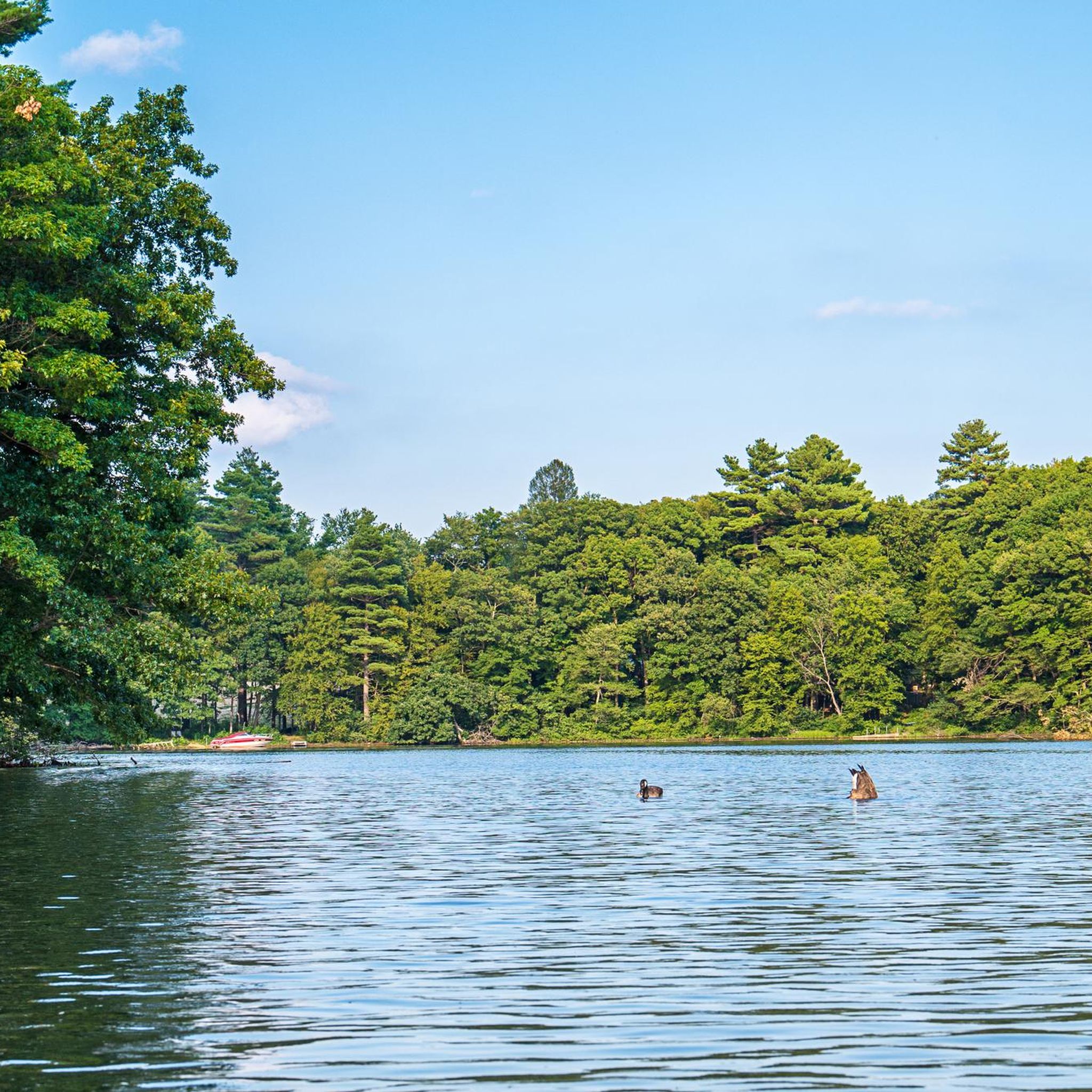
There are three ponds that make up Lake Cochituate: North, South, and Middle. All of these ponds are within Cochituate State Park. Middle Pond is the most popular pond for recreationalists, and as you ride around the area, you can often see folks swimming, kayaking, and boating. Middle Pond also boasts the most extensive trails in the park, including a well-maintained paved multi-use path that is open for cyclists/
0
0

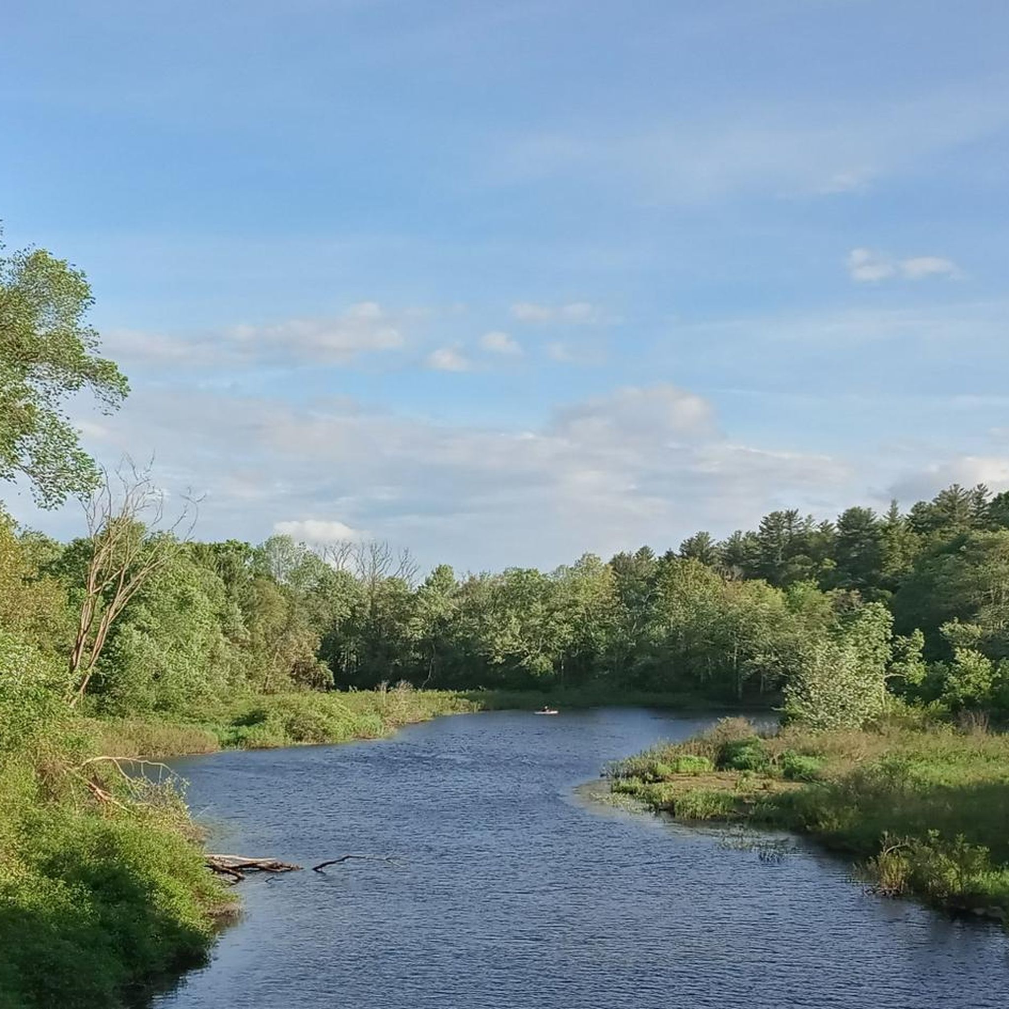
Perfectly paved rail trail connecting Natick and Saxonville. The trail leads along Lake Cochituate and offers quiet nature and even some nice views.
1
0

Cochituate State Park comprises three ponds: North, South, and Middle, forming Lake Cochituate. Middle Pond, in particular, is bustling with various water activities such as kayaking and boating. The pond boasts the most extensive trails in the park, including a well-maintained paved path that provides stunning views as you run.
0
0
Comprising three ponds, this park has trails that meander around the ponds, picnic areas, a small beach, and even offers rentals for kayaks, canoes, paddleboards, and sailboats.
0
0
Frequently Asked Questions
How many touring cycling routes are available in Cochituate State Park?
Cochituate State Park offers a wide selection of touring cycling routes, with over 60 options to explore. These routes cater to various skill levels, including 29 easy, 36 moderate, and a few more challenging trails.
Are there easy routes suitable for beginners or families in Cochituate State Park?
Yes, Cochituate State Park is known for its accessible paths, with 29 routes rated as easy. Many of these follow converted rail trails, offering smooth and relatively flat rides. A great option for beginners is the Cochituate Rail Trail – Cochituate Rail Trail loop from West Natick, which is 11.7 miles (18.8 km) long and offers a very smooth ride.
What kind of terrain can I expect on touring cycling routes in Cochituate State Park?
The terrain in Cochituate State Park primarily features converted rail trails and paths bordering water bodies. You'll find many flat, accessible sections, gentle hills, and scenic views of lakes and brooks. Routes like the Dirty Meadow Hill – Upper Charles Trail loop from Natick High School offer more varied terrain, including a hill and sections of the Upper Charles Trail.
Are there any circular touring cycling routes in Cochituate State Park?
Yes, many of the touring cycling routes in Cochituate State Park are designed as loops, allowing you to start and end at the same point. Examples include the Cochituate Rail Trail – Covered Bridge Over Pine Brook loop from North Natick and the Cochituate Rail Trail – Cochituate Rail Trail loop from Natick Center.
What are some scenic highlights or points of interest along the cycling routes?
Many routes offer views of the lakes and brooks within the park. The Cochituate Rail Trail – Covered Bridge Over Pine Brook loop from North Natick specifically features a scenic covered bridge over Pine Brook. You can also explore areas like the South Natick Dam and Park – Charles River Dam and Weir loop from Natick Center for waterside views.
What is the best season for touring cycling in Cochituate State Park?
The well-maintained rail trails and paths in Cochituate State Park are enjoyable throughout the warmer months, from spring through autumn. Spring brings fresh greenery, while autumn offers vibrant fall foliage. Summer is also popular, but it's always wise to check local weather conditions before heading out.
What do other touring cyclists enjoy most about cycling in Cochituate State Park?
The area is highly rated by the komoot community, with an average score of 4.6 stars from over 50 reviews. Cyclists often praise the accessibility of the rail trails, the scenic views of lakes and brooks, and the variety of routes that cater to different ability levels, from easy family rides to more challenging loops.
Are there any routes that are particularly long or offer a good workout?
For a longer ride with varied terrain, consider the Dirty Meadow Hill – Upper Charles Trail loop from Natick High School. This route is 18.2 miles (29.4 km) long and includes a hill, providing a good workout while exploring sections of the Upper Charles Trail.
Are the cycling routes in Cochituate State Park suitable for dogs?
While specific routes may have varying regulations, Cochituate State Park generally welcomes leashed dogs on its trails. It's always a good idea to check the park's official guidelines for any specific restrictions or areas where dogs might not be permitted, and ensure your dog is comfortable with cycling speeds and other trail users.
Where can I find parking for the touring cycling routes?
Many of the routes in Cochituate State Park start from accessible points in nearby towns like Natick. For example, the Dirty Meadow Hill – Upper Charles Trail loop starts from Natick High School, which typically offers parking. Other routes originate from areas like North Natick, West Natick, and Natick Center, where public parking options are usually available near trailheads or public facilities.
Are there places to eat or get refreshments near the cycling trails?
Given the park's proximity to towns like Natick, you'll find various cafes, restaurants, and shops within a short distance of many trailheads. It's advisable to plan your route and check for establishments along or near your chosen path before you set out.
Most popular routes in Cochituate State Park

Get inspired with the komoot mobile app


Explore more
Browse the best Cycling routes in other regions.
