The best walks and hikes in Vargas Island Provincial Park
4.5
(118)
990
hikers
22
hikes
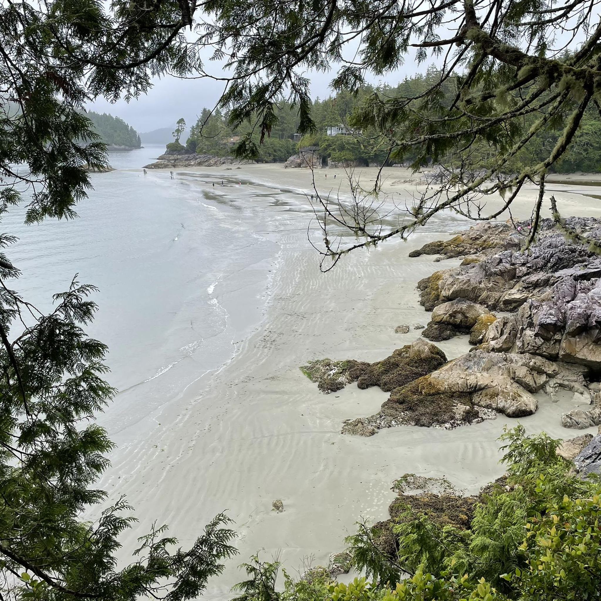
Hiking in Vargas Island Provincial Park offers diverse landscapes, from exposed rocky coasts and expansive sandy beaches to sheltered channels and an intertidal lagoon. The park's interior features bogs and temperate rainforests, providing varied terrain for exploration. Distinctive ancient sand berms, indicating past sea levels, are also present. This area is characterized by its rugged natural beauty and unique geological features.
Best hiking trails in Vargas Island Provincial Park
- The most popular hiking route is Tonquin Beach – Haida Totem Pole, Tofino loop from Tofino, a 8.3 miles (13.3 km) trail that takes 3 hours 27 minutes to complete. This moderate route offers views of the coastline and cultural landmarks.
- Another top favourite among local hikers is Tonquin Beach – Middle Beach loop from Tofino, an easy 3.5 miles (5.7 km) path. This trail features varied coastal scenery.
- Local hikers also love the Tonquin Beach loop from Tofino, a 1.8 miles (2.8 km) trail leading through coastal forest and along beaches, often completed in about 45 minutes.
- Hiking in Vargas Island Provincial Park is defined by diverse coastlines, sandy beaches, and temperate rainforests. The network offers options for different ability levels, from easy walks to more moderate routes.
- The routes in Vargas Island Provincial Park are highly rated by the komoot community with an average score of 4.6 stars from over 100 reviews. More than 800 hikers have used komoot to explore Vargas Island Provincial Park's varied terrain.
Last updated: July 5, 2026
5
hikers
6.51km
01:40
30m
30m
Easy hike. Great for any fitness level. Easily-accessible paths. Suitable for all skill levels.
4.3
(12)
81
hikers
11.8km
03:06
100m
90m
Moderate hike. Good fitness required. Easily-accessible paths. Suitable for all skill levels.

Sign up for free
31
hikers
5.67km
01:31
60m
60m
Easy hike. Great for any fitness level. Easily-accessible paths. Suitable for all skill levels.
28
hikers
2.80km
00:45
40m
40m
Easy hike. Great for any fitness level. Easily-accessible paths. Suitable for all skill levels.
5.0
(1)
15
hikers
5.54km
01:27
40m
40m
Easy hike. Great for any fitness level. Easily-accessible paths. Suitable for all skill levels.
Get access to more routes and recommendations from other explorers.
Sign up for free
Already have an account?
Our route recommendations are based on thousands of hikes, rides, and runs completed by other people on komoot.
Start today with a free account
Your next adventure awaits.
Login or Signup
Popular around Vargas Island Provincial Park
Tips from the Community

Ahous Bay is a long stretch of dark sand that can be reached only by kayak or the Telegraph Trail. Campers must be careful to leave no trace, as the local wolves often scavenge in this area. There are some fantastic tide pools to explore all along the shores of the beach, pressed up against thick forests to the east and the Pacific Ocean to the west.
0
0
Telegraph Trail is not easily accessible, but it does bring hikers clear across the wild Vargas Island. Remote and unmaintained, this trail is almost a straight line due west with almost no elevation change. The trail is reported to get quite overgrown, with a few stream crossings that might result in wet shoes. There are also warnings of wolves and to be careful with food storage as well as possible tsunamis. This is a beautiful and truly wild area, pristine wilderness that has almost no human impact.
0
0
This is not your standard trailhead with a parking lot; it's a remote cove only accessible via water taxi. There are a few kayak companies that issue day park permits for exploration of Vargas Island Park. If you would rather obtain your own permit and hire a water taxi service to the park, contact Clayoquot Connections at 250-726-8789 or Tofino Water Taxi at 250-725-8844.
0
0

Such a shame. Not every change is positive. Thanks for your update.
0
0

Impressive totem sculpture of a weeping goddess / native lady
0
0

Third Beach is a hidden sandy beach; access is via the Tonquin Trail.
2
0
The Tonquin Trail Connector, opened in March 2014, has been partially widened to a gravel road. Residential construction plans are expected in the upper section; the trail is not recommended. (May 17, 2025)
0
0
Middle Beach is located at the southern end of the Tonquin Trail. Additional access to this beach is via MacKenzie Beach Road and the Middle Beach Trail. However, there is no parking available at the trailhead.
2
0
Frequently Asked Questions
How many hiking trails are available in Vargas Island Provincial Park?
Vargas Island Provincial Park offers a variety of hiking opportunities, with over 20 routes available. These range from easy walks to more moderate trails, catering to different skill levels.
What are the typical trail conditions like in Vargas Island Provincial Park?
Trails in Vargas Island Provincial Park can be quite diverse. While some coastal paths are relatively straightforward, interior trails like the historic Telegraph Trail are often unmaintained, muddy, and slippery, requiring sturdy footwear and careful navigation. The park's rugged natural beauty means you should be prepared for wilderness conditions.
Are there any easy or family-friendly hiking options in the park?
Yes, Vargas Island Provincial Park has several easy hikes suitable for families. Out of the 23 routes, 15 are classified as easy. These often include shorter walks along the beaches or through less challenging coastal forest areas, providing accessible ways to enjoy the park's natural beauty.
What kind of wildlife can I expect to see while hiking on Vargas Island?
Vargas Island is renowned for its exceptional wildlife viewing. Offshore, you might spot gray whales during migration, sea otters, and seals. On land, coastal wolves, black bears, and deer are present, so caution is advised. The park also hosts diverse seabird colonies, particularly around the Cleland Island Ecological Reserve, though access to this specific area is prohibited to protect nesting populations.
Are dogs allowed on the trails in Vargas Island Provincial Park?
The provided information does not explicitly state the dog policy for Vargas Island Provincial Park. As a provincial park, it's generally recommended to check the official BC Parks website or local regulations regarding pets before your visit to ensure compliance and responsible wildlife interaction.
How do I get to Vargas Island Provincial Park, and what are the parking options?
Vargas Island Provincial Park is accessible primarily by kayak or boat from Tofino. There are no roads or commercial developments on the island itself, meaning there are no designated parking areas within the park. Visitors typically arrange transport from Tofino and park their vehicles there.
Do I need a permit to hike or visit Vargas Island Provincial Park?
The provided information does not explicitly mention a permit requirement for general hiking or visiting Vargas Island Provincial Park. However, as it is a provincial park and a wilderness area, it's always advisable to check the official BC Parks website for the latest regulations, especially concerning camping or specific activities, before your trip.
What is the best time of year to go hiking in Vargas Island Provincial Park?
The best time to visit Vargas Island Provincial Park for hiking is generally from spring to summer. During these months, you have a higher chance of spotting gray whales migrating offshore, and the weather tends to be more favorable for exploring the diverse landscapes, though conditions can change rapidly.
What unique natural features or landmarks can I discover on Vargas Island?
Vargas Island boasts several unique natural features. You can explore diverse coastlines, expansive sandy beaches like Ahous Bay, sheltered channels, and an intertidal lagoon. The interior features bogs and temperate rainforests. A distinctive geological highlight is the presence of ancient sand berms, crescent-shaped sand mounds indicating earlier sea levels, which can be observed along the Telegraph Trail.
Are there any cultural heritage sites to explore on Vargas Island?
Yes, Vargas Island holds significant cultural importance. It features a high concentration of Nuu-chah-nulth First Nations heritage sites, reflecting their deep and historical connection to the land. While specific sites are not detailed, their presence adds a rich cultural layer to the park's natural environment.
What should I pack for a hiking trip to Vargas Island Provincial Park?
Given the wilderness conditions and varied terrain, it's essential to pack appropriately. Recommended items include sturdy, waterproof hiking boots, layers of clothing for changing weather, rain gear, sufficient water and food, navigation tools (map, compass, or GPS), a first-aid kit, and bear spray. Practicing Leave No Trace principles is also crucial.
What do other hikers say about their experience in Vargas Island Provincial Park?
The hiking routes in Vargas Island Provincial Park are highly rated by the komoot community, with an average score of 4.6 stars from over 100 reviews. Hikers often praise the diverse coastlines, sandy beaches, and temperate rainforests, appreciating the varied terrain and the opportunity for immersive outdoor adventure.
Are there any circular hiking routes available in Vargas Island Provincial Park?
Yes, there are several circular hiking routes that allow you to experience different aspects of the park. For example, the Tonquin Beach – Haida Totem Pole, Tofino loop from Tofino is an easy 3.5-mile (5.6 km) path offering coastal views and cultural landmarks. Another option is the Tonquin Beach loop from Tofino, a 1.8-mile (2.8 km) trail through coastal forest and along beaches.
Most popular routes in Vargas Island Provincial Park

Get inspired with the komoot mobile app


Explore more
Browse the best Hikes in other regions.
