The best walks and hikes in Brackendale Eagles Provincial Park
4.5
(390)
5,489
hikers
73
hikes
Hiking in Brackendale Eagles Provincial Park and its surrounding areas offers access to the Squamish River Valley, characterized by its riverine environment and temperate rainforests. The region is set against the backdrop of the Coast Mountains, with trails often providing views of the Tantalus Range. While the park itself is a vital bald eagle sanctuary with restricted access, adjacent areas feature diverse ecosystems including lakes, rivers, and dense forests of Douglas-fir and cedar. These landscapes provide varied terrain for outdoor activities, from riverside walks to mountain ascents.
Best hiking trails in Brackendale Eagles Provincial Park
- The most popular hiking route is Brackendale Eagle Viewing Area loop from Eagle Run, an easy 1.4 miles (2.3 km) trail that takes about 35 minutes to complete. This route runs along the river dike, offering views of the Squamish River and opportunities for bald eagle sightings.
- Another top favourite among local hikers is Echo Lake Trail, a moderate 5.2 miles (8.4 km) path. This trail involves significant elevation gain, leading to Echo Lake and providing scenic views of the surrounding mountains.
- Local hikers also love the Edith Lake loop from Eagle Run, a 6.0 miles (9.6 km) trail leading through forested hills, often completed in about 2 hours 51 minutes.
- Hiking in Brackendale Eagles Provincial Park is defined by riverine environments, temperate rainforests, and views of the Coast Mountains. The network offers options for different ability levels, from easy riverside paths to more challenging ascents.
- The routes in Brackendale Eagles Provincial Park are highly rated by the komoot community with an average score of 4.6 stars from more than 280 reviews. More than 4000 hikers have used komoot to explore Brackendale Eagles Provincial Park's varied terrain.
Last updated: September 1, 2026
5.0
(2)
28
hikers
8.39km
04:03
900m
900m
Hike the moderate Echo Lake Trail in British Columbia, covering 5.2 miles with 2941 feet of elevation gain to reach Echo Lake.
5
hikers
5.18km
01:20
10m
10m
Easy hike. Great for any fitness level. Easily-accessible paths. Suitable for all skill levels.

Sign up for free
5.0
(1)
11
hikers
9.61km
02:52
290m
290m
Moderate hike. Good fitness required. Easily-accessible paths. Suitable for all skill levels.
10
hikers
2.33km
00:35
10m
10m
Easy hike. Great for any fitness level. Easily-accessible paths. Suitable for all skill levels.
24
hikers
10.3km
06:54
1,140m
1,140m
Hike the challenging Lake Lovely Water Trail in Tantalus Provincial Park, featuring a river crossing and stunning alpine lake views.
Get access to more routes and recommendations from other explorers.
Sign up for free
Already have an account?
Our route recommendations are based on thousands of hikes, rides, and runs completed by other people on komoot.
Start today with a free account
Your next adventure awaits.
Login or Signup
Popular around Brackendale Eagles Provincial Park
Tips from the Community

Spit Road is a flat, gravel route leading through the Squamish Estuary to the tip of the Squamish Spit. Following the dyke, it passes tidal wetlands and slow-moving channels with beautiful views of the surrounding mountains before reaching the shoreline at the mouth of Howe Sound. It’s a popular path for hiking and cycling, with excellent opportunities to spot birds and other wildlife.
0
0
Squamish River Estuary is a vast mosaic of tidal marshes, mudflats, and channels where the Squamish River meets Howe Sound. It’s an ecologically important area spanning 673 hectares that provides habitat for salmon, harbour seals, and other wildlife, including over 200 migratory bird species, making it one of the best birdwatching destinations in British Columbia.
0
0
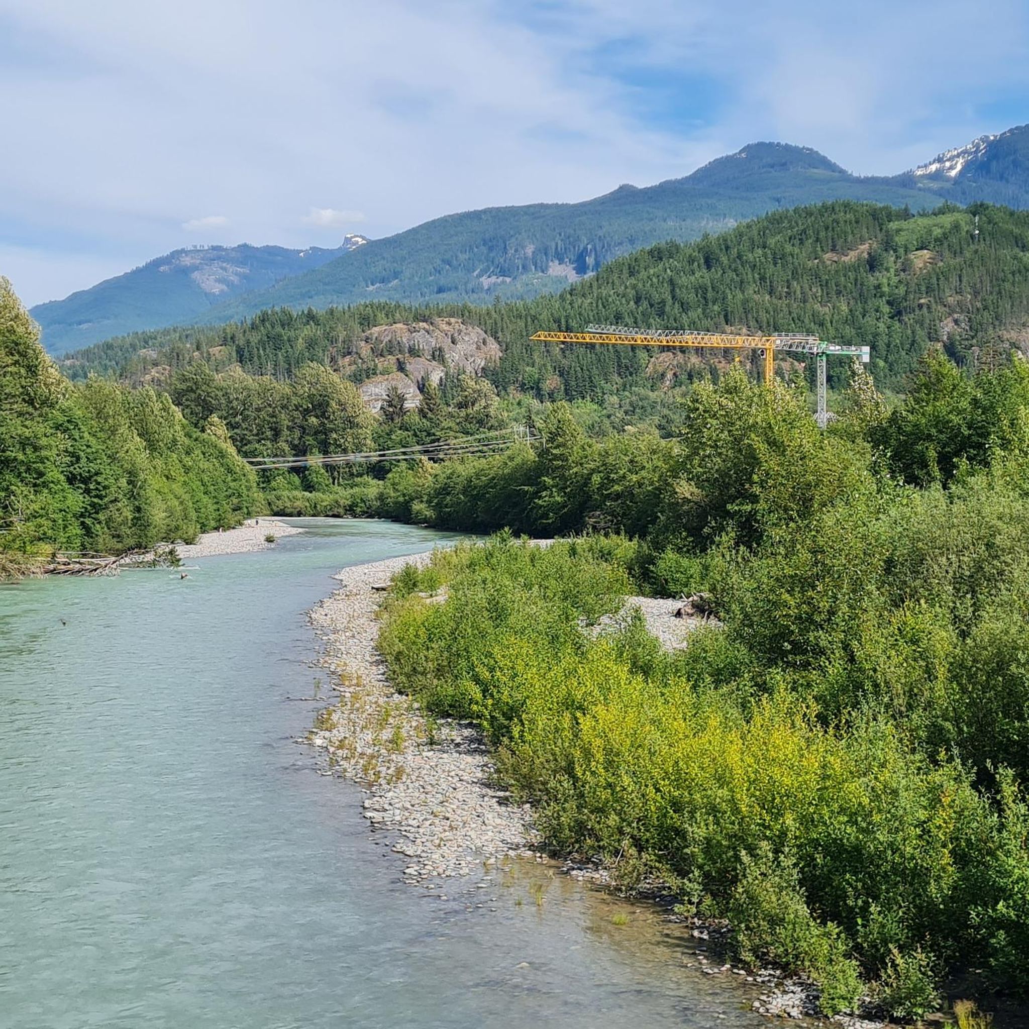
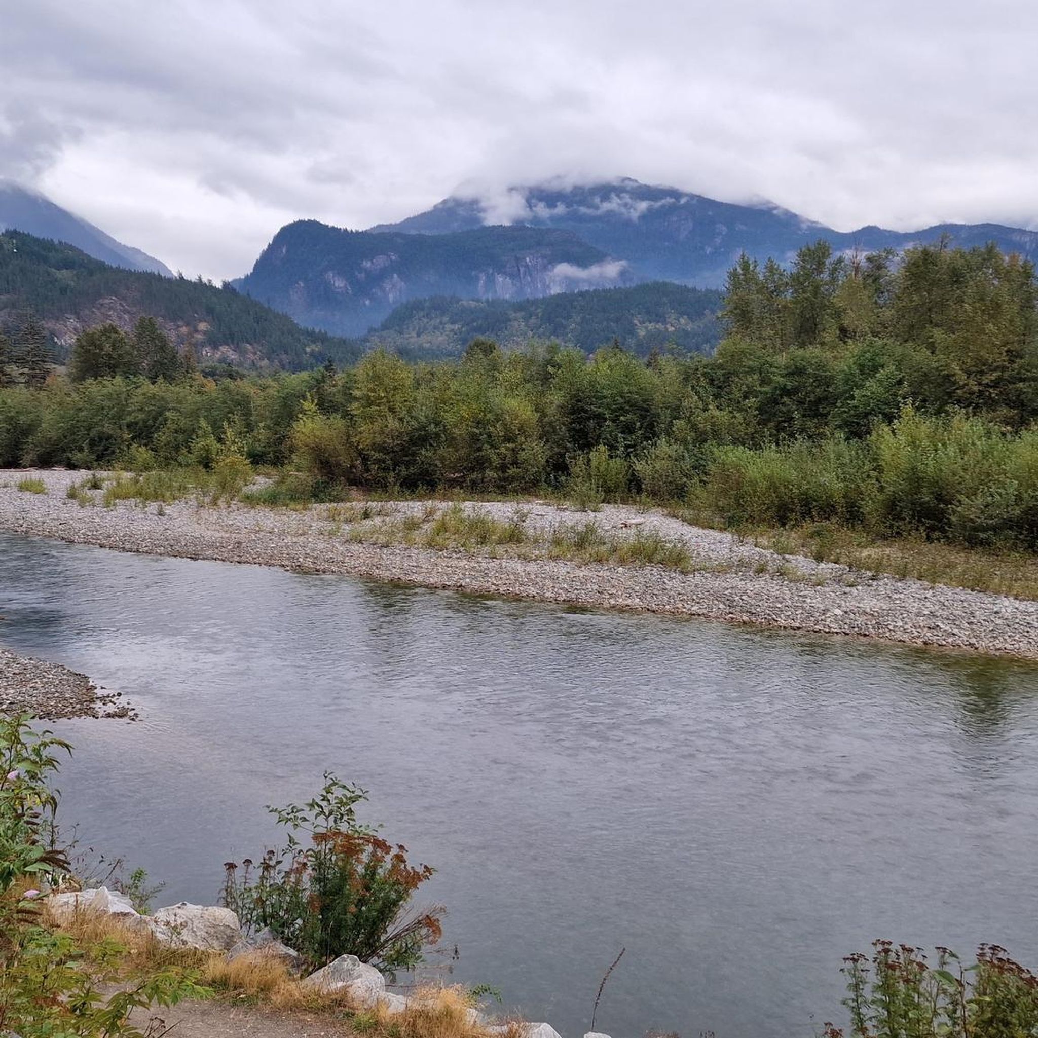
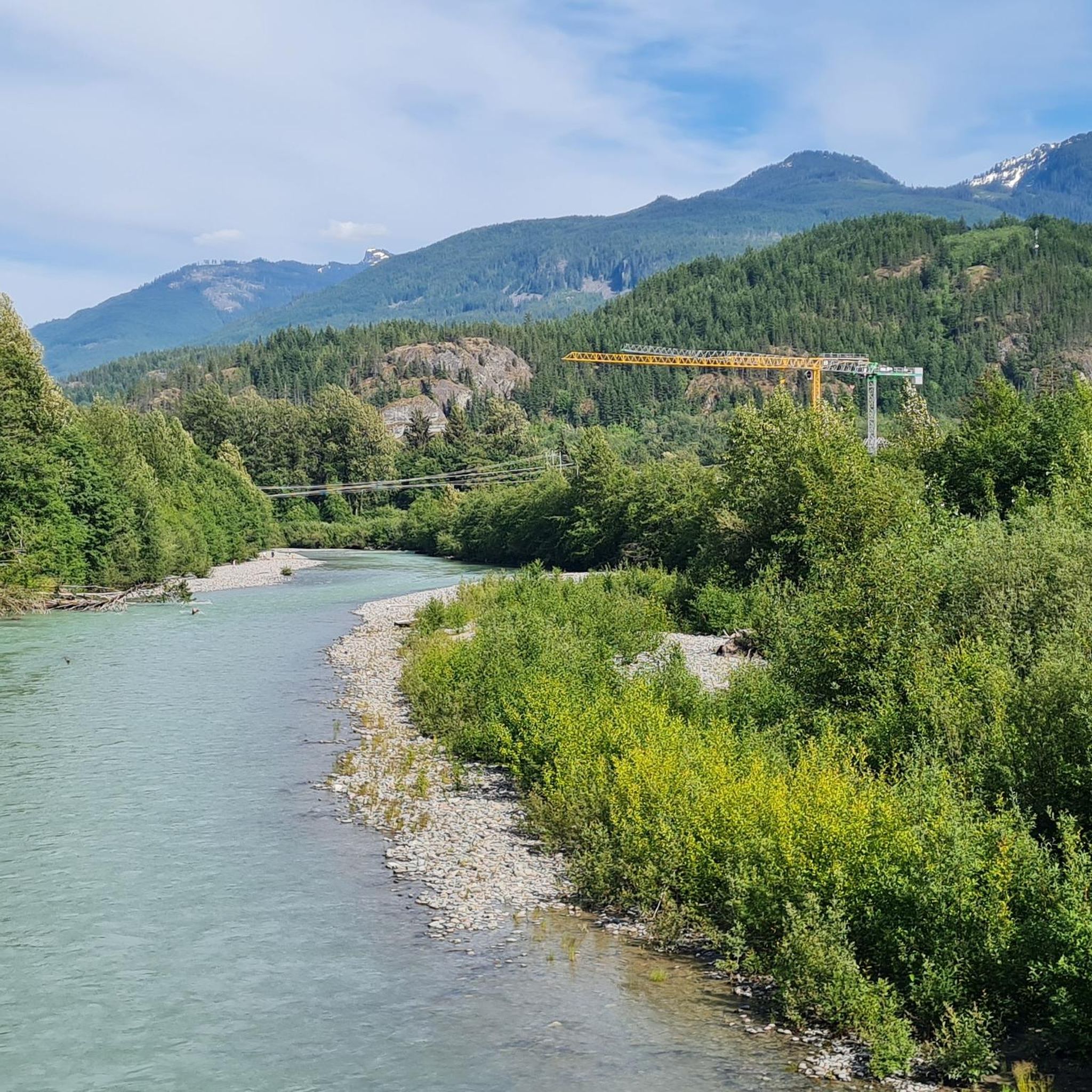
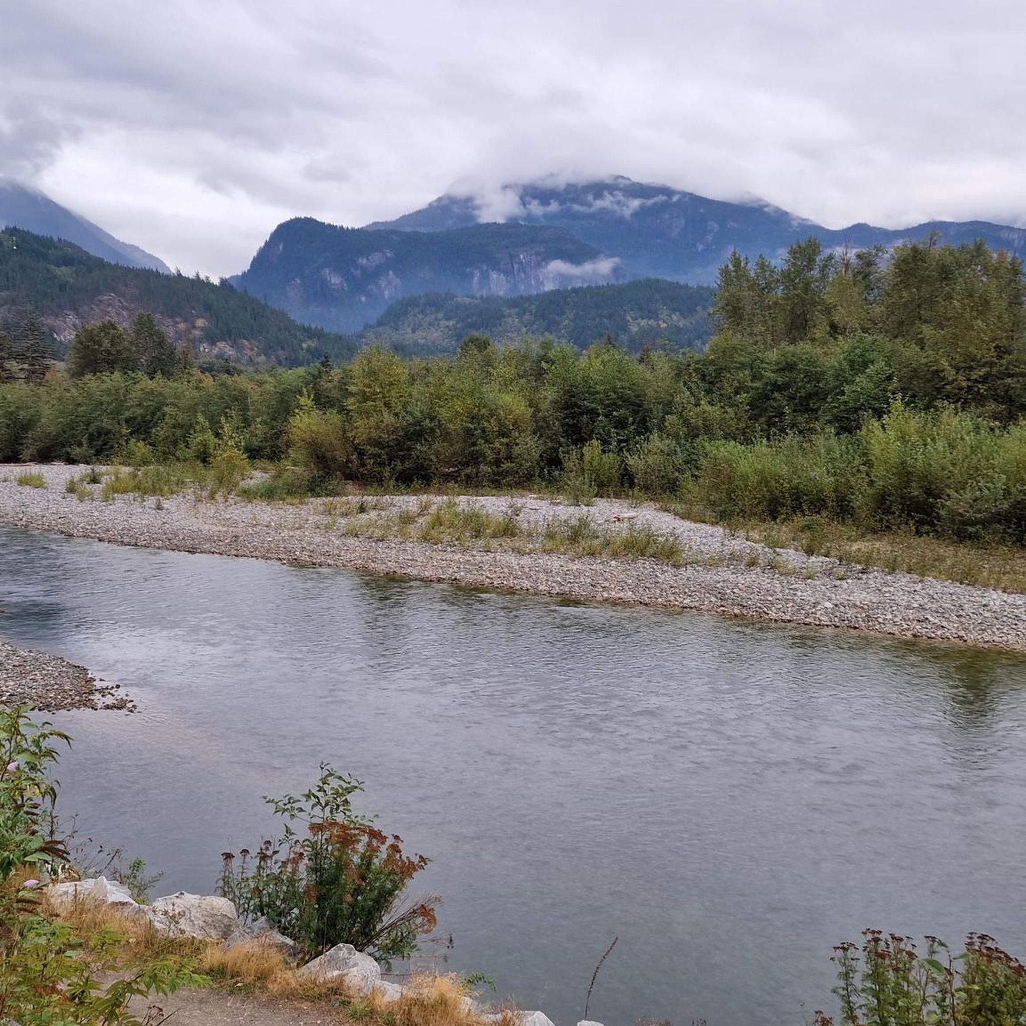
The Squamish River flows from the Coast Mountains to Howe Sound through one of British Columbia’s most scenic valleys. Along its lower reaches, the expansive river is framed by tall mountain peaks and supports a rich salmon habitat that attracts eagles, seals, and other wildlife, including bears. It’s a prime destination for fishing and whitewater rafting, and from this spot, you might see an eagle two flying overhead if you’re lucky.
0
0
Coho Park is beautiful, tucked between the Garibaldi Estates and Garibaldi Highlands neighbourhoods at the northeastern edge of the city. It’s a rare example of an urban temperate rainforest, where the forest floor is filled with ferns, mosses, and small plants, with a canopy of tall conifers that shuts out much of the sky above. The park gets its name from the coho salmon that spawn in Meighan Creek, which flows through the park on its way to the Squamish River, and is a popular spot for hiking, trail running, and mountain biking.
0
0

Lake Lovely Water Trail is a very wild and very scenic hike. You can't just walk up to the trail head, but make some arrangement to cross the Squamish River. The climb is steep through old‑growth trees, and the trail may have roots sticking up, mud, possible fallen logs, or blowdowns. When the trail ends at Lovely Water, all the effort will be worthwhile as the scenery is unbelievable.
0
0
Arriving at Lake Lovely Water Trailhead is part of the hike's adventure. The start of this trail is not accessible by foot, as there is no bridge crossing the Squamish River. The most common way to cross is by jet boat, canoe, or float plane. Using your own canoe is possible, but the river has a swift current, so only experienced boaters should attempt this crossing, and there are also services like Sea to Sky Air that can get you across the river to begin your hike to Lovely Waters.
0
0
Lake Lovely Water lives up to its name, with beautiful turquoise water, nestled in the Tantalus Range high above the Squamish River Valley, across from the Stawamus Chief. The best time to hike out to Lovely Water is between July and early October. On its eastern shore, at the end of the Lake Lovely Water Trail, is a beach, campground, emergency helipad, and hut.
0
0
Edith Lake is a small lake tucked within the forested hills of the Garibaldi Highlands, surrounded by towering Douglas-fir and cedar evergreens, with views of the Tantalus Range and Coast Mountains in the background. The trails here are well-marked and easy to follow.
1
0
Frequently Asked Questions
How many hiking trails are available in and around Brackendale Eagles Provincial Park?
There are nearly 70 hiking routes in the vicinity of Brackendale Eagles Provincial Park. These trails range from easy riverside walks to more challenging mountain ascents, offering diverse experiences for all skill levels.
What is the best time of year to visit Brackendale Eagles Provincial Park for hiking and eagle viewing?
The best time for eagle viewing is typically from November to February, when bald eagles gather for the salmon runs. While the park itself has restricted access during this period, adjacent areas like the Eagle Run Dyke offer excellent viewing opportunities. For general hiking, the spring, summer, and early fall months provide more accessible trails and pleasant weather, though some trails like the challenging Lake Lovely Water Trail are best hiked between July and early October.
Are there any easy, family-friendly hiking trails near Brackendale Eagles Provincial Park?
Yes, for an easy and family-friendly option, consider the Brackendale Eagle Viewing Area loop from Eagle Run. This 2.3 km trail runs along the river dike, offering flat terrain and excellent opportunities for bald eagle sightings during the winter months. The Estuary Chelem Trail is another relatively flat and easy option suitable for all ages, winding through tidal flats and marshes.
Can I bring my dog on the hiking trails in Brackendale Eagles Provincial Park's surrounding areas?
Many trails in the surrounding Squamish and Brackendale areas are dog-friendly, but it's always best to check specific trail regulations before heading out. For example, the popular Eagle Run Trail is generally welcoming to dogs on leash. Always ensure your dog is under control and that you clean up after them to protect the local wildlife and environment.
Are there any circular hiking routes in the area?
Yes, several circular routes are available. The Brackendale Eagle Viewing Area loop from Eagle Run is a short, easy loop perfect for eagle watching. For a moderate option, the Edith Lake loop from Eagle Run takes you through forested hills around Edith Lake. Another moderate loop is the View of Fawn Lake – Cheekye River loop from Brackendale, offering views of Fawn Lake and the Cheekye River.
What kind of wildlife can I expect to see while hiking near Brackendale Eagles Provincial Park?
Beyond the spectacular bald eagles, the area is home to diverse wildlife. Hikers might spot black bears, cougars, grey wolves, Roosevelt elk, and Columbian black-tailed deer. The Squamish Estuary Wildlife Management Area, in particular, is a haven for over 200 bird species. Always maintain a safe distance and never feed wildlife.
What are the most challenging hikes in the region?
For experienced hikers seeking a challenge, the Lake Lovely Water Trail is a difficult route known for its significant elevation gain and required river crossing to reach the trailhead. It offers stunning alpine lake views after a steep climb through old-growth trees. Another moderate-to-difficult option is the Echo Lake Trail, which also features substantial elevation gain.
Are there any places to explore near the trails, such as lakes or rivers?
Yes, the region is rich with natural features. You can explore several lakes like Stump, Alice, Edith, and Fawn Lakes, often connected by forest trails. The Squamish River, Cheakye River, and Mamquam River are also prominent features, providing critical habitat and scenic backdrops. The Squamish Estuary Wildlife Management Area offers unique tidal flats and marshes.
What do other hikers say about the trails in Brackendale Eagles Provincial Park?
The trails in and around Brackendale Eagles Provincial Park are highly rated by the komoot community, with an average score of 4.6 stars from over 280 reviews. Hikers often praise the stunning views of the Coast Mountains, the opportunities for wildlife spotting, especially eagles, and the variety of trails suitable for different fitness levels.
Is public transport available to reach hiking trailheads near Brackendale Eagles Provincial Park?
Public transport options to specific trailheads can be limited. It's advisable to check local transit schedules for Squamish and Brackendale. Many popular trailheads, such as those near Eagle Run, are often more easily accessed by car, with parking available. Consider carpooling or checking for local shuttle services if you plan to rely on public transport.
What kind of terrain can I expect on the trails?
The terrain varies significantly. You'll find easy, flat paths along river dikes, such as the Eagle Run Trail, ideal for casual walks. Other trails ascend through lush temperate rainforests with towering Douglas-fir and cedar evergreens, leading to lakes or higher viewpoints. Expect some trails to be muddy, especially after rain, so sturdy footwear is recommended.
Are there any specific permits or fees required to hike in the area?
While Brackendale Eagles Provincial Park itself has restricted access during certain periods to protect the eagles, general hiking on trails in the surrounding areas typically does not require specific permits or fees. However, always check the latest regulations for any provincial parks or protected areas you plan to enter, as conditions can change.
Most popular routes in Brackendale Eagles Provincial Park

Get inspired with the komoot mobile app


Explore more
Browse the best Hikes in other regions.
