The best walks and hikes in Seymour Watershed
4.7
(141)
2,236
hikers
15
hikes
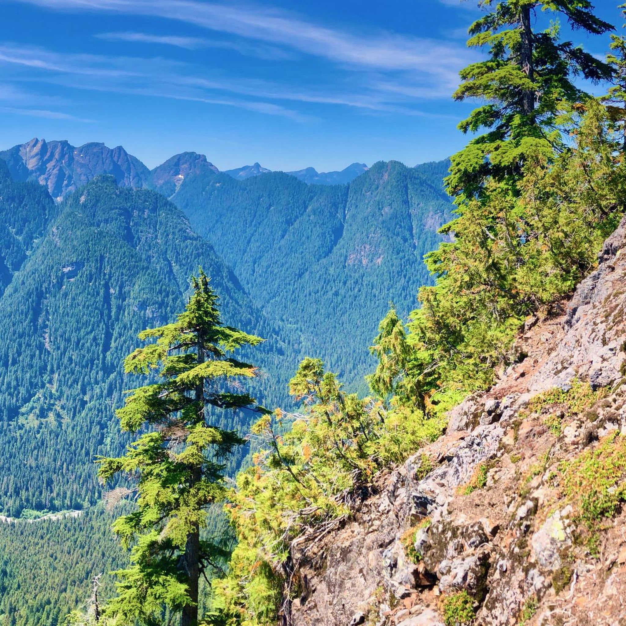
Hiking trails in Seymour Watershed are characterized by diverse mountainous terrain, lush forests, and pristine waterways, forming a significant natural park in British Columbia. The region encompasses the Lower Seymour Conservation Reserve, offering extensive trail networks amidst alpine peaks and forested slopes. The Seymour River is a defining feature, with other tributaries contributing to the watershed's rich hydrology. This area provides a wilderness experience with varied landscapes, including rocky outcrops and dense tree stands.
Best hiking trails in Seymour Watershed
…Last updated: August 28, 2026
7
hikers
8.35km
05:59
1,210m
1,210m
Hard hike. Very good fitness required. Mostly accessible paths. Sure-footedness required.
14
hikers
8.47km
06:01
1,190m
1,190m
Hard hike. Very good fitness required. Sure-footedness, sturdy shoes and alpine experience required.

Sign up for free
1
hikers
4.51km
01:27
190m
190m
Easy hike. Great for any fitness level. Easily-accessible paths. Suitable for all skill levels.
4.8
(36)
586
hikers
7.36km
02:52
400m
400m
Hard hike. Good fitness required. Sure-footedness, sturdy shoes and alpine experience required.
4.8
(14)
526
hikers
5.26km
01:30
120m
120m
Easy hike. Great for any fitness level. Easily-accessible paths. Suitable for all skill levels.
Get access to more routes and recommendations from other explorers.
Sign up for free
Already have an account?
Our route recommendations are based on thousands of hikes, rides, and runs completed by other people on komoot.
Start today with a free account
Your next adventure awaits.
Login or Signup
Popular around Seymour Watershed
Tips from the Community

This area is often explored by boat, with boats docking at various docks like this one to explore the cliffs, waterfalls, and headlands jutting out into Iron Bay. Here, there is also parking down a dirt road with the option to hike the Upper Granite Falls Trail.
0
0
Grand Creek empties into Iron Bay and is often accessible by boat, and is accessible on foot via the Upper Granite Falls Trail. This lading has trails that explore Grand Greek where it meets Iron Bay and its waterfalls. There's a rocky beach, a restroom, a camping area, and a dock near the Lower Granite Falls.
0
0

Mt Seymour is located in the District of North Vancouver, BC. It is a part of the North Shore Mountains, rising to the north from the shores of Burrard Inlet and Indian Arm to a summit of 1,449 m (4,754 ft) above the Indian River and Deep Cove neighbourhoods. Mount Seymour is most commonly identified for its ski area of the same name, and as a popular mountain biking and hiking area. It is named in honour of Frederick Seymour, second governor of the Colony of British Columbia. The name is used to refer to the ridge although the main summit is one of several, and is also known as Third Pump Peak.
3
0
Frequently Asked Questions
Are there hiking trails suitable for beginners or families in Seymour Watershed?
Yes, Seymour Watershed offers a variety of trails suitable for different skill levels. There are 6 easy trails, perfect for beginners or families looking for a gentle outing. For example, the Upper Granite Falls trail is an easy 2.8-mile route through forested areas, often completed in about 1 hour 25 minutes.
What kind of terrain can I expect on hikes in Seymour Watershed?
Hikers in Seymour Watershed will encounter diverse mountainous terrain, ranging from lush forests with varied hardwood stands to rocky outcrops and erratic boulders. The area spans three biogeoclimatic zones: coastal western hemlock, mountain hemlock, and alpine tundra, offering a continuous sense of wilderness. Some trails also feature pristine waterways and significant elevation changes.
How many hiking trails are available in Seymour Watershed?
The Seymour Watershed features an extensive network of trails. Our guide alone lists 15 distinct hiking routes, with 6 categorized as easy, 4 as moderate, and 5 as difficult, ensuring options for every preference and skill level.
Are there any trails that are accessible for strollers or wheelchairs?
Yes, the Seymour Valley Trailway, a 10-kilometer (6+ mile) paved path, is known for being wheelchair and stroller-friendly. It winds through diverse forests, offering views of Seymour Lake and a mountainous backdrop, making it ideal for those seeking accessible outdoor experiences.
Are there any notable natural features or landmarks to see while hiking?
Absolutely. The watershed is rich with natural beauty. You can explore pristine waterways like the Seymour River, Burwell Creek, and Rice Lake, which is a popular spot for walks and picnics. The Upper Granite Falls is a notable natural feature accessible via an easy trail. You might also encounter the Seymour Falls Dam, marking the beginning of the Lower Seymour Conservation Reserve.
Are there trails that offer panoramic views?
Many trails in the Seymour Watershed, particularly those in Mount Seymour Provincial Park, lead to scenic overlooks with spectacular panoramic views. For instance, the View of Vancouver loop from The Hut offers rewarding vistas. Higher elevation trails, like those leading to Mount Seymour's First Peak, often provide 360-degree views of Vancouver, Mount Baker, and Indian Arm.
Is parking available for hikers in the Seymour Watershed?
Yes, parking is generally available at key access points for hiking trails within the Seymour Watershed, particularly in areas like Mount Seymour Provincial Park and the Lower Seymour Conservation Reserve. It's advisable to check specific trailheads for parking availability and any potential fees or restrictions, especially during peak seasons.
Can I reach hiking trails in Seymour Watershed using public transport?
While the Seymour Watershed offers a wilderness experience, it's located within minutes of downtown Vancouver, making some areas accessible by public transport. Specific bus routes may serve the vicinity of Mount Seymour Provincial Park or the Lower Seymour Conservation Reserve. We recommend checking local transit schedules for the most up-to-date information on routes and stops.
What is the best time of year to hike in Seymour Watershed?
The Seymour Watershed offers hiking opportunities year-round, but the best time depends on your preferred activity. Spring to fall (roughly May to October) provides the most favorable conditions for general hiking, with warmer weather and clear trails. Winter hiking is possible, especially on lower elevation trails, but requires appropriate gear and awareness of snow and ice conditions, particularly at higher altitudes.
Are dogs allowed on trails in Seymour Watershed?
The Lower Seymour Conservation Reserve (LSCR), a key part of the watershed, generally allows dogs on leash on many of its multi-use trails. However, specific rules can vary by area, especially within Mount Seymour Provincial Park or sensitive ecological zones. Always look for signage at trailheads regarding dog regulations to ensure a pleasant and compliant hike.
What do other hikers enjoy most about hiking in Seymour Watershed?
The area is highly rated by the komoot community, with an average score of 4.7 stars from over 100 reviews. Hikers frequently praise the diverse landscapes, from lush forests to alpine views, and the extensive network of trails catering to all abilities. The accessibility to a wilderness experience so close to Vancouver is also a commonly highlighted positive aspect.
Are there any loop trails in Seymour Watershed?
Yes, the Seymour Watershed features several excellent loop trails. For a challenging experience, consider the Mount Bishop loop from Bear Island, a difficult 5.2-mile route. Another popular option is the Paton Peak – Coliseum Mountain loop from North Vancouver—Capilano, which is a difficult 5.3-mile path offering panoramic views.
What should I bring for a hike in Seymour Watershed?
Given the diverse terrain and potential for varying weather, it's wise to bring layers of clothing, sturdy hiking boots, sufficient water, and snacks. For more challenging or longer routes, a map or GPS device (like komoot's app), a first-aid kit, and bear spray are recommended. Always check the weather forecast before heading out.

Get inspired with the komoot mobile app


Explore more
Browse the best Hikes in other regions.
