Routes

Planner

Features

Updates

App

Login or Signup

Get the App

Login or Signup

Routes
Hikes
Canada
British Columbia

Lower Seymour Conservation Reserve

Routes
Hikes
Canada
British Columbia

Lower Seymour Conservation Reserve

The best walks and hikes in Lower Seymour Conservation Reserve

4.6

(991)

11,198

hikers

26

hikes

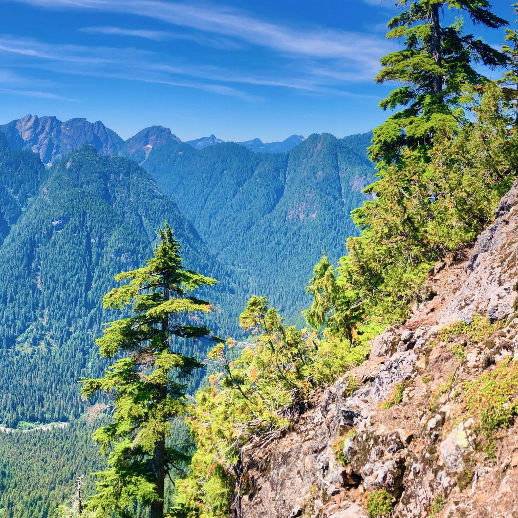
Hiking trails in Lower Seymour Conservation Reserve offer a diverse range of experiences within a rugged landscape of forested slopes, river valleys, and mountain peaks. The reserve covers 5,668 hectares, featuring extensive forests and the flowing Seymour River. This area provides varied terrain, from gentle paths to challenging ascents, catering to different hiking preferences.

Best hiking trails in Lower Seymour Conservation Reserve

  • The most popular hiking route is Mount Seymour – First Peak (1407 m) loop from The Hut,…

Last updated: July 5, 2026

4.9

(31)

490

hikers

#1.

First Peak (1407 m) – Mount Seymour loop from The Hut

7.30km

02:34

400m

400m

Moderate hike. Good fitness required. Mostly accessible paths. Sure-footedness required.

Navigate with device

Send to Phone

Save

Moderate

4.9

(11)

494

hikers

Easy hike. Great for any fitness level. Easily-accessible paths. Suitable for all skill levels.

Easy
guide_signup
Let us show you the way with the komoot mobile app
With a free komoot account, you can easily find, customize, and navigate endless outdoor adventures.

Sign up for free

Easy hike. Great for any fitness level. Easily-accessible paths. Suitable for all skill levels.

Easy

Easy hike. Great for any fitness level. Easily-accessible paths. Suitable for all skill levels.

Easy

Hard hike. Good fitness required. Sure-footedness, sturdy shoes and alpine experience required.

Hard
Sign up for free to see 22 more hikes in Lower Seymour Conservation Reserve.

Get access to more routes and recommendations from other explorers.

Sign up for free

Already have an account?

Our route recommendations are based on thousands of hikes, rides, and runs completed by other people on komoot.

Start today with a free account

Your next adventure awaits.

Login or Signup

Popular around Lower Seymour Conservation Reserve
Running Trails in Lower Seymour Conservation Reserve
MTB Trails in Lower Seymour Conservation Reserve

Road Cycling Routes in Lower Seymour Conservation Reserve

Cycling in Lower Seymour Conservation Reserve

Gravel biking in Lower Seymour Conservation Reserve

Tips from the Community

Hubert Trapp
July 29, 2025, View of Rice Lake

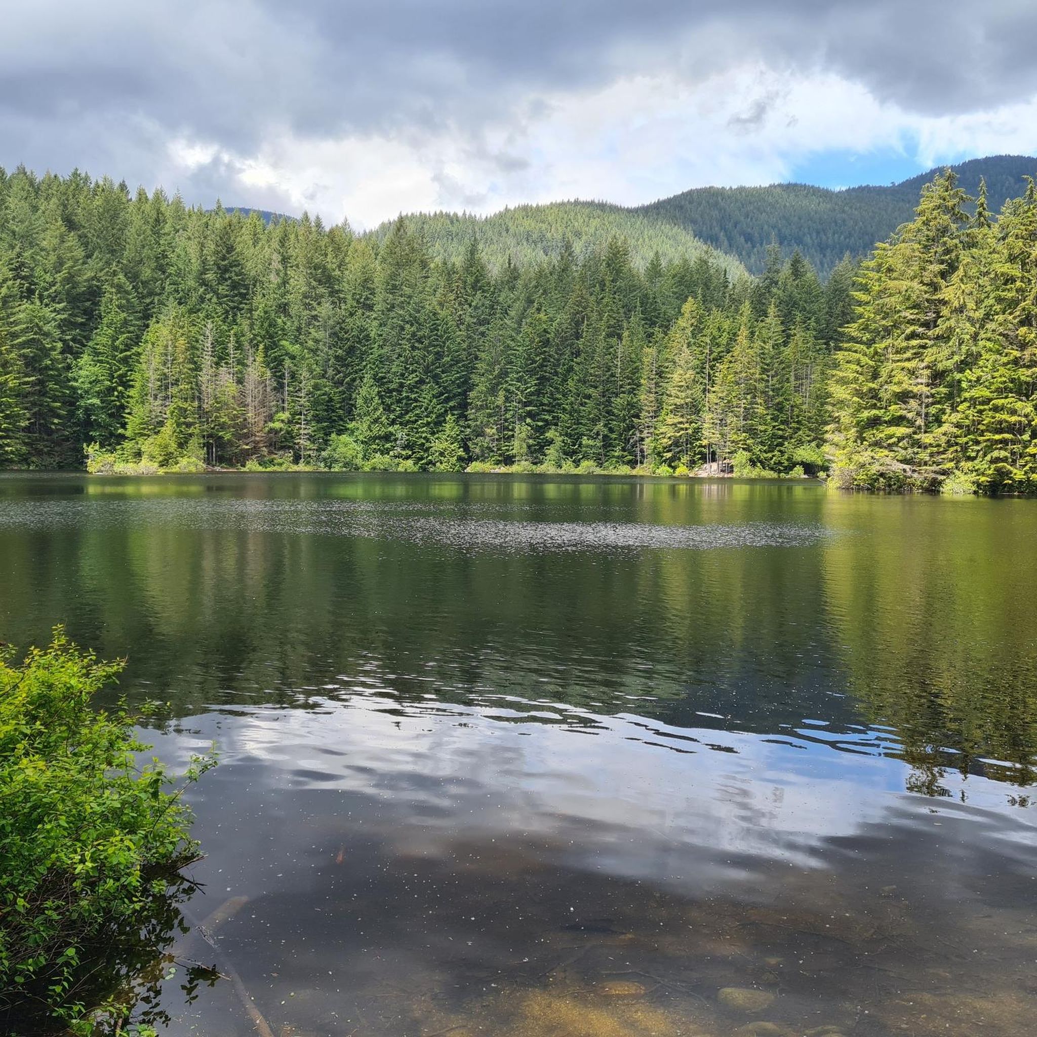
Rice Lake is located in the Lower Seymour Conservation Reserve, a few hundred meters north of the end of Lillooet Road. The lake is stocked with rainbow trout and is a popular fishing spot. A 3-km-long, mostly flat trail surrounds the lake, making it ideal for walking.

2

0

D'Arcy T
February 13, 2019, Mount Seymour

Mt Seymour is located in the District of North Vancouver, BC. It is a part of the North Shore Mountains, rising to the north from the shores of Burrard Inlet and Indian Arm to a summit of 1,449 m (4,754 ft) above the Indian River and Deep Cove neighbourhoods. Mount Seymour is most commonly identified for its ski area of the same name, and as a popular mountain biking and hiking area. It is named in honour of Frederick Seymour, second governor of the Colony of British Columbia. The name is used to refer to the ridge although the main summit is one of several, and is also known as Third Pump Peak.

3

0

Frequently Asked Questions

How many hiking trails are there in Lower Seymour Conservation Reserve?

The Lower Seymour Conservation Reserve offers an extensive network of trails, with over 65 kilometers dedicated to hiking. Komoot lists 26 distinct hiking routes within the reserve, catering to various skill levels.

What kind of terrain can I expect on hikes in Lower Seymour Conservation Reserve?

You'll find a diverse and rugged landscape, including forested slopes, river valleys, and mountain peaks. Trails range from paved paths like the Seymour Valley Trailway to more challenging, uneven mountain terrain. The Mount Seymour – First Peak (1407 m) loop from The Hut, for instance, involves significant elevation gain towards a prominent peak.

Are there any family-friendly hiking options in the reserve?

Yes, the reserve offers several family-friendly options. The Seymour Valley Trailway is a 10 km paved path ideal for families, and the 3 km gravel trail around Rice Lake is also very popular and easy to navigate. For a slightly longer but still easy option, consider the View of Rice Lake loop from Grousewoods.

Can I bring my dog on the trails in Lower Seymour Conservation Reserve?

Many trails within the Lower Seymour Conservation Reserve are dog-friendly, but it's always best to check specific trail regulations as some areas may have restrictions or require dogs to be on leash. Always ensure your dog is under control and clean up after them.

Are there any circular hiking routes available?

Yes, many routes in the reserve are designed as loops. Examples include the View of Vancouver loop from The Hut, which offers scenic views, and the Brockton Point Summit – Mount Seymour loop from Brighton Beach, leading through forested mountain terrain.

What natural features or landmarks can I see while hiking?

The reserve is rich in natural beauty. You can explore the picturesque Seymour River, which flows through the area, or visit Rice Lake, a peaceful wilderness oasis. The Seymour River Suspension Bridge is another notable landmark, and you'll find stunning views of Mount Seymour and other peaks.

Is Lower Seymour Conservation Reserve accessible by public transport?

Yes, the Lower Seymour Conservation Reserve is accessible by public transport from downtown Vancouver, making it a convenient option for hikers without a car. Check local transit schedules for the most up-to-date routes and times.

What are the parking options for hikers?

There are various parking areas available at different trailheads throughout the reserve. Popular access points often have dedicated parking lots, but it's advisable to arrive early, especially on weekends, as spaces can fill up quickly.

What is the best time of year to go hiking in Lower Seymour Conservation Reserve?

The reserve is open year-round, offering different experiences depending on the season. Spring and summer provide lush greenery and warmer temperatures, while autumn brings vibrant fall colors. Winter hiking is also possible, but some higher elevation trails may require snowshoes or microspikes due to snow and ice.

Are there options for challenging hikes in the reserve?

Absolutely. While there are many easy and moderate trails, the reserve also offers more strenuous options for experienced hikers. Trails like the Lynn Peak trail provide a good cardio workout, and the Mount Seymour – First Peak (1407 m) loop from The Hut is considered a moderate challenge with significant elevation gain.

What do other hikers say about the trails in Lower Seymour Conservation Reserve?

The trails in Lower Seymour Conservation Reserve are highly rated by the komoot community, with an average score of 4.6 stars from over 450 reviews. Hikers often praise the diverse terrain, well-maintained paths, and the stunning natural scenery, from dense forests to river views and mountain vistas.

Are there any easy, accessible trails for all abilities?

Yes, the Seymour Valley Trailway is a 10 km paved path that is wheelchair-friendly and suitable for all abilities. The 3 km gravel trail around Rice Lake is also relatively flat and easy to navigate, offering a peaceful wilderness experience.

Where can I find cafes or restaurants near Lower Seymour Conservation Reserve after my hike?

While the reserve itself is focused on conservation, there are various cafes and restaurants in the nearby North Vancouver area. You'll find options ranging from casual eateries to more established restaurants, perfect for refueling after your hike.

Most popular routes in Lower Seymour Conservation Reserve

Family-friendly hikes in Lower Seymour Conservation Reserve

Most popular attractions in Lower Seymour Conservation Reserve

Places to see

Store rating

Get inspired with the komoot mobile app

With a free komoot account, you can easily find, customize, and navigate endless outdoor adventures.

or

Join komoot Now

Store rating

Explore more

Browse the best Hikes in other regions.

Rocky MountainsSelkirk MountainsMonashee MountainsElectoral Area AVancouverAlberni-ClayoquotMetro Vancouver Regional ParksArea C (Pemberton Valley/Mount Currie/D'Arcy)Vancouver IslandArea A (Kicking Horse/Kinbasket Lake)Area D (Elaho/Garibaldi)BurnabyArea D (Oyster Bay/Buttle Lake)Colony Farm Regional ParkCentral Okanagan JEast Central Okanagan Electoral AreaArea A (Baynes Sound)Area B (South Fraser Canyon/Sunshine Valley)Sunshine Coast Regional DistrictPurcell MountainsFraser River Delta -- RamsarArea G (Forster Creek/Mount Assiniboine)Area F (McConnell Creek/Hatzic Prairie)Brackendale Eagles Provincial ParkNanaimoSurreyAbbotsfordArea E (Chilliwack River Valley)Surrey Bend Regional ParkFraser Islands Regional Park ReserveTynehead Regional ParkCariboo MountainsYoho National ParkSaanichArea B (Shelter Bay/Mica Creek)Hazelton MountainsArea A (Wells Gray Country)Coquitlam WatershedNorth Okanagan BArea C (Moyie/Bull River)Beaver Lodge Forest LandsArea P (Rivers and the Peaks)Area A (Upper Flathead/Elk Valley)Area A (Kyuquot/Nootka/Sayward)Okanagan Mountain Provincial ParkArea F (Columbia Lake/Windermere Lake)Beaufort East WoodlandsLangleyKootenay National ParkStave West Forest & Recreation AreaBurns Bog Ecological Conservancy AreaWells Gray Provincial ParkShuswap LakeArea C (Sasquatch Country)Stikine RegionArea C (Arrowsmith-Benson)Garibaldi Provincial ParkCowichan Valley GRichmondPacific Rim National Park Reserve - Long Beach UnitNorth CowichanMaple RidgeArea D (Falkland/Silver Creek)Stave LakeArea N (Beautiful Nicola Valley - South)Iona Beach Regional ParkBlackcomb Glacier Provincial ParkArea F (Grindrod/Ashton Creek/Mabel Lake)Little Qualicum Falls Provincial ParkCrown Land ReserveArea L (Grasslands)Area C (Puntledge/Black Creek)Akamina-Kishinena Provincial ParkArea H (Lighthouse Country)Blue Mountain Recreation SiteArea H (The Slocan Valley)Pitt MeadowsSayres Lake Recreation SiteGlen Valley Regional ParkTelemark Cross-Country Ski Trails Recreation SiteArea H (Robson Valley/Canoe)Təmtəmíxʷtən/Belcarra Regional ParkEagle Mountain Recreation SiteNanaimo GStawamus Chief Provincial ParkArea G (Deroche/Dewdney/Sumas Mountain)Whistler Interpretive ForestSpallumcheenKanaka Creek Regional ParkStanley Park National Historic SiteArea B (Lake Koocanusa)Area C (Chilako River/Nechako)DeltaArea E (Eagle River Valley)Upper Little Qualicum River WoodlandsShowh Lakes-Ancient Cedars Trail Recreation SiteArea H (Manning Park/Tulameen/Siwash)Robert'S Lake Regional ParkCapital GFraser Valley DBlaney Bog Regional Park ReservePacific Rim National Park Reserve - West Coast Trail UnitK'Ómoks Royston LandsVictoriaCodd Wetland Ecological Conservancy AreaArea B (Discovery Islands/Mainland Inlets)Area C (Blind Bay/Sorrento)Mount Revelstoke National ParkElk Falls Provincial ParkCapilano River Regional ParkBurnaby Lake Regional ParkComox Valley B (Lazo North)Kennedy Lake Provincial ParkCypress Provincial ParkUpper Trent River WoodlandsColumbia National Wildlife AreaUpper Puntledge River WoodlandsUpper Qualicum River WoodlandsBurnaby Mountain Conservation AreaArea A (Malaspina/Toba)Deas Island Regional ParkHarrison LakeCampbell Valley Regional ParkE.C. Manning Provincial ParkAlberni Beaufort Range WoodlandsDawley Passage Provincial ParkArea F (Alberni Highway)Golden Ears Provincial ParkWidgeon Marsh Regional Park ReserveSooke Hills Wilderness Regional ParkStrathcona Provincial ParkVictoria Harbour Migratory Bird SanctuaryGowlland Tod Provincial ParkAlouette LakeStephens Coyote Ridge Regional ParkFlorence Lake Recreation ReserveTantalus Provincial ParkSumas Mountain Regional ParkȽáu,Welṉew̱/John Dean Provincial ParkTsable Lakes WoodlandsMinnekhada Regional ParkWoodley Range Ecological ReserveCallaghan ConservancySx̱Ótsaqel / Chilliwack Lake Provincial ParkPinecone Burke Provincial ParkArea I (Youbou / Meade Creek)Epper Passage Provincial ParkCultus Lake Provincial ParkGrouse Mountain Regional ParkAyum Creek Regional Park ReserveUbc Malcolm Knapp Research ForestArea A (North Skeena)Area F (Scotch Creek/Seymour Arm)Area D (Trinity/West Creighton)Area E (Saint Mary/Skookumchuck)Alberni - Ash River WoodlandsStamp River Provincial ParkArea D (Lardeau Valley/Duncan Lake)Mount Seymour Provincial ParkCrippen Regional ParkArea C (Lois Lake/Saltery Bay)Mount Terry Fox Provincial ParkArea B (Paradise Valley)Cougar Canyon Ecological ReserveCentral SaanichArea A (Upper Bridge River Valley)Coquihalla Summit Recreation AreaArea B (Lower Columbia/Old Glory)Goldstream Provincial ParkMount Gardner Recreation SiteJuan De Fuca Provincial ParkSeymour WatershedLynn Headwaters Regional ParkCowichan Valley FArea J (Copper Desert Country)Powell LakeThacker Regional ParkPacific Spirit Regional ParkMacmillan Provincial ParkMount Geoffrey Escarpment Provincial ParkHelliwell Provincial ParkMount Arrowsmith Regional Park (Acrd)Buntzen Lake Recreation AreaArea F (Willow River/Upper Fraser)Boyle Point Provincial ParkLiumchen Ecological ReserveStrathcona Park - Upper Puntledge River WatershedBrandywine Falls Provincial ParkArea K (The Arrow Lakes)Valhalla Provincial ParkArea E (Cherryville/East Creighton)North Cowichan Municipal Forest ReserveBoundary Bay Regional ParkArea E (Naramata/Greyback)Area H (Canim Lake/Forest Grove)Pitt LakeCarmanah Walbran Provincial ParkSkeena MountainsMount Arrowsmith Massif Regional Park (Rdn)Alberni - Great Central Lake WoodlandsMount Assiniboine Provincial ParkEsté-Tiwilh/Sigurd Creek ConservancyInland Lake Provincial ParkNorth SaanichCampbell LakeCapilano WatershedThwaytes Landing Regional ParkBowen Island Ecological ReserveNorthern RockiesMount Robson Provincial ParkNairn Falls Provincial ParkArea B (Cayoosh/Pavilion)Area D (Tabor Lake/Stone Creek)Area F (Trout Creek Valley)Larch Hills Trails Recreation SiteStebbings Road Community ForestMyra-Bellevue Provincial ParkSasquatch Provincial ParkMain Lake Provincial ParkMt. Macpherson Cross-Country Trails Recreation SiteMount Begbie Recreation SiteArea A (Hudson Bay Mountain)Race Rocks Ecological ReserveElk Lakes Provincial ParkOkanagan LakeCowichan River Provincial ParkArea B (Shawnigan Lake)Vargas Island Provincial ParkArea E (Balfour/Cottonwood Lake)Height Of The Rockies Provincial ParkMt Begbie Area Recreation SiteKoksilah River Provincial ParkWoodworth Lake ConservancyArea J (Lower Arrow/Columbia)Area A (Wynndel/Crawford Bay/Riondel)Rathtrevor Beach Provincial ParkWeaver Lake Recreation SiteKootenay Boundary EKalamalka Lake Provincial ParkArea G (Salmo Valley)

Nearby adventure guides

Things to Do in Mount Seymour Provincial Park

background

Get ready to conquer new peaks

Sign up for Free

Explore
RoutesRoute plannerFeaturesHikesMTB TrailsRoad cycling routesBikepackingSitemap
Download the app
Follow Us on Socials

© komoot GmbH

Privacy Policy