The best road cycling routes in Təmtəmíxʷtən/Belcarra Regional Park
4.3
(70)
2,518
riders
43
rides
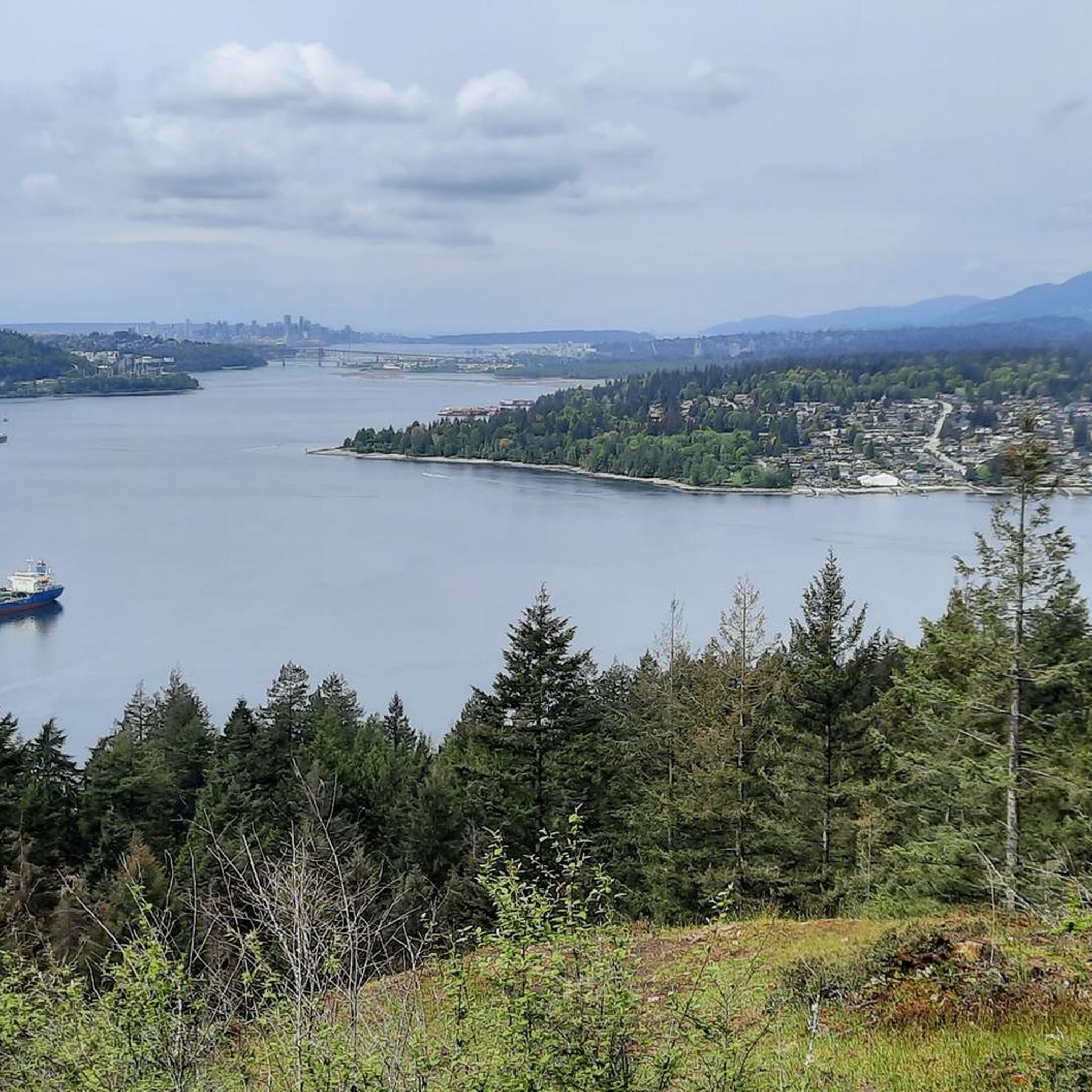
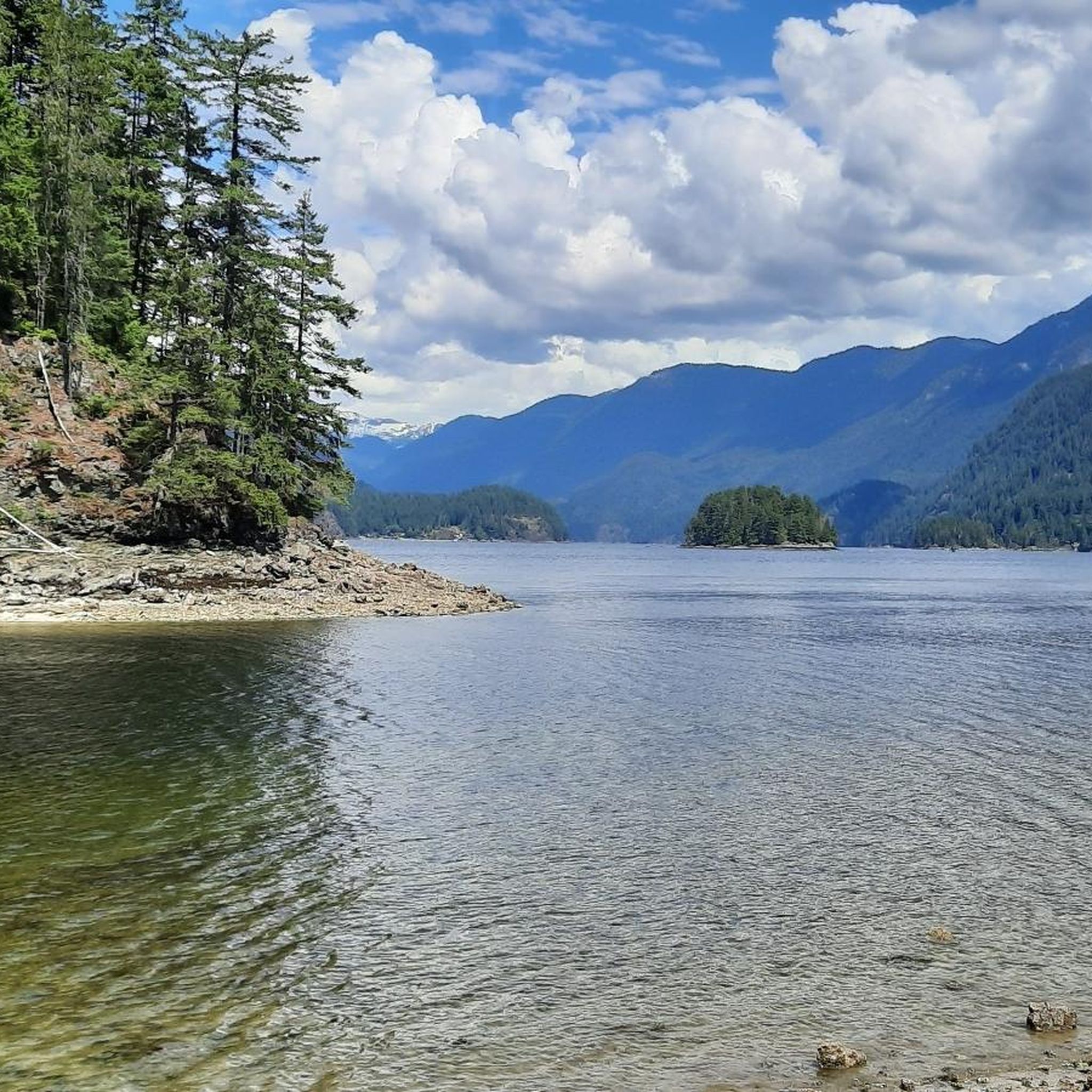
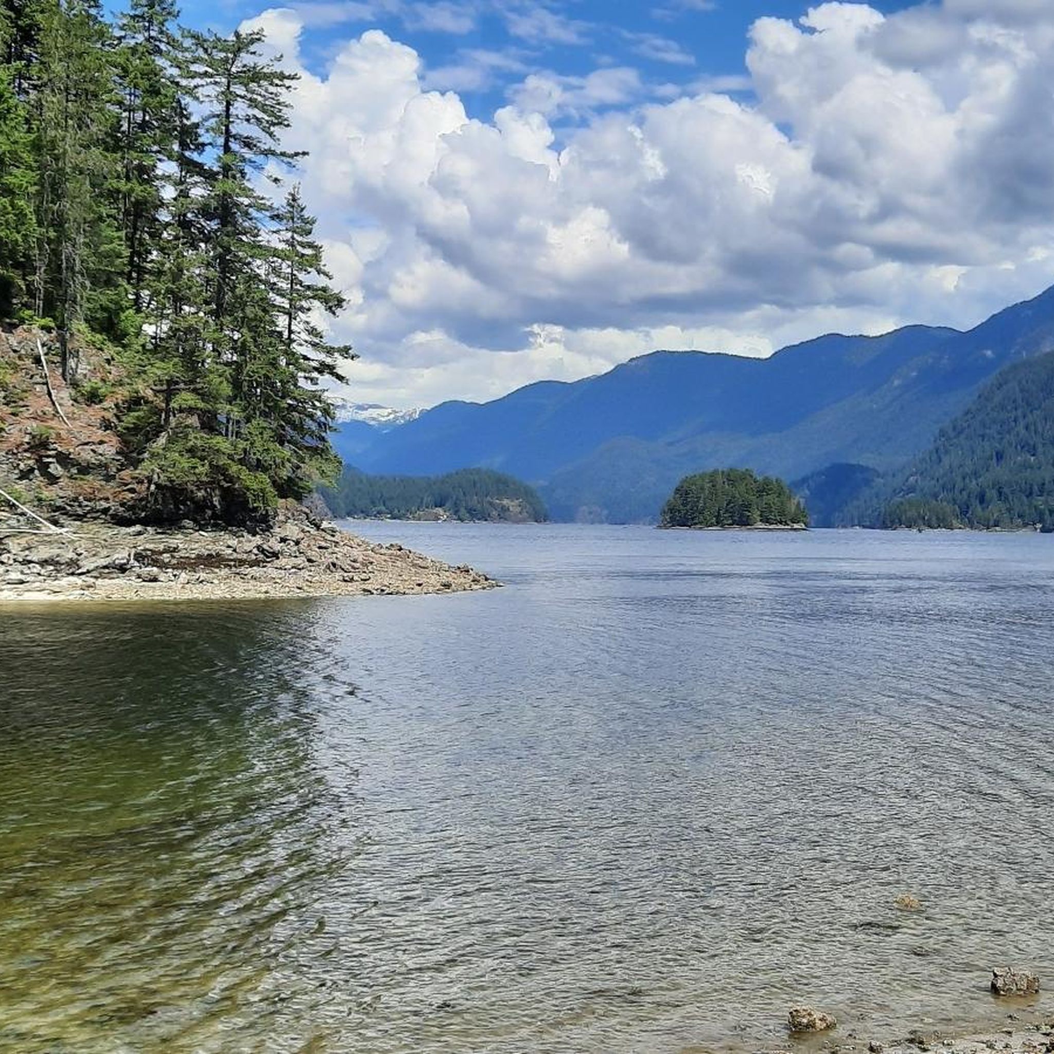
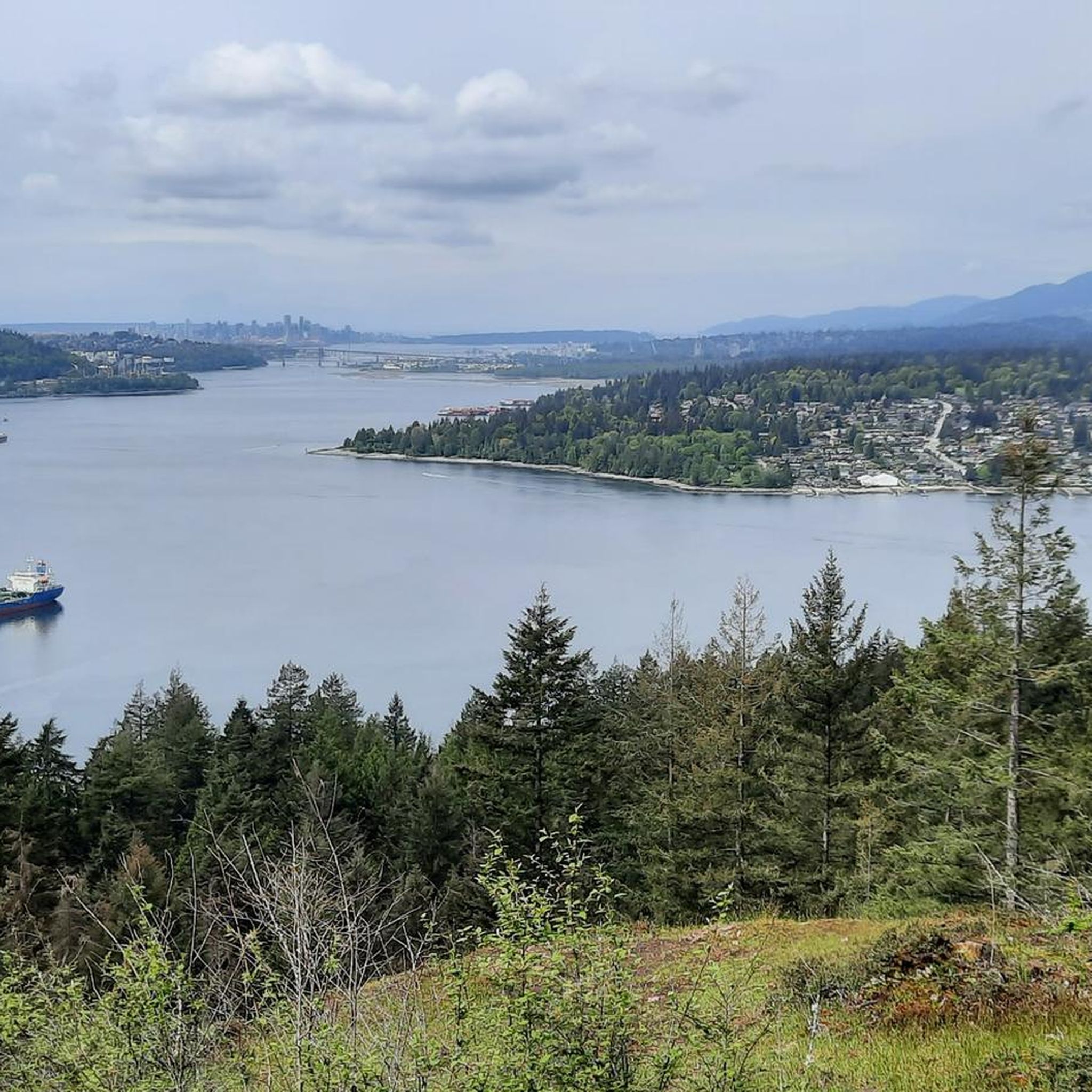
Road cycling routes in Təmtəmíxʷtən/Belcarra Regional Park traverse a diverse landscape featuring ocean waterfronts, forested shorelines, and varied terrain. The area offers a mix of challenging hills and shared roads, with a high percentage of paved surfaces suitable for road bikes. Cyclists can experience significant elevation gains and scenic views across Burrard Inlet towards Port Moody and Burnaby Mountain. The region's network of routes caters to different fitness levels, from easier rides to those requiring substantial climbs.
Best road cycling…
Last updated: July 7, 2026
4.8
(17)
544
riders
45.0km
02:11
370m
370m
Moderate road ride. Good fitness required. Mostly well-paved surfaces and easy to ride.
4.0
(1)
68
riders
39.4km
01:46
210m
210m
Moderate road ride. Great for any fitness level. Some segments of this route may be unpaved and difficult to ride.

Sign up for free
39
riders
93.9km
06:13
600m
600m
Hard road ride. Very good fitness required. Some segments of this route may be unpaved and difficult to ride.
16
riders
64.3km
03:12
840m
840m
Moderate road ride. Good fitness required. Mostly well-paved surfaces and easy to ride.
22
riders
48.3km
02:27
700m
700m
Moderate road ride. Good fitness required. Mostly well-paved surfaces and easy to ride.
Get access to more routes and recommendations from other explorers.
Sign up for free
Already have an account?
Our route recommendations are based on thousands of hikes, rides, and runs completed by other people on komoot.
Start today with a free account
Your next adventure awaits.
Login or Signup

Tips from the Community

Here, the Avison Trail crosses over Stanley Park Causeway via a sidewalk on Stanley Park Drive and gives one of the best viewpoints over Lions Gate Bridge. There is an informational sign on the sidewalk about the bridge, and the viewpoints look straight down the bridge from between the forests.
1
0

This 27-hectare park in Vancouver's Cedar Cottage neighbourhood has so much to offer it's no wonder that it is the heart of the neighbourhood. You'll find the usual park offerings like picnic area, playground, and sports fields but there's also Trout Lake in the middle of the park, 2 concession stands, hiking & biking trails, an indigenous medicine garden, and the Trout Lake Community Centre which has it's own wide range of amenities.
0
0
This historic site sits right on Richmond's Steveston waterfront, and entrance is free. It's a glimpse back in time to the 1880s community of canneries, boatyards, and homes. These buildings tell the stories of the Chinese, European, First Nations, and Japanese labourers. Visitors can explore the Seine Net Loft, Murakami House, Richmond Boat Builders, the Britannia Shipyard building, stilt houses, and the Chinese Bunkhouse.
0
0
Ambleside Park is a stunning waterfront public space on the shores of Howe Sound across the water from downtown Vancouver. This path is open for walking, jogging, or biking along the park's wide seaside boardwalk, which connects to the Centennial Seawalk. Looking south, freighters and sailboats dot the waters under the Vancouver skyline. The beach is a mix of sand and pebbles, popular for sunbathing, beachcombing, and swimming. Even dogs can enjoy the park in the designated off-leash zone. The park also has golfing, baseball, and pickleball fields, plenty of activities for everyone.
1
0

Excellent cyclist-friendly café with large, road-bike friendly bike racks, good coffee, nice pastries, and friendly service. Both indoor and outdoor seating available.
1
0

The garden in Garry Point Park commemorates Gihei Kuno, the first immigrant to arrive in Steveston from Japan in 1889. In the following decades, up to 5,000 people immigrated from his home region and shaped the fishing industry in the region. To commemorate the 100th anniversary of Kuno's arrival, the Wakayama Kenjin-kai planted a grove of Akebono cherry trees in 1989 to honor the Japanese pioneers and their descendants. (Visit May 31, 2025) Source: https://heritagebc.ca/japanese-canadian-location/kuno-garden/
2
0

The Robert Burns Memorial is an outdoor memorial and statue of Scottish poet Robert Burns, located in Stanley Park in Vancouver, British Columbia, Canada.
0
0
Frequently Asked Questions
What kind of terrain can I expect on road cycling routes in Təmtəmíxʷtən/Belcarra Regional Park?
The Təmtəmíxʷtən/Belcarra Regional Park area offers a diverse range of terrain for road cycling, characterized by ocean waterfronts, forested shorelines, and varied hills. You'll find a mix of challenging climbs and shared roads, with a high percentage of paved surfaces. Routes often feature significant elevation gains and scenic views across Burrard Inlet towards Port Moody and Burnaby Mountain.
How many road cycling routes are available in the Təmtəmíxʷtən/Belcarra Regional Park area?
There are over 45 road cycling routes available in the Təmtəmíxʷtən/Belcarra Regional Park area. These routes cater to various fitness levels, from easier rides to those requiring substantial climbs.
Are there routes suitable for beginner road cyclists in Təmtəmíxʷtən/Belcarra Regional Park?
Yes, there are routes suitable for beginner road cyclists. For example, the View of Vancouver Skyline – Science World loop from Lake City Way is an easy 40.4 km path that offers vistas of the Vancouver skyline and passes by Science World. In total, there are 11 easy routes to choose from.
What are some challenging road cycling routes in the Təmtəmíxʷtən/Belcarra Regional Park vicinity?
For those seeking a challenge, the region offers routes with substantial elevation gains. An example of a more demanding ride is the Steveston Channel – Finn Slough loop from Moody Centre, which is a difficult 92.7 km route with nearly 600 meters of elevation gain. There are 5 difficult routes in total for experienced cyclists.
What scenic views can I expect along road cycling routes near Təmtəmíxʷtən/Belcarra Regional Park?
Road cycling routes in the area offer spectacular vistas. You can enjoy views of the Vancouver skyline, Burrard Inlet, Port Moody, and Burnaby Mountain. Specific routes like the Stanley Park Drive – Lions Gate Bridge loop from Seymour provide views of Stanley Park and the Lions Gate Bridge.
Are there any notable attractions or landmarks along the road cycling routes?
Yes, several attractions and natural features can be found in the broader Təmtəmíxʷtən/Belcarra Regional Park area. Cyclists can explore areas near Belcarra Picnic Area, enjoy views from Belcarra Lookout, or visit Admiralty Point, which offers close-up views of boats and forested shorelines.
What do other road cyclists think about the routes in Təmtəmíxʷtən/Belcarra Regional Park?
The road cycling routes in Təmtəmíxʷtən/Belcarra Regional Park are highly rated by the komoot community, with an average score of 4.5 stars from over 60 reviews. More than 2,500 road cyclists have used komoot to explore the varied terrain, often praising the scenic views and diverse challenges.
Are there any loop trails for road cycling in the Təmtəmíxʷtən/Belcarra Regional Park area?
Yes, many road cycling routes in the Təmtəmíxʷtən/Belcarra Regional Park area are designed as loops. Examples include the Stanley Park Drive – Lions Gate Bridge loop from Seymour and the Adanac Bikeway – A-maze-ing Laughter Sculptures loop from Lake City Way, offering convenient circular journeys.
What is the best time of year for road biking in Təmtəmíxʷtən/Belcarra Regional Park?
The Təmtəmíxʷtən/Belcarra Regional Park area is suitable for road cycling year-round, though conditions vary seasonally. Spring and fall offer pleasant temperatures and vibrant scenery. Summer is ideal for longer rides, while winter cycling is possible, but cyclists should be prepared for cooler temperatures and potentially wet conditions.
Is there parking available for cyclists near the road cycling routes?
While specific parking details for each route vary, the Təmtəmíxʷtən/Belcarra Regional Park itself has designated parking areas, such as near the Belcarra Picnic Area. Many routes also start from urban centers or accessible points where parking facilities are typically available.
Can I access road cycling routes in Təmtəmíxʷtən/Belcarra Regional Park using public transport?
Yes, many road cycling routes in the broader Təmtəmíxʷtən/Belcarra Regional Park area are accessible via public transport connections. Routes often start from locations like Lake City Way or Moody Centre, which are served by public transit, allowing cyclists to reach starting points without a car.
Are there cafes or amenities near the road cycling routes in Təmtəmíxʷtən/Belcarra Regional Park?
Given the proximity to urban centers like Port Moody and Burnaby, there are various cafes, pubs, and other amenities available near many of the road cycling routes. Cyclists can find places to refuel or relax before, during, or after their rides, especially in areas connected to the broader Vancouver metropolitan network.
Most popular routes in Təmtəmíxʷtən/Belcarra Regional Park
Most popular attractions in Təmtəmíxʷtən/Belcarra Regional Park

Get inspired with the komoot mobile app


Explore more
Browse the best Road cycling routes in other regions.
