The best walks and hikes in Showh Lakes-Ancient Cedars Trail Recreation Site
4.6
(386)
3,134
hikers
50
hikes
Hiking in Showh Lakes-Ancient Cedars Trail Recreation Site offers diverse natural features, including ancient old-growth forests and serene lakes. The region is characterized by towering cedar trees, some over 900 years old, and encompasses 778 hectares of rocky dry forest. Hikers can explore trails around three small lakes and encounter a hidden waterfall, with some viewpoints offering mountain vistas.
Best hiking trails in Showh Lakes-Ancient Cedars Trail Recreation Site
- The most popular hiking route is Showh Lakes Viewpoint – Showh Lake Lookout loop from Showh Lakes-ancient Cedars Trail Recreation Site, a 2.8 miles (4.6 km) trail that takes 1 hour 33 minutes to complete, offering views of the lakes.
- Another top favourite among local hikers is Showh Lake Lookout loop from Showh Lakes-ancient Cedars Trail Recreation Site, a moderate 4.9 miles (8.0 km) path. This trail provides an extended exploration around the serene Showh Lakes.
- Local hikers also love the Bears n Ugliness Trail, a 2.2 miles (3.5 km) trail leading through forested terrain, often completed in about 1 hour 27 minutes.
- Hiking in Showh Lakes-Ancient Cedars Trail Recreation Site is defined by ancient old-growth forests, serene lakes, and mountain views. The network offers options for varying ability levels, from easy loops to moderate explorations.
- The routes in Showh Lakes-Ancient Cedars Trail Recreation Site are highly rated by the komoot community with an average score of 4.5 stars from over 400 reviews. More than 3000 hikers have used komoot to explore Showh Lakes-Ancient Cedars Trail Recreation Site's varied terrain.
Last updated: July 8, 2026
5.0
(7)
61
hikers
Easy hike. Great for any fitness level. Easily-accessible paths. Suitable for all skill levels.
3.54km
01:27
290m
290m
Easy hike. Great for any fitness level. Easily-accessible paths. Suitable for all skill levels.

Sign up for free
4.7
(6)
18
hikers
Moderate hike. Good fitness required. Easily-accessible paths. Suitable for all skill levels.
4.4
(7)
36
hikers
Moderate hike. Good fitness required. Easily-accessible paths. Suitable for all skill levels.
4
hikers
23.4km
09:03
1,420m
1,430m
Hard hike. Very good fitness required. Mostly accessible paths. Sure-footedness required.
Get access to more routes and recommendations from other explorers.
Sign up for free
Already have an account?
Our route recommendations are based on thousands of hikes, rides, and runs completed by other people on komoot.
Start today with a free account
Your next adventure awaits.
Login or Signup
Popular around Showh Lakes-Ancient Cedars Trail Recreation Site
Tips from the Community

Parking for Bears 'n Ugliness Trail is just a pull-off on the highway, where you can park right by the "Whistler Welcome Sign", which says "Whistler Host Mountain Resort 2010 Olympic and Paralympic Winter Games Bienvenue".
0
0
Bears 'n Ugliness is open to both mountain bikers and hikers and is rated as a black diamond trail. It has a steep climb up to a lookout point, and some hikers continue past that point to Cougar Peak, where there is an unofficial trail to the top.
0
0

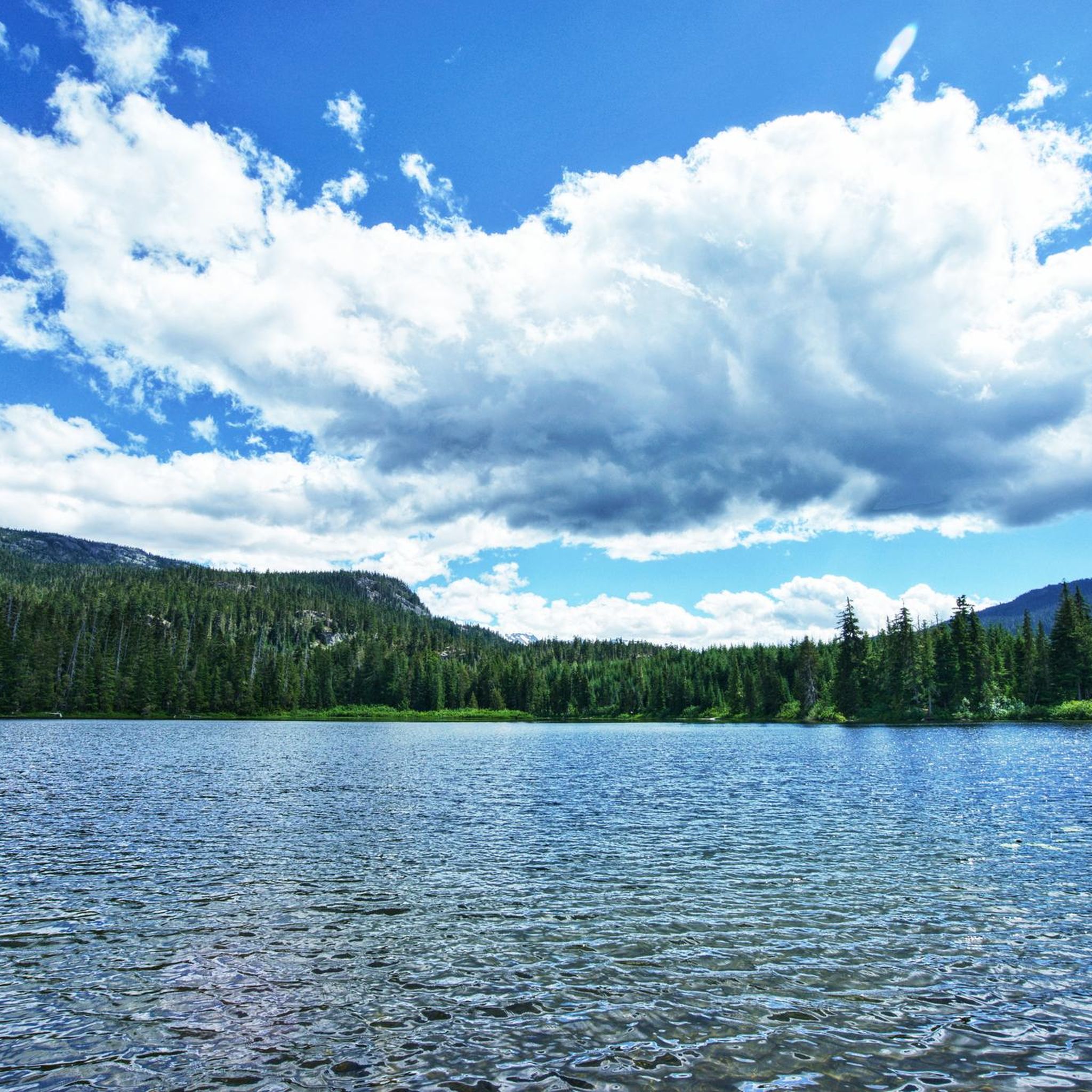
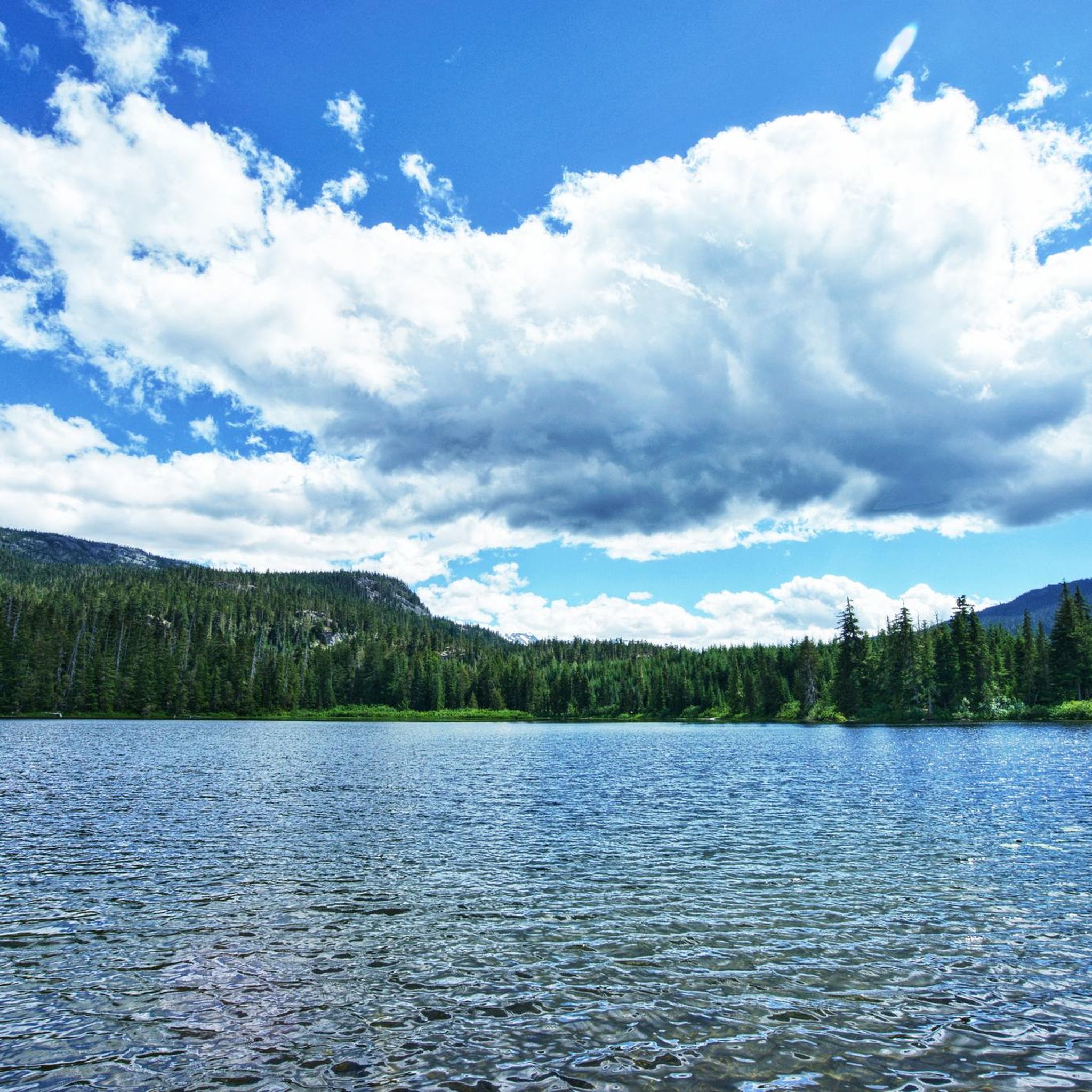
Screaming Cat Lake is a pristine green lake that sits right along the Skywalk North Trail. It appears suddenly between the trees, with still waters and a small island in the middle. It’s a great place to stop for a snack, recharge, and enjoy the view after the big climb up and before continuing along the Skywalk route.
0
0
19 Mile Creek Trail finishes halfway up Rainbow Mountain, right under Rainbow Glacier. This Glacier is slowly melting into Iceberg Lake, bright blue in color, and often seen with little chunks of glacier in it floating around.
0
0

The trailhead of the 19 Mile Creek Trail is located at the dead-end of Mountain View Drive in Alpine Meadows. There are no designated parking spaces, and parking is on the roadside; it is advisable to speak with residents. There are no interpretive signs or trail information at the trailhead; various hiking apps, including Komoot, offer trail directions and maps. On Google Maps, the location is referred to as the Skywalk Trailhead; however, it is located just above Mountain View Drive on a gravel road, which does not seem suitable for parking. The Skywalk Trail is a round-trip hike to Iceberg Lake on the 19 Mile Creek Trail / Skywalk North and back on the Skywalk North / Screaming Cat Lake Trail. The nearest bus stop is at the corner of Mountain View Drive and Valley Drive in Alpine Meadows. (Visit May 30, 2025)
2
1
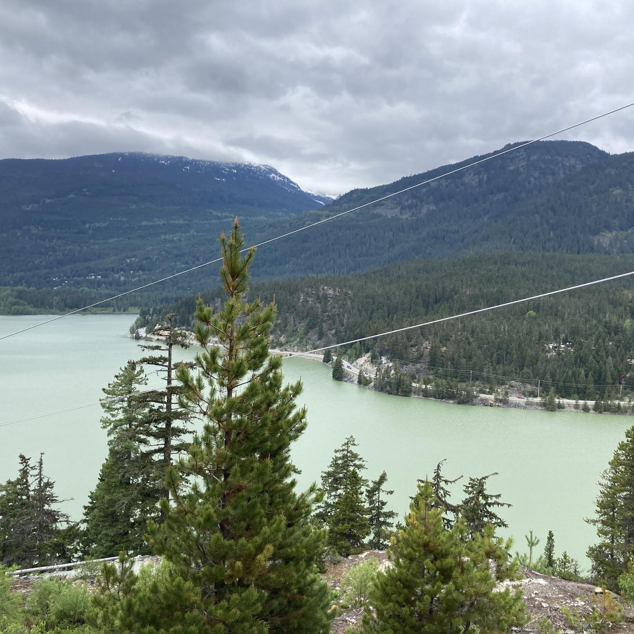
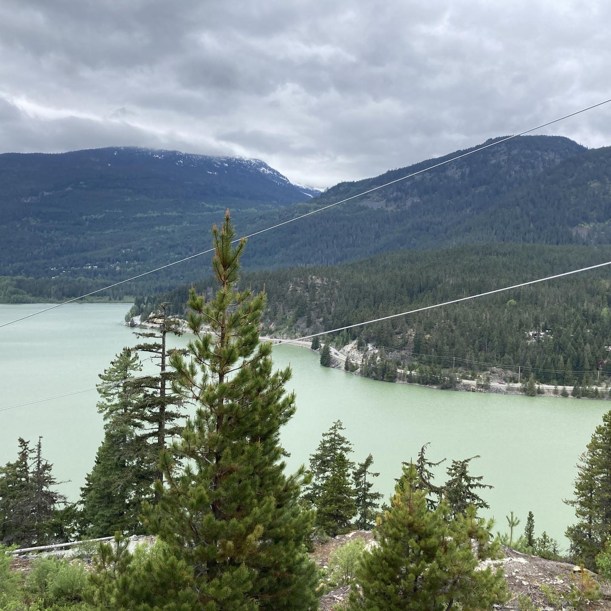
The viewpoint is tucked away on the new 19 Mile Creek Hiking Trail, a shorter alternative to or from Mountain View. Despite the bad weather, we have a good view of Green Lake and the mountains of the Garibaldi Range: Blackcomb Mountain, Phalanx Mountain, Wedge Mountain, and Mount Weart, whose peaks are partially obscured by cloud cover. (Visit May 30, 2025)
2
1

A crushed car - makes you wonder how it got there.
0
0
Frequently Asked Questions
How many hiking trails are available in Showh Lakes-Ancient Cedars Trail Recreation Site?
There are over 50 hiking routes in the Showh Lakes-Ancient Cedars Trail Recreation Site. These range from easy strolls around the lakes to more challenging explorations through the ancient forests.
What kind of terrain can I expect on the trails?
The terrain in Showh Lakes-Ancient Cedars Trail Recreation Site is diverse, featuring rocky dry forests, serene lake shores, and ancient old-growth forests with towering cedar trees. Trails often have a gradual uphill climb, making them suitable for various skill levels.
Are there any family-friendly hiking options?
Yes, the area offers several family-friendly options. The Ancient Cedars Trail itself is generally considered easy to moderate and is a 5-kilometer loop through an awe-inspiring old-growth forest. While not stroller-friendly, it's suitable for most visitors. Many of the 27 easy routes available, such as the Bears n Ugliness Trail, are also great for families.
Can I bring my dog on the trails?
Yes, the Showh Lakes-Ancient Cedars Trail Recreation Site is dog-friendly, which is a significant advantage for pet owners. You can enjoy the trails with your canine companion, especially on routes like the Showh Lakes Viewpoint – Showh Lake Lookout loop.
Are there any circular hiking routes?
Yes, many trails in the area are designed as loops. For example, the Showh Lakes Viewpoint – Showh Lake Lookout loop is an easy 4.6 km circular route offering lake views. For a longer option, consider the moderate Showh Lake Lookout loop, which is 8.0 km.
What natural features or landmarks can I see while hiking?
Hikers can marvel at massive ancient cedar trees, some over 900 years old, along the Ancient Cedars Trail. The area also features three serene lakes, a hidden waterfall, and offers stunning snowy mountain views from certain points, including a viewpoint overlooking Showh Lake and the Soo Valley.
What is the best time of year to visit Showh Lakes-Ancient Cedars Trail Recreation Site for hiking?
The area is beautiful year-round. While hiking is popular in warmer months, the fall offers vibrant colors and an abundance of mushrooms. In winter, the site transforms into a destination for snowshoeing and snowmobiling, though trails are kept for foot traffic only.
What do other hikers say about the trails in this recreation site?
The trails in Showh Lakes-Ancient Cedars Trail Recreation Site are highly rated by the komoot community, with an average score of 4.5 stars from over 400 reviews. Hikers often praise the tranquil, remote forest setting, the awe-inspiring ancient trees, and the well-marked paths.
Are there any longer or more challenging hikes available?
Yes, for those seeking a longer adventure, there are 17 moderate and 6 difficult routes. A moderate option is the Cougar Mountain Basecamp – Showh Lake Lookout loop, which spans over 13 km and offers extended exploration through the diverse landscape.
Is there parking available at the trailheads?
While the guide data does not specify exact parking locations, the Ancient Cedars Trail is well-marked and relatively easy to find, implying accessible starting points. It's generally advisable to check local resources for specific parking information before your visit.
Can I combine the Ancient Cedars Trail with exploring the Showh Lakes?
Yes, the connection between the Ancient Cedars Trail and the Showh Lakes allows for extended exploration. You can loop around the lakes, adding to the diversity of your hiking experience and enjoying both the ancient forest and the serene waters.
Most popular routes in Showh Lakes-Ancient Cedars Trail Recreation Site

Get inspired with the komoot mobile app


Explore more
Browse the best Hikes in other regions.
