The best walks and hikes in Yoho National Park
4.7
(2404)
23,083
hikers
56
hikes
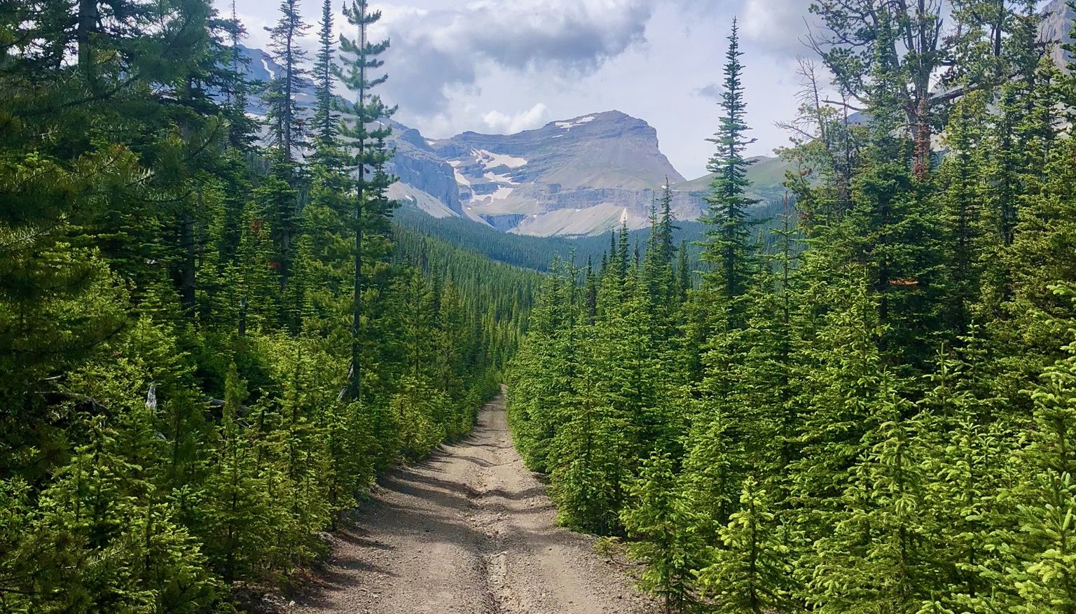
Hiking in Yoho National Park offers diverse terrain characterized by towering peaks, lush valleys, and impressive waterfalls. The park's glacial origins have created numerous turquoise lakes and rugged alpine environments. This Canadian Rockies destination features varied landscapes, from dense forests to high plateaus, shaped by significant precipitation.
Best hiking trails in Yoho National Park
- The most popular hiking route is Yoho Valley Trail & Twin Falls Trail loop — Yoho National Park, a 10.2 miles (16.4 km) trail that takes 4 hours 48 minutes to complete. This moderate route explores the scenic Yoho Valley and passes by significant waterfalls.
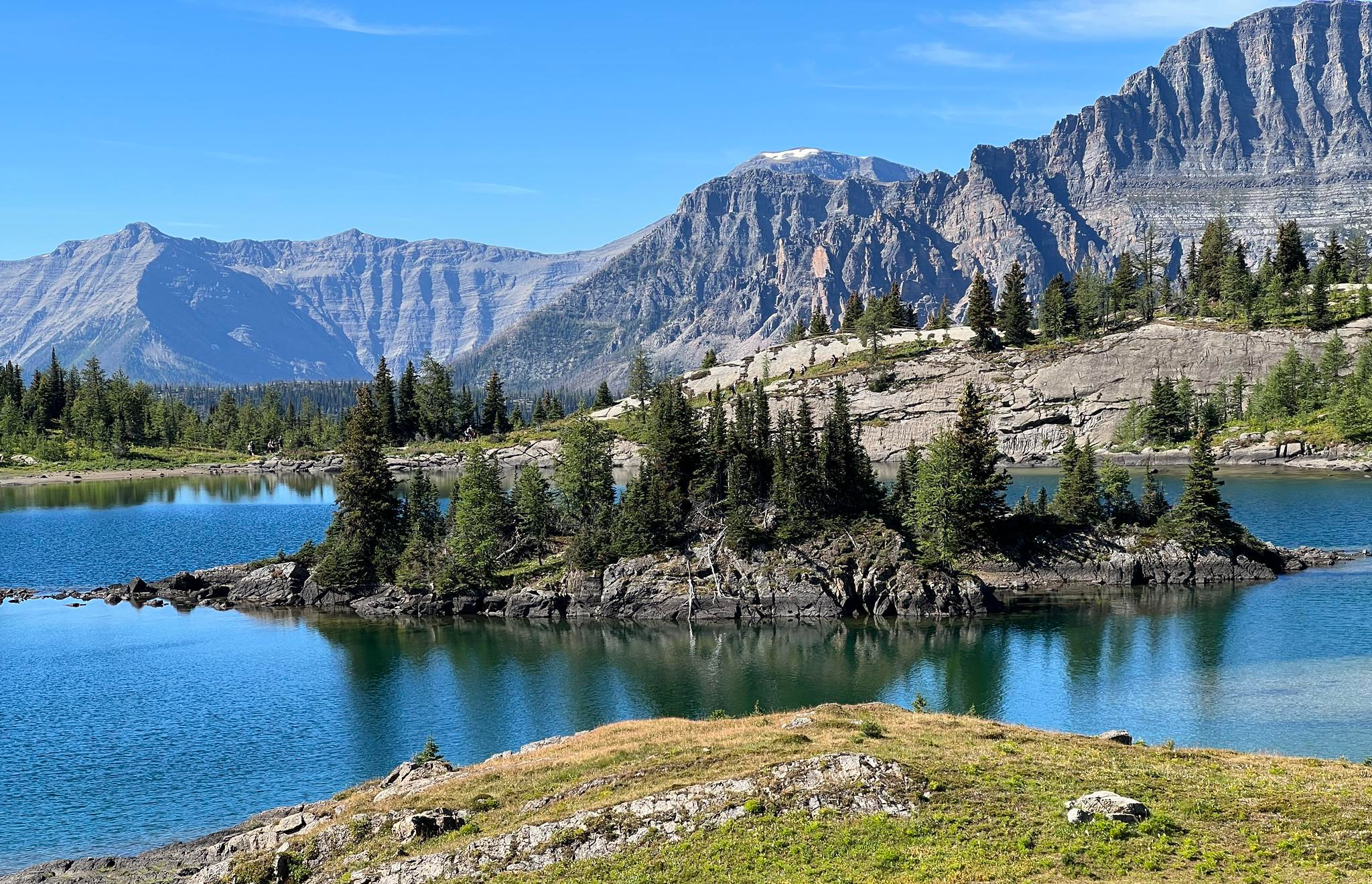
- Another top favourite among local hikers is Lake O'Hara and Hungabee Lake via Alpine Loop Trail — Yoho National Park, a difficult 6.0 miles (9.6 km) path. This trail offers challenging alpine scenery with views of multiple glacier-fed lakes.
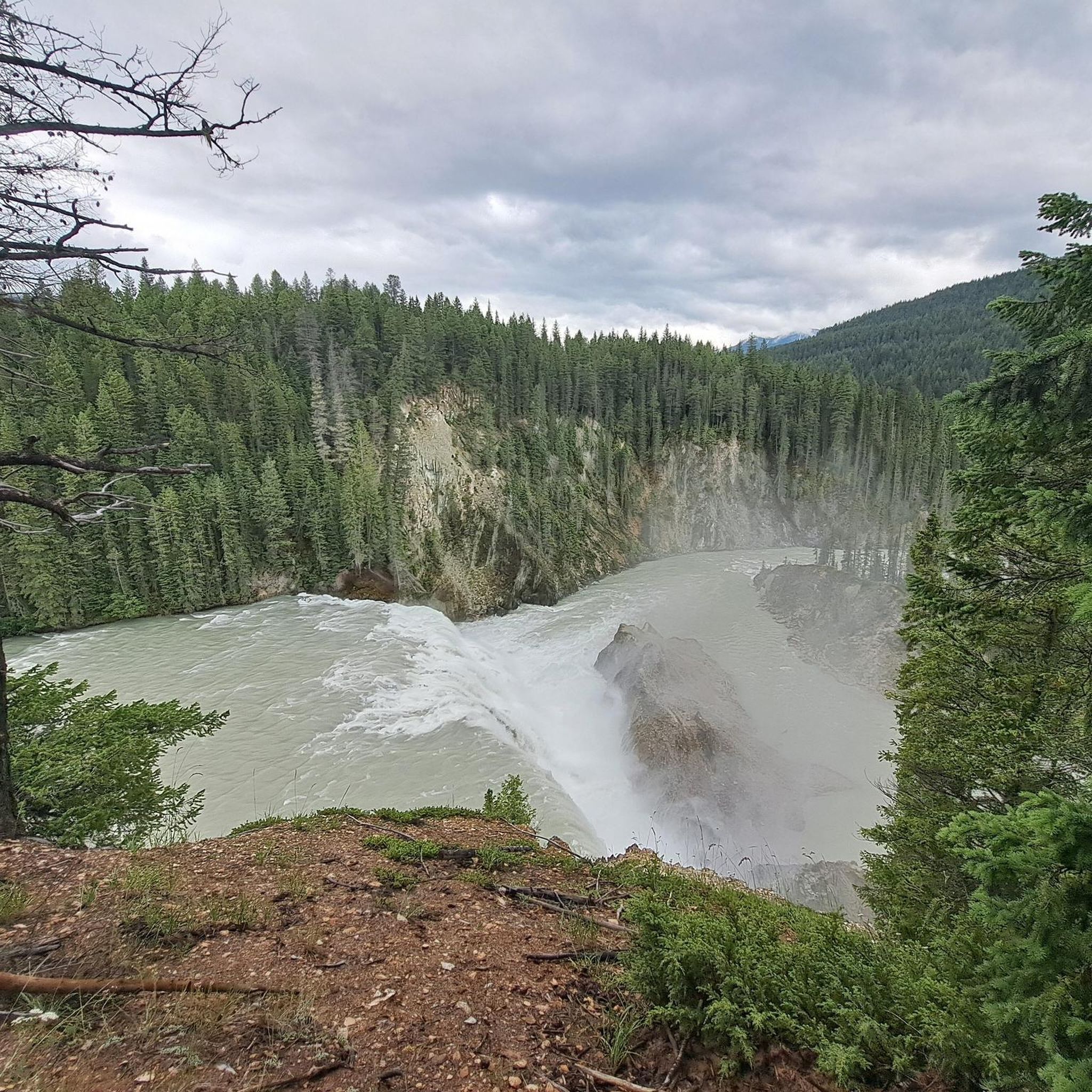
- Local hikers also love the Wapta Falls Trail – Wapta Falls loop from Wapta Falls Parking, a 2.7 miles (4.3 km) trail leading through forested paths to the base of a powerful waterfall, often completed in about 1 hour 10 minutes.
- Hiking in Yoho National Park is defined by majestic waterfalls, vividly colored glacial lakes, and challenging alpine trails. The network offers options for various ability levels, from easy strolls to demanding high-elevation routes.
- The routes in Yoho National Park are highly rated by the komoot community with an average score of 4.7 stars from over 600 reviews. More than 6000 hikers have used komoot to explore Yoho National Park's varied terrain.
Last updated: August 23, 2026
4.7
(26)
179
hikers
16.4km
04:48
430m
430m
Moderate hike. Good fitness required. Easily-accessible paths. Suitable for all skill levels.
5.0
(3)
42
hikers
9.62km
03:23
390m
390m
Hard hike. Good fitness required. Sure-footedness, sturdy shoes and alpine experience required.

Sign up for free
4.7
(185)
1,749
hikers
4.53km
01:14
60m
60m
Easy hike. Great for any fitness level. Easily-accessible paths. Suitable for all skill levels.
5.0
(1)
42
hikers
7.34km
02:24
320m
320m
Hike the difficult 4.6-mile Lake McArthur Loop Trail in Yoho National Park for stunning sapphire-blue lake views and challenging terrain.
5.0
(2)
38
hikers
11.8km
05:48
820m
820m
Hike the challenging Lake O'Hara Alpine Circuit in Yoho National Park for 7.3 miles of spectacular views and alpine lakes.
Get access to more routes and recommendations from other explorers.
Sign up for free
Already have an account?
Our route recommendations are based on thousands of hikes, rides, and runs completed by other people on komoot.
Start today with a free account
Your next adventure awaits.
Login or Signup



Tips from the Community

If you're hiking the Alpine Circuit in the recommended clock-wise manner then this viewpoint will be the payoff for your final steep ascent, and what a payoff it is! You'll be treated to spectacular views across the lake, valley, and surrounding mountains.
0
0
Most hikers reach this point via the steep trail up from Lake O'Hara. From here you can head up to the summit of East Wiwaxy Peak or follow the ridgeline down to Lake Oesa. You'll be treated to phenomenal views no matter where you choose to head next!
0
0

Laughing Falls is a thundering waterfall with a mountain-energy vibe along the Little Yoho River. There are simple wooden bridges for river crossings, picnic benches, and backcountry camping, with bear bag hangs. A Parks Canada pass is required for entry, and a backcountry permit is required for camping.
0
0
Marpole Lake is a quiet, lesser-known destination in Yoho National Park. The lake sits in a glacial basin with darker waters, and visitors can escape the crowds here.
1
0
Lake Duchesnay is a small alpine lake, part of the Duchesnay Basin, below Mount Duchesnay and Mount Niles. At 2,100 meters above sea level, this glacial-fed lake is shallow and dries up in the summer, but when it has water, it trickles down from snowmelt and small glaciers from the Waputik Range.
1
0
Twin Falls is one of the main attractions at Yoho National Park. This twin-plunge waterfall descends 180 meters, and the second falls drops about the same distance. Fed by Twin Falls Creek, flowing from Glacier des Poilus, these two falls have a strong spray and a very scenic view.
1
0
Point Lace Falls flows from a small tributary of Twin Falls Creek; the best views are from late June through September. When it's flowing, it has a delicate "lace-like" water pattern.
1
0
This section of trail gives you excellent views of Mary Lake in the foreground and the surrounding mountains in the distance.
0
0
Frequently Asked Questions
What kind of terrain can I expect on hikes in Yoho National Park?
Yoho National Park offers a diverse range of terrain, from lush valleys and dense forests to rugged alpine environments and high plateaus. You'll encounter trails that wind through wooded paths, lead to powerful waterfalls, and ascend to glacier-fed lakes and panoramic viewpoints. The park's significant precipitation contributes to its 'lush, magical feel' in many forested areas.
Are there hiking options for all skill levels in Yoho National Park?
Yes, Yoho National Park provides trails for all abilities. You can find easy strolls, such as the Wapta Falls Trail, which is 4.3 km long and leads to a powerful waterfall. There are also moderate routes like the Yoho Valley Trail & Twin Falls Trail loop, and challenging alpine adventures such as the Lake O'Hara and Hungabee Lake via Alpine Loop Trail.
Which hikes feature impressive waterfalls in Yoho National Park?
Yoho National Park is renowned for its majestic waterfalls. You can visit Takakkaw Falls, Canada's second-tallest waterfall, which is easily accessible and a starting point for longer hikes. The Wapta Falls Trail leads to the park's largest waterfall on the Kicking Horse River. Other notable waterfalls like Laughing Falls and Twin Falls can be reached via trails starting from the Takakkaw Falls area.
Where can I find the famous turquoise lakes in Yoho National Park?
The park's glacial origins have created several vividly colored lakes. Emerald Lake is a must-see, known for its stunning turquoise hue, with a 5.2-kilometer trail circling it. The Lake O'Hara area is another true gem, offering multiple stunning lakes and trails, including the picturesque Lake McArthur.
Are there any unique geological features to see while hiking?
Yes, Yoho National Park boasts unique geological formations. The Natural Bridge is a distinctive rock formation where the Kicking Horse River has eroded limestone over millennia. Additionally, the Burgess Shale, a UNESCO World Heritage site, is famous for its exceptionally well-preserved 508-million-year-old fossils, accessible via guided hikes.
Can I see glaciers or alpine vistas on hikes in Yoho National Park?
For adventurous hikers, Yoho offers trails with spectacular glacier and alpine views. The Iceline Trail provides breathtaking panoramas of several glaciers, glacier lakes, and alpine meadows. The challenging Lake O'Hara Alpine Circuit also offers phenomenal alpine scenery, high plateaus, and views of multiple glacier-fed lakes.
Are there any family-friendly hiking trails in Yoho National Park?
Yoho National Park has several options suitable for families. Easy trails like the Wapta Falls Trail are great for all ages, leading to a spectacular waterfall with minimal elevation gain. The walk to the main viewing area of Takakkaw Falls is also an easy, short stroll perfect for families.
Are dogs allowed on trails in Yoho National Park?
Generally, dogs are permitted on most trails in Yoho National Park, but they must be kept on a leash at all times. This is crucial for their safety, the safety of wildlife, and to respect other hikers. Always check specific trail regulations before heading out, as some sensitive areas or wildlife corridors might have restrictions.
What is the best time of year to go hiking in Yoho National Park?
The best time for hiking in Yoho National Park is typically from late spring to early fall (June to September). During this period, most trails are free of snow, wildflowers are in bloom, and the weather is generally favorable. Late spring offers powerful waterfall flows from meltwater, while fall brings vibrant yellow larch trees to alpine areas like the Lake O'Hara region.
How can I avoid crowds on popular trails in Yoho National Park?
To avoid crowds, consider hiking early in the morning or later in the afternoon. Exploring trails like Sherbrooke Lake, which offers stunning views without the large crowds of more famous spots, can also provide a quieter experience. For popular areas like Lake O'Hara, access is restricted, often requiring a shuttle bus reservation, which helps manage visitor numbers.
What are the parking and public transport options for trailheads in Yoho National Park?
Many of Yoho National Park's main attractions and trailheads are easily accessible via the Trans-Canada Highway, which passes through the park. Parking lots are available at popular trailheads such as Takakkaw Falls and Wapta Falls. For specific areas like Lake O'Hara, access is often managed by a shuttle bus system, and reservations are typically required.
What do other hikers enjoy the most about hiking in Yoho National Park?
The hiking routes in Yoho National Park are highly rated by the komoot community, with an average score of 4.7 stars from over 600 reviews. Hikers frequently praise the park's stunning natural beauty, including its majestic waterfalls, vividly colored glacial lakes, and challenging alpine vistas. The diverse terrain and well-maintained paths also receive high marks.
Most popular attractions in Yoho National Park

Get inspired with the komoot mobile app


Explore more
Browse the best Hikes in other regions.
