The best running trails in Parc National Des Hautes-Gorges-De-La-Rivière-Malbaie
109
runners
6
runs
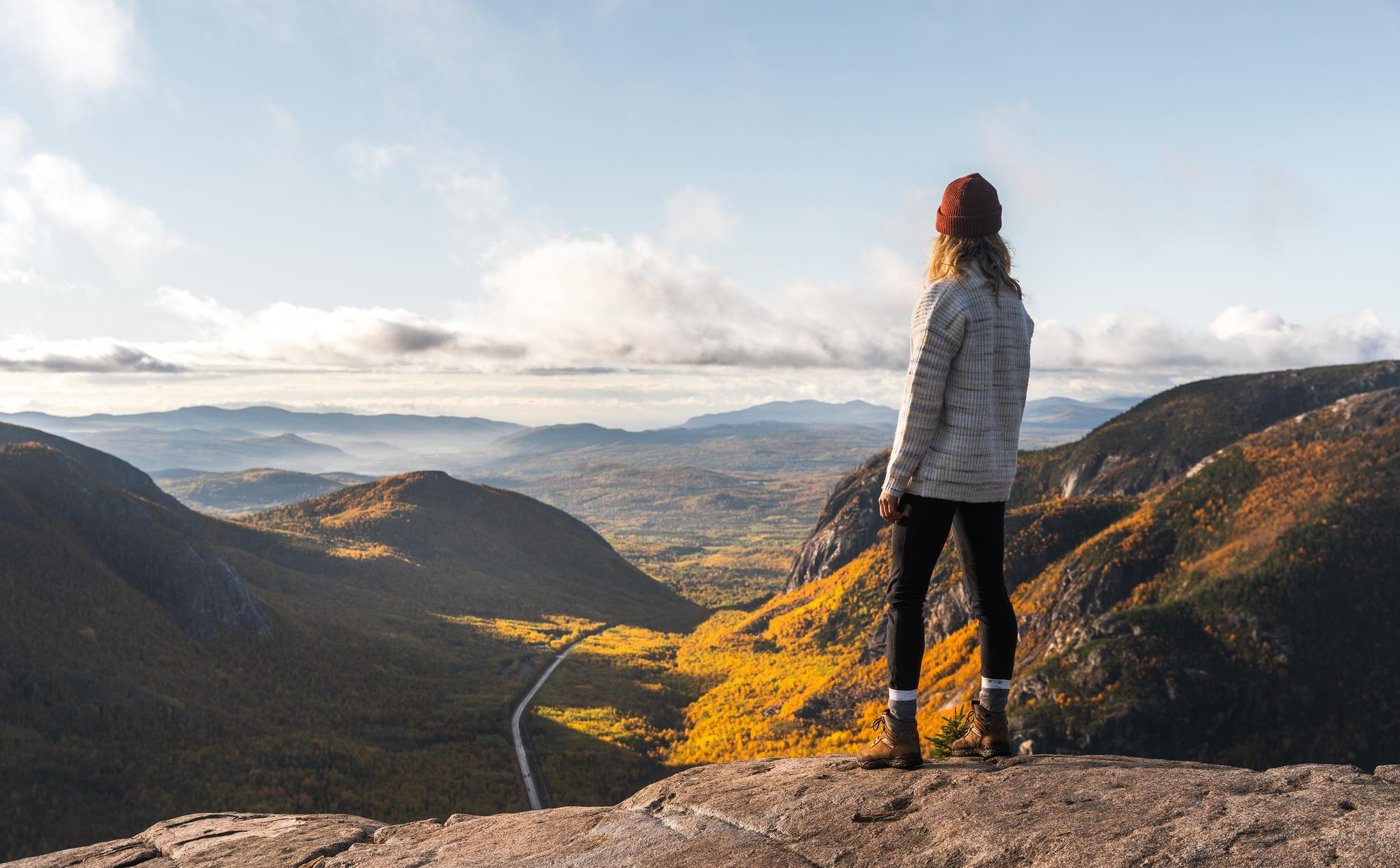
Jogging routes in Parc National Des Hautes-Gorges-De-La-Rivière-Malbaie traverse a landscape defined by dramatic glacial valleys and impressive mountain walls. The region features high plateaus, the Malbaie River with its waterfalls, and pristine forests. Running trails here offer varied terrain, from riverside paths to routes with significant elevation gains, suitable for different fitness levels.
Best jogging routes in Parc National Des Hautes-Gorges-De-La-Rivière-Malbaie
- The most popular jogging route is Point de vue du Yéti – Le Belvédère loop from Centre de découverte et de services Félix-Antoine-Savard, a 12.4 miles (19.9 km) trail that takes 2 hours 30 minutes to complete. This difficult route features notable elevation changes and panoramic views.
- Another top favourite among local runners is Sommet No. 2 – Sommet No. 3 loop from Camping le Pin-Blanc, a difficult 7.1 miles (11.4 km) path. This route includes substantial climbs, reaching over 2,897 feet (883 meters) of elevation gain.
- Local runners also love the Point de vue du Yéti loop from Centre de découverte et de services Félix-Antoine-Savard, an 8.0 miles (12.8 km) trail leading through varied forest and open sections, often completed in about 1 hour 37 minutes.
- Jogging in Parc National Des Hautes-Gorges-De-La-Rivière-Malbaie is defined by glacial valleys, mountain walls, and the Malbaie River. The network offers options for different ability levels, from moderate forest paths to challenging mountain ascents.
- The guide includes highly-rated routes that showcase the best of the region's landscape. More than 170 runners have used komoot to explore Parc National Des Hautes-Gorges-De-La-Rivière-Malbaie's varied terrain.
Last updated: July 15, 2026
48
runners
Hard run. Very good fitness required. Mostly paved surfaces. Suitable for all skill levels.
26
runners
Moderate run. Good fitness required. Mostly paved surfaces. Suitable for all skill levels.

Sign up for free
12
runners
7.56km
00:57
210m
210m
Moderate run. Good fitness required. Mostly paved surfaces. Suitable for all skill levels.
10
runners
Hard run. Very good fitness required. Mostly paved surfaces. Suitable for all skill levels.
8
runners
6.22km
00:48
220m
220m
Moderate run. Good fitness required. Mostly paved surfaces. Suitable for all skill levels.
Our route recommendations are based on thousands of hikes, rides, and runs completed by other people on komoot.
Start today with a free account
Your next adventure awaits.
Login or Signup
Popular around Parc National Des Hautes-Gorges-De-La-Rivière-Malbaie
Other adventures in Parc National Des Hautes-Gorges-De-La-Rivière-Malbaie

Tips from the Community

very beautiful trail, and perfect for relaxing near the lake
0
0

We did it on October 3, 2024… 40,000 people a year do this hike ;-)
0
0

Luckily, there are three peaks up here, which makes the climb even more worthwhile.
0
0
The water of Lac du Pic Chevelu flashes between the trees.
0
0

Together with Lac Larouche and Lac du Foulon, Lac Sans Oreille is nestled between some rolling hills covered with scented pine trees. What a great place to be! Enjoy the pristine nature and keep your eyes peeled for wildlife.
1
0

Take the shuttle bus from the park's parking lot/visitor center to the trailhead. This runs approximately every 10 minutes. Alternatively, you can reach the trailhead on foot, approximately 6 km.
0
0

Wonderful view of the entire area. When the weather is nice. :-)
0
0

The most beautiful panorama is undoubtedly at the first summit, where a breathtaking view of the Malbaie river valley and the surrounding mountains await hikers who will dare to take up the challenge.
1
0
Frequently Asked Questions
How many running routes are available in Parc National des Hautes-Gorges-de-la-Rivière-Malbaie?
The park offers a selection of 7 dedicated running routes, ranging from moderate to difficult, allowing you to explore its dramatic glacial valleys and impressive mountain walls. These trails cater to various fitness levels, ensuring a suitable challenge for most runners.
Are there challenging running trails for experienced runners in the park?
Yes, Parc National des Hautes-Gorges-de-la-Rivière-Malbaie features several challenging routes with significant elevation gains. For instance, the Sommet No. 2 – Sommet No. 3 loop from Camping le Pin-Blanc is a difficult 7.1-mile (11.4 km) path with over 2,897 feet (883 meters) of elevation gain, perfect for those seeking a strenuous workout. Another difficult option is the Point de vue du Yéti – Le Belvédère loop from Centre de découverte et de services Félix-Antoine-Savard, a 12.4-mile (19.9 km) trail with notable elevation changes.
What kind of views can I expect on the running routes?
The running routes in Parc National des Hautes-Gorges-de-la-Rivière-Malbaie offer breathtaking scenery. You'll encounter dramatic glacial valleys, impressive mountain walls, and the central Malbaie River with its white waters and cascades. Trails often provide panoramic views of peaks like Mounts Élie and Jérémie, and Montagne des Érables, overlooking bodies of water such as Lac Noir.
Are there any moderate running options for those looking for a less intense experience?
Absolutely. The park includes several moderate running routes. The Point de vue du Yéti loop from Centre de découverte et de services Félix-Antoine-Savard is an 8.0-mile (12.8 km) trail that leads through varied forest and open sections, offering a good balance of challenge and accessibility. Other moderate options include the Lac Sans Oreille loop from Bloc sanitaire 1 and the Lac Sans Oreille loop from Lac Sans Oreille.
Can I find circular running routes in Parc National des Hautes-Gorges-de-la-Rivière-Malbaie?
Yes, many of the park's running trails are designed as loops, providing a convenient circular experience. Examples include the Sommet No. 2 – Sommet No. 3 loop, the Point de vue du Yéti – Le Belvédère loop, and the Point de vue du Yéti loop, all offering varied terrain and stunning vistas.
What do other runners enjoy most about jogging in Parc National des Hautes-Gorges-de-la-Rivière-Malbaie?
Runners frequently praise the park's magnificent and diverse natural setting. The combination of dramatic glacial valleys, impressive mountain walls, and the scenic Malbaie River creates a breathtaking backdrop. The varied terrain, from riverside paths to challenging mountain ascents, is also highly appreciated, offering something for every fitness level.
Are there any specific permits or fees required to access the jogging trails?
As a national park, Parc National des Hautes-Gorges-de-la-Rivière-Malbaie typically requires an entry fee or permit for access. It's advisable to check the official park website or Tourisme Charlevoix for the most current information on entry requirements and fees before your visit.
What is the best time of year for running in Parc National des Hautes-Gorges-de-la-Rivière-Malbaie?
The park is generally excellent for running during the warmer months, from late spring through early autumn, when trails are clear of snow and ice. The vibrant fall foliage also offers a spectacular running experience. While some trails might be accessible in winter for activities like fat biking or Nordic skiing, dedicated running might be limited due to snow conditions.
Are there any facilities like parking available near the running routes?
Yes, the park provides facilities for visitors. Many routes, such as those starting from Centre de découverte et de services Félix-Antoine-Savard or Camping le Pin-Blanc, have designated parking areas. It's always a good idea to confirm specific parking locations when planning your run.
Can I find trails suitable for a family run with children?
While some trails in the park feature significant elevation, there are also more accessible riverside paths and sections that could be suitable for families looking for a relaxed jog or walk. The Lac Sans Oreille loop from Bloc sanitaire 1, for example, is a moderate 5.3-mile (8.5 km) route that might be manageable for active families.
What kind of terrain should I expect on the running trails?
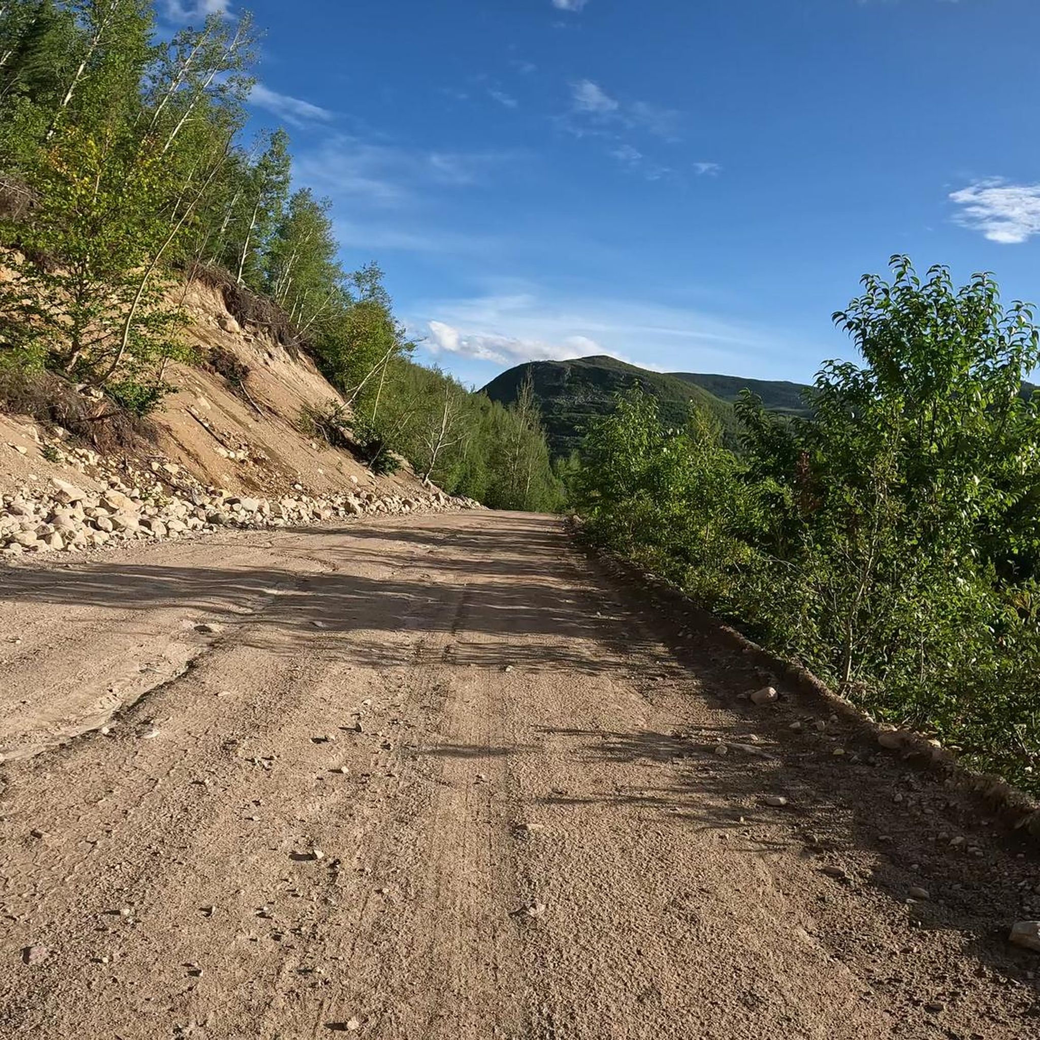
The terrain in Parc National des Hautes-Gorges-de-la-Rivière-Malbaie is quite varied. You'll encounter everything from relatively flat riverside paths to trails with significant elevation changes, traversing mixed forests, open sections, and rocky slopes. This diversity makes for an engaging and dynamic running experience.
Are there any waterfalls or cascades visible from the running routes?
Yes, the Malbaie River is a central feature of the park, known for its white waters and numerous waterfalls and cascades descending rocky slopes. Many trails, particularly those that meander along the valley, will offer opportunities to see these beautiful natural features.
Most popular routes in Parc National Des Hautes-Gorges-De-La-Rivière-Malbaie

Get inspired with the komoot mobile app


Explore more
Browse the best Running Trails & Routes in other regions.
