Attractions and Places To See in Zepa Sierras De Burete, Lavia Y Cambrón - Top 7
Attractions and places to see in Zepa Sierras De Burete, Lavia Y Cambrón is a protected mountainous area primarily located in the Murcia region of Spain, recognized for its significant ecological value as a Zone of Special Conservation. This area features high and medium-sized mountains with diverse geology, including Jurassic limestones and dolomites. The region supports extensive forests of Aleppo pine and Kermes oak, alongside rich fauna, notably various bird species and mammals. It offers a landscape characterized by rugged…
Last updated: July 5, 2026
Vía Verde del Noroeste: Bullas to Cehegín
Highlight (Segment) • Cycleway
Fill up your water in Bullas or in Cehegín because you will not enter where to do it in between.
Translated by Google •
Tip by

Pico de la Selva
Highlight • Summit
Translated by Google •
Tip by

Sign up now to discover places like this
Get recommendations on the best single tracks, peaks, & plenty of other exciting outdoor places.
Sign up for free
Coto Real Forest Refuge
Highlight • Mountain Hut
Translated by Google •
Tip by

Vereda de Arjona Trail
Highlight (Segment) • Trail
It's a standard wide Spanish tractor track at the …
Tip by

C5 Casas Nuevas South Road
Highlight (Segment) • Cycleway
Translated by Google •
Tip by

Sign up for free to discover even more attractions in Zepa Sierras De Burete, Lavia Y Cambrón.
Sign up for free
Already have an account?
Start today with a free account
Your next adventure awaits.
Login or Signup
Popular around Zepa Sierras De Burete, Lavia Y Cambrón
A ride through the "Huerta de Europa" – Transmurciana on MTB
Road Cycling Routes in Zepa Sierras De Burete, Lavia Y Cambrón
MTB Trails in Zepa Sierras De Burete, Lavia Y Cambrón
Hiking in Zepa Sierras De Burete, Lavia Y Cambrón
Cycling in Zepa Sierras De Burete, Lavia Y Cambrón
Running Trails in Zepa Sierras De Burete, Lavia Y Cambrón

Gravel biking in Zepa Sierras De Burete, Lavia Y Cambrón
Other adventures in Zepa Sierras De Burete, Lavia Y Cambrón

Tips from the Community

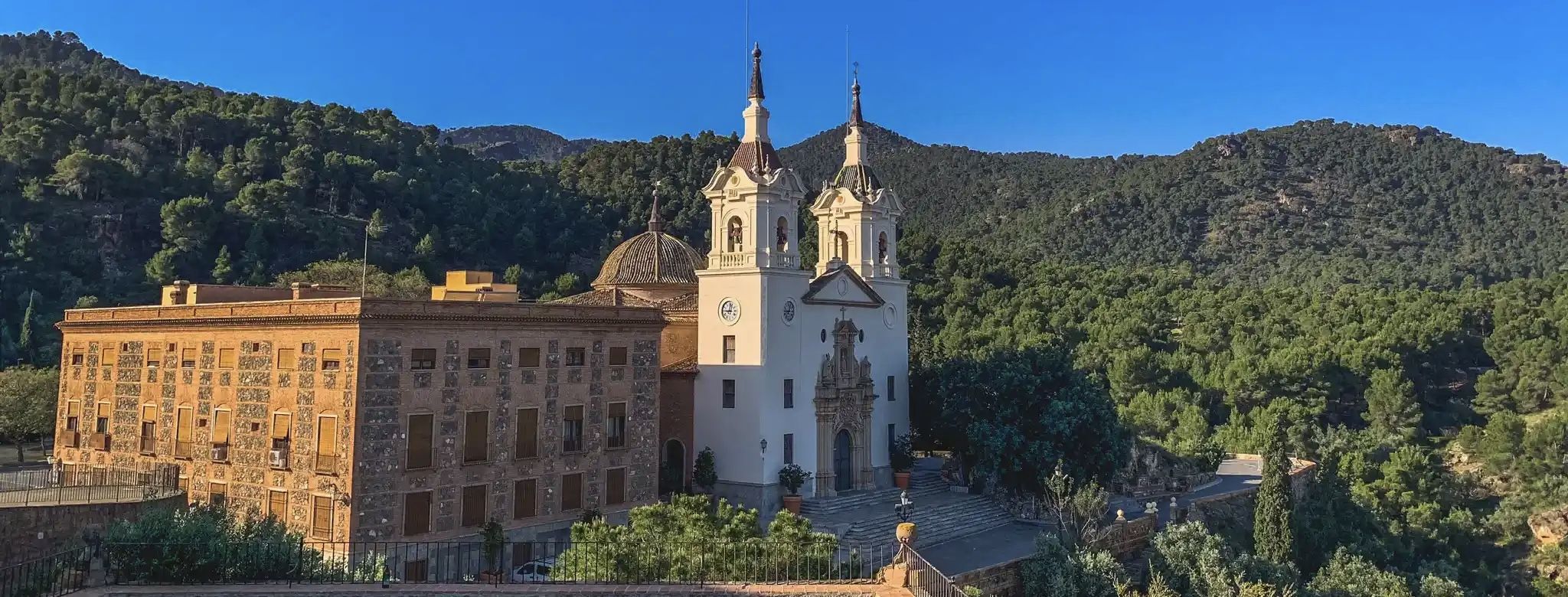
More than a refuge, it is a hostel, located in the Burete mountain range.
0
0

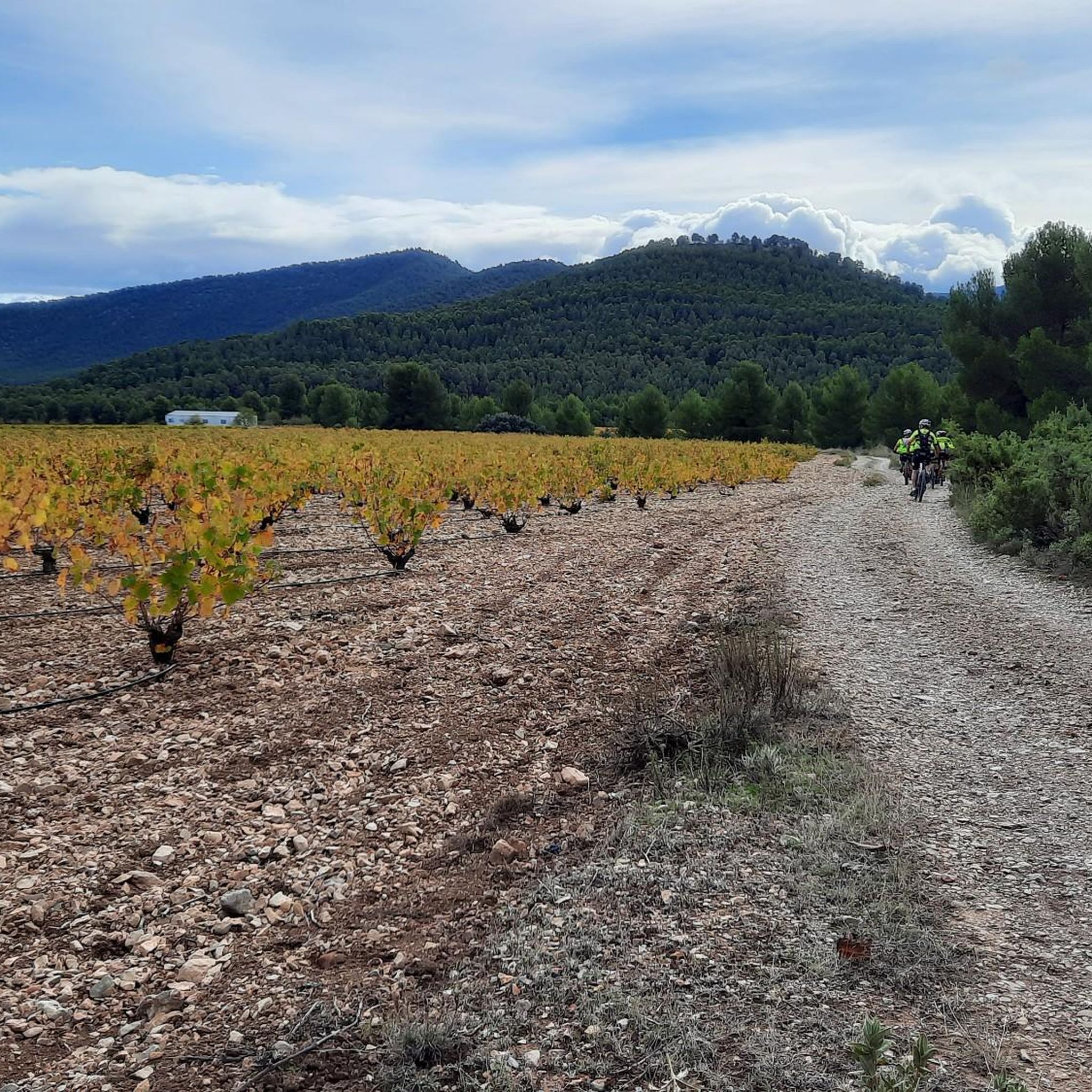
This detour makes a great change from the V.V. Noroeste. It's real outback Spain and much more scenic than the V.V. It's a standard wide Spanish tractor track at the beginning leading to a very wide forest track later on. It is not technical at all and is well suited to MTB's; Gravel bikes and touring bikes with wide tyres. It's no different to riding on the V.V. for the main part. The last 200M before rejoining the V.V. (going in the direction of Cehegin) are a bit rougher but are fine with care.
0
0

One of the worst roads in Spain. You can usually get through quite well on the central reservation, but you have to concentrate very much on the road. North of Casas Nuevas, however, the C5 becomes good. The scenery would be great if you didn't have to concentrate so much on the road. If you want to go around the Sierra Espuña in the west, you will unfortunately have to pass here or take a much longer route.
0
0

Peak belonging to the Sierra de Pedro Ponce with an altitude of just over 1,500 m above sea level. Very good climb for gravel bike.
0
0
Komoot (OCM) shows this section to be Unpaved Singletrack. That is not the case as can be seen in some of the photos. There is an asphalt track for most of the VV in this section, not always in the best condition, but an easy ride. (Although there is also a gravel track alongside much of it.) Bikes can pass in both directions, so it is also not singletrack.
3
0

The old forest refuge of Coto Real (Cehegín) has been rehabilitated and is now a bioclimatic building built with, in part, native wood and marble from the area. The old Arab roof tiles of the original shelter have been preserved. This refuge is located within a protection zone for birds (among them the booted eagle, the short-toed eagle, the eagle owl, the goshawk and the sparrow hawk) and the electricity supply has been carried out through an underground line so as not to harm these protected bird species. The refuge is located in the most mountainous area of the region and is surrounded by forests of Aleppo pine and Kermes oak. You will also find rosemary, juniper, rockrose, thyme, esparto grass and other plant species. In spring, you may be lucky enough to spot up to ten species of orchids, some of them endemic to this area.
1
0

The top of Cerro de la Selva offers stunning views in all directions. You will be able to see the landscapes of the regions of the Mula River and the Guadalentín Valley in all its splendor. Make sure you wear good shoes and plenty of water for the whole journey!
1
0
Ascent to the peak of the Jungle by track in perfect conditions. Altitude 1,521m. Good views of the north face of Sierra Espuña and the Sierras of Moratalla and Caravaca
0
0
Frequently Asked Questions
What natural features and viewpoints can I explore in Zepa Sierras De Burete, Lavia Y Cambrón?
The region is characterized by a rugged, mountainous landscape with high and medium-sized peaks. A prominent natural feature is Pico de la Selva, which offers stunning panoramic views of the Mula River and the Guadalentín Valley from its summit of over 1,500 meters. The area also boasts extensive forests of Aleppo pine and Kermes oak, along with diverse flora including rosemary, juniper, rockrose, thyme, and various orchid species.
Are there good trails for cycling or walking in the area?
Yes, sections of the Vía Verde del Noroeste: Bullas to Cehegín pass through the area, offering an accessible route for cycling or walking. This section is considered one of the most scenic segments of the Greenway. Additionally, the Vereda de Arjona Trail provides a more scenic, off-the-beaten-path alternative, suitable for mountain bikes, gravel bikes, and touring bikes with wide tires.
What is the Coto Real Forest Refuge and what can I expect there?
The Coto Real Forest Refuge is a rehabilitated bioclimatic hut located in the most mountainous part of the region. It was constructed using native wood and marble, preserving original Arab roof tiles. Surrounded by pine and oak forests, it's situated within a bird protection zone, making it an excellent spot for nature observation, especially for bird species like the booted eagle and eagle owl. It serves as a hostel rather than a basic refuge.
What kind of wildlife can I expect to see in the ZEPA?
Zepa Sierras De Burete, Lavia Y Cambrón is a crucial habitat for various bird species, particularly birds of prey such as the booted eagle, short-toed eagle, eagle owl, goshawk, and sparrow hawk. Mammals like foxes, wild boars, and aoudad (arruí) are also present, with recent sightings of Iberian wild goats. In spring, you might also encounter up to ten species of orchids, some endemic to the region.
What outdoor activities are available in Zepa Sierras De Burete, Lavia Y Cambrón?
The region offers a variety of outdoor activities. You can find numerous MTB trails, including challenging loops around Sifón de Burete and Coto Real Forest Refuge. For road cyclists, there are road cycling routes offering views of Pico de la Selva. Hikers can explore waterfall hikes, such as those around Usero Waterfall.
What is the terrain like for outdoor activities in the region?
The terrain is generally rugged and mountainous, characterized by high and medium-sized mountains with steep slopes. The geology primarily consists of Jurassic limestones and dolomites in higher elevations, with Cretaceous marls and Triassic clays in lower areas. While some sections of the Vía Verde are asphalted, other trails can be gravel or unpaved, requiring appropriate footwear or bike tires.
When is the best time to visit Zepa Sierras De Burete, Lavia Y Cambrón?
Spring is an excellent time to visit, as you may be lucky enough to spot up to ten species of orchids, some endemic to the area, in bloom. The weather during spring and autumn is generally milder and more pleasant for outdoor activities like hiking and cycling. Summers can be hot, while winters are cooler, especially at higher elevations.
Are there family-friendly activities or attractions?
Yes, the Vía Verde del Noroeste: Bullas to Cehegín is categorized as family-friendly, offering an easy and scenic route for walking or cycling suitable for all ages. The gentle gradients and mostly paved surface make it an enjoyable option for families.
What do visitors enjoy most about Zepa Sierras De Burete, Lavia Y Cambrón?
Visitors particularly appreciate the stunning panoramic views from summits like Pico de la Selva, which offers expansive vistas of the Mula River and Guadalentín Valley. The scenic beauty of the Vía Verde del Noroeste is also highly rated, with many considering it one of the most beautiful segments of the Greenway. The natural tranquility and diverse flora and fauna, especially the birdlife around the Coto Real Forest Refuge, are also significant draws.
Are there any cultural or historic sites in the vicinity of the ZEPA?
While the ZEPA itself is primarily a natural protected area, it extends across several municipalities in Murcia, including Cehegín, Bullas, Caravaca de la Cruz, and Mula. These towns offer additional local cultural experiences and historical sites. For example, Cehegín, a municipality within the ZEPA, has its own historical charm and amenities.
Is public transport available to reach Zepa Sierras De Burete, Lavia Y Cambrón?
Direct public transport options into the heart of the ZEPA are limited due to its rugged and protected nature. However, the protected area extends across several municipalities in Murcia, such as Cehegín, Bullas, and Caravaca de la Cruz, which may have bus connections from larger cities. From these towns, access to the natural areas typically requires private transport or local taxis.
Are permits required for hiking or other activities in the ZEPA?
Generally, permits are not required for hiking or cycling on established trails like the Vía Verde del Noroeste. However, as it is a Special Protection Area for Birds (ZEPA) and a Zone of Special Conservation (ZEC), visitors are expected to respect environmental regulations, stay on marked paths, and avoid disturbing wildlife. For specific activities or larger groups, it's always advisable to check with local authorities or park management for any specific requirements.
Most popular routes in Zepa Sierras De Burete, Lavia Y Cambrón

Get inspired with the komoot mobile app


Explore more
Still not found the Highlight you’re looking for? See guides of the top attractions in other regions:
