The best walks and hikes in Rare Charitable Reserve
4.1
(8)
90
hikers
30
hikes
Rare Charitable Reserve hiking trails offer access to over 1500 acres of diverse ecosystems, including mature forests, limestone cliffs, and alvars. The region is characterized by its varied terrain, with trails running alongside the Grand River and through woodlands. Hikers can explore a network of paths that cater to different preferences, ranging from easy walks to moderate routes. The reserve features unique geological formations and a rich biodiversity, providing varied landscapes for outdoor activities.
Best hiking trails in Rare Charitable…
Last updated: October 12, 2026
5
hikers
3.20km
00:50
20m
20m
Easy hike. Great for any fitness level. Easily-accessible paths. Suitable for all skill levels.
1
hikers
4.51km
01:10
20m
20m
Easy hike. Great for any fitness level. Easily-accessible paths. Suitable for all skill levels.

1
hikers
4.55km
01:11
30m
30m
Hike the easy 2.8-mile Devil's Creek Trail through wetlands to Devil's Falls, offering scenic views and a boardwalk experience.
11
hikers
7.75km
02:01
50m
50m
Moderate hike. Good fitness required. Easily-accessible paths. Suitable for all skill levels.
5
hikers
12.0km
03:03
40m
40m
Moderate hike. Good fitness required. Easily-accessible paths. Suitable for all skill levels.
Get access to more routes and recommendations from other explorers.
Already have an account?
Our route recommendations are based on thousands of hikes, rides, and runs completed by other people on komoot.
Start today with a free account
Your next adventure awaits.


Tips from the Community

Pioneer Memorial Tower Park sits within the Pioneer Tower Natural Area. The centerpiece is the Waterloo Pioneer Memorial Tower, built in 1925–26 to designs by architect William Langton. Standing 18.9 metres tall and clad in local fieldstone, the tower commemorates the arrival of Pennsylvania German settlers to the Waterloo region between 1800 and 1803.
0
0
Trans-Canada Trail offers a tranquil mix of natural beauty and local history along the Grand River in Kitchener. This easy-rated, well-maintained section runs on dirt and gravel paths that wind through mixed forest canopy and open meadow pockets, making it a popular spot for year-round walking, trail running, birdwatching, and cycling. Dogs are welcome on leash. The route connects to the larger Walter Bean Grand River Trail network.
0
0

Bauman Creek is an ecologically sensitive tributary of the Grand River. This waterway plays an important role as a habitat for brook trout. The water is consistently cold here and has high oxygen content, an indicator of good health and supporting a healthy population of native brook trout.
0
0
This area of forest is full of trees that are part of a walnut and pine plantation. The Black Walnut trees and Pine forests create a cool shady forest and a habitat for local wildlife like white-tailed deer.
0
0
This butterfly meadow along Maple Lane has only native wildflowers like milkweed and forget-me-nots growing here, making it a butterfly haven. It has become an important feeding and breeding stopover for various species, like Monarch butterflies.
0
0
At this point, the looped Osprey Trail meets the Grand River Trail, and it is the Grand River Trail's farthest point west. Both trails are relatively short, so linking them up is a fun way to see the lush forest, and connecting the Osprey Trail with the Grand Trunk Trail is an awesome larger loop option.
0
0
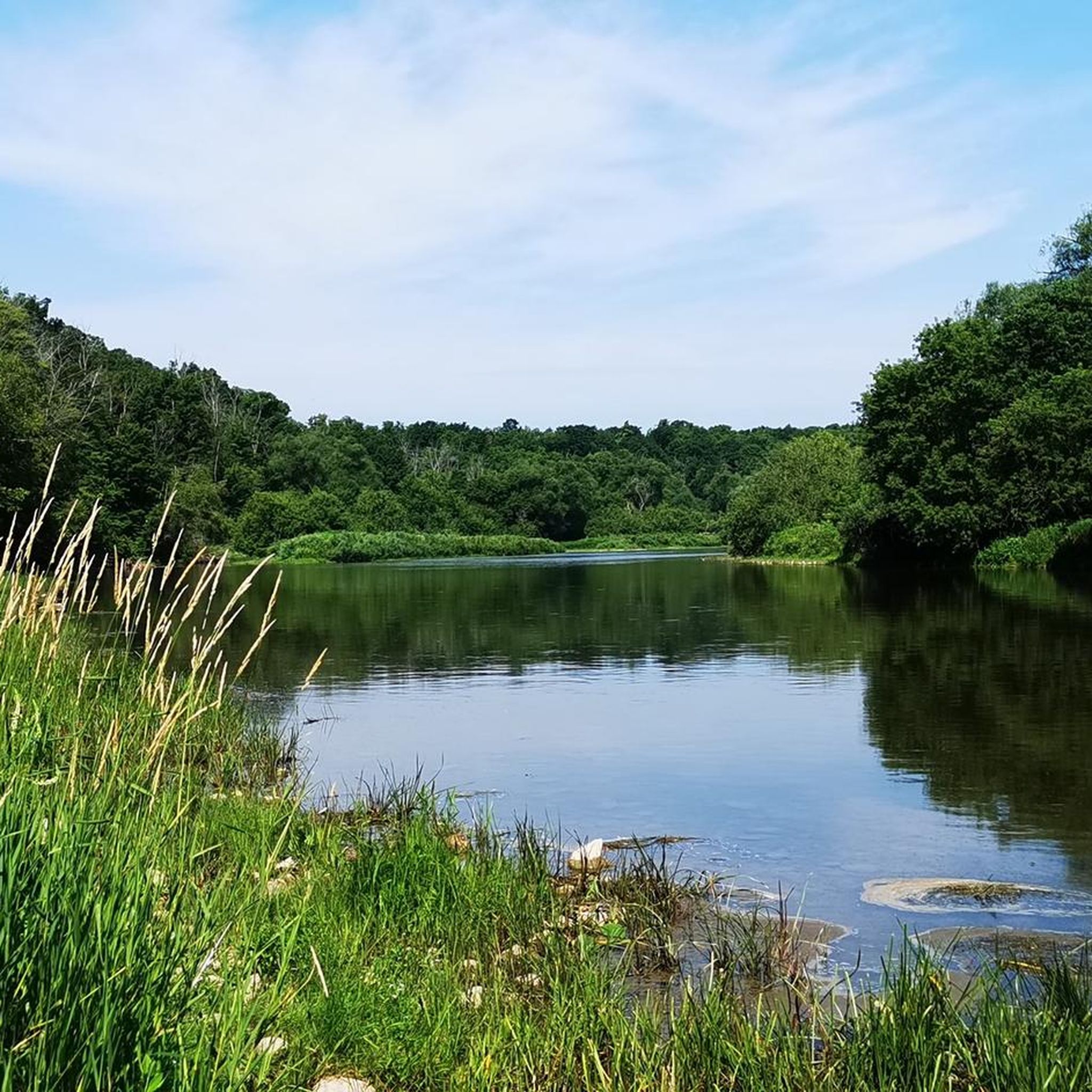
The Grand River Trail spans the thick forest between the Walter Bean Grand River Trailhead and the Osprey Trail junction. This dirt path brings hikers through protected landscapes along the Grand River, scenic riverbanks and is a great wildlife viewing trail.
0
0
The Walter Bean Grand River Trailhead is the perfect spot to start or end a hike on either the Grand Trunk Trail or the Grand River Trail. There are maps, trash cans and a dirt parking area here, and sometimes a porta-potty, but that is not always available.
0
0
Frequently Asked Questions
How many hiking trails are there in Rare Charitable Reserve?
Rare Charitable Reserve offers a diverse network of over 20 hiking trails. These routes cater to various preferences, ranging from easy walks to more moderate paths, allowing you to explore the reserve's unique ecosystems.
Are there any family-friendly hiking options in Rare Charitable Reserve?
Yes, many trails in Rare Charitable Reserve are suitable for families. The reserve features over 12 kilometers of publicly accessible trails, with many being easy walks on grass and soil. For a gentle introduction, consider the Devil's Creek Trail, which is an easy 4.6 km route.
Can I bring my dog on the trails in Rare Charitable Reserve?
While most trails in Rare Charitable Reserve prohibit dogs to protect fragile ecosystems, some specific trails do welcome leashed dogs. These include the ECO Centre Trail, Grand Allée, Maple Lane, and Deer Run trails. Always check signage before heading out with your pet.
What kind of natural features and landmarks can I expect to see while hiking?
Rare Charitable Reserve is rich in natural beauty and historical points of interest. You can explore diverse ecosystems like mature forests, meadows, and globally rare alvars. The River Trail offers scenic views of the Grand River and impressive limestone cliffs, as well as archaeological sites. Don't miss the historic 1840s Slit Barn or the Osprey Tower, which provides views of the Grand and Speed River confluence.
Are there any circular hiking routes available?
Yes, Rare Charitable Reserve features several circular routes perfect for a varied hiking experience. An excellent option is the Devil's Creek Trail loop, an easy 6.2 km path that allows you to return to your starting point after exploring the natural surroundings.
What is the general difficulty level of trails in Rare Charitable Reserve?
The trails in Rare Charitable Reserve primarily range from easy to moderate difficulty. You'll find 16 easy routes and 5 moderate routes, with no difficult trails. This makes the reserve accessible for a wide range of hikers, from beginners to those looking for a slightly more challenging walk.
What do other hikers enjoy most about hiking in Rare Charitable Reserve?
The area is highly rated by the komoot community, with an average score of 4.7 stars. Reviewers often praise the diverse ecosystems, the scenic views along the Grand River, and the well-maintained paths that offer a peaceful escape into nature. The variety of trails, from easy walks to moderate routes, is also frequently highlighted.
Is there public transport access to Rare Charitable Reserve?
While the region is primarily accessed by car, public transport options to the general Cambridge area exist. However, direct public transport links to the specific trailheads within Rare Charitable Reserve may be limited. It's advisable to check local transit schedules for the most up-to-date information on reaching the reserve.
Where can I park when visiting Rare Charitable Reserve?
Rare Charitable Reserve provides designated parking areas for visitors. Specific parking locations are available at various trailheads. It's recommended to consult the reserve's official website or local maps for detailed information on parking facilities and access points before your visit.
Do I need a permit to hike in Rare Charitable Reserve?
Generally, the 12 kilometers of publicly accessible trails within Rare Charitable Reserve are free to use and do not require a permit for hiking. However, as an environmental institute, the reserve emphasizes conservation, so visitors are encouraged to stay on marked trails to protect the fragile ecosystems.
What is the best time of year to visit Rare Charitable Reserve for hiking?
Rare Charitable Reserve offers unique experiences throughout the year. Spring is particularly beautiful, with ephemeral wildflowers like White Trillium and Bloodroot blooming along the Woodland Trail. Autumn brings vibrant fall foliage. The trails are accessible year-round, but conditions can vary, so checking local weather before your visit is always a good idea.
Are there any longer, moderate trails for experienced hikers?
Yes, for those looking for a longer, more moderate challenge, the Speed River loop via Mill Run Trail — Cambridge, Ontario is an excellent choice. This 12.0 km path follows the Speed River, offering scenic views and a more extended hiking experience.
Most popular routes in Rare Charitable Reserve

Get inspired with the komoot mobile app


Explore more
Browse the best Hikes in other regions.
