The best walks and hikes in Ропотамо
4.8
(39)
407
hikers
18
hikes
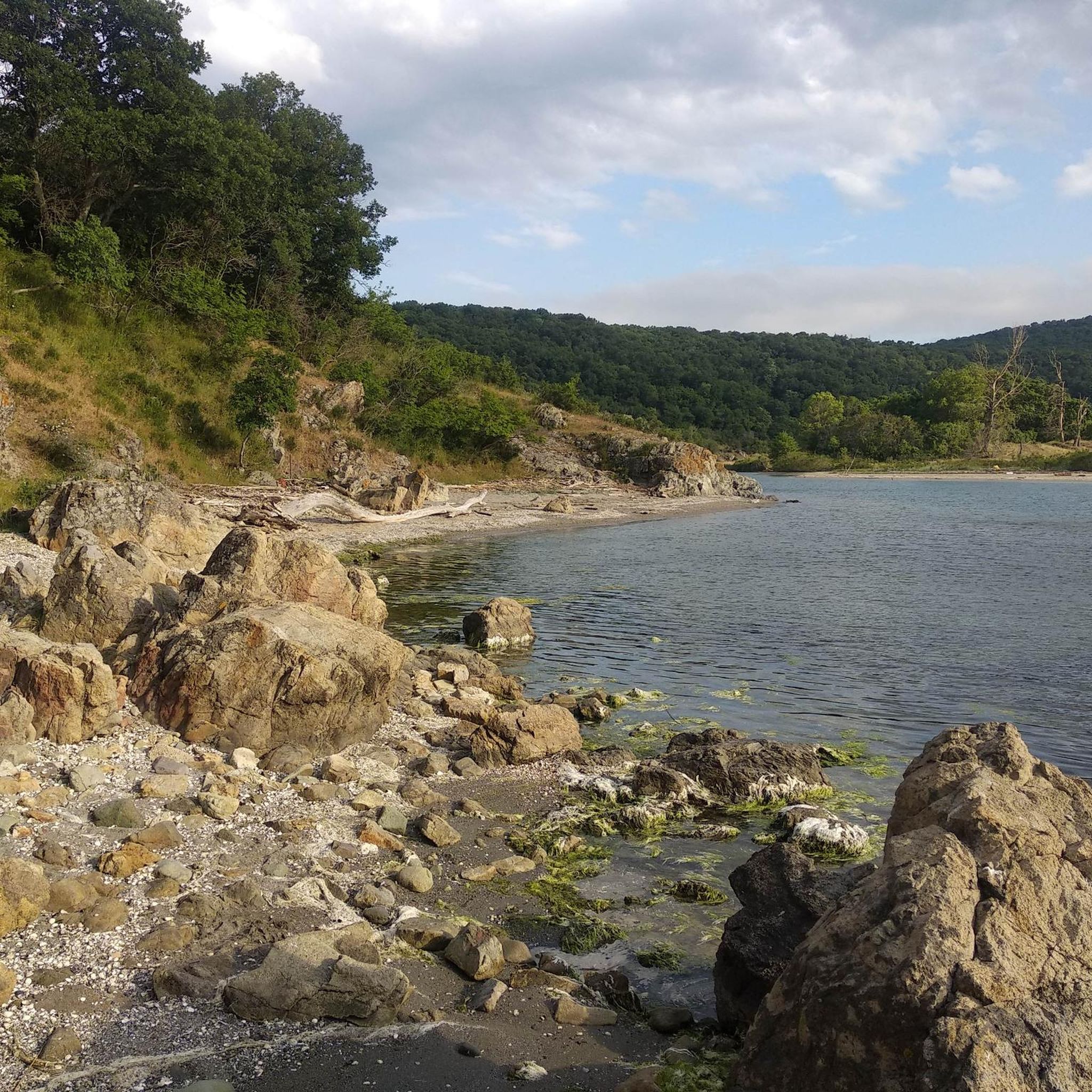
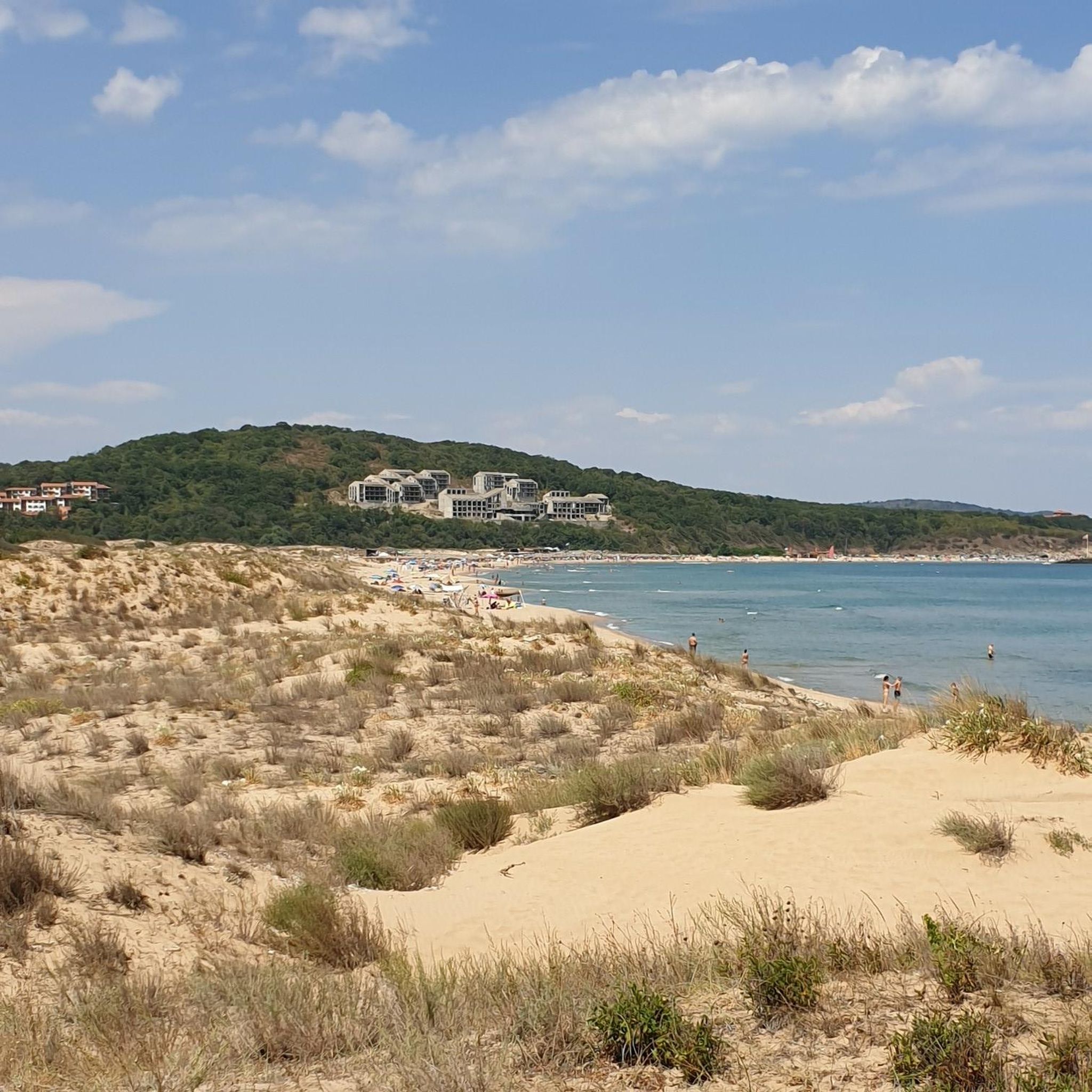
Hiking in Ропотамо offers diverse landscapes along the Bulgarian Black Sea coast, characterized by the Ropotamo River and its unique liman. The region features dense riparian longoz forests, sandy dunes, coastal lakes, and marshes. Rocky formations, such as the "Lion's Head," add dramatic geological features to the terrain. This varied environment provides a range of natural features for exploration.
Best hiking trails in Ропотамо
- The most popular hiking route is Nuptial Bed, Beglik Tash – Beglik Tash Rock Sanctuary loop from Ропотамо, a 5.5 miles (8.8 km) trail that takes 2 hours 30 minutes to complete. This moderate route explores the ancient Thracian sanctuary of Beglik Tash.
- Another top favourite among local hikers is Beglik Tash Sacrificial Altar – The Throne at Beglik Tash loop from Ропотамо, a moderate 5.3 miles (8.5 km) path. This trail leads through the area's significant rock formations and historical sites.
- Local hikers also love the Beglik Tash Sacrificial Altar – Beglik Tash Rock Sanctuary loop from Ропотамо, a 4.6 miles (7.4 km) trail leading through the Thracian sanctuary, often completed in about 2 hours 6 minutes.
- Hiking in Ропотамо is defined by the Ropotamo River's longoz forests, sandy dunes, and impressive rocky formations. The network offers options for easy, moderate, and difficult trails, catering to various ability levels.
- The routes in Ропотамо are highly rated by the komoot community with an average score of 4.8 stars from over 30 reviews. More than 300 hikers have used komoot to explore Ропотамо's varied terrain.
Last updated: July 1, 2026
5.0
(6)
25
hikers
Moderate hike. Good fitness required. Easily-accessible paths. Suitable for all skill levels.
4.8
(5)
17
hikers
Moderate hike. Good fitness required. Easily-accessible paths. Suitable for all skill levels.

Sign up for free
10
hikers
6.25km
01:46
130m
130m
Easy hike. Great for any fitness level. Easily-accessible paths. Suitable for all skill levels.
5.0
(1)
9
hikers
3.96km
01:07
80m
80m
Easy hike. Great for any fitness level. Easily-accessible paths. Suitable for all skill levels.
4.3
(3)
24
hikers
9.73km
02:38
130m
130m
Moderate hike. Good fitness required. Easily-accessible paths. Suitable for all skill levels.
Get access to more routes and recommendations from other explorers.
Sign up for free
Already have an account?
Our route recommendations are based on thousands of hikes, rides, and runs completed by other people on komoot.
Start today with a free account
Your next adventure awaits.
Login or Signup
Popular around Ропотамо
Tips from the Community

At one end of the upper surface of element 5 (Fig. 10) there is a man-made crevice which is 30 cm deep and 80 cm long, and at the opposite end – a seating place, or perhaps a hand-carved bathtub overlooking East. Rock bath (sharapanas) collected rainwater necessary for rituals.
0
0
To the West of element 3 there are two adjoining megaliths (Fig. 9 at the background). One of them is shaped like a cube with a size of 2 m., and the other – like a parallelepiped, whose dimensions are 2 х 2 х 5 m.
0
0
It consists of two megaliths which are about 3 m tall, located almost perpendicularly on either side of Element 2 (Fig. 9). The one on the left is thinner at its East end and is 4 m long, whereas the right one is shaped like a parallelepiped and is 5.2 m long
0
0
It has a shape very close to a parallelepiped (Fig.8) which is 4,8 m long, 60 cm high, and 2 m wide. Its long axis is almost precisely oriented in the East-West direction (Fig.3). It seems possible for the flat the upper surface of Element 2 to have been manually knapped, however, it might be the case that it had simply split from the megalith on its right, whose vertical wall is almost flat
1
0
Coins left by tourists on a nuptial bed in Beglik Tash prehistoric rock sanctuary situated on the southern Black Bulgarian Sea coast
0
0
Stones position and the name of the rituals in Begliktash
0
0
Some artifacts copies can be found or you can buy from the shop.
0
0
The ticket office near Beglik Tash
0
0
Frequently Asked Questions
What kind of terrain can I expect when hiking in Ропотамо?
Hiking in Ропотамо offers a diverse landscape, from dense, jungle-like riparian forests (longoz forests) along the Ropotamo River to sandy dunes, coastal lakes, and marshes. You'll also encounter impressive rocky formations, such as the famous "Lion's Head," adding dramatic geological features to the trails.
Are there any easy hiking trails suitable for beginners in Ропотамо?
Yes, Ропотамо offers several easy trails. For instance, the Zmeyova Kashta Hiking Map – Ropotamo Beach loop from Primorsko is an easy 6.2 km route. Another accessible option is the Ropotamo Beach loop from Беглик таш - ропотамо, which is about 3.9 km long.
What are the best times of year to go hiking in Ропотамо?
The best time to visit Ропотамо for hiking is during spring and early autumn. Temperatures are pleasant, and nature is at its peak, with blooming water lilies and migrating birds. During warmer months, be aware of mosquitoes.
Are there any notable natural landmarks or viewpoints along the trails?
Absolutely. The region is famous for its impressive rocky phenomena, including the "Lion's Head" (Лъвската глава), an iconic rock formation resembling a lion's profile. You can also find other notable rock formations around Cape Agalina and Cape Kolokita. The Ropotamo River itself, with its unique liman and longoz forests, offers picturesque views.
Can I find circular hiking routes in Ропотамо?
Yes, many of the trails in Ропотамо are designed as loops. For example, the Nuptial Bed, Beglik Tash – Beglik Tash Rock Sanctuary loop from Ропотамо is a popular 8.8 km circular route. Another option is the Beglik Tash Sacrificial Altar – The Throne at Beglik Tash loop from Ропотамо, an 8.5 km loop exploring historical sites and rock formations.
What kind of wildlife can I expect to see while hiking in the reserve?
Ропотамо is rich in biodiversity. You might spot various birds, snakes, and turtles in the riparian forests. The reserve is home to rare species like the Ropotamo primrose and European otter, alongside a wide array of fish, mammals such as deer, foxes, and mouflons, and over 260 bird species, especially around the Arkutino marsh.
Is there parking available near the hiking trailheads?
While the guide doesn't specify exact parking locations, the area is generally accessible. Given the popularity of sites like Beglik Tash and the Ropotamo River, it is reasonable to expect designated parking areas near major trail entry points, especially for the more frequented routes.
What do other hikers enjoy most about the trails in Ропотамо?
The trails in Ропотамо are highly rated by the komoot community, with an average score of 4.8 stars. Hikers often praise the diverse landscapes, the unique longoz forests, and the impressive rock formations like the Lion's Head. The combination of natural beauty and historical sites, such as the Thracian sanctuary Begliktash, is also frequently highlighted.
Are there any specific rules or permits required for hiking in the Ropotamo Nature Reserve?
The Ropotamo Nature Reserve has a strict regime. While some paths are freely accessible for walking, pedestrian access is generally allowed only on designated tourist trails. It's always advisable to stay on marked paths to protect the sensitive ecosystems.
Are there any historical or cultural sites accessible via hiking trails?
Yes, the region holds significant historical importance. The Thracian sanctuary Begliktash, a complex of high rocks used in ancient Thracian rituals, is accessible via hiking trails. Routes like the Beglik Tash Sacrificial Altar – Beglik Tash Rock Sanctuary loop from Ропотамо specifically lead through this ancient site.
What should I bring for a hike in Ропотамо?
For hiking in Ропотамо, it's recommended to bring light, comfortable shoes, plenty of water, and binoculars for birdwatching, given the rich avian diversity. During warmer months, mosquito repellent would also be beneficial.

Get inspired with the komoot mobile app


Explore more
Browse the best Hikes in other regions.
