Attractions and Places To See in Περισυνάκη - Αγριοκεφάλα - Μανίκα Δήμου Σφακίων - Top 10
Best attractions and places to see in Περισυνάκη - Αγριοκεφάλα - Μανίκα Δήμου Σφακίων are found within the broader Municipality of Sfakia in the Chania Regional Unit of Crete, Greece. This area is recognized for its natural beauty, offering diverse landscapes from gorges to mountain passes. The region provides opportunities for connecting with nature and exploring historical sites. It serves as a base for experiencing the natural and cultural richness of Sfakia.
Best attractions and places to see in Περισυνάκη…
Last updated: October 9, 2026
Kalikratis Gorge
Highlight (Segment) • Gorge
Translated by Google •
Tip by

Kallikratis Pass
Highlight • Mountain Pass
Tip by

Sign up now to discover places like this
Get recommendations on the best single tracks, peaks, & plenty of other exciting outdoor places.
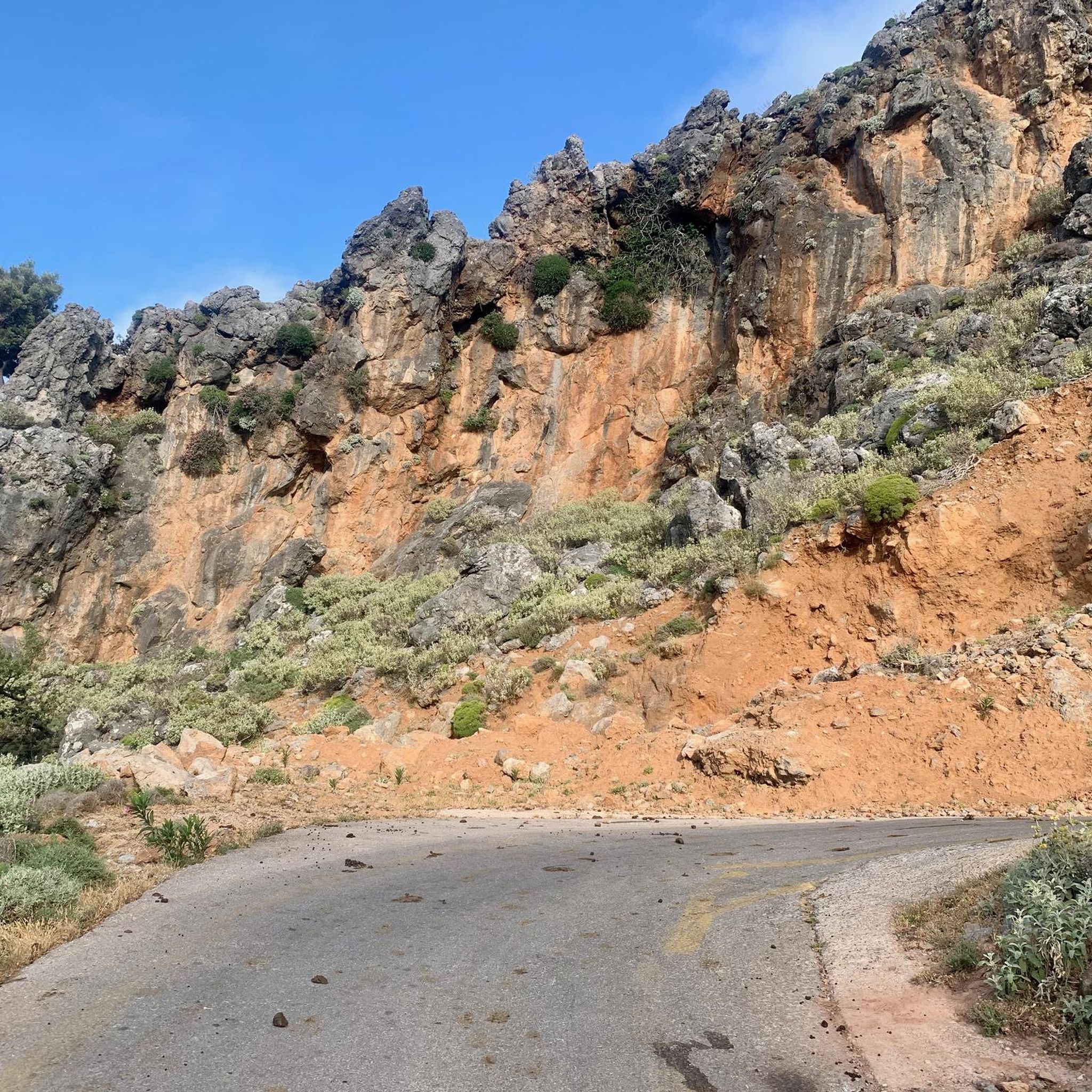
Wildlife in the Kallikratis Gorge
Highlight • Gorge
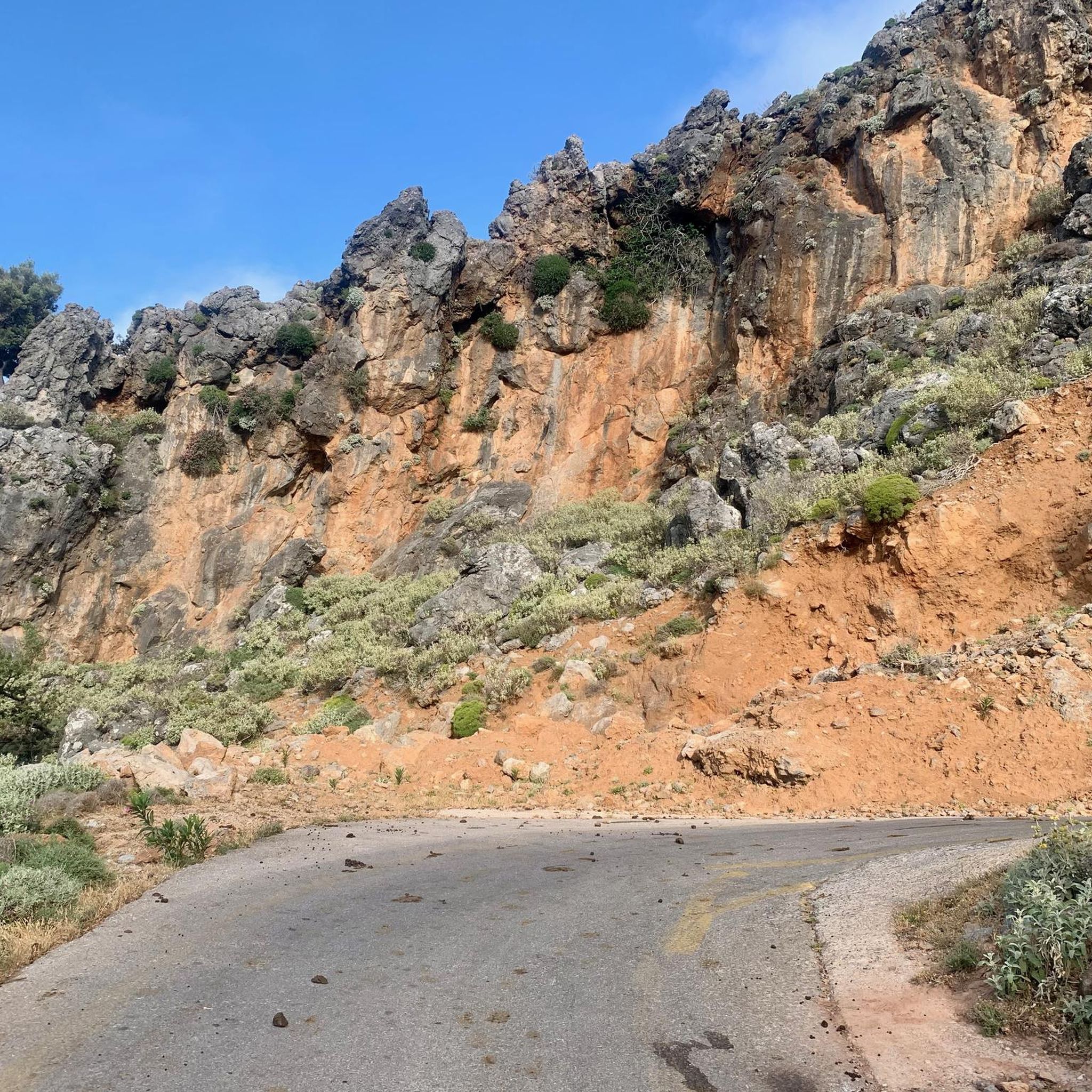
The goats can be found almost everywhere on Crete, including here in the Kallikratis Gorge. Be careful, if the goats flee into the steep walls in fear, loose stones can fall down.
Translated by Google •
Tip by
Mountain Pass Near Anogeia
Highlight • Mountain Pass
Quäldich Pass Description:
Anyone traveling from the Rethymnon area towards the Imbros or Kallikratis-Kapsodasos Passes must first conquer the Bourolos Pass, unless they choose a longer detour via Sellia along the south coast of Crete.
Translated by Google •
Tip by

Asfendou Gorge
Highlight • Gorge
Translated by Google •
Tip by

Sign up for free to discover even more attractions in Περισυνάκη - Αγριοκεφάλα - Μανίκα Δήμου Σφακίων.
Already have an account?
Start today with a free account
Your next adventure awaits.
Popular around Περισυνάκη - Αγριοκεφάλα - Μανίκα Δήμου Σφακίων
Hiking in Περισυνάκη - Αγριοκεφάλα - Μανίκα Δήμου Σφακίων
Road Cycling Routes in Περισυνάκη - Αγριοκεφάλα - Μανίκα Δήμου Σφακίων
Cycling in Περισυνάκη - Αγριοκεφάλα - Μανίκα Δήμου Σφακίων
Running Trails in Περισυνάκη - Αγριοκεφάλα - Μανίκα Δήμου Σφακίων
MTB Trails in Περισυνάκη - Αγριοκεφάλα - Μανίκα Δήμου Σφακίων
Tips from the Community

The road is beautifully laid out, has wonderful views, and is not very busy, but with gradients of up to 19%, it's not for everyone ;-)
1
0

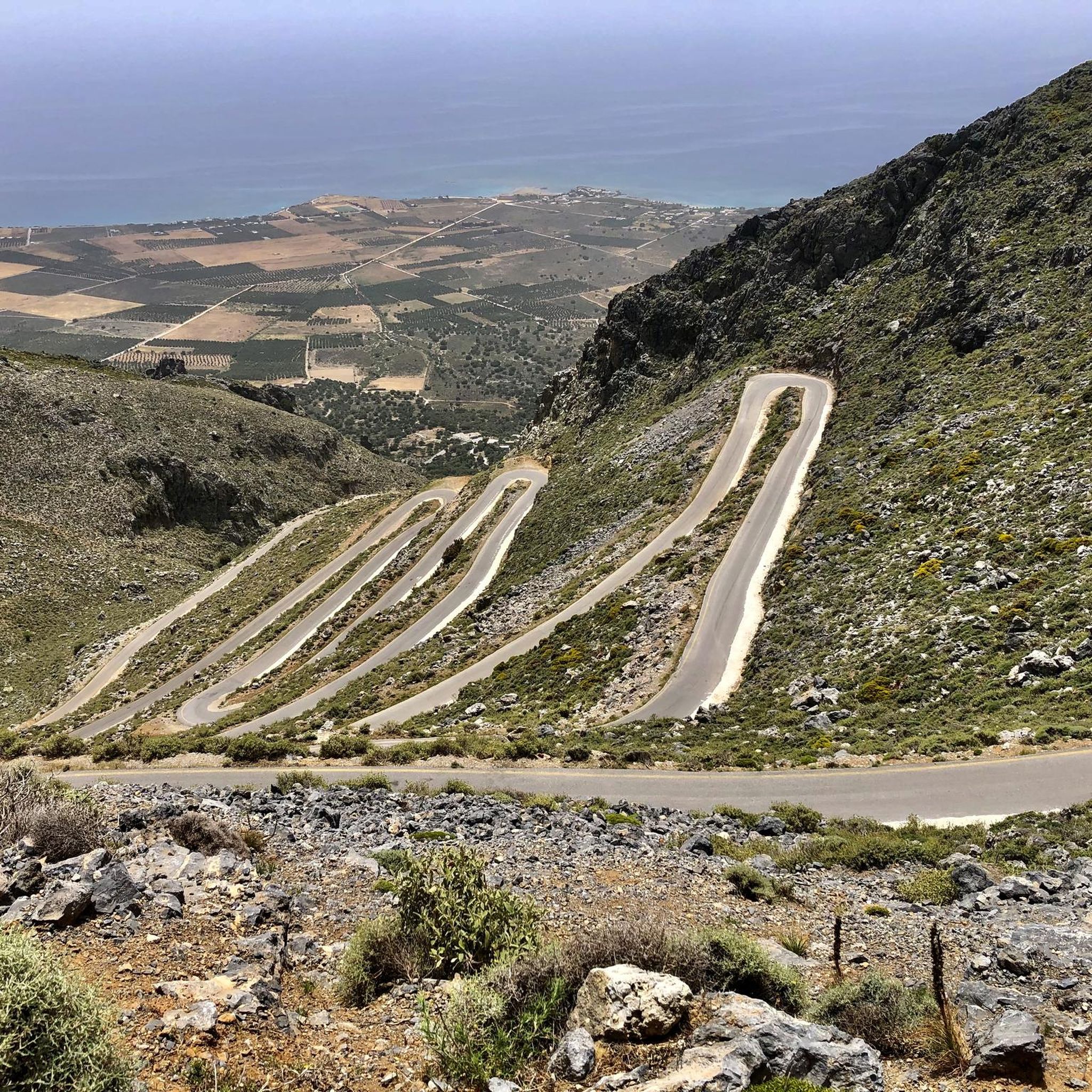
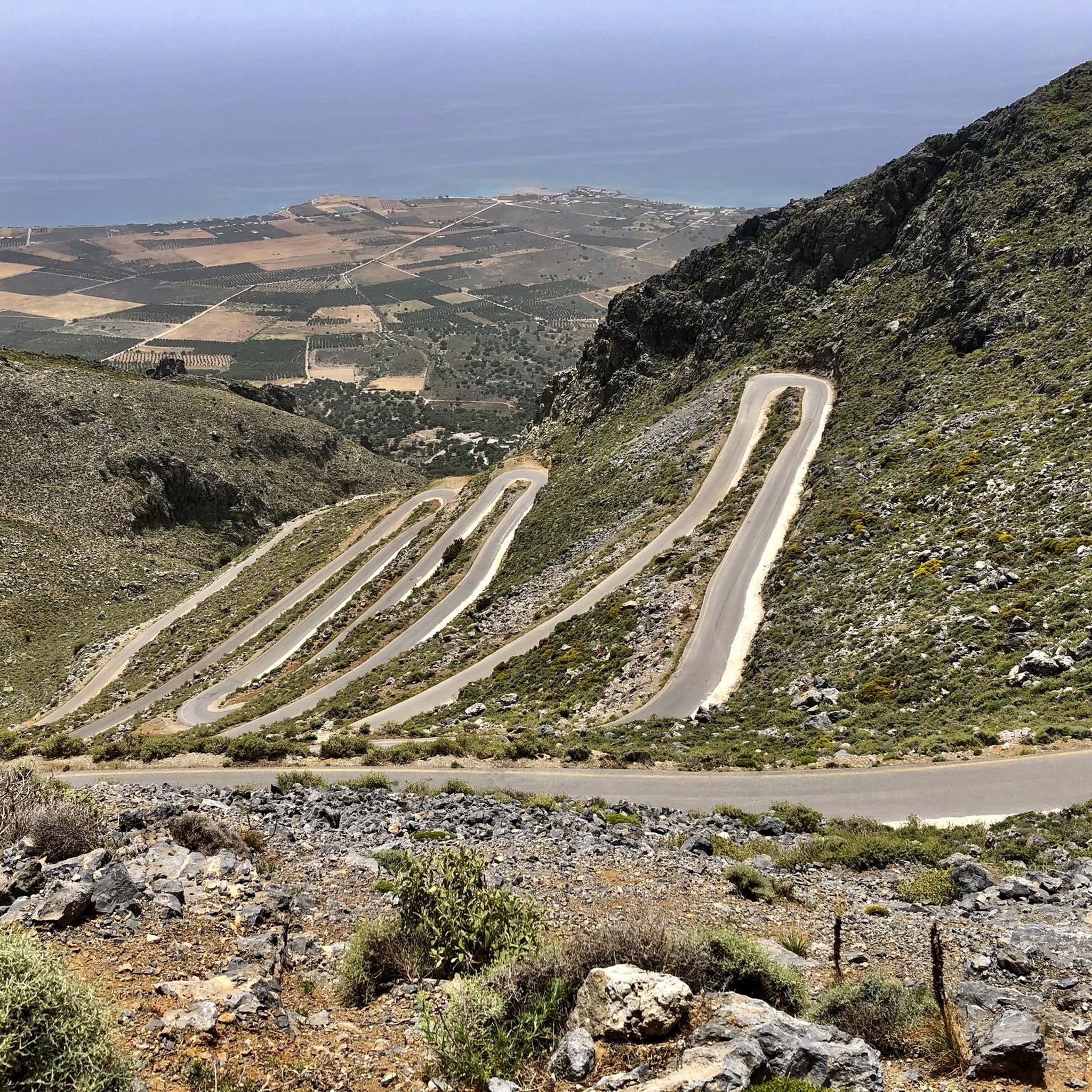
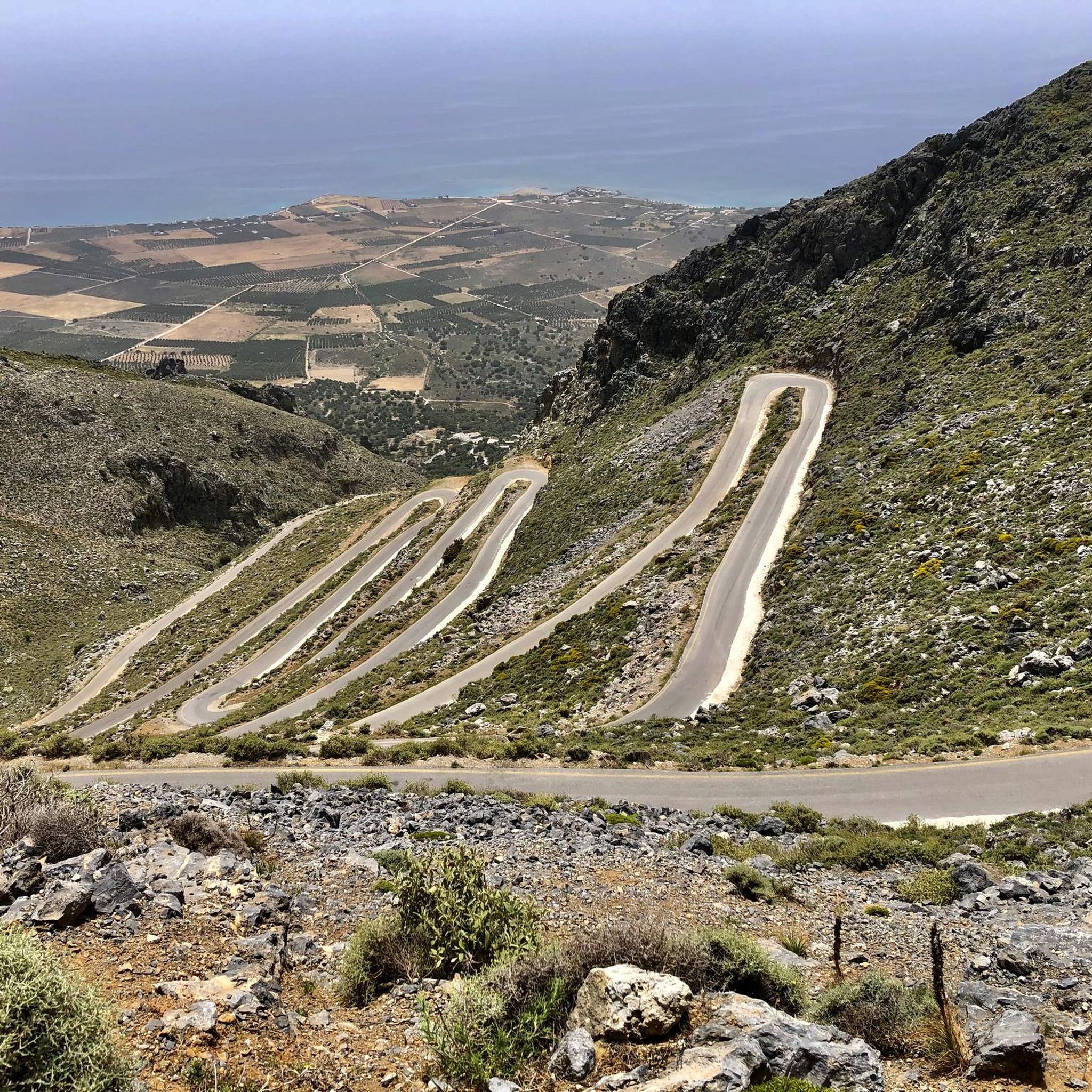
Quäldich Pass Description: Southern Ascent from Kapsodasos 6.7 km | 643 m elevation gain | 9.6% (~10.4%) The southern ascent begins in the village of Kapsodasos at an altitude of approximately 100 m. The turnoff to Kallikratis is signposted (as of 2018 on a very weathered sign). The route initially heads north for a little over half a kilometer before a veritable hairpin bend festival unfolds over the next five kilometers. The road winds its way up a barren rocky slope via a total of 27 hairpin bends. There is virtually no vegetation along the route, which has its own charm and offers consistently wonderful views, especially of the hairpin bends already conquered and the Libyan Sea shimmering in the distance. The gradient is inconsistent over these first 5.5 kilometers, averaging just over 10%, but quite steep. In addition to battling the steep incline, the author also encountered a rather strong headwind on the ascent, which swept down the slope and added to the effort. After completing the switchbacks, the worst is over, and the route continues relatively flat for half a kilometer northwards before the remaining 700 meters to the highest point of the route, where the final meters of elevation gain must be conquered at a manageable gradient. Once at the top, the route descends for about a kilometer, followed by a gentle climb of almost three kilometers towards Kallikrátis. From there, however, more elevation gain awaits, as one must either tackle the easy western ascent to the Bourolos Pass or the 560-meter climb of the eastern ascent to the Asfendos Pass. Northern Ascent 1 km | 64 m elevation gain | 6.4% (~8.8%)
1
0
Quäldich Pass Description: The Kallikratis-Kapsodasos Pass lies not far from the south coast of Crete, between Kapsodasos and Kallikratis. As is often the case in Crete, there is unfortunately no pass sign and therefore no official name for the crossing. It is also not marked on local maps. The owner of Olympic Bike in Rethymnon informed the author that the crossing is known locally as the Kapsodasos Pass, or simply Kapsodasos Pass, based on the starting point of the southern ascent. Elsewhere, it is referred to as the Kallikratis Climb. We cannot and do not wish to commit to a definitive name. This is not a pass in the conventional sense, as the road does not connect two valleys, but rather leads from the south coast parallel to a gorge, climbing a slope into the island's interior. However, like a pass, it does cross a high point. Consequently, the southern ascent can involve a considerable amount of elevation gain, while the northern ascent involves only a slight difference in altitude. As of 2018, the entire route is in excellent condition and has a much better road surface than the surrounding roads. Only in the lower section of the southern approach were there occasionally some stones on the road, which only required extra caution on the descent. Furthermore, the road is mostly single-lane, hardly used, and therefore a real pleasure to drive.
1
0
Bourolos Pass 818 m Quäldich Pass Description: Anyone traveling from the Rethymnon area towards the Imbros or Kallikratis-Kapsodasos Passes must first conquer the Bourolos Pass, unless they choose a longer detour via Sellia along the south coast of Crete. The pass runs roughly west-east, with two ascents from the east. The southern ascent offers several options at the beginning. The eastern ascents are quite scenic, while the pass summit itself is barren and unspectacular.
0
0


In fact, this "pass" isn't the highest point; it only looks that way. After a short descent, the climb continues for another 100 meters before reaching Kallikratis.
1
1

In case you plan to combine this one with the Imbros Pass in one tour, I would recommend to go Imbros downhill and Kallikratis uphill. There is lots of stones and sometimes fine Gravel/Sand on the road which makes descending at speed dangerous.
2
2

Yes, indeed, it goes up well to Kallikratis. But the climb resumes after Kallikratis, and it's not a bad thing.
2
1
Frequently Asked Questions
What kind of natural attractions can I explore in Περισυνάκη - Αγριοκεφάλα - Μανίκα Δήμου Σφακίων?
The region is rich in natural beauty, primarily known for its impressive gorges and mountain passes. Key attractions include Kalikratis Gorge, which offers well-marked paths and abundant plant life, and the dramatic Kallikratis Pass with its scenic hairpins. The broader Sfakia region also features the famous Samaria Gorge and the more accessible Imbros Gorge.
Are there hiking opportunities near these attractions?
Yes, the area is excellent for hiking. You can find a variety of trails, from moderate to challenging. For example, there are moderate loops like the "Wildlife in the Kallikratis Gorge – Kallikratis Gorge loop from Patsianos" (13.1 km) or the "Taverna Vigles – Frangokastello Castle loop from Patsianos" (11 km). You can explore more options on the Hiking in Περισυνάκη - Αγριοκεφάλα - Μανίκα Δήμου Σφακίων guide page.
Are there easy hiking trails suitable for beginners or families?
Absolutely. For easier walks, consider routes like the "Saint John the Baptist Chapel – Taverna Vigles loop from Kapsodhasos" (4.8 km) or the "Vagelis Farm Botanic Garden – View of the Libyan Sea loop from Kolokasia" (4.9 km). These are generally less strenuous and offer a pleasant way to experience the landscape. More easy options are available on the Easy hikes in Περισυνάκη - Αγριοκεφάλα - Μανίκα Δήμου Σφακίων guide page.
Can I see wildlife in the area?
Yes, the natural environment, particularly in places like the Wildlife in the Kallikratis Gorge, is home to various animals. You might spot goats, including the Cretan wild goat (Kri-Kri), though common house goats are more frequently seen. Always be mindful of your surroundings, especially in steep areas where loose stones might be dislodged by animals.
What historical or cultural sites can I visit?
The region has a rich history. You can explore the Agiasmatzi Cave (Spilaio Agiasmatzi), a cultic cave with over 3000 years of history, though access can be challenging. The broader Sfakia region also features the Askifou War Museum and the Venetian castle at Frangokastelo. Ancient Paleolithic cave paintings have also been discovered in a cave at Skordolakia in Asfendou.
What is the best time of year to visit for outdoor activities?
The spring (April to June) and autumn (September to October) months are generally considered the best for outdoor activities in Crete, including the Sfakia region. The weather is milder, making hiking and exploring more comfortable, and the natural landscape is often at its most vibrant. Summers can be very hot, especially for strenuous activities, while winters can bring cooler temperatures and occasional rain.
Are there challenging routes for experienced hikers or cyclists?
Definitely. The Kallikratis Pass offers a beautiful, steep climb, with sections averaging a 10% gradient, making it a challenge for cyclists. For mountain biking, difficult routes like the "Frangokastello Castle – Entrance to Imbros Gorge loop from Fortress Frangokastello" (53.9 km) are available. You can find more challenging options on the MTB Trails in Περισυνάκη - Αγριοκεφάλα - Μανίκα Δήμου Σφακίων guide page.
What do visitors enjoy most about the attractions in Περισυνάκη - Αγριοκεφάλα - Μανίκα Δήμου Σφακίων?
Visitors particularly appreciate the stunning natural beauty and the sense of adventure. The Kalikratis Gorge is praised for its well-marked paths and abundant herbs. The Kallikratis Pass is often compared to the Alps for its dramatic scenery and challenging climbs. The opportunity to observe wildlife, even common goats, in their natural habitat also adds to the appeal.
Are there options for accommodation or dining nearby?
While the immediate area of Περισυνάκη - Αγριοκεφάλα - Μανίκα is more rural, the broader Sfakia region, including villages like Kallikratis, Kapsodhasos, and Patsianos, offers various tavernas and guesthouses. These provide opportunities for local Cretan cuisine and comfortable stays, serving as good bases for exploring the attractions.
How can I access the attractions, and is parking available?
Access to many attractions, especially the gorges and passes, is typically by car. Parking is generally available near trailheads or in nearby villages. Public transport options within the Sfakia municipality can be limited, so having your own vehicle often provides the most flexibility for exploring the diverse sites.
Are there any coastal attractions or beaches nearby?
Yes, the Sfakia coastline, which is part of the broader region, features several stunning beaches. Notable ones include Frangokastelo beach, Glyka Nera beach, Ilingas Beach, and Marmara beach. These offer excellent opportunities for swimming and relaxation after exploring the inland attractions.
Is the area suitable for dog-friendly walks?
Many of the natural trails and open spaces in the region are suitable for dog-friendly walks, especially the less strenuous routes. However, it's always advisable to keep dogs on a leash, particularly in areas with wildlife or livestock, and to be respectful of local regulations and other hikers. Always carry water for your pet, especially during warmer months.
Most popular routes in Περισυνάκη - Αγριοκεφάλα - Μανίκα Δήμου Σφακίων
Most popular attractions in Περισυνάκη - Αγριοκεφάλα - Μανίκα Δήμου Σφακίων

Get inspired with the komoot mobile app


Explore more
Still not found the Highlight you’re looking for? See guides of the top attractions in other regions:
