The best walks and hikes in Sic Calanchi Civita Di Bagnoregio
4.5
(1214)
7,925
hikers
69
hikes
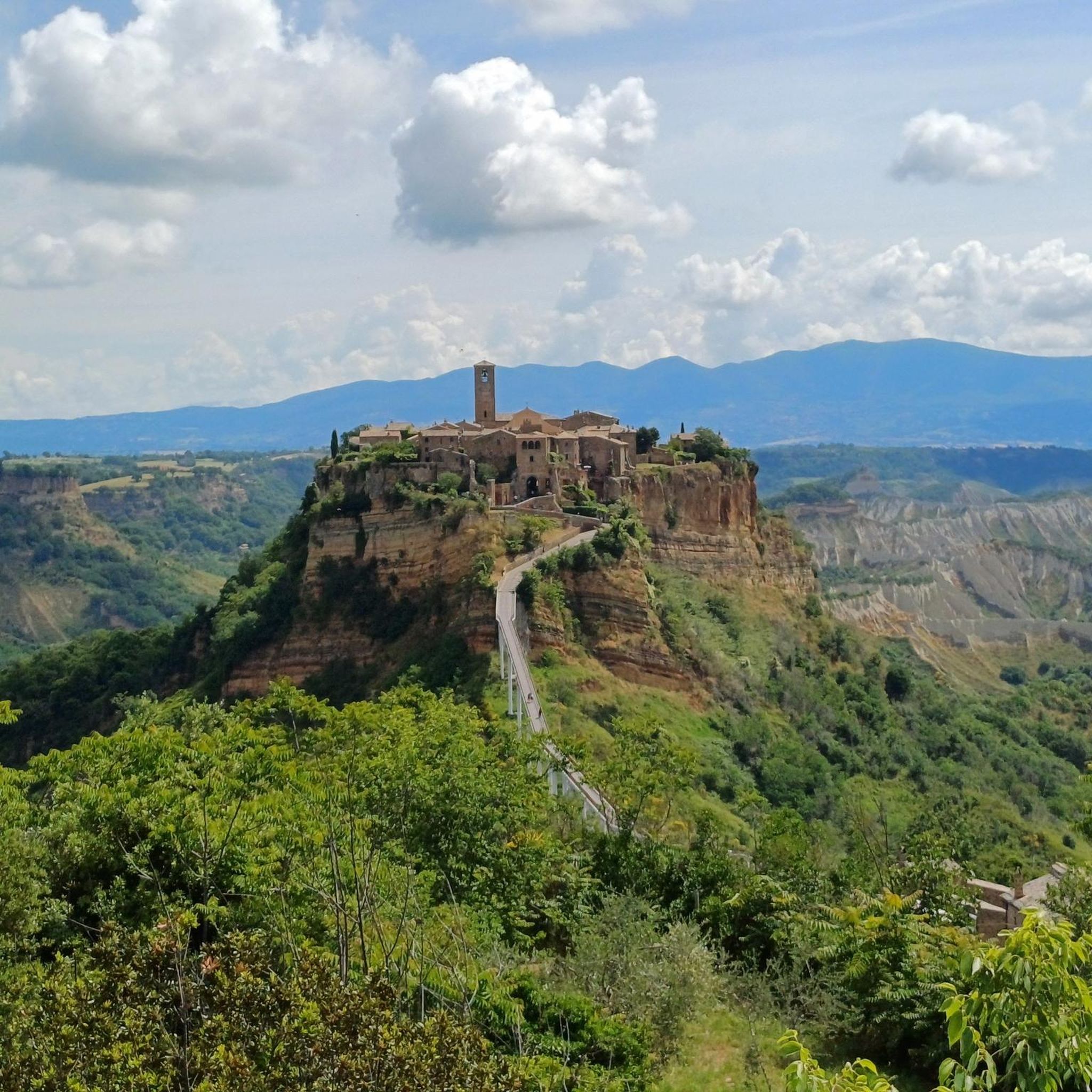
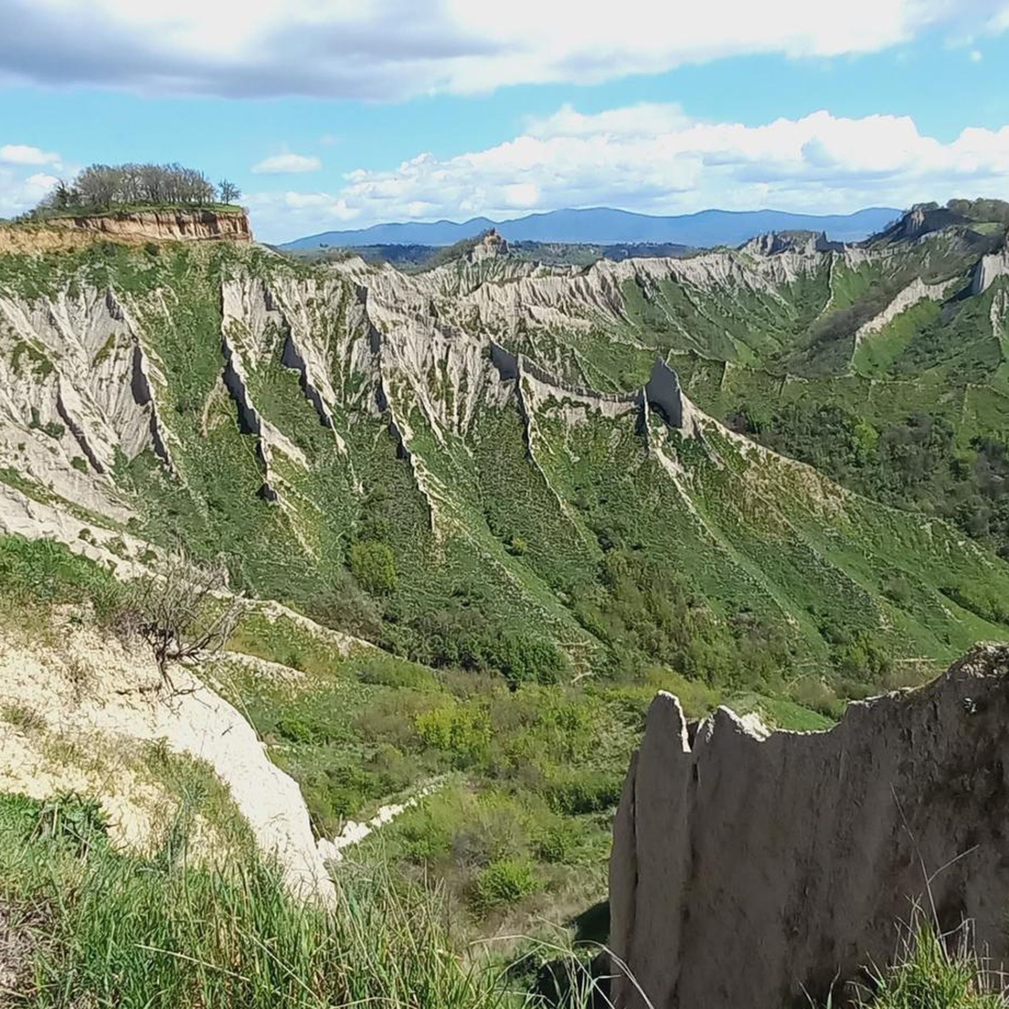
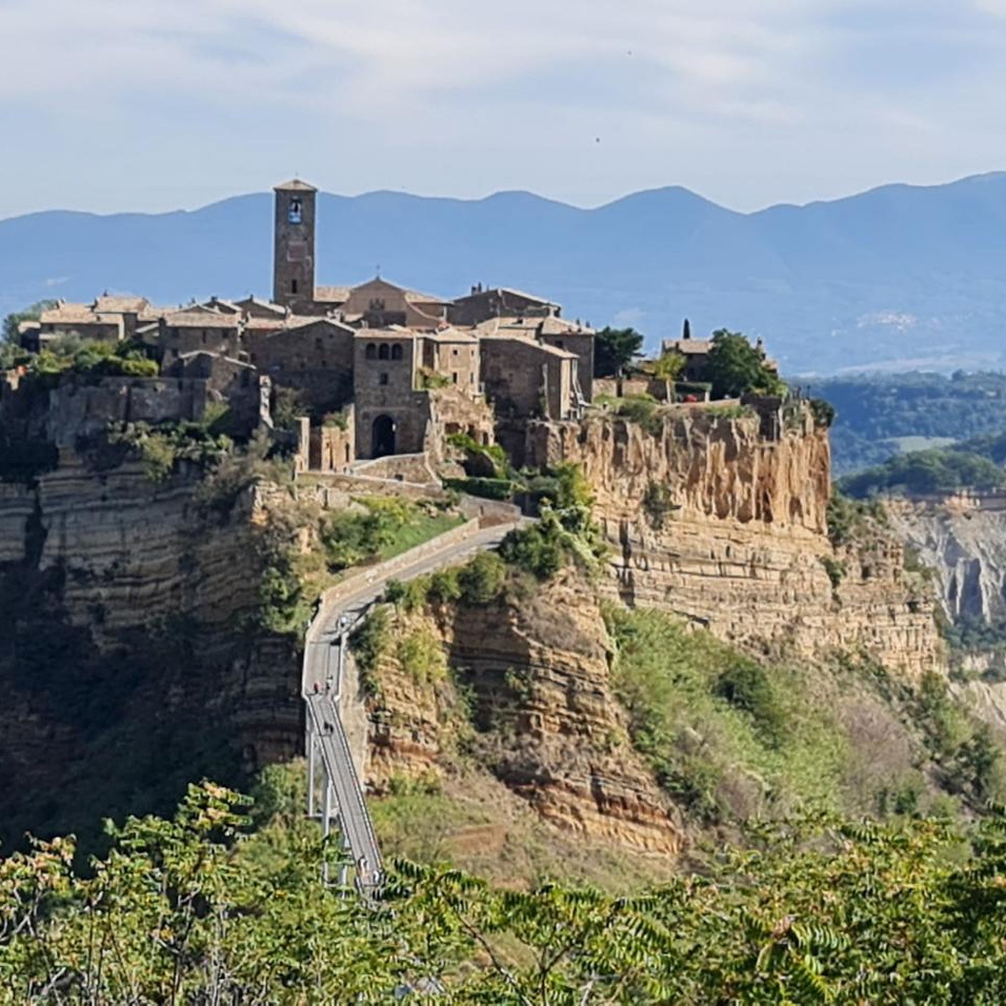
Hiking trails in Sic Calanchi Civita Di Bagnoregio traverse a distinctive landscape shaped by geological erosion. The region is characterized by dramatic "calanchi" formations, which are deep gullies and ravines carved into soft clay and tuff rock. These unique geological features create a rugged, undulating terrain, offering panoramic viewpoints over the Valle dei Calanchi and the iconic Civita di Bagnoregio perched on its isolated tufa plateau.
Best hiking trails in Sic Calanchi Civita Di Bagnoregio
- The most popular hiking route…
Last updated: October 10, 2026
4.0
(1)
3
hikers
4.77km
01:29
180m
180m
Embark on an easy hike that takes you through the unique landscape surrounding Civita di Bagnoregio. This ring tour covers 3.0 miles (4.8 km) with a manageable elevation gain of…
4.6
(35)
651
hikers
Easy hike. Great for any fitness level. Easily-accessible paths. Suitable for all skill levels.

5.0
(1)
100
hikers
Easy hike. Great for any fitness level. Easily-accessible paths. Suitable for all skill levels.
4.6
(7)
59
hikers
24.0km
07:10
750m
760m
Hard hike. Very good fitness required. Easily-accessible paths. Suitable for all skill levels.
5.0
(1)
36
hikers
Easy hike. Great for any fitness level. Easily-accessible paths. Suitable for all skill levels.
Get access to more routes and recommendations from other explorers.
Already have an account?
Our route recommendations are based on thousands of hikes, rides, and runs completed by other people on komoot.
Start today with a free account
Your next adventure awaits.

Tips from the Community

After visiting Civita di Bagnoregio, we came here to eat something and were very positively surprised. The food was great.
0
0
Old town square, just as you imagine a square in Italy. Café, church etc.
0
0
From the village, you have a wonderful view over the rugged ridges of the valle dei calanchi.
0
0
From here you climb into another time...
0
0
Very early in the morning it is still quiet and most beautiful. Wonderful mood of colors and light.
0
0
Sweet, but also makes you think about tourism. How much can you sell yourself, when does privacy begin? But, a beautiful village!
0
0
The dying city sees up to 14,000 people a day, who each pay 5.00 Euros entrance fee for this. It borders on prostitution to have to put up with this. In itself a beautiful village, which for this high price looks the way it does. We were there early in the morning, when the Chinese tour groups arrived around 11:00 AM, we were already on our way back.
0
0
On foot and as early as possible in the morning, then it's still beautiful.
0
0
Frequently Asked Questions
How many hiking trails are there in Sic Calanchi Civita Di Bagnoregio?
The region offers a wide selection of routes, with over 60 hiking trails available. These range from easy strolls to more challenging paths through the unique eroded terrain.
What is the best time of year to hike in Sic Calanchi Civita Di Bagnoregio?
Spring and autumn are generally the most pleasant times for hiking, with milder temperatures and beautiful light for photography. Summer can be very hot, so early mornings or late afternoons are recommended if hiking during this season. Always check local weather forecasts before heading out.
What makes the landscape of Sic Calanchi Civita Di Bagnoregio unique for hiking?
The landscape is defined by its dramatic 'calanchi' formations – deep gullies and ravines carved into soft clay and tuff rock by erosion. These geological features create a rugged, undulating terrain, offering panoramic viewpoints over the Valle dei Calanchi and the iconic Civita di Bagnoregio perched on its isolated tufa plateau.
Are there easy hiking trails suitable for beginners in Sic Calanchi Civita Di Bagnoregio?
Yes, there are many easy trails perfect for beginners. For example, the View of Civita di Bagnoregio – Civita di Bagnoregio Bridge loop from Bagnoregio is an easy 1.0-mile (1.7 km) path that offers great views without significant elevation gain.
Are there circular hiking routes available in Sic Calanchi Civita Di Bagnoregio?
Yes, many routes in the area are circular, allowing you to start and end in the same location. A popular option is the View of Civita di Bagnoregio – Santa Maria Gate loop from Lubriano, a moderate 5.3-mile (8.5 km) trail that provides diverse scenery.
Is there parking available for hikers visiting Sic Calanchi Civita Di Bagnoregio?
Parking is generally available in the towns surrounding the hiking areas, such as Bagnoregio and Lubriano. There are designated parking lots, often paid, especially closer to the access point for Civita di Bagnoregio. It's advisable to arrive early during peak season to secure a spot.
Are the hiking trails in Sic Calanchi Civita Di Bagnoregio suitable for families with children?
Many trails are suitable for families, especially the easier, shorter loops. The unique landscape and the sight of Civita di Bagnoregio can be very engaging for children. Consider routes like the View of Civita di Bagnoregio – View of the Calanchi Valley loop from Bagnoregio, which is an easy 2.3-mile (3.8 km) path with expansive vistas.
Are dogs allowed on the hiking trails in Sic Calanchi Civita Di Bagnoregio?
Generally, dogs are welcome on the hiking trails in the Sic Calanchi region. However, it's always recommended to keep them on a leash, especially in areas with wildlife or near agricultural land. Be sure to carry water for your dog, particularly on warmer days, as natural water sources might be scarce.
What kind of views can I expect on the hikes in Sic Calanchi Civita Di Bagnoregio?
Hikers can expect breathtaking panoramic views of the dramatic Calanchi Valley, the iconic 'dying city' of Civita di Bagnoregio perched on its tufa plateau, and the surrounding Lazio countryside. Many trails offer multiple viewpoints, allowing for stunning photo opportunities.
What interesting places can I explore near the hiking trails?
Beyond the trails, you can explore the historic village of Civita di Bagnoregio itself, accessible via a pedestrian bridge. Other points of interest include the ancient Santa Maria Gate and various viewpoints offering spectacular vistas of the Calanchi Valley.
What should I wear or bring for hiking in Sic Calanchi Civita Di Bagnoregio?
Given the varied terrain and potential for sun exposure, wear comfortable, sturdy hiking shoes with good grip. Layers of clothing are advisable, as temperatures can change. Always bring plenty of water, especially during warmer months, sun protection (hat, sunscreen), and snacks. A map or GPS device is also recommended.
Most popular routes in Sic Calanchi Civita Di Bagnoregio
Most popular attractions in Sic Calanchi Civita Di Bagnoregio

Get inspired with the komoot mobile app


Explore more
Browse the best Hikes in other regions.
