The best walks and hikes in Monti Serano - Brunette (Sommità)
4.4
(337)
1,652
hikers
123
hikes
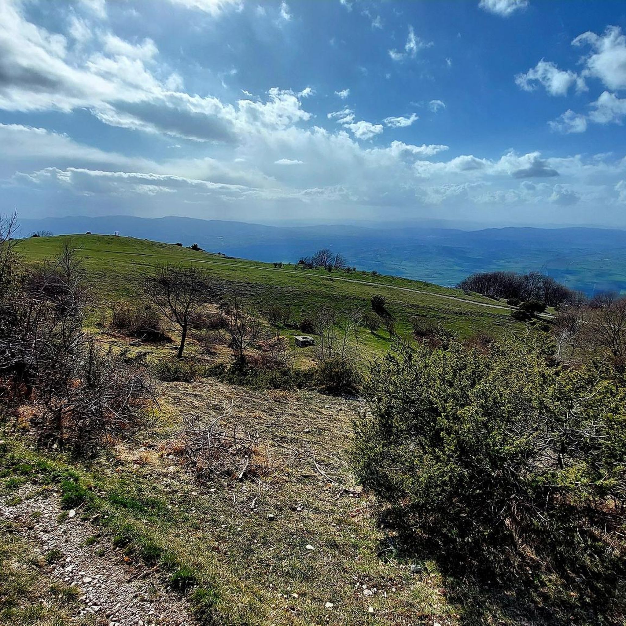
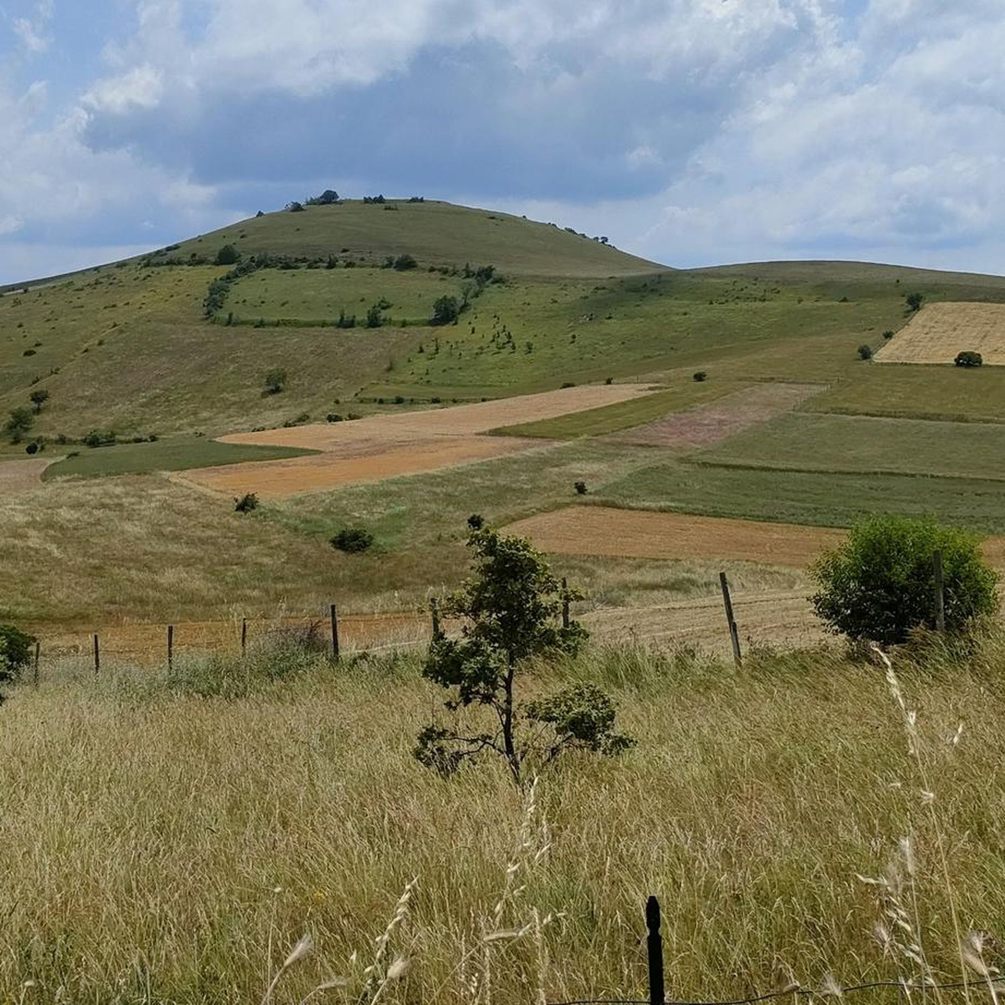
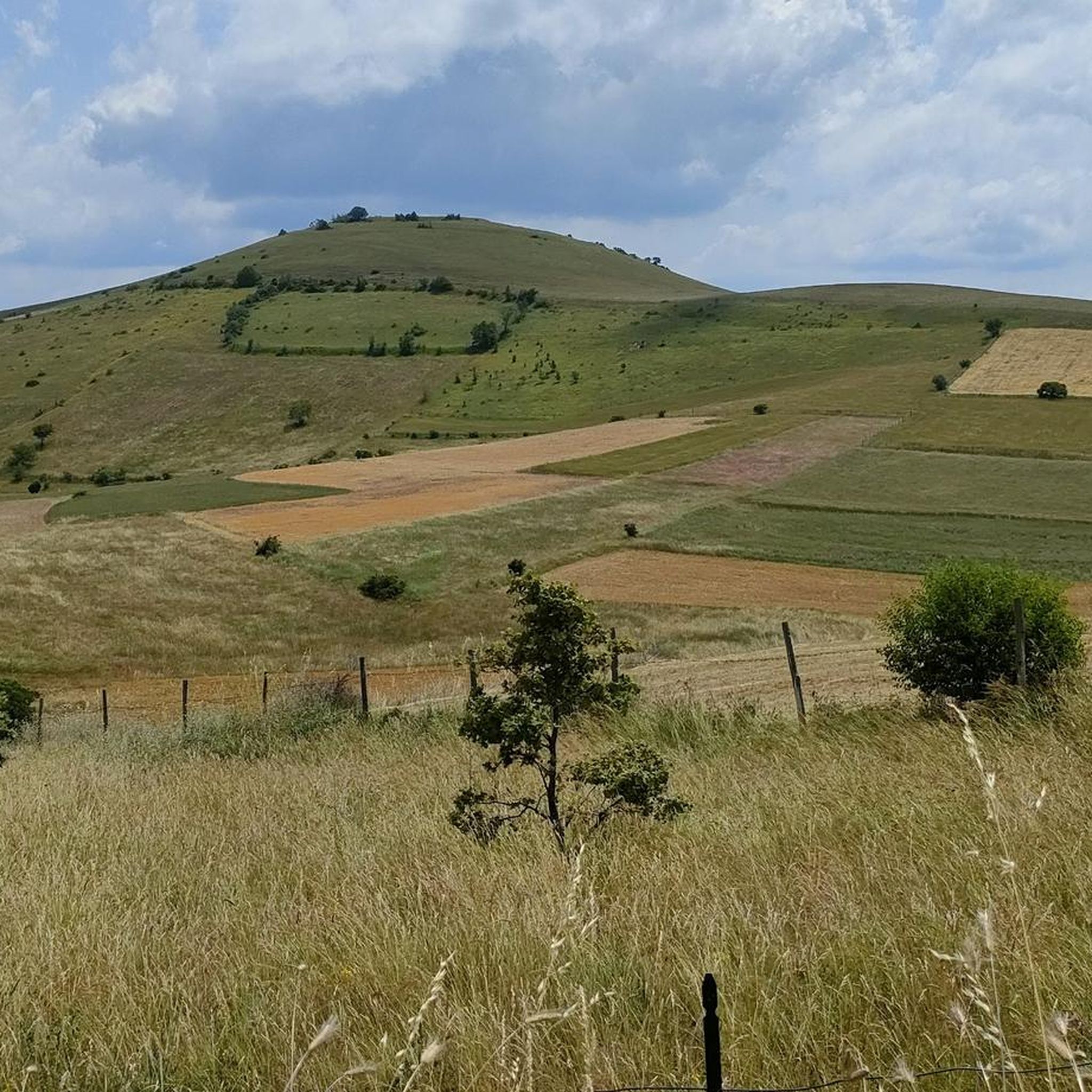
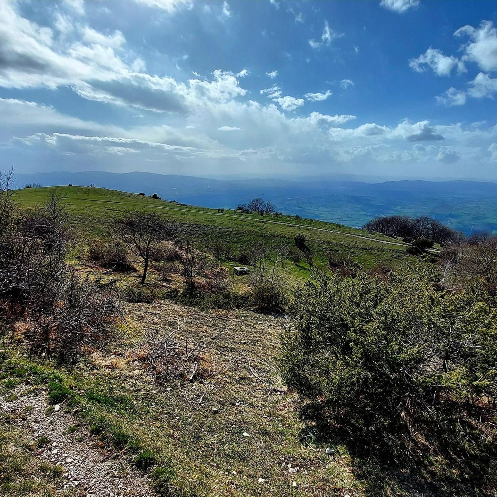
Hiking in Monti Serano - Brunette (Sommità) offers diverse landscapes within the Umbria-Marche Apennines. The region features mountainous terrain with peaks like Monti Serano (1429m) and Brunette (1421m), largely covered in mixed tree forests. Hikers can observe karstic geological formations, including dolines and karstic plains, alongside lower-altitude olive groves. Panoramic views are available from higher elevations, providing a varied backdrop for outdoor activities.
Best hiking trails in Monti Serano - Brunette (Sommità)
- The most popular hiking route is Scenic Road…
Last updated: July 9, 2026
4.2
(9)
24
hikers
12.6km
03:59
510m
510m
Moderate hike. Good fitness required. Easily-accessible paths. Suitable for all skill levels.
4.1
(10)
32
hikers
Moderate hike. Good fitness required. Mostly accessible paths. Sure-footedness required.

Sign up for free
5.0
(1)
18
hikers
11.8km
04:07
490m
490m
Moderate hike. Good fitness required. Mostly accessible paths. Sure-footedness required.
19
hikers
Moderate hike. Great for any fitness level. Mostly accessible paths. Sure-footedness required.
5.0
(1)
12
hikers
7.85km
02:42
350m
350m
Moderate hike. Good fitness required. Mostly accessible paths. Sure-footedness required.
Get access to more routes and recommendations from other explorers.
Sign up for free
Already have an account?
Our route recommendations are based on thousands of hikes, rides, and runs completed by other people on komoot.
Start today with a free account
Your next adventure awaits.
Login or Signup

Tips from the Community

Beautiful long climb from the valley
2
0

The coast of the Trevi mountains is very interesting for bikers, there are paths for all tastes, for enthusiasts I recommend the annual spring meeting "Gusta Trevi".
0
0

Beautiful places and beautiful views.
0
0
Very long and panoramic path that starts near the Casette del Monte Brunette and ends at the CAI refuge of Pozzo di Mezzanotte. Recommended both on foot and by bike
0
0

Beautiful excursion especially if done through the Pettino ring passing through the beech forest!
0
0

Remaining on the coast thanks to continuous ups and downs, this road near Pettino offers a splendid view of the Umbrian valleys below, from Spoleto and Montefalco.
2
0
Very panoramic point, excellent for a regenerating stop
0
0

The climb that leads to Pettino is 12 km long with an average gradient of 6.6, the hardest part is a drittone that meets in the last 4 km of the climb, in this drittone the slope is constant around 13/14% and 1.5 km long , then the climb becomes softer and when you see the antennas you understand that it is almost over
2
0
Frequently Asked Questions
How many hiking trails are available in Monti Serano - Brunette (Sommità)?
There are over 100 hiking routes in Monti Serano - Brunette (Sommità), offering a wide range of options for different skill levels and preferences.
What is the general difficulty level of hikes in this region?
The trails in Monti Serano - Brunette (Sommità) cater to various fitness levels. You'll find approximately 26 easy routes, 71 moderate routes, and 7 more challenging routes, ensuring there's something for everyone from casual walkers to experienced hikers.
What kind of landscapes can I expect to see while hiking in Monti Serano - Brunette (Sommità)?
The region is characterized by diverse landscapes, including the peaks of Monti Serano and Brunette, extensive mixed tree forests, and unique karstic geological formations like dolines and karstic plains. At lower altitudes, you can also explore picturesque olive groves.
Are there any notable viewpoints or natural features to discover?
Yes, reaching the summit of Monte Serano offers stunning panoramic views. You can also observe interesting geological features such as micrite limestone formations and karstic dolines near Monte Brunette's peak. Another great viewpoint is Colle Martorello (1374 m).
Are there any circular hiking routes in Monti Serano - Brunette (Sommità)?
Many routes in the area are designed as loops. For example, you could try the Monti Serano - Brunette Summit loop from Maestà, a moderate 5 km trail that offers a great way to experience the local scenery.
What do other hikers say about the trails in Monti Serano - Brunette (Sommità)?
The trails are highly regarded by the komoot community, with an average rating of 4.5 stars from over 280 reviews. Hikers often praise the varied terrain, the beautiful forest sections, and the rewarding panoramic views from the summits.
Are there family-friendly hiking options in the area?
Yes, the region offers several easy routes suitable for families. These trails are typically up to 2 hours long with less than 300 meters (1,000 ft) of elevation gain, often on accessible paths, making them ideal for all skill levels.
Can I hike with my dog in Monti Serano - Brunette (Sommità)?
Generally, dogs are welcome on the trails in Monti Serano - Brunette (Sommità). It's always a good idea to keep your dog on a leash, especially in areas with wildlife or near livestock, and to follow local regulations regarding pet waste.
Are there any cultural or historical sites along the hiking trails?
Beyond natural beauty, the area offers a connection to history. An 'olive grove footpath' can lead hikers to Romanesque churches like San Pietro a Pettine and San Nicolò. There are also mountain huts, such as Casetta Ciccaia, which can serve as interesting stopovers.
What is the best time of year to go hiking in Monti Serano - Brunette (Sommità)?
The Monti Serano - Brunette (Sommità) region is enjoyable for hiking across multiple seasons. Spring and autumn offer pleasant temperatures and vibrant foliage, while summer provides warmer weather for higher altitude trails. Winter hiking is possible, but requires appropriate gear and experience due to potential snow and ice.
Where can I find parking for the trailheads?
While specific parking locations are not detailed for every trailhead, many routes, such as the Scenic Road to Pettino – Monte Brunette Summit loop from Pettino, typically have designated parking areas near their starting points in villages or along access roads. It's advisable to check the specific tour details on komoot for parking information before you go.
Are there any mountain huts or shelters along the trails?
Yes, there are mountain huts in the area, such as Casetta Ciccaia. These can provide a welcome stopover during longer hikes. For example, the Church of Casetta Ciccaia – View of Monti Serano Summit loop from Coste passes by this notable point.
Most popular routes in Monti Serano - Brunette (Sommità)
Most popular attractions in Monti Serano - Brunette (Sommità)

Get inspired with the komoot mobile app


Explore more
Browse the best Hikes in other regions.
