The best walks and hikes in Area Wilderness Croseraz-Val Bona
4.4
(4667)
21,096
hikers
602
hikes
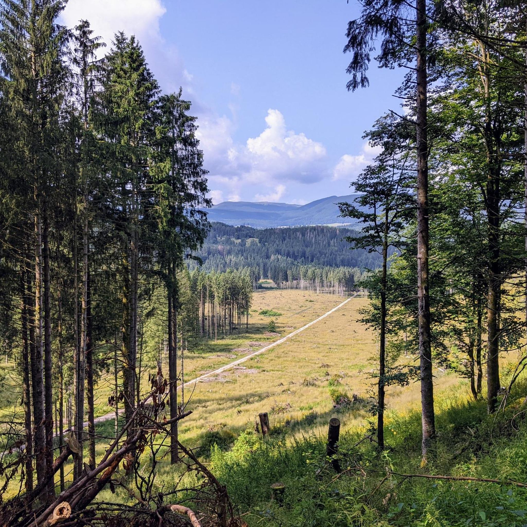
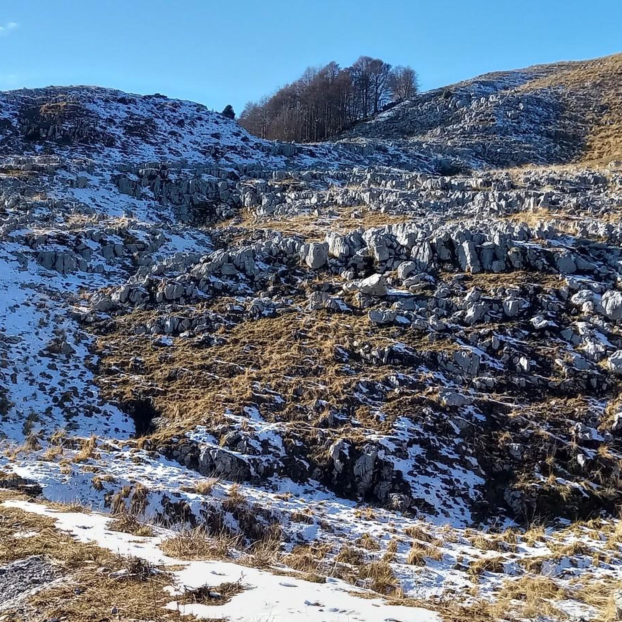
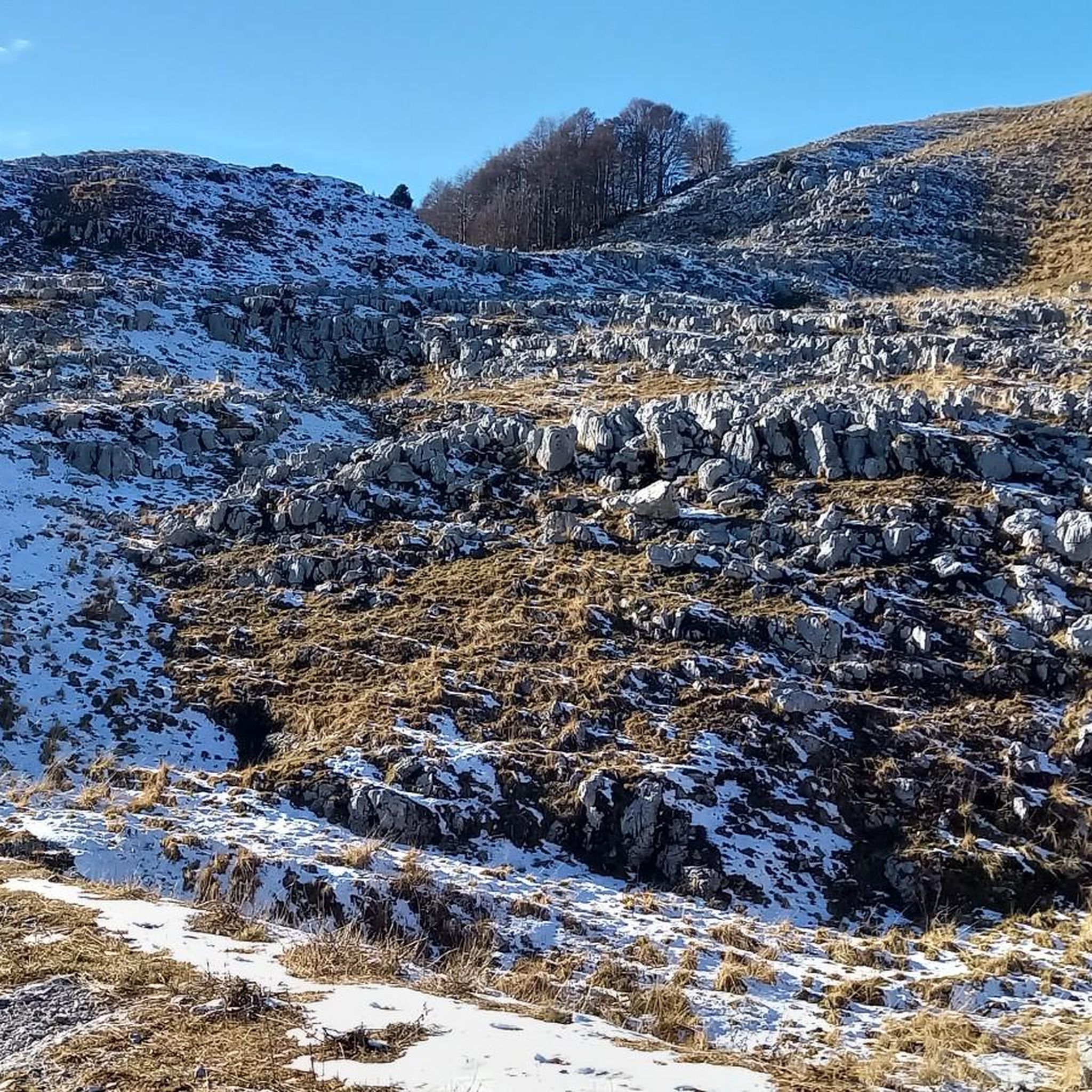
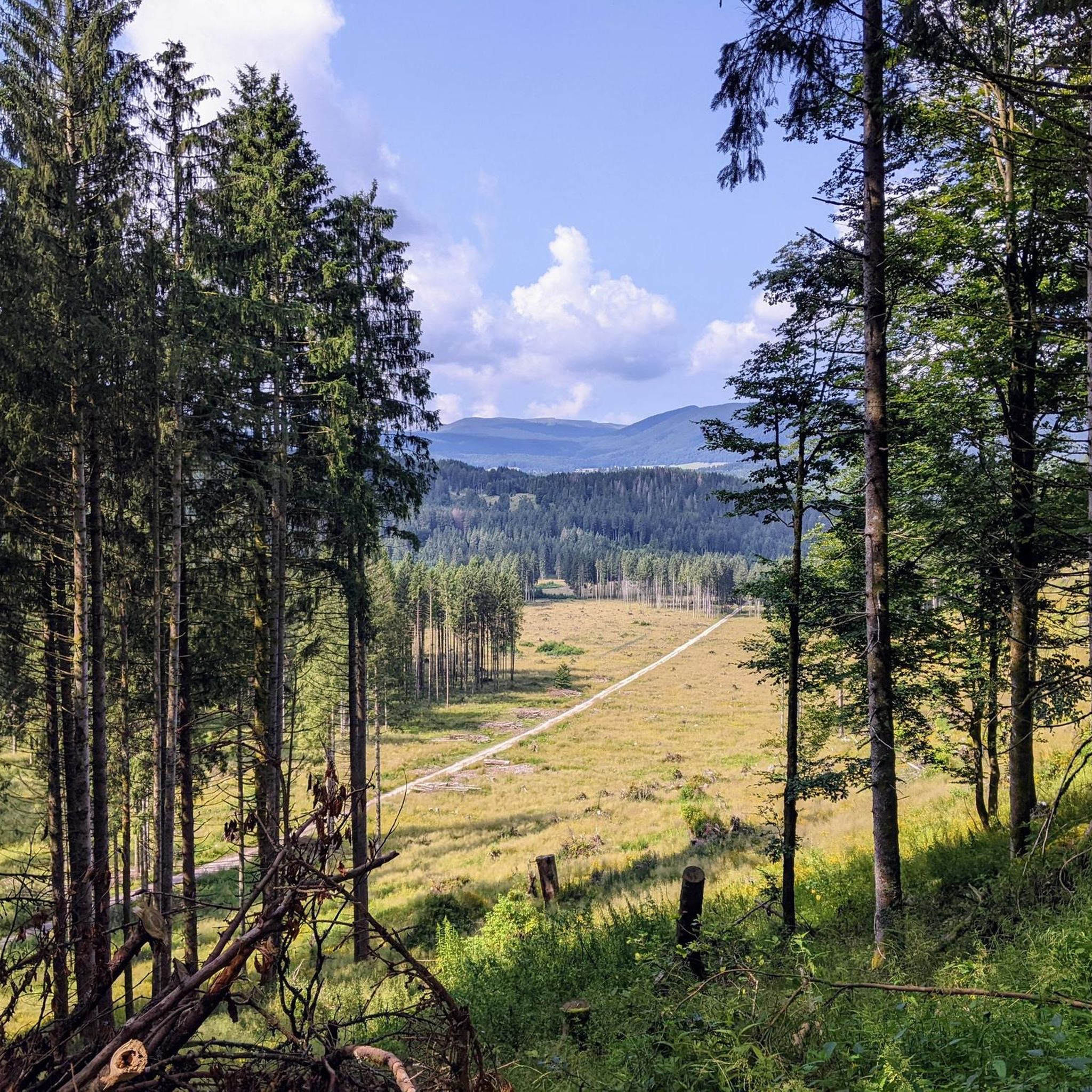
Hiking in Area Wilderness Croseraz-Val Bona, located in the Friulian Prealps, offers diverse landscapes for outdoor enthusiasts. The region is characterized by its position on the eastern Cansiglio Plateau, with Monte Croseraz reaching 1,694 meters above sea level. Higher elevations feature a karstic plateau dotted with small dolines, alongside subalpine beech forests, mixed forests, and expansive high-altitude meadows. This varied terrain provides a range of hiking experiences.
Best hiking trails in Area Wilderness Croseraz-Val Bona
- The most popular hiking route…
Last updated: July 4, 2026
4.5
(4)
9
hikers
6.07km
02:50
390m
390m
Moderate hike. Good fitness required. Mostly accessible paths. Sure-footedness required.
5.0
(2)
5
hikers
3.75km
01:30
200m
200m
Hard hike. Great for any fitness level. Sure-footedness, sturdy shoes and alpine experience required.

Sign up for free
5.0
(1)
6
hikers
3.74km
01:25
130m
130m
Moderate hike. Great for any fitness level. Mostly accessible paths. Sure-footedness required.
4.5
(8)
43
hikers
7.60km
05:52
700m
710m
Hard hike. Very good fitness required. Sure-footedness, sturdy shoes and alpine experience required.
5.0
(2)
7
hikers
9.51km
03:51
420m
420m
Moderate hike. Good fitness required. Mostly accessible paths. Sure-footedness required.
Get access to more routes and recommendations from other explorers.
Sign up for free
Already have an account?
Our route recommendations are based on thousands of hikes, rides, and runs completed by other people on komoot.
Start today with a free account
Your next adventure awaits.
Login or Signup
Popular around Area Wilderness Croseraz-Val Bona


Tips from the Community

crossroads of paths and excellent panorama
0
0


Crossing the ski slope, take the uphill path that leads to Landro delle Lamate and beyond. It's an easy hike, even suitable for children accustomed to walking.
0
0

Abandoned and in very bad condition, unusable. There are some remains of building material. Too bad, it is located in a small and beautiful valley.
0
0

With snow snow Col Cornier is a destination worth a visit.
0
0
Beautiful Cansiglo Plateau
0
0
Following the CAI 984 path down from Col Cornier allows you to enter an incredibly beautiful place that brings peace and becomes therapy for the mind and heart.
0
0
Frequently Asked Questions
How many hiking trails are available in Area Wilderness Croseraz-Val Bona?
There are over 570 hiking routes recorded in Area Wilderness Croseraz-Val Bona on komoot, offering a wide range of experiences. These include 125 easy routes, 331 moderate routes, and 118 difficult trails, catering to various fitness levels and preferences.
What kind of landscapes and natural features can I expect to see while hiking?
Area Wilderness Croseraz-Val Bona is characterized by its diverse natural features. You'll encounter subalpine beech forests, mixed forests with spruce and white fir, and high-altitude beech forests. The higher elevations feature a distinctive karstic plateau dotted with small, partially wooded dolines, snow valleys, and expansive high-altitude meadows. Monte Croseraz, at 1,694 meters, is the highest point.
Are there any challenging hikes for experienced trekkers?
Yes, for experienced alpine enthusiasts, the region offers challenging treks. The Alta Via dei Rondoi is a notable option, offering a ridge traverse that includes via ferrata sections and connects five peaks within the Friulian Prealps. This type of route requires very good fitness, sturdy footwear, and prior alpine experience.
Are there any circular hiking routes in Area Wilderness Croseraz-Val Bona?
Yes, many routes in the area are circular, often starting from Piancavallo. For example, the Baita Arneri – Casera Palantina loop from Piancavallo / Plancjaval is a popular moderate loop, and the Baita Arneri – Col Cornier loop from Piancavallo / Plancjaval is another well-liked option that leads through forested areas.
What is the best time of year to go hiking in this region?
The best time to hike in Area Wilderness Croseraz-Val Bona is generally from late spring to early autumn (May to October) when the weather is milder and trails are clear of snow. During these months, you can fully appreciate the diverse vegetation and wildlife. Higher altitude trails may still have snow patches in early spring.
What wildlife might I encounter on the trails?
The wilderness area is home to a rich variety of fauna typical of the Cansiglio region. Hikers might spot deer, roe deer, alpine hare, marten, capercaillie, black grouse, hazel grouse, ptarmigan, and rock partridge. Birdwatchers may also be lucky enough to see black woodpeckers, goshawks, eagle owls, and even golden eagles.
Are there any easy or beginner-friendly hiking trails?
Yes, the area offers numerous easy paths suitable for all skill levels. These routes, classified as SAC 1, typically involve up to 2 hours of hiking and around 300 meters (1,000 feet) of elevation gain. These are perfect for those new to hiking or looking for a relaxed walk.
What do other hikers say about Area Wilderness Croseraz-Val Bona?
The area is highly rated by the komoot community, with an average score of 4.4 stars from over 4,200 reviews. More than 19,000 hikers have used komoot to explore its varied terrain, often praising the diverse landscapes, well-maintained trails, and the sense of wilderness.
Is there public transport available to reach the hiking trailheads?
While specific public transport details to individual trailheads within the wilderness area are limited, the main access points like Piancavallo are generally more accessible. It's advisable to check local bus schedules or consider driving to reach the starting points for most hikes.
Are dogs allowed on the hiking trails?
As a wilderness area, it's generally expected that dogs are allowed on trails, but they should always be kept on a leash to protect the local wildlife and ensure the safety of other hikers. Always check for specific local regulations or signage at trailheads regarding pets.
Are there any specific safety considerations for hiking in this region?
Given the varied terrain, including karstic plateaus and higher elevations, hikers should be prepared for changing weather conditions. For more challenging routes, especially those with via ferrata sections like the Alta Via dei Rondoi, appropriate gear, experience, and sure-footedness are essential. Always carry sufficient water, navigation tools, and inform someone of your plans.
What types of forests will I hike through?
You will hike through a comprehensive range of forest types. These include typical subalpine beech forests, mixed forests featuring spruce and white fir, and as you ascend to higher altitudes, high-altitude beech forests. These diverse woodlands contribute significantly to the area's rich biodiversity.
Most popular routes in Area Wilderness Croseraz-Val Bona

Get inspired with the komoot mobile app


Explore more
Browse the best Hikes in other regions.
