The best MTB trails in Bardonecchia - Val Fredda
4.4
(1519)
9,960
riders
153
rides
Mountain bike trails in Bardonecchia - Val Fredda traverse a landscape characterized by alpine valleys, dense forests, and high mountain passes in the Italian Alps. The region offers varied terrain, from challenging ascents to flowing descents, with routes often following old military roads or scenic paths. Elevation changes are significant, providing diverse riding experiences across different altitudes. This area is known for its natural beauty and offers a robust network of mountain bike trails.
Best mountain bike trails in Bardonecchia…
Last updated: October 4, 2026
4.0
(3)
10
riders
13.1km
01:17
300m
300m
Easy mountain bike ride. Great for any fitness level. Suitable for all skill levels.
4.8
(49)
280
riders
31.6km
03:50
1,310m
1,310m
Hard mountain bike ride. Very good fitness required. Suitable for all skill levels.

4.7
(9)
52
riders
27.3km
03:44
1,250m
1,250m
Hard mountain bike ride. Very good fitness required. Advanced riding skills necessary. Some portions of the route may require you to push your bike.
4.9
(7)
34
riders
21.7km
02:03
580m
580m
Moderate mountain bike ride. Good fitness required. Advanced riding skills necessary.
4.3
(9)
99
riders
36.6km
04:26
1,500m
1,500m
Hard mountain bike ride. Very good fitness required. Advanced riding skills necessary. Some portions of the route may require you to push your bike.
Get access to more routes and recommendations from other explorers.
Already have an account?
Our route recommendations are based on thousands of hikes, rides, and runs completed by other people on komoot.
Start today with a free account
Your next adventure awaits.


Tips from the Community

Starting point of the fabulous military road of Pramand, which goes beyond the summit of Jafferau, up to Salbertrand
0
0

Currently completely empty, you could walk through.
0
0

Up to here, a large part of the descent is normally done while riding, although you have to be careful on the sections eroded by water and also pay a lot of attention to the many marmot burrows... beautiful traps!. Shortly after the beautiful stone with the Dauphiné symbol, which centuries ago, like now, marked the border, the path gradually begins to "disappear" into the valley, the technical sections begin!
0
0
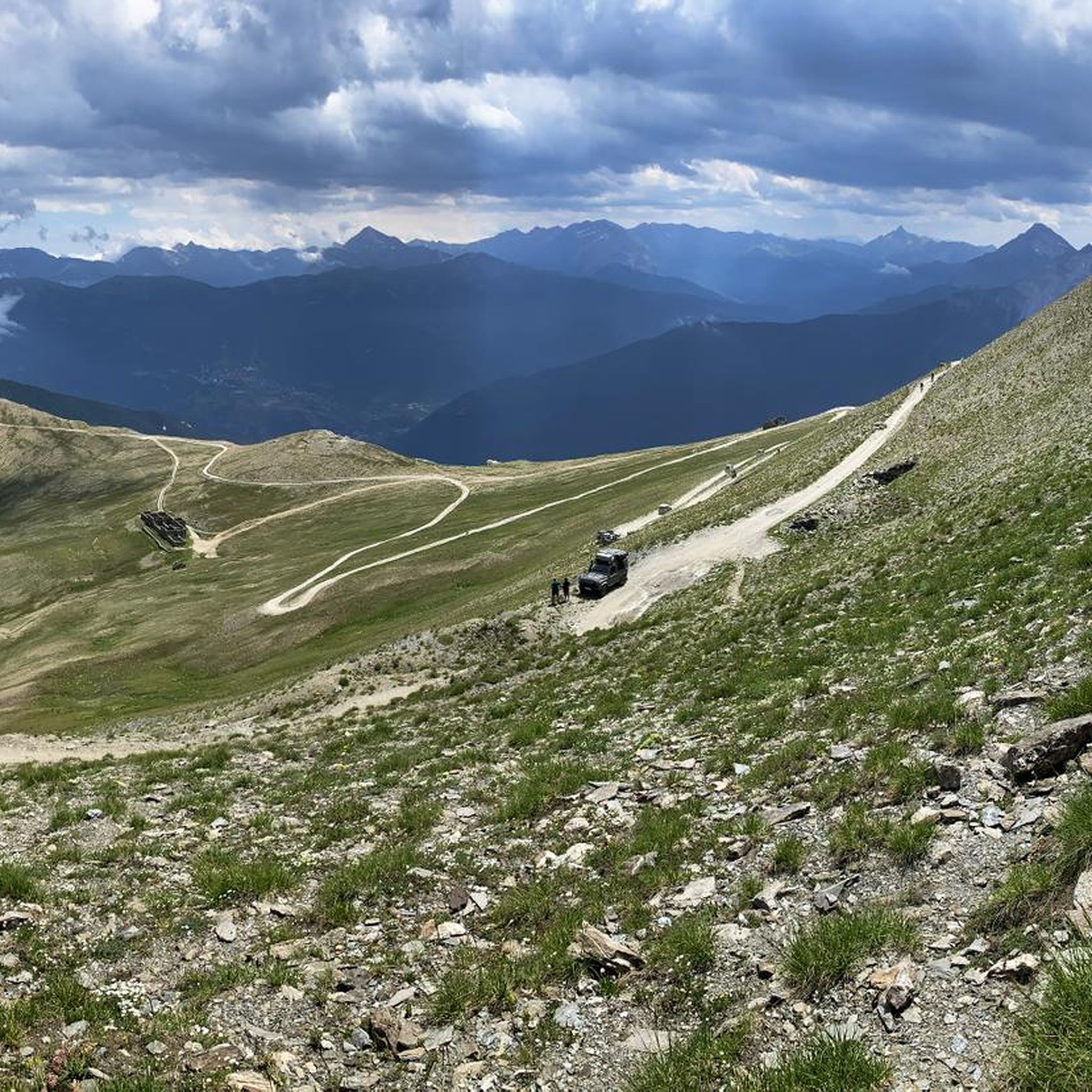
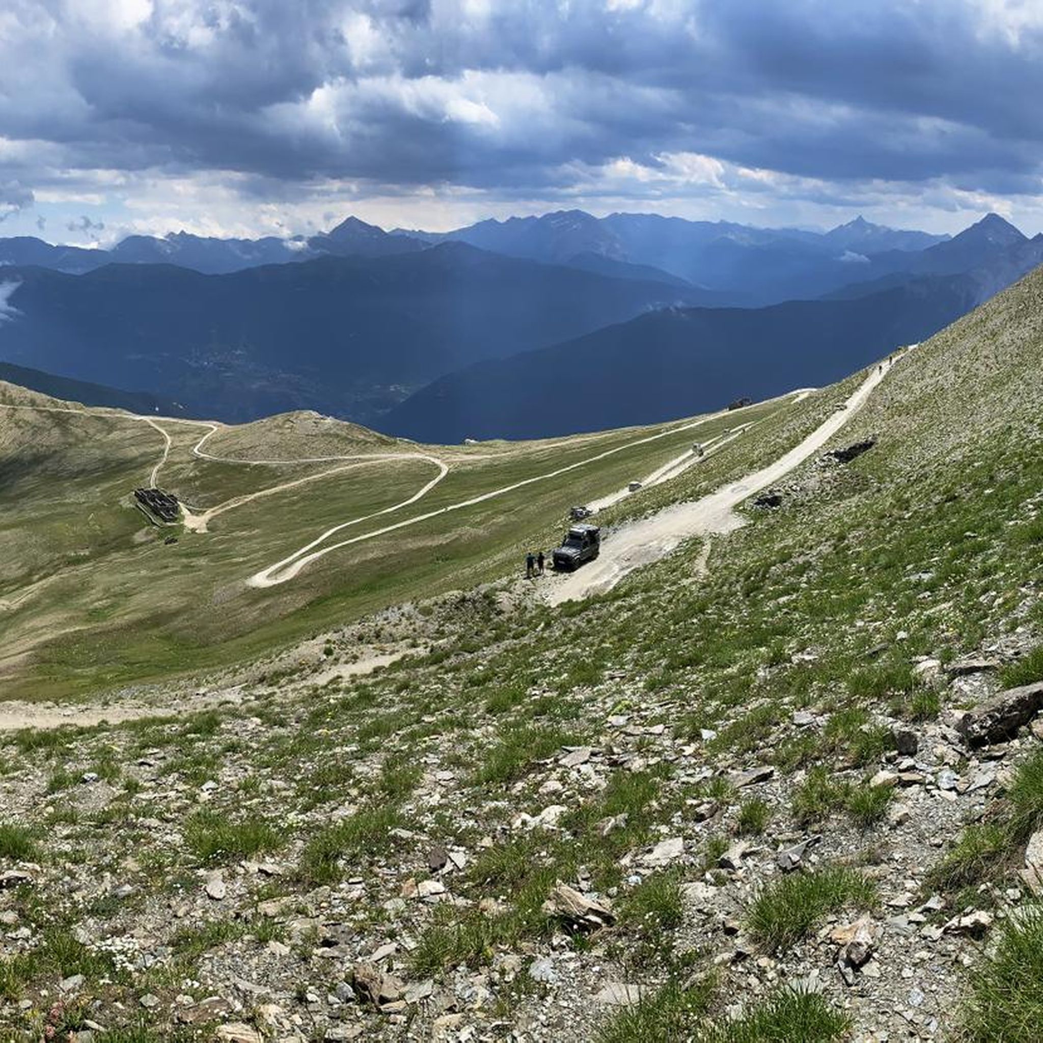
Once you reach the Colomion pass, this long traverse begins. Besides the ever-widening panorama as you ascend, it also offers less prohibitive gradients and long stretches, especially in the initial part, that are almost flat. If you've made it this far, you'll surely appreciate them!
0
0
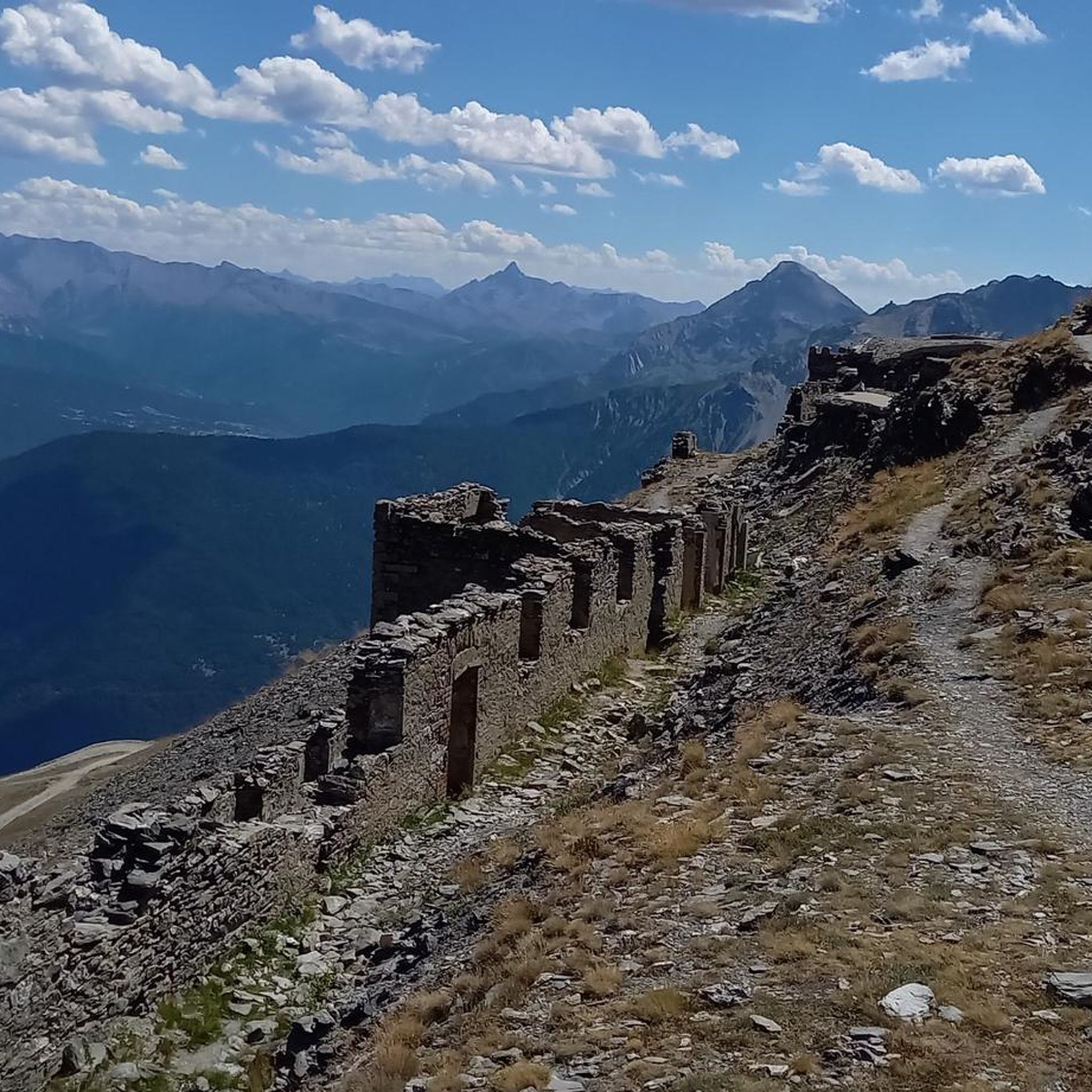
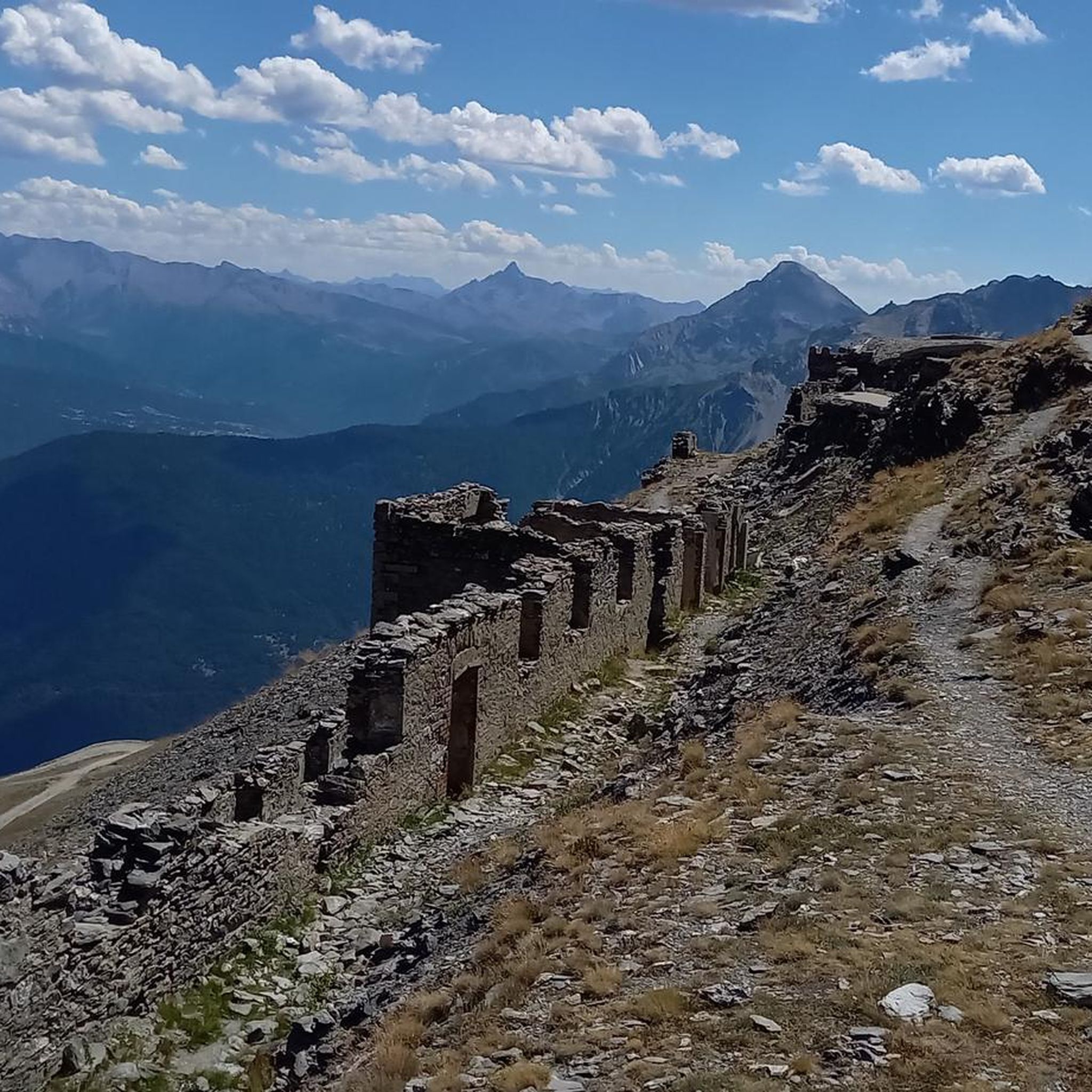
The fortification was erected between 1885 and 1894, with the aim of monitoring the outlet of the Frejus railway tunnel in anticipation of a possible French attack. During the First World War, its artillery was requisitioned and moved to the Austro-Hungarian front, while on the eve of the Second World War, it was incorporated into the fortified system of the Alpine Wall. It was then requisitioned by the Germans and completely dismantled after the end of hostilities. It remained abandoned for a long time, until, starting in 1995, a recovery project was initiated, still partly ongoing, equipping the structure with a museum and a guided tour. The road that reaches it from the valley floor is yet another demonstration of the construction skills of military engineering: the dirt road gains altitude with gentle hairpin bends, bordered by dry stone walls that are still perfectly in place. Near Grange Bersac, it passes a charming little church, shortly after the route leaves the woods and ends in wide meadows near another beautiful little church, dedicated to St. Anne. From here, the dirt road splits: straight ahead leads to Pian del Sole and the Bardonecchia MTB circuit, while climbing towards Colomion, turning right, a final short climb reaches the fort. The view of Guglia Rossa and the Re Magi (Three Wise Men) group, which dominate the Bardonecchia basin, is magnificent.
0
0

Nice climb on a wide and not too steep road...
0
0
It's the most scenic part of the descent. Incredible...
0
0
I haven't seen the monument but the landscape is stunning.
0
0
Frequently Asked Questions
How many mountain bike trails are there in Bardonecchia - Val Fredda?
Bardonecchia - Val Fredda offers a comprehensive network of over 150 mountain bike trails. These routes cater to various skill levels, with a significant number of challenging options for experienced riders.
What is the best time of year for mountain biking in Bardonecchia - Val Fredda?
The prime season for mountain biking in Bardonecchia - Val Fredda typically runs from late spring through early autumn (May to October). During these months, the weather is generally stable, and trails are clear of snow, offering optimal conditions for exploring the alpine terrain.
Are there any family-friendly mountain bike trails in Bardonecchia - Val Fredda?
Yes, there are several options suitable for families. While many trails involve significant elevation, some routes offer gentler gradients. For a moderate experience, consider the Wooden Water Fountain – Decauville loop from Bardonecchia, which is 8.2 miles (13.1 km) long and features a mix of forest paths.
Where can I find beginner mountain biking routes in Bardonecchia - Val Fredda?
While Bardonecchia - Val Fredda is known for its challenging terrain, there are around 12 easier routes available. These typically feature less elevation gain and smoother surfaces, ideal for those new to mountain biking or looking for a more relaxed ride. Look for routes marked as 'easy' on komoot.
What are some advanced mountain bike trails in Bardonecchia - Val Fredda?
For experienced riders seeking a challenge, Bardonecchia - Val Fredda boasts over 90 difficult trails. Routes like the Passo della Mulattiera e Col des Acles – giro ad anello, a 19.6 miles (31.6 km) trail with over 1300 meters of elevation gain, offer demanding ascents and technical descents through high mountain passes.
Are there circular mountain bike trails available?
Yes, many mountain bike trails in Bardonecchia - Val Fredda are designed as circular routes, allowing you to start and finish at the same point. Examples include the popular Rochemolles Lake and Dam – Refuge Scarfiotti loop from Rochemolles and the challenging Fort Föens da Beaulard – giro ad anello.
What kind of views can I expect on mountain bike trails in Bardonecchia - Val Fredda?
Mountain bike trails in Bardonecchia - Val Fredda offer diverse and stunning alpine views. You can expect panoramic vistas of high mountain passes, dense pine forests, and picturesque valleys. Many routes also feature views of historical fortifications and serene mountain lakes.
What are some interesting landmarks or attractions along the mountain bike trails?
The region is rich in historical and natural attractions. Along the trails, you might encounter sites like Fort Jafferau, an impressive historical fortification, or ride sections of the scenic Decauville Trail. Col Basset also offers notable viewpoints.
What do other mountain bikers enjoy most about mountain biking in Bardonecchia - Val Fredda?
The area is highly rated by the komoot community, with an average score of 4.5 stars from over 1100 reviews. Reviewers often praise the varied terrain, from challenging ascents to flowing descents, and the stunning alpine scenery that defines the region's trails.
Are there any trails that pass by a dam or lake?
Yes, the Rochemolles Lake and Dam – Refuge Scarfiotti loop from Rochemolles is a popular moderate trail that offers scenic views of the Rochemolles Lake and its dam, leading towards a mountain refuge.
Are there any routes that follow old military roads?
Many routes in Bardonecchia - Val Fredda utilize old military roads, which often provide a unique riding experience with historical context and access to high-altitude areas. These paths contribute to the varied terrain, offering both challenging climbs and scenic stretches.
What is the typical elevation gain on mountain bike trails in this region?
Elevation changes in Bardonecchia - Val Fredda are significant, reflecting its alpine nature. Even moderate trails can involve several hundred meters of climbing, while difficult routes often feature over 1000 meters of elevation gain, providing a robust workout and rewarding descents.
Most popular routes in Bardonecchia - Val Fredda
Most popular attractions in Bardonecchia - Val Fredda

Get inspired with the komoot mobile app


Explore more
Browse the best MTB trails in other regions.
