The best running trails in Pian Della Badia (Tiglieto)
4.3
(3)
299
runners
28
runs
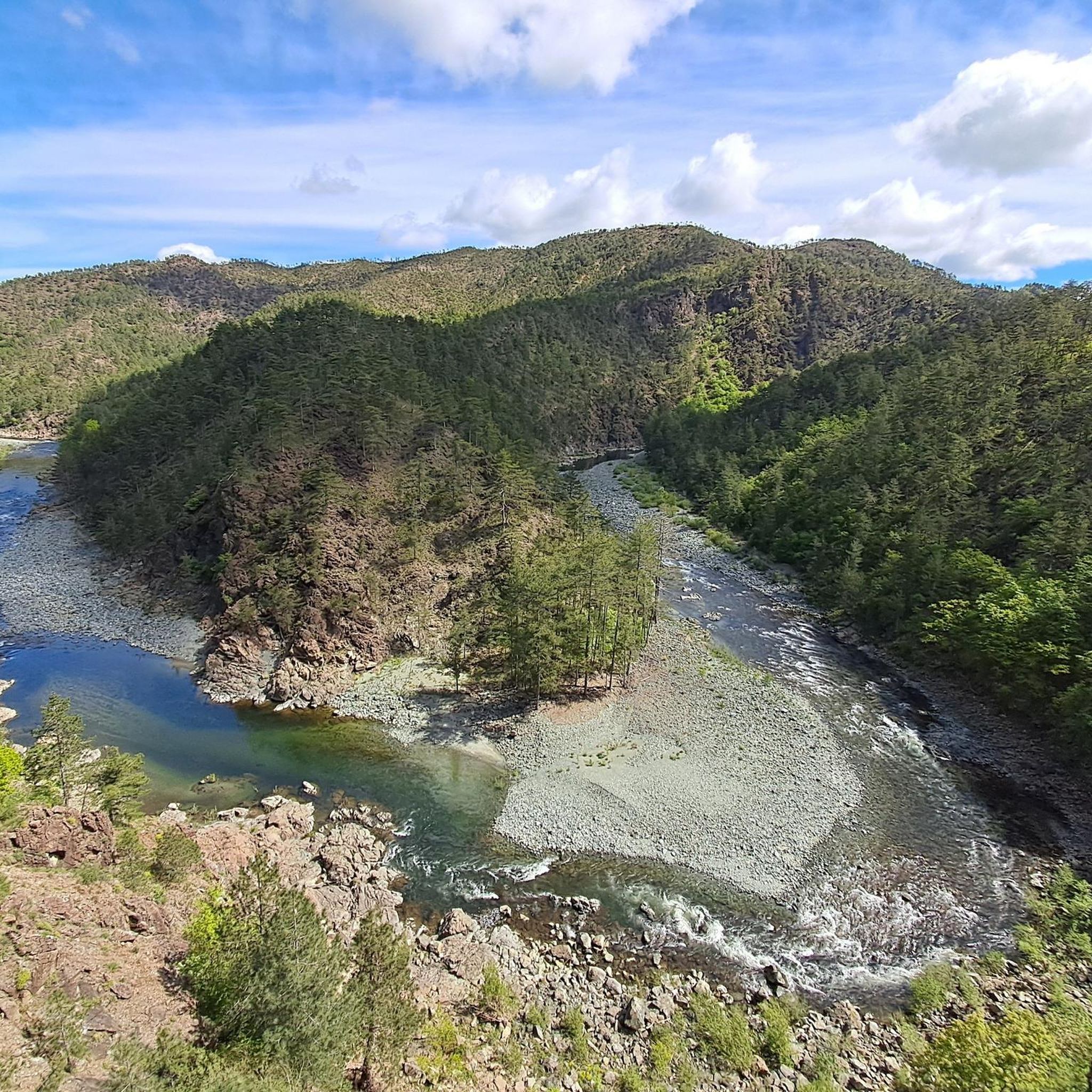
Jogging routes in Pian Della Badia (Tiglieto) traverse a diverse landscape within the Beigua Regional Natural Park. The region features a mix of forests, prairies, and ancient rock formations, with paths winding through beech and chestnut woods. The Orba river and its tributaries, including scenic canyons, add natural points of interest. Terrain varies from gentle slopes along the river to more challenging ascents.
Best jogging routes in Pian Della Badia (Tiglieto)
- The most popular jogging route is San Luca Church…
Last updated: July 13, 2026
6
runners
12.0km
01:41
480m
480m
Hard run. Very good fitness required. Sure-footedness, sturdy shoes and alpine experience required.
15.9km
02:15
630m
630m
Hard run. Very good fitness required. Sure-footedness, sturdy shoes and alpine experience required.

Sign up for free
19
runners
12.2km
01:20
270m
270m
Moderate run. Good fitness required. Mostly paved surfaces. Suitable for all skill levels.
13
runners
8.13km
01:01
300m
300m
Hard run. Very good fitness required. Sure-footedness, sturdy shoes and alpine experience required.
3.0
(1)
9
runners
10.1km
01:27
330m
330m
Hard run. Very good fitness required. Sure-footedness, sturdy shoes and alpine experience required.
Get access to more routes and recommendations from other explorers.
Sign up for free
Already have an account?
Our route recommendations are based on thousands of hikes, rides, and runs completed by other people on komoot.
Start today with a free account
Your next adventure awaits.
Login or Signup
Popular around Pian Della Badia (Tiglieto)
Tips from the Community

Very panoramic point from which you can see the sea!
0
0

It is usually open on weekends between May and September
0
0

The Argentea refuge, managed by volunteers from the CAI of Arenzano, is open for overnight stays every weekend from May to September and every day in August. For organized groups, there is the possibility of midweek openings by contacting the number 347 7115341
0
0

Remains of an ancient village now overgrown by vegetation. There is only one house restored by the Park, unfortunately not used to date.
0
0

It's worth getting there and then exploring the surroundings
0
0

The Faiallo pass is a pass in the Ligurian Apennines. 1044m above sea level
0
0

Beautiful refuge located a stone's throw from the top of Mount Argentea, at an altitude of 1,088 meters above sea level. It is managed by the CAI of Arenzano and is open from May to September on weekends.
2
0

Small shelter with a Madonna not far from the Argentea refuge
1
0
Frequently Asked Questions
How many running routes are available in Pian Della Badia (Tiglieto)?
Pian Della Badia (Tiglieto) offers a wide selection of running routes, with over 25 trails available for exploration. These routes traverse diverse landscapes within the Beigua Regional Natural Park.
What are the typical difficulty levels of running trails in this area?
The majority of running trails in Pian Della Badia (Tiglieto) are classified as difficult, with 22 such routes. There are also 4 moderate routes, but no easy routes are specifically listed. This means runners can expect varied terrain and significant elevation changes on most trails.
What is the best time of year for running in Pian Della Badia (Tiglieto)?
The best times to visit Pian Della Badia (Tiglieto) for outdoor activities like running are generally spring and autumn. During these seasons, the weather is pleasant, and the natural colors of the landscape are vibrant. Summer can also be suitable, especially if you wish to cool off in the clear waters of the streams.
Are there any family-friendly running routes in Pian Della Badia (Tiglieto)?
Yes, the region offers routes suitable for various fitness levels, including families. The Anello della Badia di Tiglieto is described as an easy to moderate excursion, making it ideal for a family run or walk. While specific family-friendly running routes are not detailed in the guide, the moderate trails can often be adapted for a family outing.
Can I bring my dog on the running trails in Pian Della Badia (Tiglieto)?
Pian Della Badia is located within the Beigua Regional Natural Park, which generally allows dogs on trails. However, it's always recommended to keep dogs on a leash to protect local wildlife and ensure a pleasant experience for all trail users. Please check specific park regulations for any restricted areas.
What kind of natural features or landmarks can I expect to see while running?
Runners in Pian Della Badia (Tiglieto) will encounter a rich variety of natural and historical sights. The routes wind through lush beech and chestnut woods, alongside the scenic Orba river and its tributaries, featuring canyons and river crossings, sometimes via ancient Romanesque bridges. The ancient Cistercian Abbazia di Santa Maria alla Croce is a significant historical landmark and often a starting point for trails.
Are there any running routes that offer scenic viewpoints?
Yes, some trails in Pian Della Badia (Tiglieto) offer rewarding views. While many routes traverse dense forests and river valleys, certain ascents, such as those leading towards Monte Poggio, provide panoramic vistas of the surrounding wild landscape and the Beigua Regional Natural Park.
Are there circular running routes available in Pian Della Badia (Tiglieto)?
Yes, circular routes are a popular option in the area. A notable example is the Anello della Badia di Tiglieto, which is a well-known circular excursion. Many of the routes listed on komoot, such as San Luca Church (Molare) loop from Bandita, are also designed as loops, allowing you to start and finish at the same point.
What do other runners enjoy the most about jogging in Pian Della Badia (Tiglieto)?
The running routes in Pian Della Badia (Tiglieto) are highly rated by the komoot community, with an average score of 4.0 stars. Runners often praise the diverse terrain, the serene atmosphere of the dense forests, and the picturesque river valleys. The mix of natural beauty and historical elements, like the ancient abbey, also contributes to a unique running experience.
Where can I find longer, more challenging running options in the area?
For runners seeking a challenge, Pian Della Badia (Tiglieto) offers numerous difficult routes. One such option is the Monte Argentea and Cima del Pozzo Loop from Vara Inferiore, which is nearly 10 miles long with significant elevation changes. Another challenging trail is the Val Gargassa Canyon – Veirera locality loop from Rossiglione, offering a demanding run through varied landscapes.
Are there any running trails that follow rivers or streams?
Absolutely. The Orba river and its tributaries are prominent features of the landscape in Pian Della Badia (Tiglieto). Many running routes, such as the Torrente Stura loop from Rossiglione, lead through river valleys and along the banks of streams, offering picturesque views and the soothing sounds of flowing water. You'll often encounter river crossings, adding to the adventure.
How long are the running trails in Pian Della Badia (Tiglieto) typically?
The running trails in Pian Della Badia (Tiglieto) vary significantly in length. You can find routes ranging from around 5 miles (8 km) to nearly 10 miles (16 km). For example, the Torrente Stura loop from Rossiglione is about 5 miles, while the Rio Berlino loop from Rossiglione is over 6.5 miles (10.6 km), providing options for different running preferences and fitness levels.
Most popular routes in Pian Della Badia (Tiglieto)

Get inspired with the komoot mobile app


Explore more
Browse the best Running Trails & Routes in other regions.
