The best running trails in Schwarze Berge
4.3
(355)
2,536
runners
244
runs
Jogging routes in Schwarze Berge navigate a landscape characterized by hilly and forested terrain, featuring a mix of woodlands and open meadows. The region includes valleys and several ponds, offering varied scenery for runners. These natural features provide diverse conditions, from gentle paths to areas with more significant elevation changes. The terrain offers invigorating ascents and descents, contributing to a comprehensive workout.
Best jogging routes in Schwarze Berge
- The most popular jogging route is Basalt Lake Tintenfass – View of…
Last updated: August 12, 2026
12
runners
Moderate run. Good fitness required. Mostly paved surfaces. Suitable for all skill levels.
3.3
(3)
8
runners
8.79km
01:07
320m
320m
Hard run. Very good fitness required. Mostly paved surfaces. Suitable for all skill levels.

Sign up for free
5.0
(1)
8
runners
25.4km
03:00
640m
640m
Hard run. Very good fitness required. Mostly paved surfaces. Suitable for all skill levels.
8
runners
13.1km
01:36
230m
230m
Moderate run. Good fitness required. Mostly paved surfaces. Suitable for all skill levels.
4
runners
7.99km
00:54
150m
150m
Moderate run. Good fitness required. Mostly paved surfaces. Suitable for all skill levels.
Get access to more routes and recommendations from other explorers.
Sign up for free
Already have an account?
Our route recommendations are based on thousands of hikes, rides, and runs completed by other people on komoot.
Start today with a free account
Your next adventure awaits.
Login or Signup
Popular around Schwarze Berge

Extra tours South - Excellent premium hiking trails of the Rhön

Discover Rhön - Half-day tours through the biosphere reserve

Naturlehrpfade – Natur und Wissen

Hiking in the Rhön Mountains where nature and history combine
Hiking in Schwarze Berge
MTB Trails in Schwarze Berge
Cycling in Schwarze Berge
Road Cycling Routes in Schwarze Berge

Gravel biking in Schwarze Berge

Mountain Hikes in Schwarze Berge
Other adventures in Schwarze Berge


Tips from the Community

The Kreuzberg in the Rhön has always attracted people as a place of power. In pre-Christian times, there was a sacred ash tree there, which is remembered by the old name "Aschberg". Since the Christianization of the Franks by St. Kilian and his companions in the year 686, the Kreuzberg has been considered the Holy Mountain of the Franks. The monastery, located just below the summit, was founded in 1644 by Franciscan monks. The pilgrimages are popular with the population, both from the surrounding area and traditionally from the Lower Franconian district town of Würzburg, which makes the long journey on foot to the pilgrimage church every year. Quelle: https://www.biosphaerenreservat-rhoen.de/mensch/tourismus-gastronomie-und-erholung/schaetze-der-rhoen/der-kreuzberg
1
0

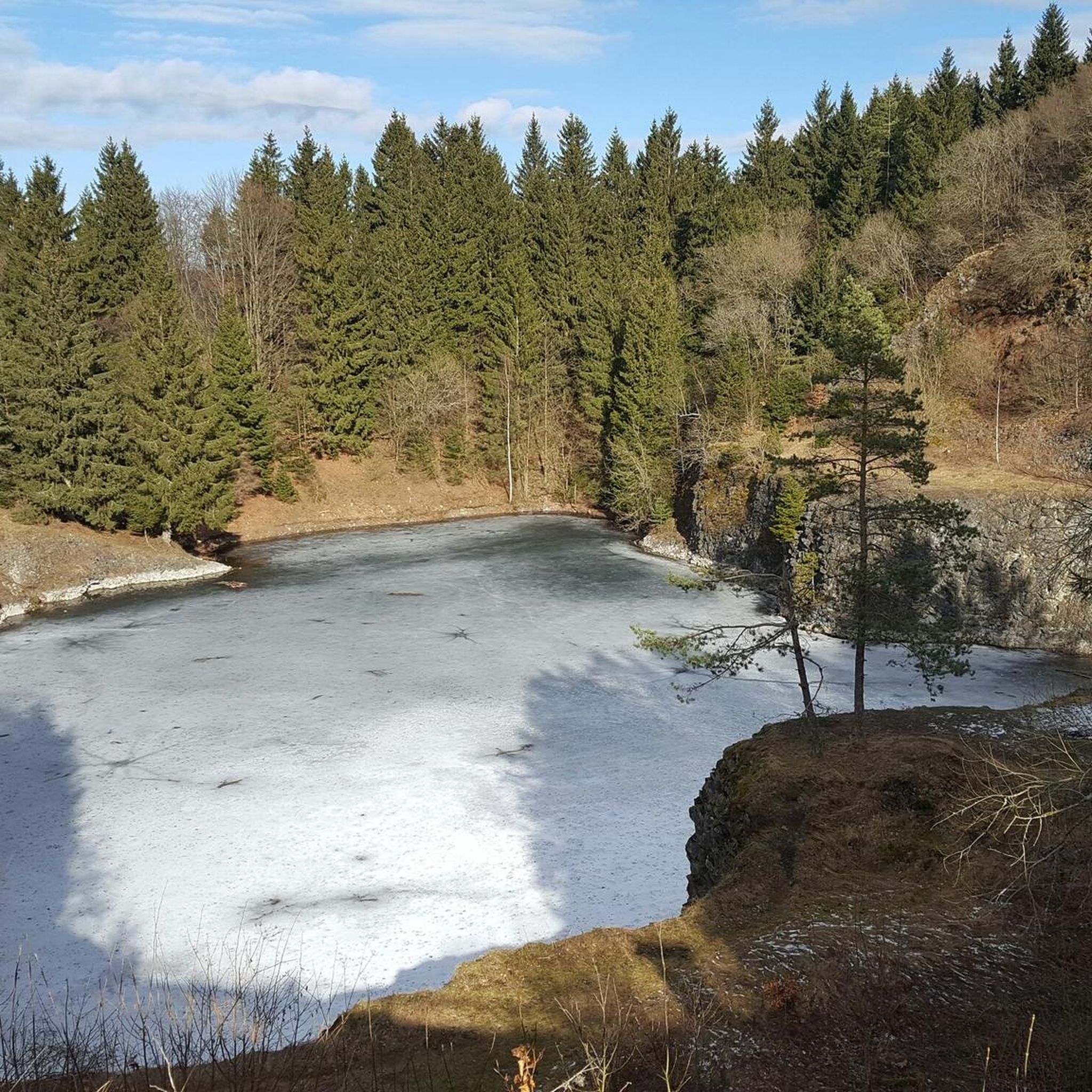
Great stone embankment, made by nature :)
0
0

Directly below the Kreuzberg is a paid hiking parking lot. From there it is only about 400 meters to the Kreuzberg monastery. Via a steep staircase, you reach the Kreuzberg (928 m above sea level). On the way, you pass three oversized crosses that represent striking waypoints. A little further up, you finally reach the even larger summit cross of the mountain. The location is part of the Bischofsheimer Gipfel-Pass with stamp number 3 (directly next to the cross pedestal).
1
0

The transmission tower from Kreuzberg can be seen in good visibility (from the top right) 😊
0
0


I really hope the hut will be rebuilt 😫 https://osthessen-news.de/n11773753/kissinger-huette-steht-in-flammen-buergermeisterin-reubelt-mir-blutet-das-herz.html
1
0

Is only open occasionally
0
0
Frequently Asked Questions
What kind of terrain can I expect on the running trails in Schwarze Berge?
The Schwarze Berge region is characterized by hilly and forested terrain, featuring a diverse mix of woodlands and open meadows. You'll find trails winding through valleys and past several ponds, offering varied scenery. Some areas include steep inclines, providing a challenging workout, while others offer more moderate paths.
Are there many running routes to choose from in Schwarze Berge?
Yes, the Schwarze Berge area offers a wide selection of routes. There are over 200 running trails available, catering to various fitness levels, from easy paths to more challenging routes with significant elevation changes.
What do other runners enjoy most about jogging in Schwarze Berge?
The running routes in Schwarze Berge are highly rated by the komoot community, with an average score of 4.3 stars. Runners often praise the diverse landscapes, the tranquility of the forests, and the engaging experience of navigating the hilly terrain. Over 1700 runners have used komoot to explore the area.
Are there any family-friendly jogging routes in Schwarze Berge?
While specific 'family-friendly' routes are not explicitly detailed, the region's diverse trail network includes paths through lush forests and open meadows, which can be suitable for families. The presence of well-maintained trails and varied scenery allows for enjoyable outings. For a moderate option, consider the Würzburger Karl-Straub-Haus – View from Feuerberg loop from Schwarze Berge, which is 7.7 miles (12.4 km) long.
Can I bring my dog on the running trails in Schwarze Berge?
Yes, the Wildpark Schwarze Berge, which is central to the region, is generally dog-friendly. Dogs are allowed on a short leash throughout most of the park, making it a great option for those who enjoy running with their canine companions. However, dogs are typically not permitted in petting enclosures or flight show areas.
Are there any circular running routes in Schwarze Berge?
Many of the running routes in Schwarze Berge are designed as loops, offering convenient circular options. For example, the popular Basalt Lake Tintenfass – View of the Teufels Tintenfass loop from Riedenberg is a 5.4-mile (8.7 km) circular trail with notable elevation gains.
What natural landmarks or viewpoints can I see while running in Schwarze Berge?
The region offers several natural landmarks and viewpoints. You can run past the picturesque Basalt Lake Tintenfass or explore trails near the Platzer Kuppe summit. The View of the Rhön from the Würzburger Haus also offers stunning panoramic views. The Elbe Observation Tower (Elbblickturm) in the Wildpark provides panoramic views of Hamburg and the Elbe glacial valley, which could be a scenic addition to a run.
Are there any challenging long-distance running trails in Schwarze Berge?
Absolutely. For runners seeking a significant challenge, the Kreuzberg Monastery – Kreuzberg Summit Cross loop from Schwarze Berge is a difficult 15.8-mile (25.4 km) path that traverses varied terrain with substantial ascents, perfect for long-distance training.
What are the options for easy or beginner-friendly running routes?
While many routes feature hills, Schwarze Berge also offers easier options. Out of over 200 routes, 31 are classified as easy, providing gentler paths suitable for beginners or those looking for a less strenuous run. These routes typically wind through lush forests and open meadows, offering a pleasant experience without extreme elevation.
Is there public transport access to the running trails in Schwarze Berge?
The Schwarze Berge region, particularly the Wildpark Schwarze Berge, is accessible. While specific public transport stops directly at trailheads are not detailed, the area is generally well-connected, allowing visitors to reach the starting points of various running routes. It's advisable to check local transport schedules for the most convenient access points.
Are there places to stop for refreshments or shelter along the routes?
Yes, there are huts and cabins in the Schwarze Berge region that can serve as points for refreshments or shelter. Notable options include the Würzburger Karl-Straub-Haus and the Rhön Mountain Lodge. These can be convenient stops during or after your run.
What is the best time of year to go jogging in Schwarze Berge?
Schwarze Berge offers enjoyable running conditions throughout much of the year. The lush forests provide ample shade, making it pleasant even on warmer days in spring and summer. Autumn brings beautiful foliage, while well-maintained trails can also be suitable for winter jogging, depending on snow conditions. The varied terrain ensures an engaging experience in any season.
Most popular routes in Schwarze Berge
Most popular attractions in Schwarze Berge

Get inspired with the komoot mobile app


Explore more
Browse the best Running Trails & Routes in other regions.
