Boyneburg Und Schickeberg Bei Breitau
Boyneburg Und Schickeberg Bei Breitau
The best walks and hikes in Boyneburg Und Schickeberg Bei Breitau
4.7
(3293)
9,729
hikers
646
hikes
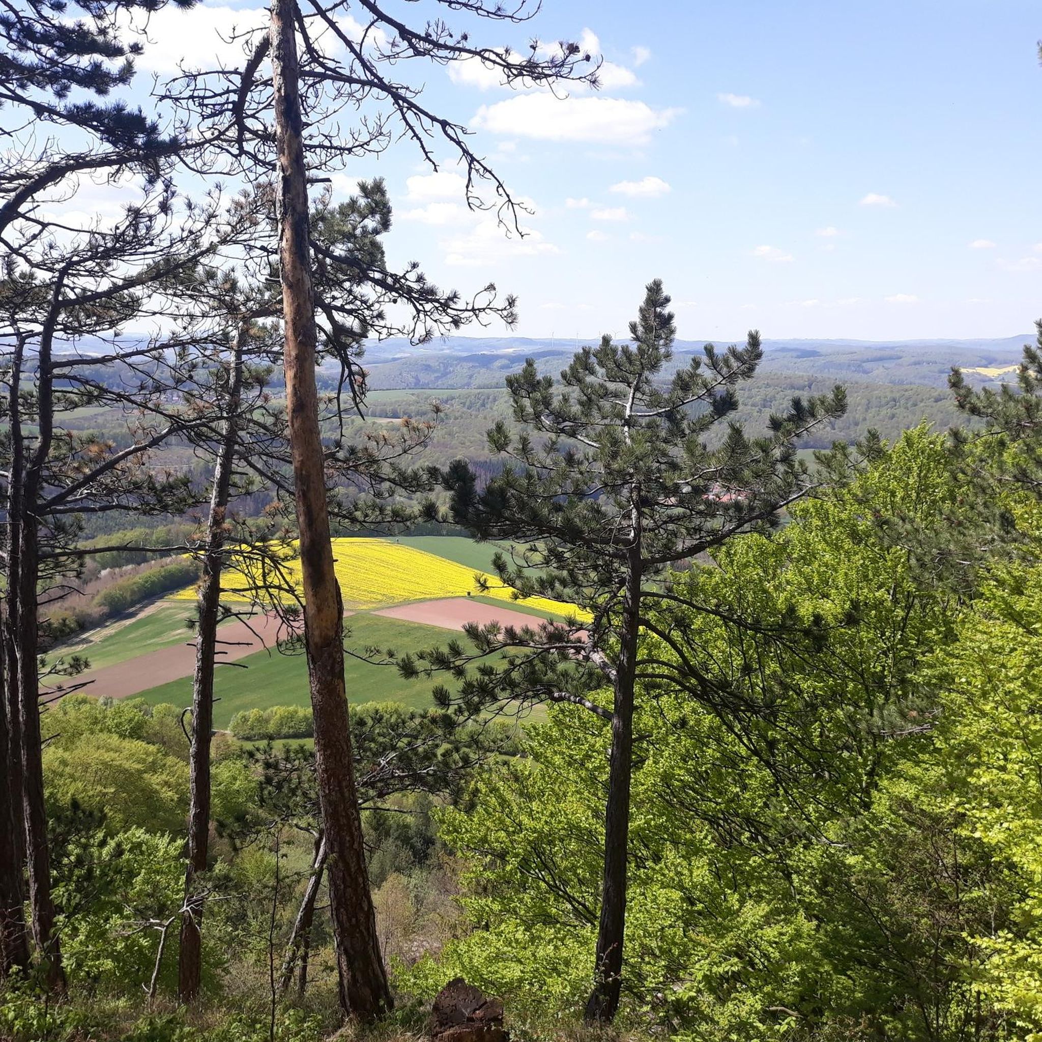
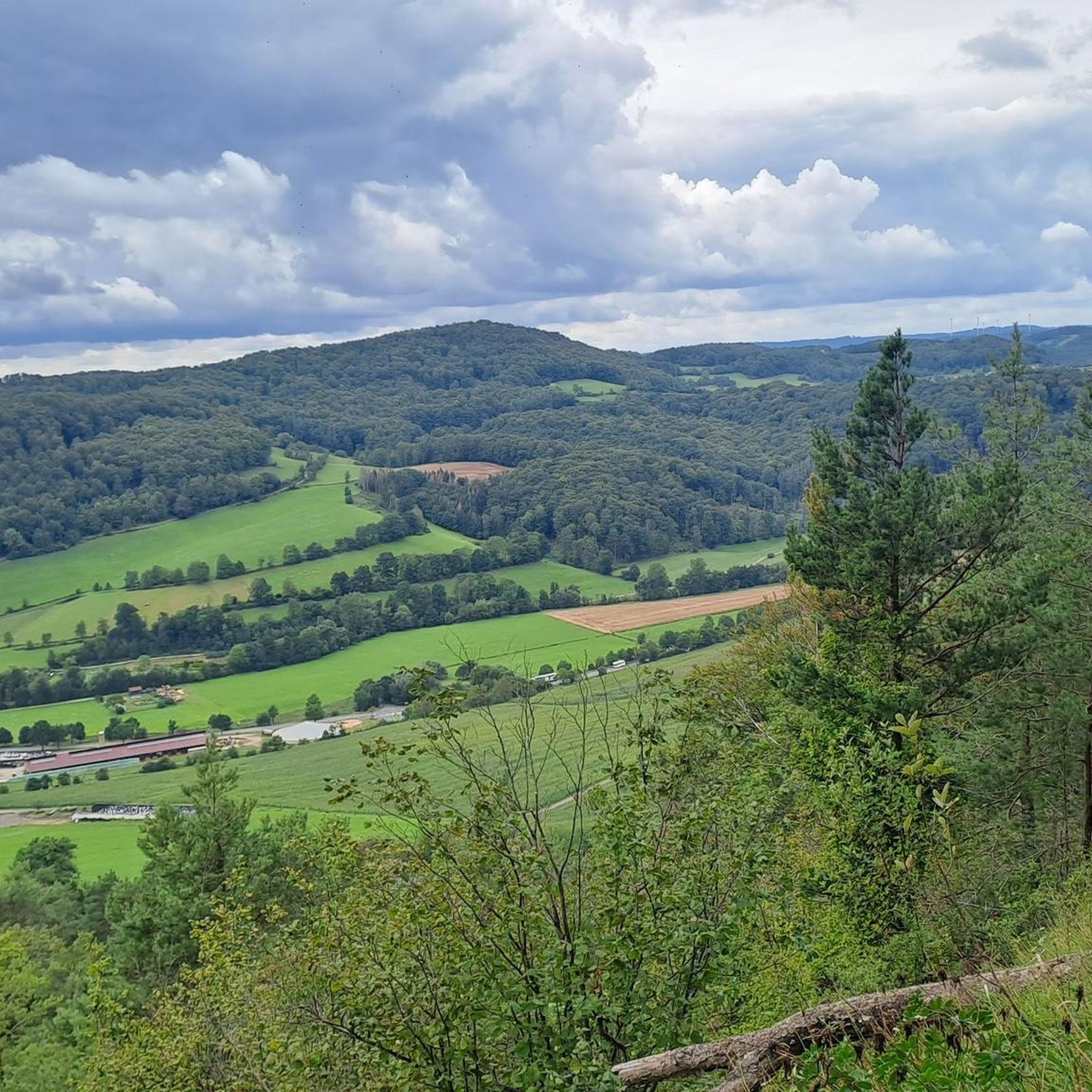
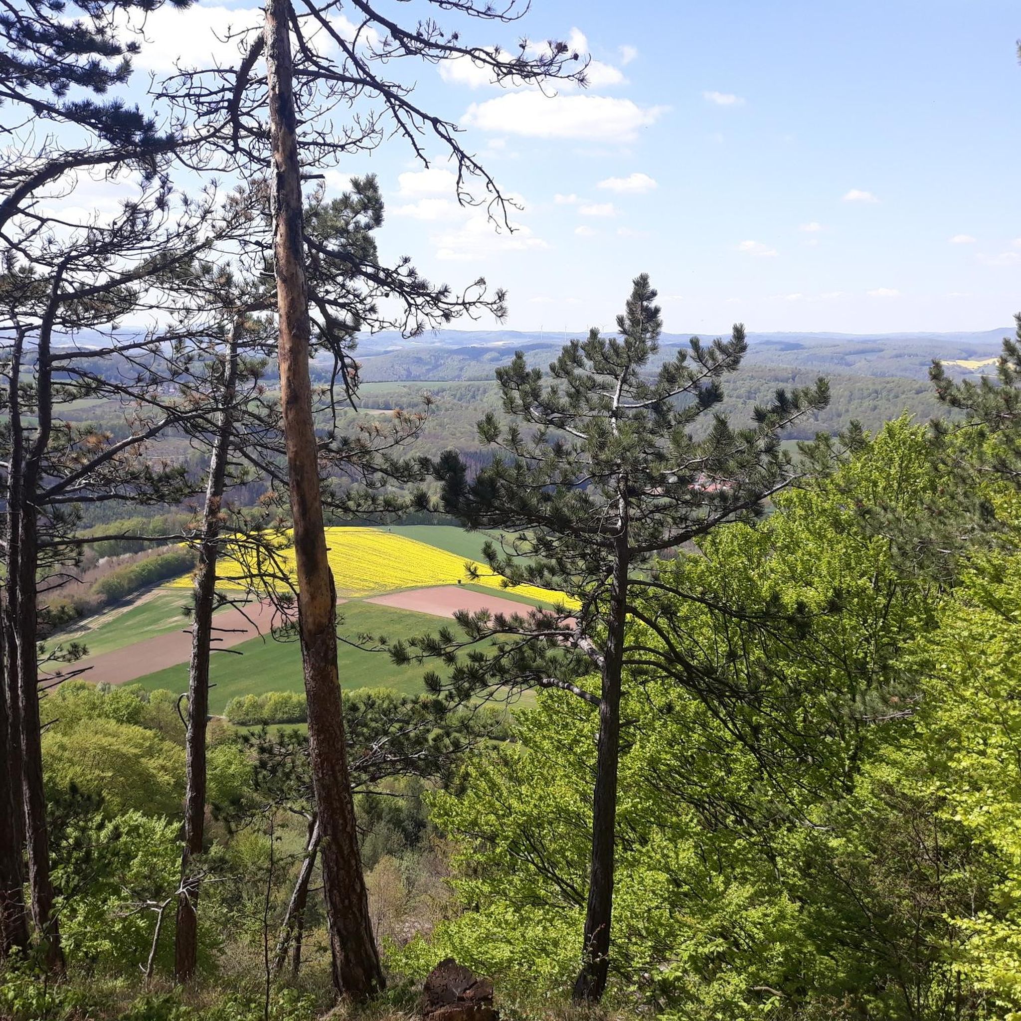
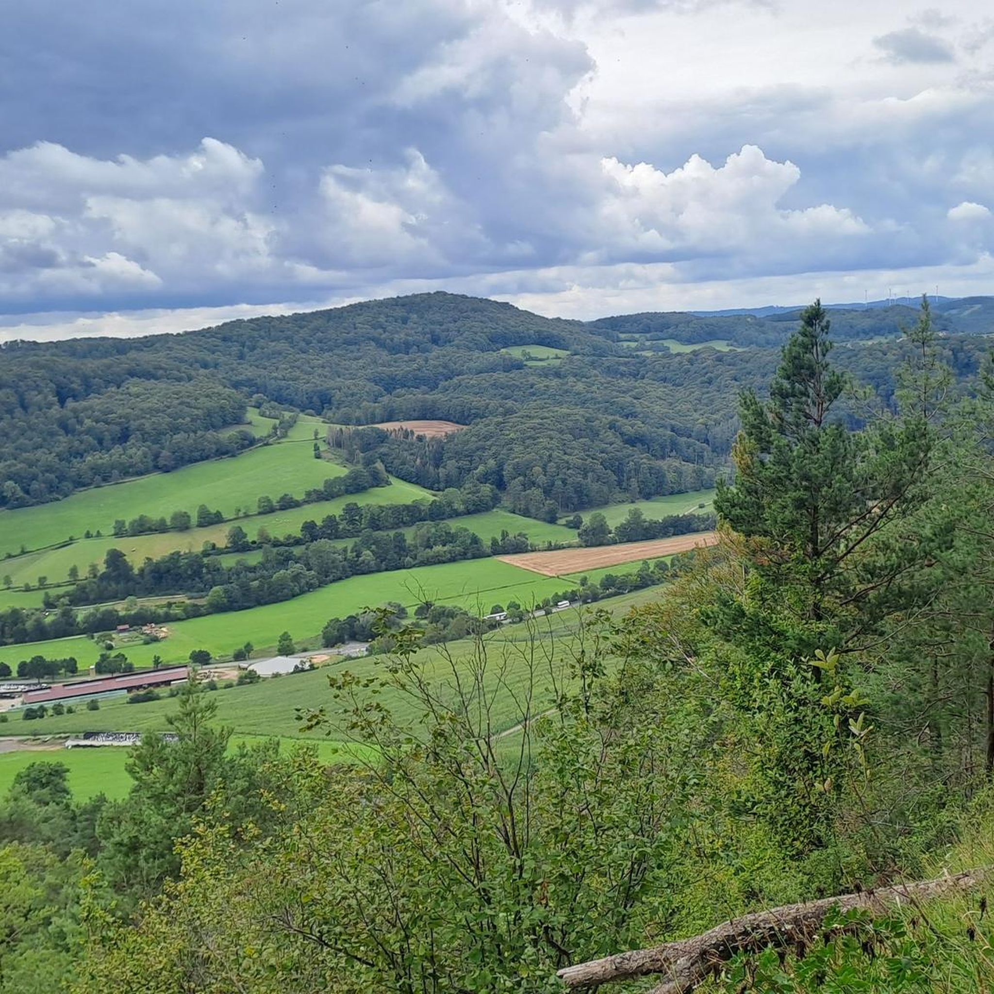
Hiking in Boyneburg Und Schickeberg Bei Breitau offers diverse landscapes within a designated nature reserve and Fauna-Flora-Habitat area. The region is characterized by prominent elevations like Boyneburg (513 m) and Schickeberg (500.2 m), dramatic cliff formations, and unique, near-primeval forests. Hikers will encounter varied terrain, including Hesse's largest active rockfall region, which contributes to its rugged beauty and rich biodiversity.
Best hiking trails in Boyneburg Und Schickeberg Bei Breitau
- The most popular hiking route is Rest Area Drei Linden –…
Last updated: July 12, 2026
4.9
(142)
493
hikers
15.5km
04:28
380m
380m
Moderate hike. Good fitness required. Easily-accessible paths. Suitable for all skill levels.
4.8
(8)
35
hikers
Easy hike. Great for any fitness level. Easily-accessible paths. Suitable for all skill levels.

Sign up for free
4.2
(5)
10
hikers
Easy hike. Great for any fitness level. Easily-accessible paths. Suitable for all skill levels.
5.0
(4)
20
hikers
10.6km
03:05
280m
280m
Moderate hike. Good fitness required. Easily-accessible paths. Suitable for all skill levels.
4.8
(4)
8
hikers
Hard hike. Very good fitness required. Easily-accessible paths. Suitable for all skill levels.
Get access to more routes and recommendations from other explorers.
Sign up for free
Already have an account?
Our route recommendations are based on thousands of hikes, rides, and runs completed by other people on komoot.
Start today with a free account
Your next adventure awaits.
Login or Signup
Tips from the Community

🐴🌺🛏️The poppy fields near Grandenborn were not yet in full bloom, only a pretty flower showed itself here and there. The huge "Trojan Horse" next to the poppy field was already peeking out from afar. We actually checked in at the bed in the "corn-no-poppy field" and already took a lying sample🛌🏼. Unfortunately, the old TV set placed in front of it was broken 📺, so we cancelled again...😉.
0
0

Hiking parking lot above Grandenborn. Ideal starting point for the premium trail P13 or also for a short walk to the Boyneburg (approx. 1.6 km from here)
0
0

It's easy to see from a distance, but when you walk past it, it's truly impressive.
0
0

By the end of the 1980s, pastoral farming had declined due to the mechanization of green fodder production, and water supply for grazing cattle was no longer needed. The "horse," however, remained, albeit without agricultural use. It was rebuilt into its current figure in 2012.
1
0

Beautiful starting point for a floral expedition
1
1

Trojan Horse: On a hill south of Grandenborn, the "Trojan Horse" can be seen even from a great distance. It is unique and one of the town's most striking landmarks. In the 1960s, not only were horses replaced by tractors as draft animals, but there was also an increasing focus on dairy farming, which was actively promoted by the still-young European Community. Meadows were converted into pastures by fencing. In summer, the animals remained on the pasture overnight, just like on alpine pastures, until autumn. The farmers' investments were supported with subsidies from the EC's "Green Plan" funding program. This also included providing water for the animals. To transport the necessary drinking water for the grazing animals up to a distance of almost three kilometers during the grazing season, a water pipeline network was built in the pastureland. A pasture water cooperative handled the financial aspects. The existing reservoir above the dairy farm, north of Grandenborn, was located at 436 meters above sea level, too low to pump water to and across the pastures of the Büch. Consequently, an additional pumping station and a larger water reservoir had to be installed "Auf dem Büch" (452 meters above sea level). Due to its shape, this water reservoir has always been referred to as a "horse" or even a "Trojan horse." At the end of the 1980s, pasture farming declined due to the mechanization of forage production, and the water supply for grazing livestock was no longer needed. However, the "horse" remained, albeit without agricultural use, and in 2012 was transformed into the current sculpture of the "Trojan Horse of Grandenborn." Hiking Club P13 - Boyneburg
1
1

The ruins can be hiked from different directions and with different levels of difficulty. It is part of the P13 and from the Boyneburg hiking car park (Grandenborn)
1
0
Very beautiful old ruin and well-maintained hiking trails. The ruin can be hiked from different directions and with various levels of difficulty. It is part of the P13 and can be reached from the Boyneburg hiking car park (Grandenborn)
2
0
Frequently Asked Questions
How many hiking trails are available in Boyneburg Und Schickeberg Bei Breitau?
Boyneburg Und Schickeberg Bei Breitau offers a comprehensive network of nearly 700 hiking trails. These routes cater to all abilities, with over 360 easy trails, 275 moderate options, and 26 more challenging treks for experienced hikers.
What kind of landscapes can I expect to see while hiking in this region?
The region is characterized by a remarkable combination of diverse landscapes. You'll encounter prominent elevations like Boyneburg (513 m) and Schickeberg (500.2 m), dramatic cliff formations, and unique, near-primeval forests. It's also Hesse's largest active rockfall region, contributing to its rugged beauty and rich biodiversity.
Are there any historical landmarks or attractions to explore along the trails?
Yes, the area is rich in history. A central attraction is the Boyneburg Castle Ruins, the remains of a legendary imperial castle with ties to Friedrich I Barbarossa. You can also find the Boyneburg Rocky Gorge and the historic Boyneburg estate nearby.
Are there any family-friendly hiking options in Boyneburg Und Schickeberg Bei Breitau?
Absolutely. The region has numerous easy walks perfect for families. For instance, the Boyneburg Castle Ruins – Boyneburg Castle Ruins loop is an easy 3.5 km trail through diverse woodlands, often completed in about an hour, making it ideal for families with children.
What are some notable natural features or viewpoints in the area?
Boyneburg Und Schickeberg Bei Breitau is a nature reserve and Fauna-Flora-Habitat area. You can experience dramatic cliff formations like those at Schickeberg and the 'Zehn-Uhr-Klippen'. The Karst Spring Renda Valley Ditch – Struth Viewpoint loop offers varied scenery, including a natural spring and a viewpoint with stunning vistas of the surrounding valleys.
Are there circular hiking routes available?
Yes, many routes in the region are circular, offering convenient starting and ending points. A popular easy option is the Knight’s Path on the Schickeberg – Rest Area Drei Linden loop, which is about 5.5 km long. For a longer moderate option, consider the Rest Area Drei Linden – Boyneburg Castle Ruins loop.
What is the best time of year to go hiking in Boyneburg Und Schickeberg Bei Breitau?
The region's diverse forests and natural features make it appealing across seasons. Spring and autumn offer vibrant colors and comfortable temperatures. Summer is excellent for exploring the shaded woodlands, while winter can provide unique snowy landscapes, though some paths might be more challenging.
What makes the forests in Boyneburg Und Schickeberg Bei Breitau unique?
The forests here are particularly special due to the region's geological characteristics, especially in rugged areas with steep slopes. These conditions foster unique, near-primeval forests with rich biodiversity, providing habitats for rare plant and animal species. A significant, Hesse-wide important yew tree population also grows on natural sites within these forests.
What do other hikers say about the trails in Boyneburg Und Schickeberg Bei Breitau?
The trails in Boyneburg Und Schickeberg Bei Breitau are highly rated by the komoot community, with an average score of 4.7 stars from over 3,000 reviews. Hikers often praise the varied terrain, the historical significance of the Boyneburg Castle Ruins, and the natural beauty of the protected area.
Can I observe wildlife in Boyneburg Und Schickeberg Bei Breitau?
As a Natura 2000 site, the area is dedicated to conserving various habitat types, supporting a rich array of wildlife. This includes bird species like the Tengmalm's Owl, Stock Dove, Black Woodpecker, and Red Kite, as well as the Greater Mouse-eared Bat, making it an excellent spot for wildlife observation, especially in the unique forest ecosystems.
Are there any longer, more challenging hikes for experienced trekkers?
Yes, for those seeking a greater challenge, the region offers more demanding treks. While not explicitly listed in the provided routes, the Premium hiking trail P13 is known to be a 17 km circular route through the protected area, featuring various elevation changes. You can find a trailhead for this route at P13 Trailhead Grandenborn.
Where can I find parking for the hiking trails?
Parking is available at various points around the region. The Rest Area Drei Linden is a common starting point for several routes, and the P13 Trailhead Grandenborn also offers parking facilities, providing convenient access to the trails.
Most popular routes in Boyneburg Und Schickeberg Bei Breitau
Most popular attractions in Boyneburg Und Schickeberg Bei Breitau

Get inspired with the komoot mobile app


Explore more
Browse the best Hikes in other regions.
