The best walks and hikes in Naturschutzgebiet Leckfeld
4.5
(718)
2,771
hikers
264
hikes
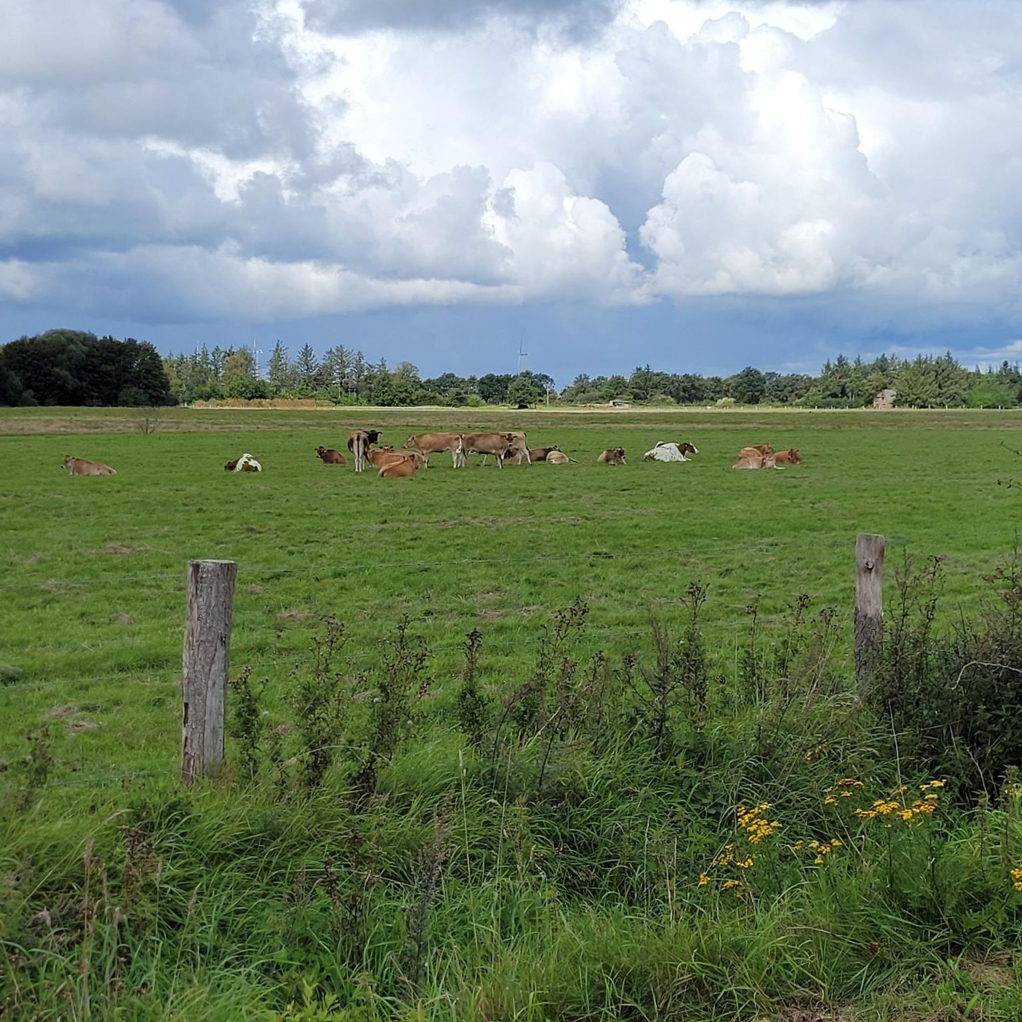
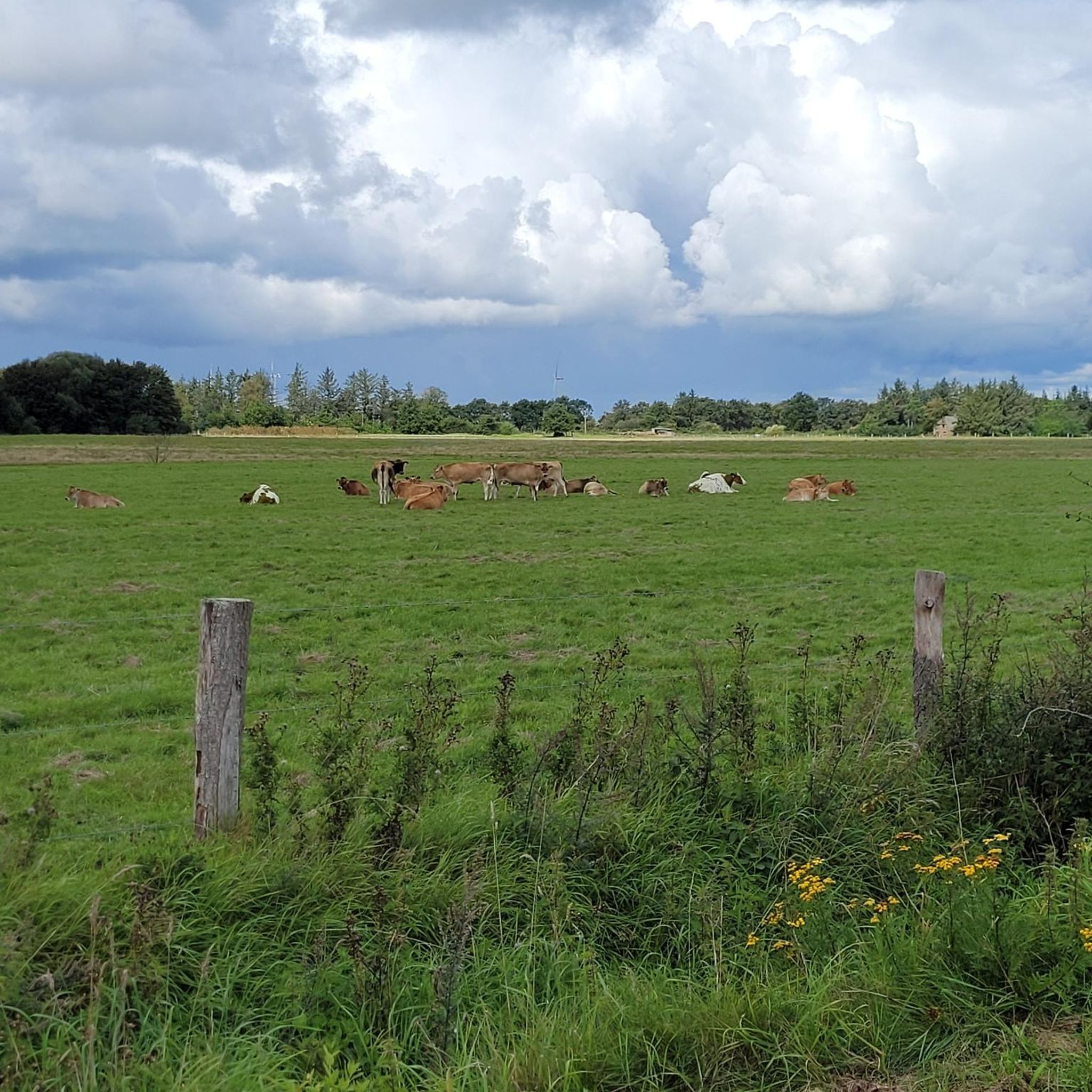
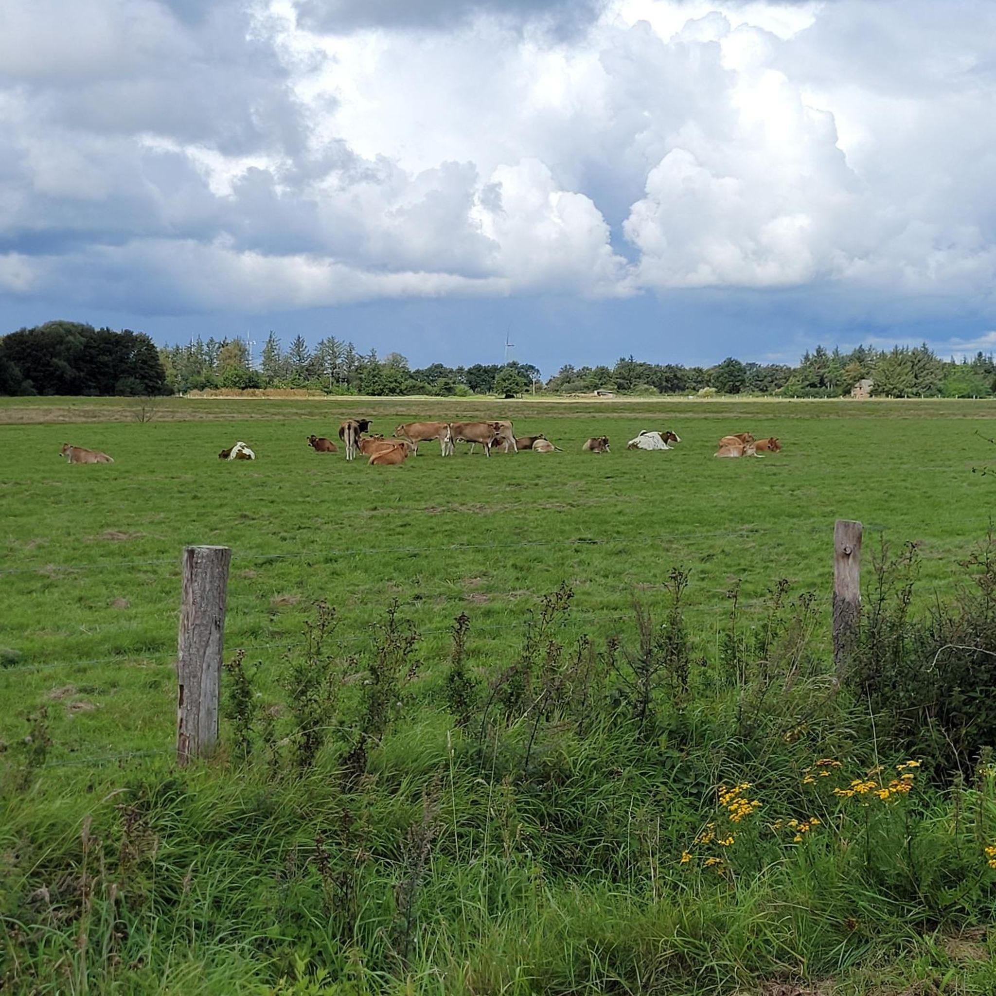
Hiking trails in Naturschutzgebiet Leckfeld traverse a diverse landscape spanning approximately 206 hectares in northern Schleswig-Holstein, Germany. The area is characterized by nutrient-poor open landscapes, including grasslands, sand heaths, and wet heaths. Hikers will encounter fens, small bodies of water, hedgerows, and small wooded sections, creating varied scenery. This mosaic of habitats supports significant biodiversity, including endangered plant and butterfly species.
Best hiking trails in Naturschutzgebiet Leckfeld
- The most popular hiking route is Wild camping site Leck – Karlumer Forest…
Last updated: October 11, 2026
16
hikers
4.64km
01:11
10m
10m
Easy hike. Great for any fitness level. Easily-accessible paths. Suitable for all skill levels.
3.0
(1)
17
hikers
8.46km
02:08
20m
20m
Moderate hike. Good fitness required. Easily-accessible paths. Suitable for all skill levels.

13
hikers
4.13km
01:03
10m
10m
Easy hike. Great for any fitness level. Easily-accessible paths. Suitable for all skill levels.
13
hikers
Easy hike. Great for any fitness level. Easily-accessible paths. Suitable for all skill levels.
4.0
(2)
10
hikers
8.41km
02:08
20m
20m
Moderate hike. Good fitness required. Easily-accessible paths. Suitable for all skill levels.
Get access to more routes and recommendations from other explorers.
Already have an account?
Our route recommendations are based on thousands of hikes, rides, and runs completed by other people on komoot.
Start today with a free account
Your next adventure awaits.
Tips from the Community

An old pharmacy here on the market square.
2
0
Old stone coffins placed here at the church.
1
0
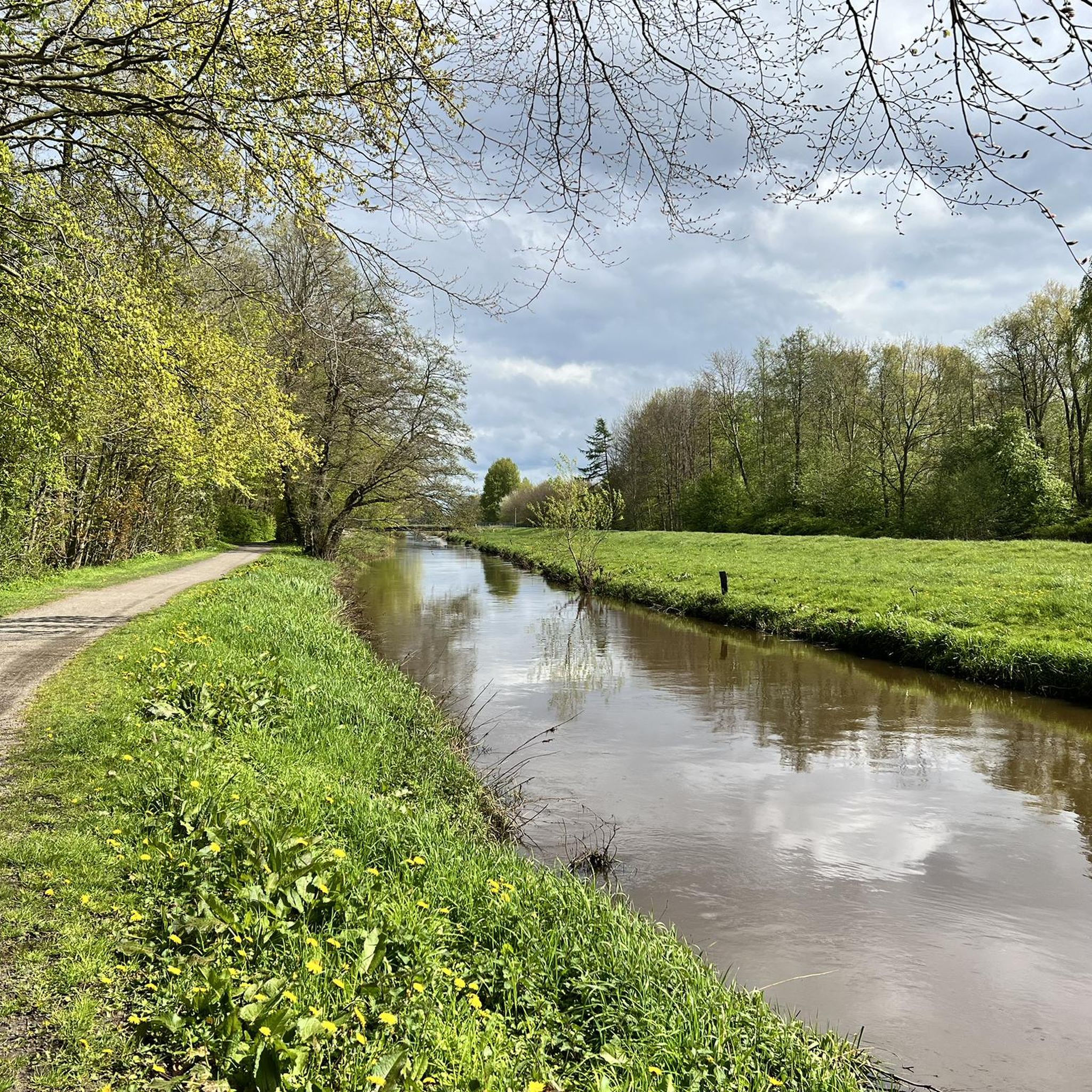
A beautiful tour around Leck and through the parks and nature.
1
0
A fountain on the Lecker market square.
0
0
A beautiful church with a richly decorated old altar and a beautiful organ
0
0

Interesting facts about history, nature and technology - that's what the Leck circular hiking trail offers, combined with exercise, for young and old! On this approximately 7 km long circular hiking trail, you will gain interesting insights into the history of the green heart of North Friesland. Of course, the circular hiking trail can also be ridden by bike. The circular hiking trail harmoniously connects the Westerholz, the Kempergraben public park, the Augarten, the Lecker Au, the Kokkedahler Swamp and the Osterholz. The circular hiking trail improves the local recreation and tourism offerings in Leck. Entry is possible at several points on the circular trail, for example, hikers can use the car park at the public park or the car park at the Ludwig Feddersen Bridge to enter. Areas with high natural potential (biotopes, floodplains, swamp areas, forests + meadows) show a cross-section of the region's natural diversity and reflect historical development. https://www.leck.de/rww/
3
0
There are several stone coffins from the 12th century in the former cemetery. The coffins made of Mainz sandstone were probably used to bury wealthy merchants in places that were later submerged in storm floods. The coffins washed out in the mudflats were used for a long time as watering holes for livestock. https://de.wikipedia.org/wiki/St._Willehad_(Leck)
2
0
The cemetery in Kirchhofstrasse belongs to the municipality of Leck just as death belongs to life. The cemetery is not only a place of peace and reflection, but is also one of our most beautiful green spaces in the municipality. The idyllic design helps relatives to overcome their grief. In addition to its importance as a final resting place for people, the park-like cemetery also invites you to take a walk. There are over 4 km of paths on an area of around 4 hectares and around 2.5 km of beech and 1.5 km of thuja hedges have been planted. The first burials can be found in the grave register in 1891. I think it's particularly good that dogs are expressly allowed in the cemetery. There are even "poop bag dispensers" here. Exemplary! You can find more information about the cemetery here: https://www.leck.de/unser-friedhof/
3
0
Frequently Asked Questions
How many hiking trails are available in Naturschutzgebiet Leckfeld?
Naturschutzgebiet Leckfeld offers a wide variety of hiking experiences, with over 280 routes available. These range from easy strolls to more moderate excursions, catering to different fitness levels.
What kind of terrain can I expect when hiking in Naturschutzgebiet Leckfeld?
Hikers in Naturschutzgebiet Leckfeld will encounter a diverse landscape characterized by extensive, nutrient-poor open areas, including grasslands, sand heaths, and wet heaths. The trails also lead through fens, past small bodies of water, and occasionally through hedgerows and small wooded sections, offering a constantly changing scenery.
Are there any circular hiking routes in Naturschutzgebiet Leckfeld?
Yes, the region is well-suited for circular walks. A notable option is the Wild camping site Leck – Karlumer Forest loop from Naturschutzgebiet Leckfeld, an easy 4.6 km trail. Another popular choice is the Augarten, Leck – Kokkedahler Bridge loop from Leck, which is 4.1 km long and also considered easy.
What are the difficulty levels of hikes in Naturschutzgebiet Leckfeld?
The majority of hikes in Naturschutzgebiet Leckfeld are considered easy, with 212 out of 284 routes falling into this category. There are also 71 moderate trails and a single difficult route, ensuring options for various experience levels.
What natural features or landmarks can I see while hiking?
The primary attractions within Naturschutzgebiet Leckfeld are its diverse ecosystems and rich biodiversity. You can observe extensive grasslands, sand heaths, fens, and small bodies of water. The area is home to several endangered plant species, such as the Common Milkwort and Lung Gentian, as well as various butterfly species and the endangered Common Spadefoot toad. The Kokkedahler Marsh – Augarten, Leck loop from Leck, for example, explores marshlands typical of the region.
Is Naturschutzgebiet Leckfeld suitable for family-friendly hikes?
Yes, with a large number of easy routes and relatively flat terrain, Naturschutzgebiet Leckfeld is very suitable for family-friendly hikes. The varied landscapes and opportunities for nature observation make it an engaging experience for all ages.
Can I bring my dog on the hiking trails?
While specific regulations for dogs can vary, generally, dogs are welcome on trails in Naturschutzgebiet Leckfeld. It's always recommended to keep dogs on a leash to protect the local wildlife and sensitive ecosystems, especially given the presence of endangered species.
What do other hikers say about Naturschutzgebiet Leckfeld?
The hiking trails in Naturschutzgebiet Leckfeld are highly rated by the komoot community, with an average score of 4.5 stars from over 600 reviews. Hikers often praise the peaceful atmosphere, the diverse natural scenery, and the well-maintained paths that offer a mix of open and sheltered environments.
Are there any longer, more challenging routes for experienced hikers?
While most routes are easy to moderate, there are options for longer excursions. For instance, the Augarten, Leck – Fishermen's Cottages in Leck loop from Leck is a moderate 8.4 km trail that provides a good workout. There is also one route classified as difficult for those seeking a greater challenge.
What is the best time of year to go hiking in Naturschutzgebiet Leckfeld?
Naturschutzgebiet Leckfeld offers unique experiences throughout the year. Spring brings blooming wildflowers, while summer allows for full enjoyment of the open heathlands. Autumn provides beautiful colors, and even winter can offer serene, crisp walks. The diverse habitats ensure there's always something to observe, though specific conditions like wet fens might be more prevalent in certain seasons.
Is there public transport access to Naturschutzgebiet Leckfeld?
Information on specific public transport stops directly within the reserve is limited. However, the nearby town of Leck serves as a regional hub and likely offers connections that could bring you close to the reserve's access points. It's advisable to check local bus schedules for routes serving the Leck area.
Where can I park when visiting Naturschutzgebiet Leckfeld for a hike?
While specific parking areas within the nature reserve are not detailed, access points to trails often have designated parking. Given the popularity of the area, especially for routes starting near Leck, you can typically find parking facilities close to trailheads or in the surrounding communities.
Most popular routes in Naturschutzgebiet Leckfeld

Get inspired with the komoot mobile app


Explore more
Browse the best Hikes in other regions.
