The best walks and hikes in Nsg Emsaue Östlich Warendorf
4.5
(2064)
10,064
hikers
19
hikes
Hiking trails in Nsg Emsaue Östlich Warendorf traverse a diverse landscape shaped by the Ems river and its floodplains. This nature reserve, established in 1999, features extensive renaturation efforts that have restored natural habitats. The terrain is characterized by riparian forests, willow bushes, wet grasslands, and ecologically valuable oxbow lakes and flood channels. The area offers generally flat paths with minimal elevation gain, making it suitable for various hiking abilities.
Best hiking trails in Nsg Emsaue Östlich Warendorf
- The most popular hiking route is Small weir – Rapids on the Ems loop from NSG Axtbach, a 5.4 miles (8.7 km) trail that takes 2 hours 12 minutes to complete. This moderate route follows the Ems river, showcasing its renatured banks and surrounding natural areas.
- Another top favourite among local hikers is Ems River Kilometer 66 – Dwarf Forest loop from Vohren, an easy 3.4 miles (5.4 km) path. This route leads through varied riverine landscapes, including sections of the "Dwarf Forest" and views of the Ems.
- Local hikers also love the Weir on the Ems – Emsaue loop from NSG Axtbach, a 9.1 miles (14.6 km) trail leading through the Ems floodplains, often completed in about 3 hours 41 minutes.
- Hiking in Nsg Emsaue Östlich Warendorf is defined by the Ems river, its renatured floodplains, and diverse habitats including riparian forests and oxbow lakes. The network offers options for different ability levels, from easy walks to more moderate treks.
- The routes in Nsg Emsaue Östlich Warendorf are highly rated by the komoot community with an average score of 4.4 stars from over 500 reviews. More than 3000 hikers have used komoot to explore Nsg Emsaue Östlich Warendorf's varied terrain.
Last updated: July 5, 2026
4.4
(19)
60
hikers
8.72km
02:12
20m
20m
Moderate hike. Good fitness required. Easily-accessible paths. Suitable for all skill levels.
4.9
(7)
40
hikers
5.40km
01:22
10m
10m
Easy hike. Great for any fitness level. Easily-accessible paths. Suitable for all skill levels.

Sign up for free
4.3
(3)
27
hikers
5.37km
01:22
10m
10m
Easy hike. Great for any fitness level. Easily-accessible paths. Suitable for all skill levels.
4.7
(6)
22
hikers
14.6km
03:42
30m
30m
Moderate hike. Good fitness required. Easily-accessible paths. Suitable for all skill levels.
4.8
(10)
32
hikers
6.66km
01:41
10m
10m
Easy hike. Great for any fitness level. Easily-accessible paths. Suitable for all skill levels.
Get access to more routes and recommendations from other explorers.
Sign up for free
Already have an account?
Our route recommendations are based on thousands of hikes, rides, and runs completed by other people on komoot.
Start today with a free account
Your next adventure awaits.
Login or Signup

Tips from the Community


Unfortunately, the path is currently a dead end. We continued along the edge of the field anyway. After that, however, the hike is good again. It's still a shame that there isn't a well-maintained section of the path there, especially if you're traveling with a stroller.
0
0

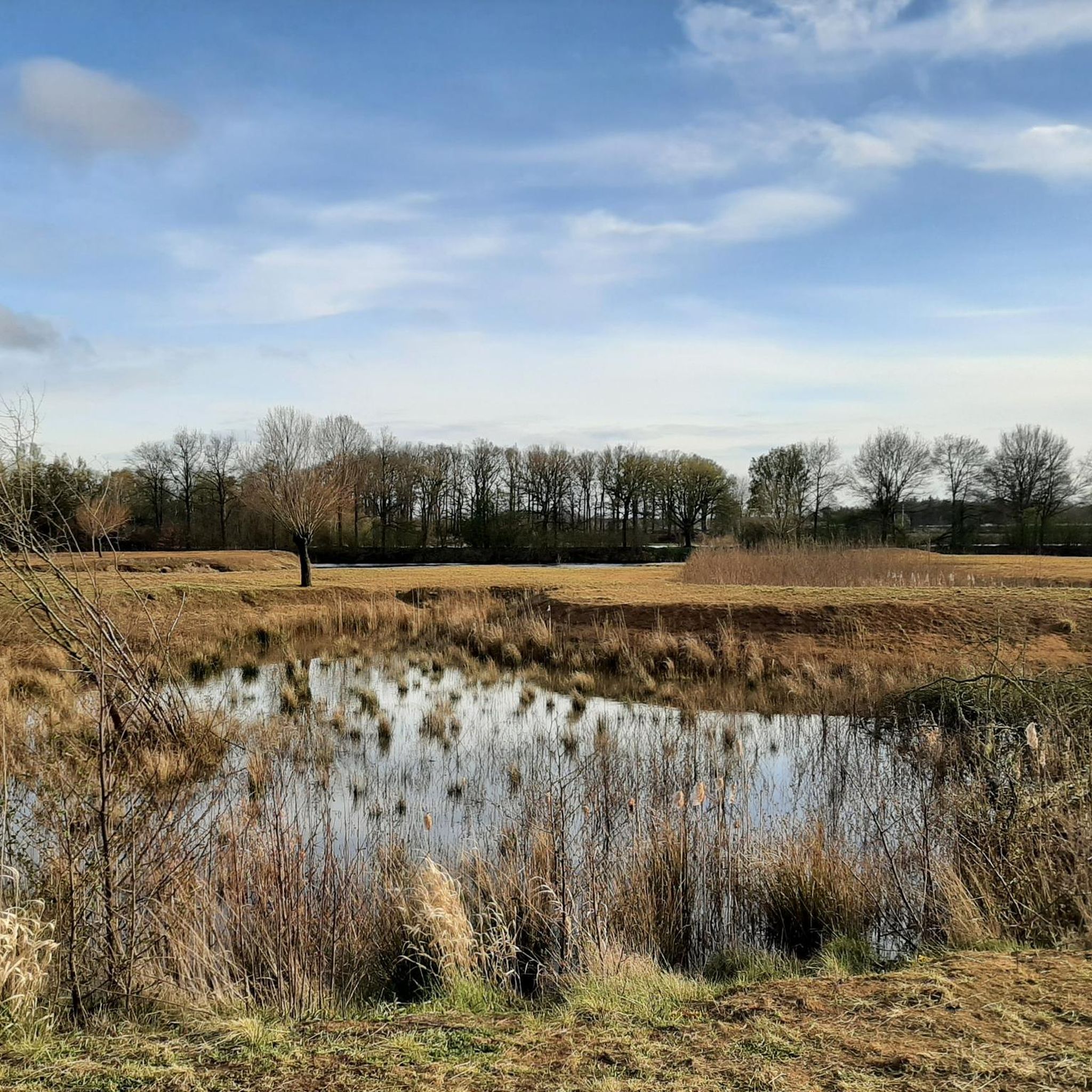
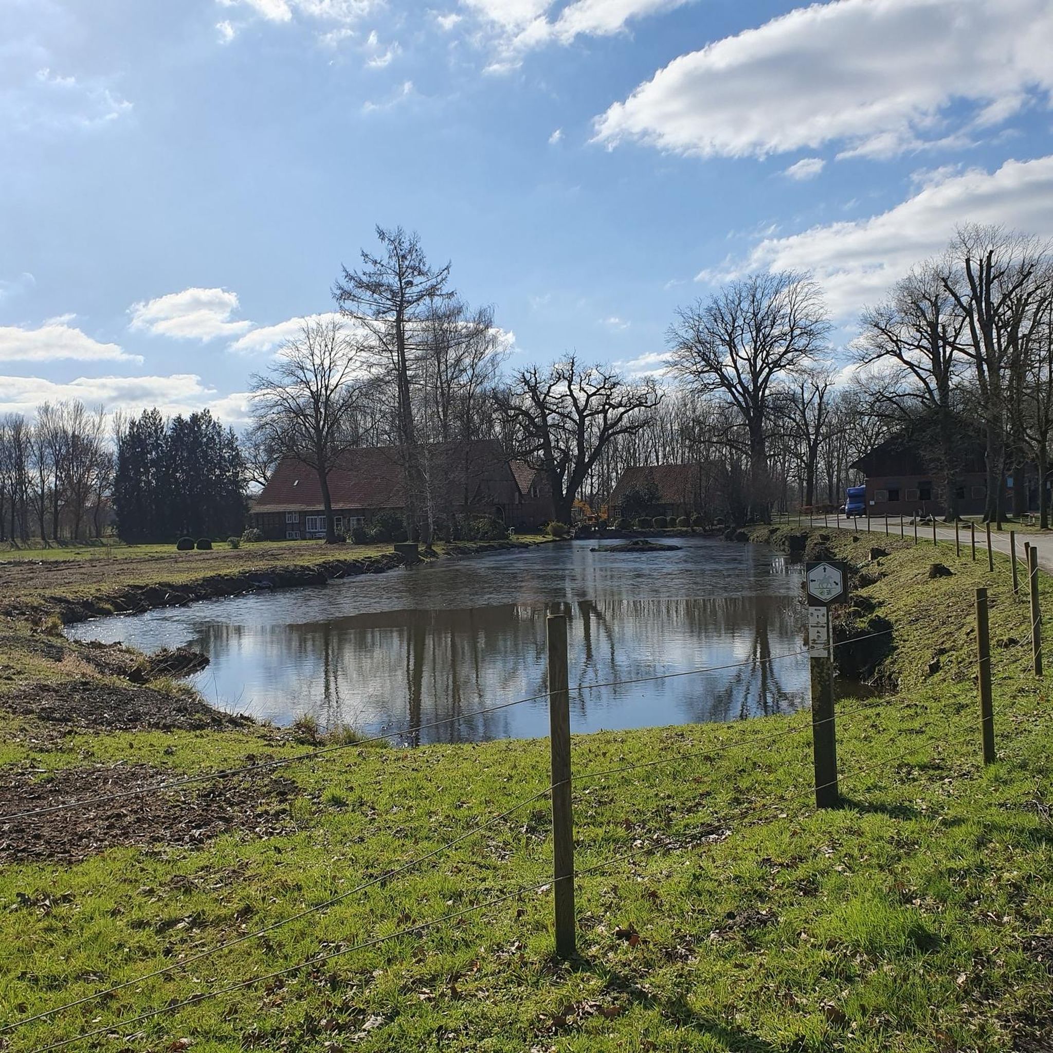
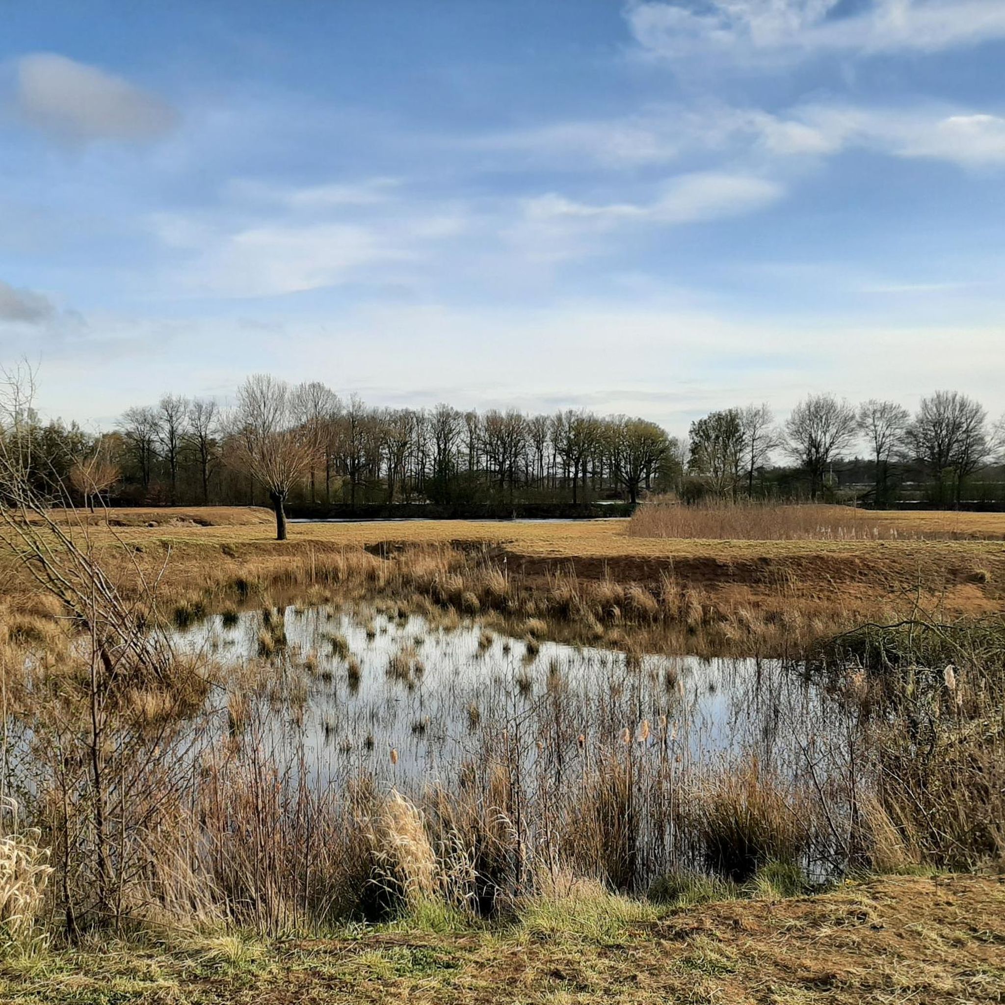
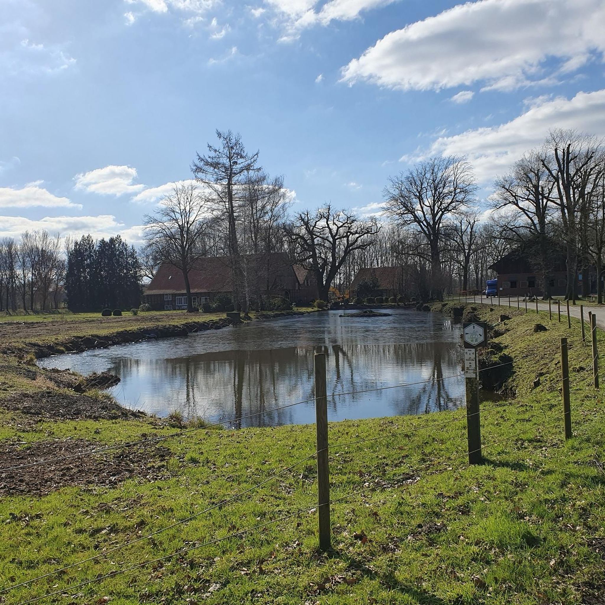
At this point the Ems has been partially renaturalized and is taking a big turn. If you stand there you can hear the water splashing and birdsong. - A little way upstream there is a kind of staircase (possibly a fish ladder), from there comes the pleasant splashing.
1
0
The local waterworks (Wasserversorgung Beckum GmbH) have set up something really great here. It is this beautiful, solid picnic area with fresh drinking water. There are also a few information boards that provide information about the waterworks and the production of fresh water in general.
0
0

Fredenblossom! When the larkspur blooms on Freden, you walk through a sea of flowers.
0
0

The Ems renaturation shows how beautiful it is when nature shapes itself and recovers. We humans also have better protection against flooding.
3
0

That should be the "love book". There are also historical photos of it. NB
3
0

Frequently Asked Questions
How many hiking trails are available in Nsg Emsaue Östlich Warendorf?
There are nearly 20 hiking trails in Nsg Emsaue Östlich Warendorf, offering a variety of options for different preferences and fitness levels. The majority of these, 15 routes, are considered easy.
What kind of terrain can I expect on the hiking trails in Nsg Emsaue Östlich Warendorf?
The trails primarily traverse the Ems river and its floodplains, featuring diverse habitats such as riparian forests, willow bushes, and wet grasslands. You'll find generally flat paths with minimal elevation gain, making them accessible for various abilities. Renaturation efforts have restored much of the river's natural beauty, creating a dynamic and ecologically rich environment.
Are there hiking routes suitable for families or beginners?
Yes, Nsg Emsaue Östlich Warendorf is well-suited for families and beginners. Many paths are easily accessible and require no special skills. Out of the nearly 20 available routes, 15 are classified as easy, perfect for casual walks and family outings. An example is the Ems River Kilometer 66 – Dwarf Forest loop from Vohren, an easy 5.4 km (3.4 miles) path.
What unique natural features can I see while hiking in the Emsaue?
The Emsaue is known for its renatured Ems river and floodplains, featuring valuable oxbow lakes and flood channels. A unique attraction is the "Wilden Weiden" (Wild Pastures), where Heck cattle and Konik horses graze freely, shaping the landscape and fostering biodiversity. You can also find impressive natural monuments, including varied rock formations and steep cliffs.
Are there circular hiking routes in Nsg Emsaue Östlich Warendorf?
Yes, many of the trails in Nsg Emsaue Östlich Warendorf are circular routes, allowing you to start and end at the same point. For instance, the Ems River Kilometer 66 – Axbach Bridge loop from Vohren is an easy 6.9 km (4.3 miles) circular hike that takes you through varied riverine landscapes.
What kind of wildlife can I spot in the nature reserve?
The NSG Emsaue Östlich Warendorf is rich in wildlife. In the riparian forests, you might spot orioles, nightingales, and various woodpeckers. The oxbow lakes and flood channels are home to amphibians like the great crested newt and aquatic plants. The diverse insect life attracts birds such as red-backed shrikes and hobbies, as well as bats. Keep an eye out for kingfishers, shore larks, and lapwings near the water.
Are there any viewpoints or interesting landmarks along the trails?
Yes, there are several points of interest. You can enjoy the View of the Ems River from the Herrlichkeit Bridge, which offers scenic vistas. The area also features highlights related to the Restoration of the Ems River below the mouth of the Axtbach, showcasing the ongoing renaturation efforts. Additionally, you might encounter the Liebesbuche with exposed roots, a notable natural monument.
What do other hikers enjoy most about hiking in Nsg Emsaue Östlich Warendorf?
The area is highly rated by the komoot community, with an average score of 4.4 stars from over 560 reviews. Reviewers often praise the peaceful natural environment, the well-maintained paths along the Ems river, and the opportunity to observe diverse wildlife and the unique "Wilden Weiden" with grazing animals.
Is Nsg Emsaue Östlich Warendorf accessible by public transport?
While specific public transport connections directly to trailheads can vary, the region around Warendorf is generally served by local bus routes. It's advisable to check local public transport schedules for connections to villages or points near the nature reserve, such as Vohren, which is a common starting point for several routes.
Are there designated parking areas for hikers?
Yes, for many of the popular routes, there are designated parking areas available. For example, routes starting from Vohren or NSG Axtbach typically have nearby parking facilities. It's always a good idea to check the tour details on komoot for specific parking information related to your chosen trail.
Can I bring my dog on the hiking trails?
Generally, dogs are welcome on the hiking trails in Nsg Emsaue Östlich Warendorf. However, as it is a nature reserve with sensitive ecosystems and grazing animals like Heck cattle and Konik horses, it is crucial to keep dogs on a leash at all times to protect wildlife and ensure the safety of both your pet and the animals.
What is the best time of year to hike in Nsg Emsaue Östlich Warendorf?
The Nsg Emsaue Östlich Warendorf offers enjoyable hiking experiences throughout the year. Spring brings blooming flora and active birdlife, while summer provides lush green landscapes. Autumn showcases beautiful fall colors, and even winter offers serene, quiet walks, especially along the Ems river. Always check local weather conditions before heading out.
Most popular routes in Nsg Emsaue Östlich Warendorf
Most popular attractions in Nsg Emsaue Östlich Warendorf

Get inspired with the komoot mobile app


Explore more
Browse the best Hikes in other regions.
