The best MTB trails in Kaiserwinkel
4.6
(96)
216
riders
43
rides
Mountain biking in Kaiserwinkel offers a diverse landscape nestled between the Chiemgau Alps and the imposing Kaiser Mountains, including the rugged Wilder Kaiser and the gentler Zahmer Kaiser ranges. The region features an extensive network of trails that traverse forest paths, alpine meadows, and the unique Schwemm moorland. Riders can explore varied terrain, from the shores of Lake Walchsee to the scenic Kaisertal valley.
Best mountain bike trails in Kaiserwinkel
- The most popular mountain bike trail is Black Bridge –…
Last updated: June 27, 2026
5.0
(1)
2
riders
45.4km
02:54
110m
110m
Moderate mountain bike ride. Good fitness required. Advanced riding skills necessary.
5.0
(1)
3
riders
24.4km
01:23
30m
30m
Moderate mountain bike ride. Great for any fitness level. Advanced riding skills necessary.

Sign up for free
5.0
(1)
3
riders
35.9km
02:10
40m
40m
Moderate mountain bike ride. Good fitness required. Advanced riding skills necessary.
5.0
(1)
3
riders
25.5km
01:33
30m
30m
Moderate mountain bike ride. Great for any fitness level. Advanced riding skills necessary.
1.0
(1)
3
riders
19.6km
01:03
40m
40m
Easy mountain bike ride. Great for any fitness level. Suitable for all skill levels.
Get access to more routes and recommendations from other explorers.
Sign up for free
Already have an account?
Our route recommendations are based on thousands of hikes, rides, and runs completed by other people on komoot.
Start today with a free account
Your next adventure awaits.
Login or Signup
Tips from the Community

The nature trail with a rest area near Belfort in the Drömling is a beautiful place for a short break in the middle of nature. Information boards provide knowledge about the unique flora and fauna of the biosphere reserve, while the spacious rest area with seating invites you to linger. Ideal for hikers and cyclists who want to enjoy the tranquility of the landscape and at the same time learn more about the nature of the Drömling.
0
0
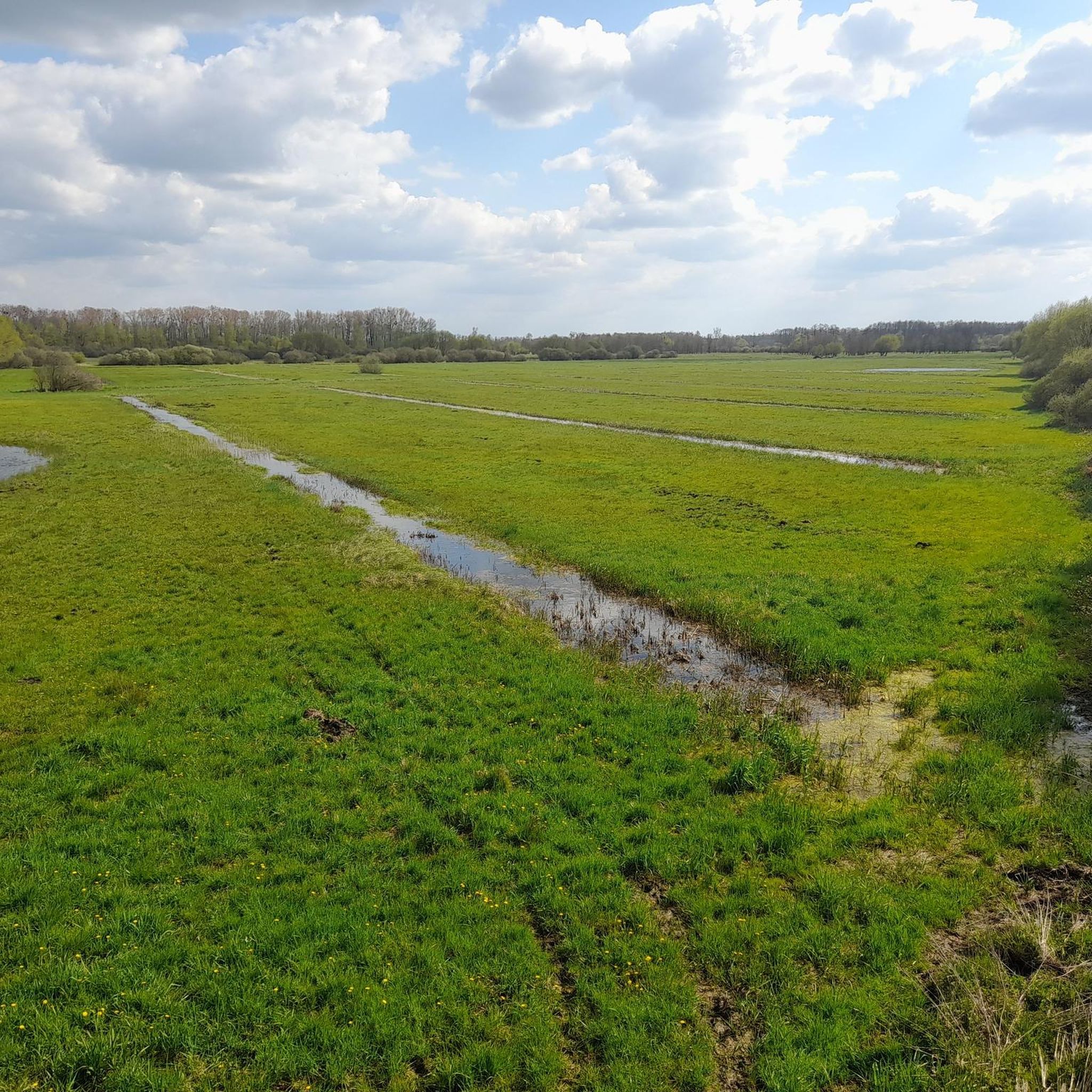
The resting place on the nature trail in Ohre-Drömling is located in one of the quietest and most natural landscapes in Northern Germany – in the middle of the Drömling nature and wetland area, which stretches between Lower Saxony and Saxony-Anhalt. The region is also called the „Land of a thousand ditches“ because of its many ditches, wet meadows, and floodplains. The resting place itself is part of a nature trail or a cycle and hiking path system along the Ohre and its floodplains. It serves as a small, natural stopover for visitors exploring the area on foot or by bike. Typical for such resting places in the Drömling are simple seating facilities, a quiet location directly on watercourses or ponds, and good integration into the landscape.
0
0
The Ohre-Drömling nature reserve is located in the border region between Lower Saxony and Saxony-Anhalt and is one of the characteristic lowland wetlands of Northern Germany. At its center is the region around the Ohre River and the large moor and meadow area of the Drömling. The Drömling is an originally very marshy landscape that has been heavily altered over the centuries by drainage and agricultural use. Nevertheless, it has remained an important refuge for many animal and plant species to this day. Typical features include extensive ditches, wet meadows, swamp forests, and small streams.
0
0
A nice tip for the route along the Steimker Graben: It's best to walk the route early in the morning or late in the afternoon, when it's quieter and the light is particularly pleasant. The route is well-suited for walking or cycling and offers plenty of greenery and a relaxed atmosphere right by the water – ideal for switching off for a while.
0
0

As I said, I would have liked to have seen it in peace, if it had been dry and I had had enough time.
0
0
It's a shame it was drizzling and I absolutely had to catch my train, otherwise I would have gladly taken my time again!
0
0
Very elaborate and created with great attention to detail.
0
0
The Inner German Border Memorial Kaiserwinkel–Jahrstedt is an impressive place of remembrance that documents the former division of Germany between Lower Saxony and Saxony-Anhalt.
0
0
Frequently Asked Questions
How many mountain bike trails are there in Kaiserwinkl?
Kaiserwinkl offers a comprehensive network of over 125 km of mountain biking routes. On komoot, you'll find 47 curated mountain bike tours, catering to various skill levels.
What is the best time of year for mountain biking in Kaiserwinkl?
The Kaiserwinkl region is ideal for mountain biking from spring through autumn. The diverse terrain, from forest paths to alpine meadows, provides excellent conditions for riding during these seasons. The weather is generally pleasant, allowing for comfortable exploration of the extensive trail network.
Are there easy mountain bike trails suitable for beginners or families in Kaiserwinkl?
Yes, Kaiserwinkl has a good selection of easy trails. Out of the 47 tours available on komoot, 20 are rated as easy, making them perfect for beginners or families looking for a more relaxed ride. These often traverse perfect forest paths and offer gentle gradients.
What kind of terrain can I expect on mountain bike trails in Kaiserwinkl?
You can expect a diverse range of terrain in Kaiserwinkl. Trails wind through extensive forest paths, open alpine meadows, and even the unique Schwemm moorland. The region, nestled between the Chiemgau Alps and the Kaiser Mountains, offers everything from leisurely rides to more challenging mountain ascents.
Are there any mountain bike routes with significant elevation gain for advanced riders?
While many routes feature moderate elevation, Kaiserwinkl does offer more challenging options. For instance, the region is part of the Bike Trail Tirol, which includes stages with more demanding ascents. On komoot, you'll find 2 difficult mountain bike tours for experienced riders seeking a greater challenge.
What are some scenic viewpoints or natural attractions accessible by mountain bike in Kaiserwinkl?
Mountain bikers in Kaiserwinkl are consistently rewarded with panoramic vistas. You can ride to spots offering breathtaking views of the surrounding alpine world. Consider visiting the Kaiserwinkel Observation Tower for expansive views, or explore routes near the unique Wet meadows and ditches in the Schwemm moorland, Northern Tyrol's largest moorland area.
Can I find circular mountain bike routes in Kaiserwinkl?
Yes, many of the mountain bike routes in Kaiserwinkl are designed as loops, allowing you to start and finish at the same point. An example is the moderate Black Bridge – Rimpau Memorial Stone loop from Jahrstedt, which covers 45.4 km.
What do other mountain bikers say about the trails in Kaiserwinkl?
The mountain bike trails in Kaiserwinkl are highly rated by the komoot community, with an average score of 4.6 stars from over 90 reviews. Riders often praise the varied terrain, the well-signposted paths, and the stunning natural beauty of the region, particularly the views of the Kaiser Mountains and Lake Walchsee.
Are there any facilities or rest areas along the mountain bike trails?
Yes, you can find facilities along some routes. For example, the Rest Area at Fanggraben provides a convenient spot to take a break. The region also has charming villages like Kössen and Walchsee, where you can find cafes and pubs.
Is it possible to rent e-bikes or e-mountain bikes in Kaiserwinkl?
Yes, Kaiserwinkl is very accessible for e-bike and e-mountain bike enthusiasts. Numerous outlets and sports shops in the region offer rentals, making it easy to explore the trails even if you don't have your own equipment.
Are there any mountain bike routes that pass by Lake Walchsee?
Yes, some routes in Kaiserwinkl traverse areas near Lake Walchsee, which is acclaimed as the warmest swimming lake in Tyrol. These trails offer beautiful views of the lake and its surroundings, providing a refreshing element to your ride.
How accessible are the mountain bike trails by public transport or car parking?
Kaiserwinkl's villages like Kössen, Walchsee, Schwendt, and Rettenschöss serve as good starting points for many trails. While specific public transport links to trailheads vary, the region is generally well-connected, and parking facilities are available in these towns, making trail access convenient for riders.
Most popular routes in Kaiserwinkel
Most popular attractions in Kaiserwinkel

Get inspired with the komoot mobile app


Explore more
Browse the best MTB trails in other regions.
