The best cycling routes in Naturschutzgebiet Oberharz
4.5
(4889)
28,435
riders
602
rides
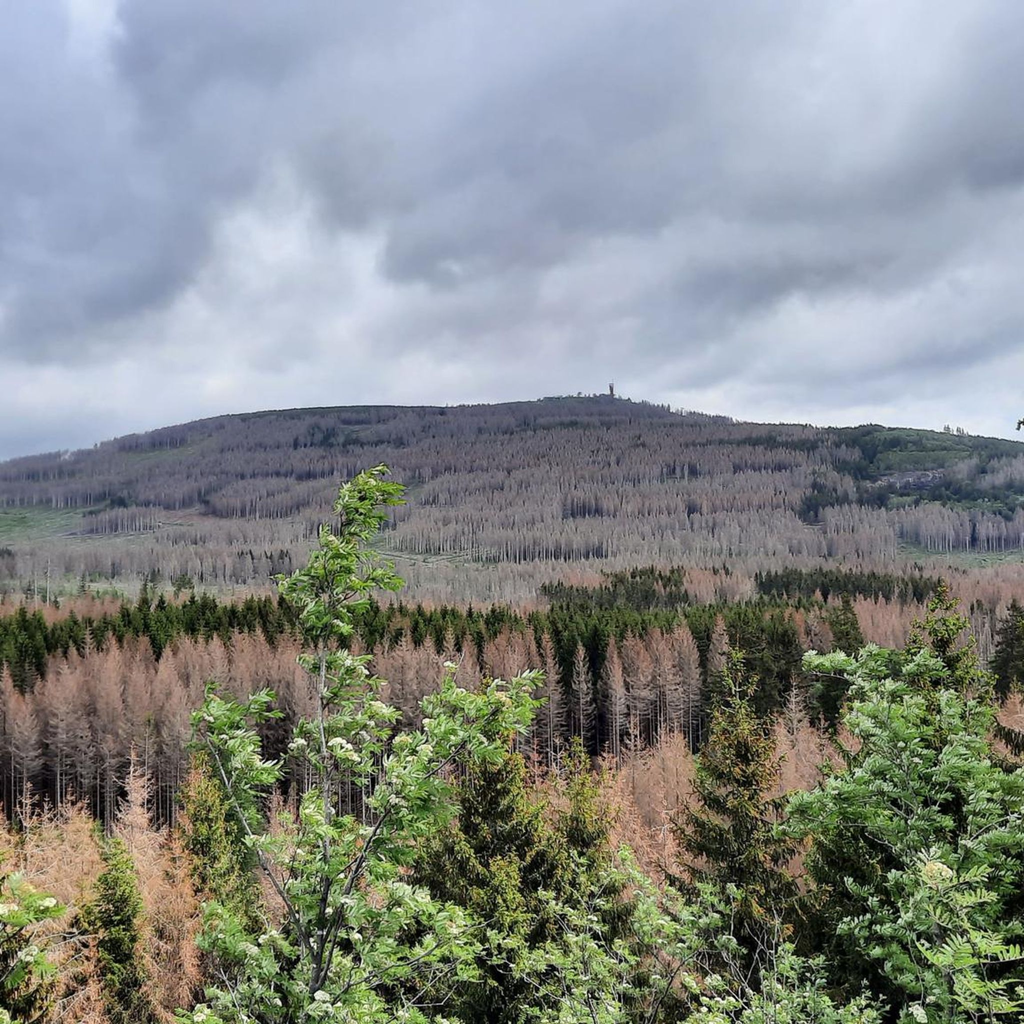
Touring cycling routes in Naturschutzgebiet Oberharz traverse a diverse low mountain range landscape, characterized by extensive forests, ancient moors, and numerous watercourses. The region features striking quartzite cliffs, such as those in Jermerstein, offering expansive views of prominent peaks like the Brocken. Cyclists can also explore routes alongside the historic Upper Harz Water Management System, a UNESCO World Heritage site. This area directly borders the Harz National Park, providing access to a broader network of trails through varied ecosystems.
Best…
Last updated: October 15, 2026
4.0
(4)
18
riders
13.4km
01:02
180m
180m
Moderate bike ride. Good fitness required. Mostly paved surfaces. Suitable for all skill levels.
4.5
(157)
657
riders
31.5km
02:27
780m
790m
Hard bike ride. Very good fitness required. Mostly paved surfaces. Suitable for all skill levels.

4.7
(71)
497
riders
14.8km
01:08
270m
280m
Moderate bike ride. Good fitness required. Mostly paved surfaces. Suitable for all skill levels.
4.2
(5)
82
riders
Hard bike ride. Very good fitness required. Mostly paved surfaces. Suitable for all skill levels.
4.6
(9)
52
riders
Hard bike ride. Very good fitness required. Mostly paved surfaces. Suitable for all skill levels.
Get access to more routes and recommendations from other explorers.
Already have an account?
Our route recommendations are based on thousands of hikes, rides, and runs completed by other people on komoot.
Start today with a free account
Your next adventure awaits.
Tips from the Community

historic place on the way up
0
0
The journey is the destination - not always easy terrain, but very beautiful in dry weather
1
0

It feels like you're in another world 🌿
0
0
This is a great place for hiking and cycling 🚲
0
0

A popular rest area, especially for groups - here you can sit comfortably while the others wait for the photo of the train.
1
0

Seating and a photo spot for the steam locomotive. The "Brocken Fox" also likes to be here, searching for edible items in the tourists' leftovers.
1
0

nearby are interesting water distribution facilities - very typical for the Harz
1
0

Really cool ride. You should take a ride!
0
0
Frequently Asked Questions
How many touring cycling routes are available in Naturschutzgebiet Oberharz?
Naturschutzgebiet Oberharz offers a wide selection of touring cycling routes, with over 600 trails to explore. These routes cater to various skill levels, including easy, moderate, and difficult options.
What kind of terrain can I expect on touring cycling routes in Naturschutzgebiet Oberharz?
The region features a diverse low mountain range landscape. You'll encounter extensive forests, ancient moors, and numerous watercourses. Notable geological formations include striking quartzite cliffs, such as those in Jermerstein, which offer expansive views. Many routes also pass alongside the historic Upper Harz Water Management System, a UNESCO World Heritage site.
Are there touring cycling routes suitable for beginners or families in Naturschutzgebiet Oberharz?
Yes, Naturschutzgebiet Oberharz provides options for all skill levels. There are nearly 70 easy touring cycling routes, perfect for beginners or families looking for a relaxed ride. These paths often wind through scenic areas without significant elevation changes.
Are there any challenging touring cycling routes for experienced riders?
Absolutely. For experienced touring cyclists seeking a challenge, there are over 300 difficult routes available. These trails often feature significant elevation gains and varied terrain, such as the Neuer Goetheweg – Brocken Summit loop from Braunlage, which covers 19.5 miles (31.4 km) and includes substantial climbing towards the Brocken summit.
Can I find circular touring cycling routes in Naturschutzgebiet Oberharz?
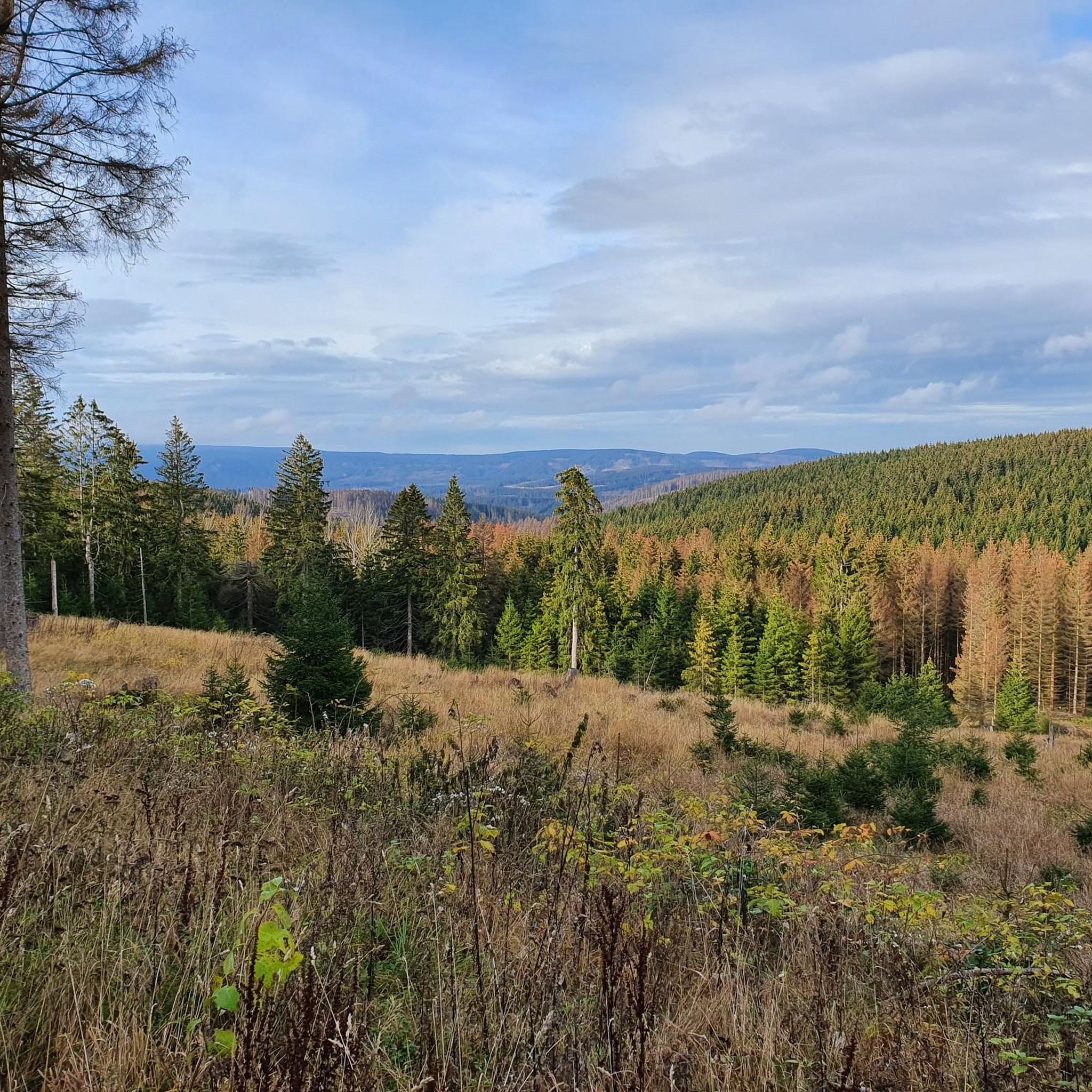
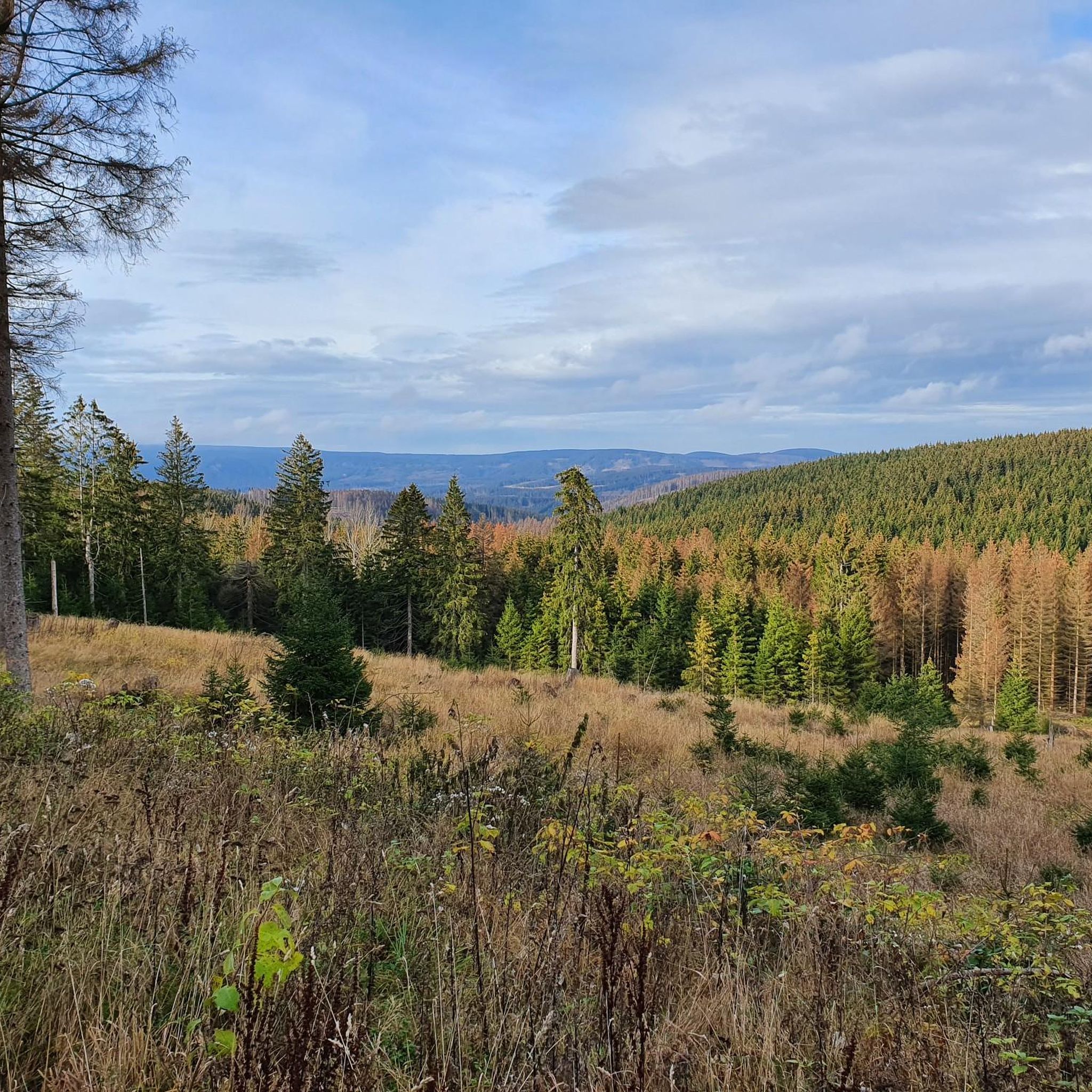
Many touring cycling routes in Naturschutzgebiet Oberharz are designed as loops, allowing you to start and finish at the same point. For example, the popular View of Torfhaus – View of the Brocken loop from Torfhaus is an 8.4-mile (13.4 km) circular trail offering views of the Harz landscape.
What natural features or landmarks can I see while cycling in Naturschutzgebiet Oberharz?
While cycling, you can discover several natural landmarks. The Maiden Crag is a notable natural monument. You might also encounter the Kalbetal climb to Torfhaus or the United Kids Foundation Forest. The region's quartzite cliffs, like those at Jermerstein, provide impressive geological sights.
Are there any viewpoints along the touring cycling routes?
Yes, the region offers several viewpoints. From the Jermerstein cliffs, you can enjoy expansive views of prominent peaks like the Wurmberg, Achtermann, and the Brocken on clear days. Specific viewpoints include the View of Jungfernklippe and the View from Jermerstein Cliffs, providing scenic panoramas of the Harz landscape.
What is the best time of year for touring cycling in Naturschutzgebiet Oberharz?
The diverse landscapes of Naturschutzgebiet Oberharz are particularly inviting in spring and autumn. During these seasons, the extensive beech forests, especially those bordering the Harz National Park, display vibrant colors. Summer also offers pleasant conditions for cycling through the fresh air of the Harz Mountains.
What do other touring cyclists enjoy the most about touring cycling in Naturschutzgebiet Oberharz?
The area is highly rated by the komoot community, with an average score of 4.5 stars from over 3900 reviews. Cyclists often praise the diverse terrain, the well-maintained paths, and the beautiful scenery, including the historic Upper Harz Water Management System and views of the Brocken.
Are there any touring cycling routes that offer views of the Brocken?
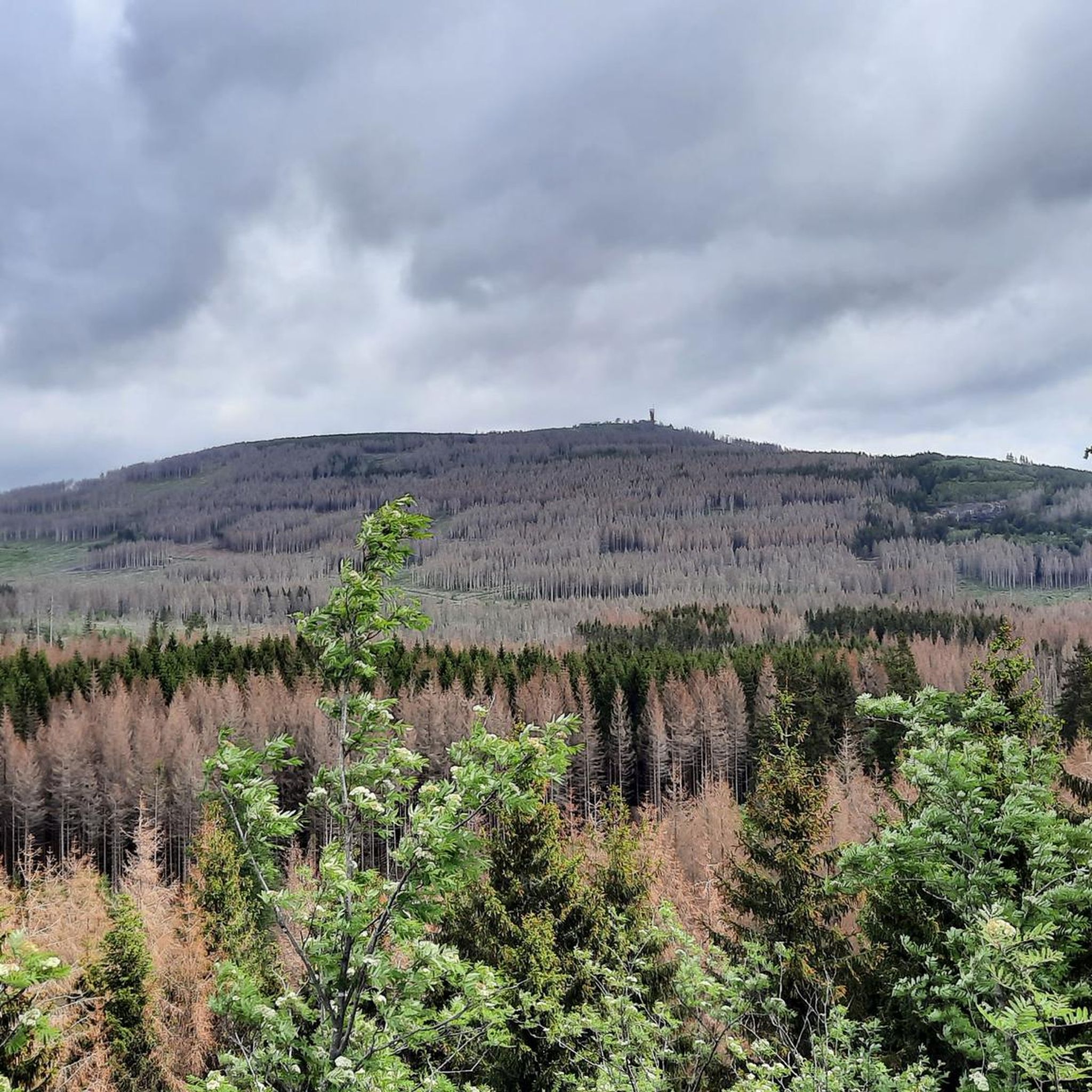
Yes, several routes provide stunning views of the Brocken, the highest peak in the Harz. The View of the Brocken – Neuer Goetheweg loop from Torfhaus is a 9.2-mile (14.8 km) trail that leads through characteristic Harz forests and offers glimpses of the iconic mountain. Another option is the View of Brocken and Wurmberg – Cattle Barn Forest Inn loop from Braunlage.
Can I bring my dog on touring cycling routes in Naturschutzgebiet Oberharz?
While the guide does not specify dog-friendly routes, the region's extensive network of trails through forests and natural areas generally welcomes dogs, provided they are kept on a leash and owners adhere to local regulations, especially within the nature reserve and bordering Harz National Park.
Are there any routes that pass by the Upper Harz Water Management System?
Yes, the historic Upper Harz Water Management System, a UNESCO World Heritage site, is an integral part of the region's landscape and cycling experience. Many routes, particularly those around Clausthal-Zellerfeld, wind past its artificial ponds, ditches, and tunnels, offering a unique blend of natural beauty and cultural heritage.
Most popular routes in Naturschutzgebiet Oberharz
Most popular attractions in Naturschutzgebiet Oberharz

Get inspired with the komoot mobile app


Explore more
Browse the best Cycling routes in other regions.
