The best running trails in Park Krajobrazowy Mierzeja Wiślana
4.6
(11)
722
runners
56
runs
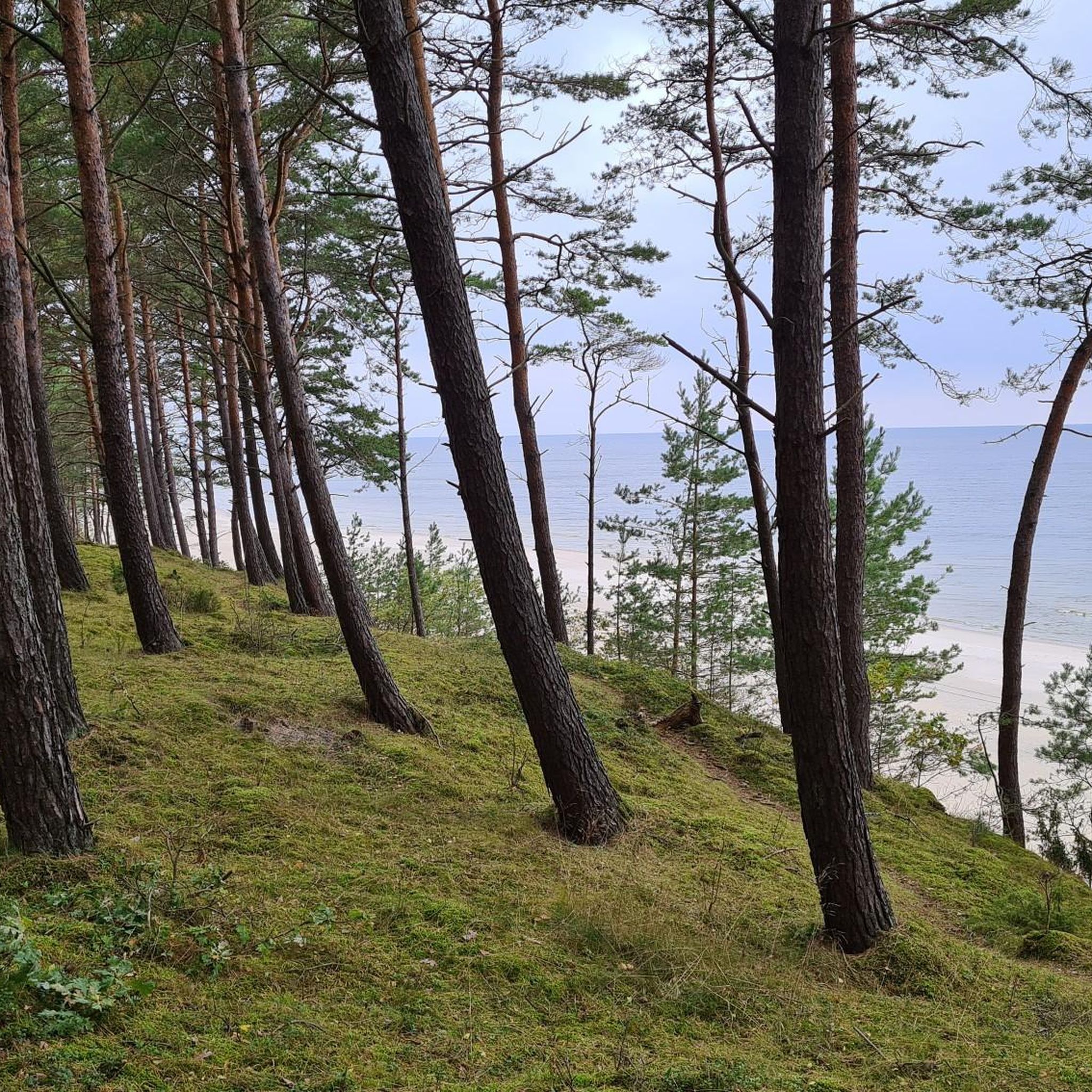
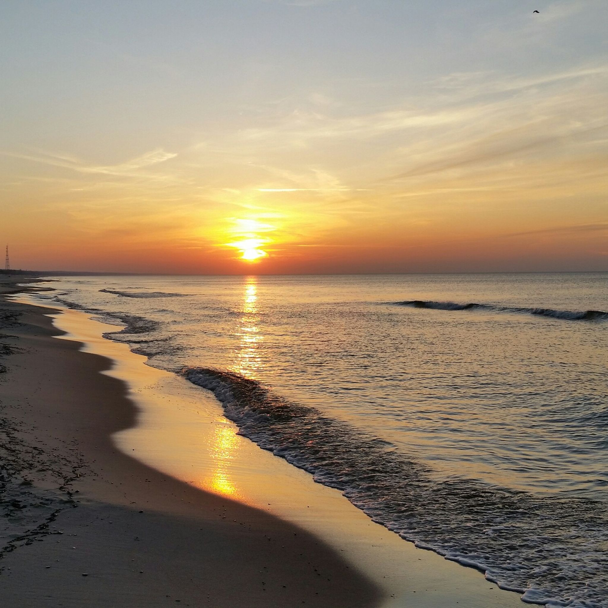
Jogging in Park Krajobrazowy Mierzeja Wiślana offers diverse terrain across the Vistula Spit, a narrow landform separating the Baltic Sea from the Vistula Lagoon. The region features wide sandy beaches, impressive dune systems, and extensive pine forests covering approximately 80% of the park. Runners can experience varied surfaces, from soft sand to shaded forest paths, with the highest dune, Wielbłądzi Garb, providing elevation up to 56 meters above sea level. The landscape also includes the reed-covered shores of the Vistula…
Last updated: October 12, 2026
5.0
(1)
48
runners
Moderate run. Good fitness required. Mostly paved surfaces. Suitable for all skill levels.
38
runners
16.6km
01:53
70m
70m
Hard run. Very good fitness required. Mostly paved surfaces. Suitable for all skill levels.

23
runners
9.72km
01:05
40m
40m
Moderate run. Good fitness required. Mostly paved surfaces. Suitable for all skill levels.
43
runners
8.13km
00:53
60m
60m
Moderate run. Good fitness required. Mostly paved surfaces. Suitable for all skill levels.
3.0
(1)
20
runners
20.2km
02:09
90m
90m
Hard run. Very good fitness required. Mostly paved surfaces. Suitable for all skill levels.
Get access to more routes and recommendations from other explorers.
Already have an account?
Our route recommendations are based on thousands of hikes, rides, and runs completed by other people on komoot.
Start today with a free account
Your next adventure awaits.

Tips from the Community

Without hustle and bustle with lots of amber 🪤🤗😜
0
0


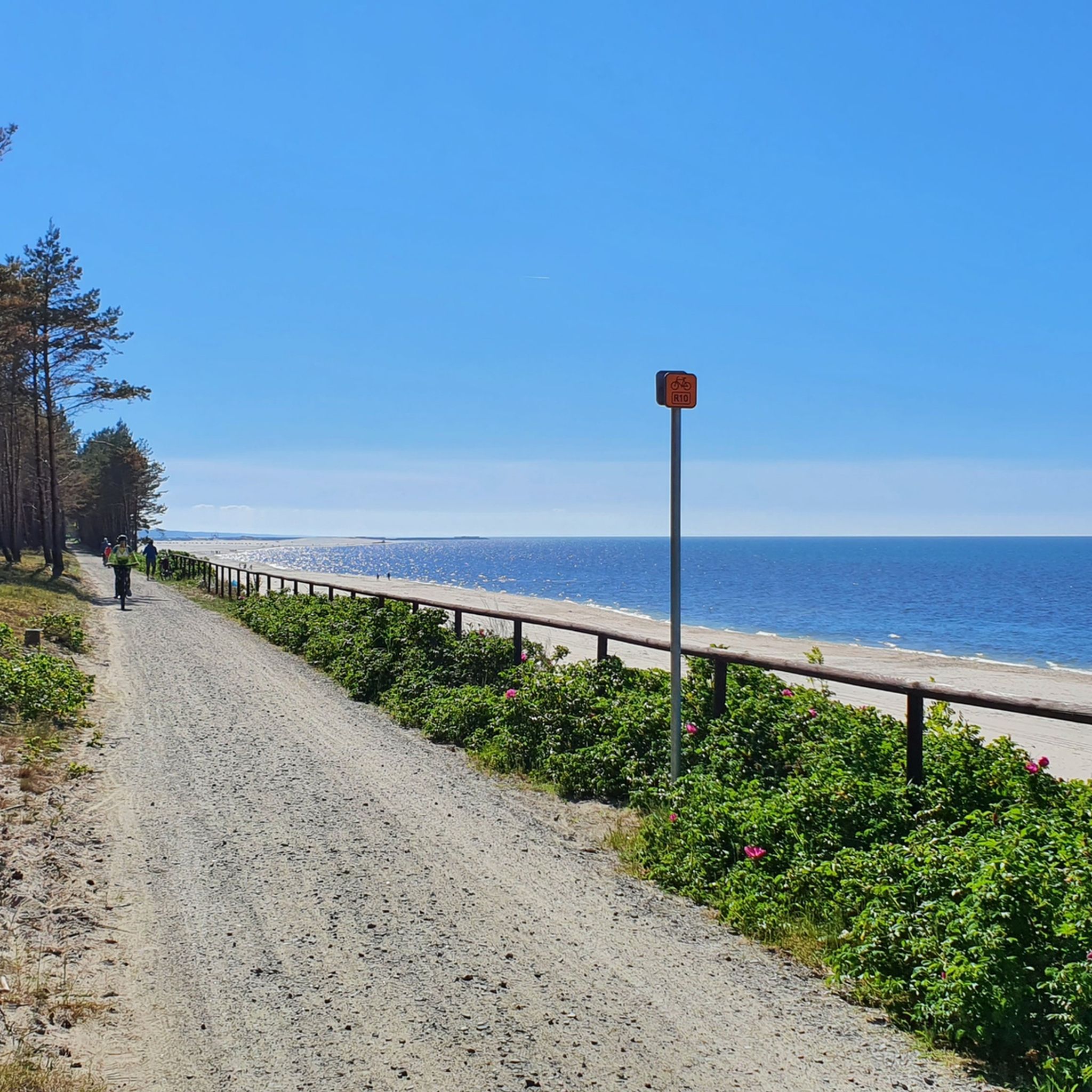
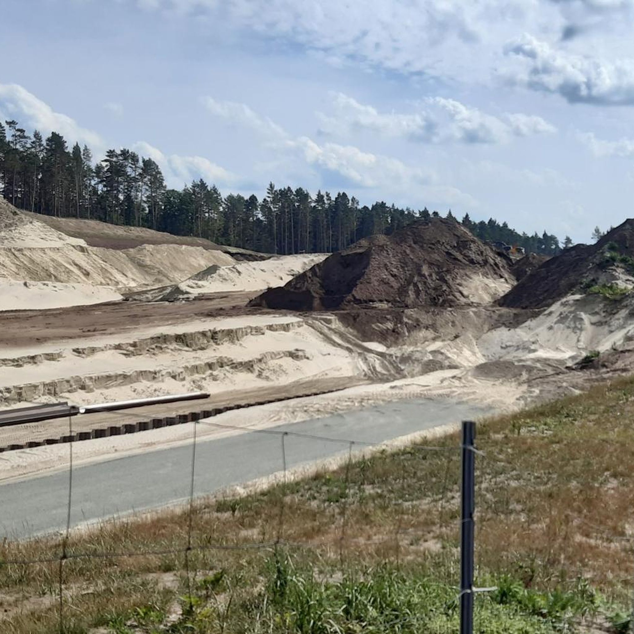
The Vistula Spit navigation canal is part of the waterway from the Bay of Gdańsk through the Vistula Lagoon and the Elbląg River to the port of Elbląg. The Przekop Spit canal is the most famous and spectacular section of this route, essential to ensuring Poland's sovereign access to the Vistula Lagoon from the sea. National Road 501 runs along the Spit, leading through Stegna and Sztutowo to Krynica Morska. To ensure continuous traffic on this road, two swing bridges were built, one of which is always open to road traffic. This is indicated by road signs with variable message. For cyclists, there are designated bike paths and a viewing point on the western side of the Przekop. It is possible to cycle to the end of the breakwaters, but not during storms. Despite the great attractiveness of this location, there are no dining options or shops. WW
2
0

The first lighthouse was built in 1895 as a brick tower with a Fresnel shade and a fuel source – a kerosene lamp, which was replaced by an electric one in 1938. The lighthouse was blown up in 1945 by retreating German troops. Reconstruction after the war A new facility was built and launched in 1951, according to designs from the Gdańsk University of Technology. It was made of concrete blocks, in the form of a truncated cone, about 27m high, and the light is located at a height of 53m above sea level, with a range of up to 18–19 Mm.
2
0

One of the nicer places to rest along the route.
0
0
A place of relaxation for many cyclists. There is a shelter and a lying tree that serves as a bench during a photo session and :-)
0
0
A unique place, with a shelter and a beautiful view. It is worth stopping here to rest.
0
0

The place is nice and cool, it's a pity there are no ships😀
0
0
Frequently Asked Questions
What kind of terrain can I expect on the running trails in Park Krajobrazowy Mierzeja Wiślana?
The region offers a diverse range of terrain for runners. You'll find wide, sandy beaches along the Baltic Sea, extensive pine forests covering about 80% of the park, and paths along the reed-covered shores of the Vistula Lagoon. The landscape also features impressive dune systems, including the highest dune, Wielbłądzi Garb, which provides elevation up to 56 meters above sea level.
Are there running routes suitable for beginners or those looking for an easier jog?
Yes, Park Krajobrazowy Mierzeja Wiślana offers several easy running routes. Out of the 38 available routes, 5 are classified as easy, providing gentler paths through the diverse landscape. These are perfect for a relaxed run or for those new to trail running.
Can I bring my dog on the jogging trails in Park Krajobrazowy Mierzeja Wiślana?
While the region is generally dog-friendly, specific regulations may apply in protected areas like nature reserves. It's always best to keep your dog on a leash and ensure you clean up after them. For detailed rules regarding specific trails or reserves, it's advisable to check local signage or the park's official information.
What are some notable natural features or landmarks I might see while running?
Runners can enjoy various natural and man-made landmarks. You might encounter the impressive dune systems, including the Trail to Wielbłądzi Garb, offering panoramic views. The park is also home to significant bird reserves like Mewia Łacha and Kąty Rybackie, and you can spot the Lighthouse in Krynica Morska. The R10 Cycle Route also passes through the park, offering another perspective.
Are there any circular running routes in the park?
Yes, many of the routes in Park Krajobrazowy Mierzeja Wiślana are designed as loops, allowing you to start and finish at the same point. For example, the Krynicki starodrzew loop from Krynica Morska is a popular circular trail through the characteristic pine forests.
What is the best time of year to go jogging in Park Krajobrazowy Mierzeja Wiślana?
The park is suitable for jogging year-round, but each season offers a different experience. Spring and autumn provide pleasant temperatures and beautiful scenery with changing foliage. Summer is ideal for combining a run with a dip in the Baltic Sea, though trails can be busier. Winter offers a unique, tranquil experience, especially in the pine forests, but requires appropriate gear for potentially colder and snowier conditions.
Where can I find parking for the running trails?
Parking facilities are generally available in the towns and villages located within or near the park, such as Krynica Morska or Kąty Rybackie. Many trailheads are accessible from these areas. It's advisable to check specific parking options when planning your route, especially during peak season.
What do other runners say about the trails in Park Krajobrazowy Mierzeja Wiślana?
The running routes in Park Krajobrazowy Mierzeja Wiślana are highly rated by the komoot community, with an average score of 4.5 stars. Runners often praise the varied surfaces, from soft sand to shaded forest paths, and the beautiful coastal views. The diverse landscape and well-maintained trails contribute to a rewarding experience.
Are there any routes that offer views of the Baltic Sea?
Absolutely. The park's location on the Vistula Spit means many routes run parallel to the Baltic Sea coastline. The Kąty Rybackie Lighthouse – Wejście 21 Beach loop from Krynica Morska is a great example, offering stunning coastal views and direct access to the sandy beaches.
Are there any longer running routes for experienced runners?
Yes, for more experienced runners seeking a challenge, there are longer and more difficult routes. For instance, the Krynicki starodrzew loop from Oczyszczalnie ścieków Krynica Morska is a difficult 10.4-mile (16.8 km) trail that leads through dense pine forests, providing a substantial workout.
Are there places to eat or stay near the jogging routes?
The towns and villages along the Vistula Spit, such as Krynica Morska and Kąty Rybackie, offer various accommodation options, restaurants, and cafes. These are conveniently located near many of the popular jogging routes, allowing you to refuel and relax after your run.
What kind of wildlife might I encounter on the trails?
Park Krajobrazowy Mierzeja Wiślana is rich in biodiversity. You might spot various bird species, especially in the bird reserves like Mewia Łacha, which is known for tern colonies, and Kąty Rybackie, home to a large cormorant colony. The extensive pine forests also host various mammals, making for an immersive natural experience.
Most popular routes in Park Krajobrazowy Mierzeja Wiślana
Most popular attractions in Park Krajobrazowy Mierzeja Wiślana

Get inspired with the komoot mobile app


Explore more
Browse the best Running Trails & Routes in other regions.
