The best mountain hikes in Schutzzone Rothirsch
4.9
(49)
594
hikers
39
hikes
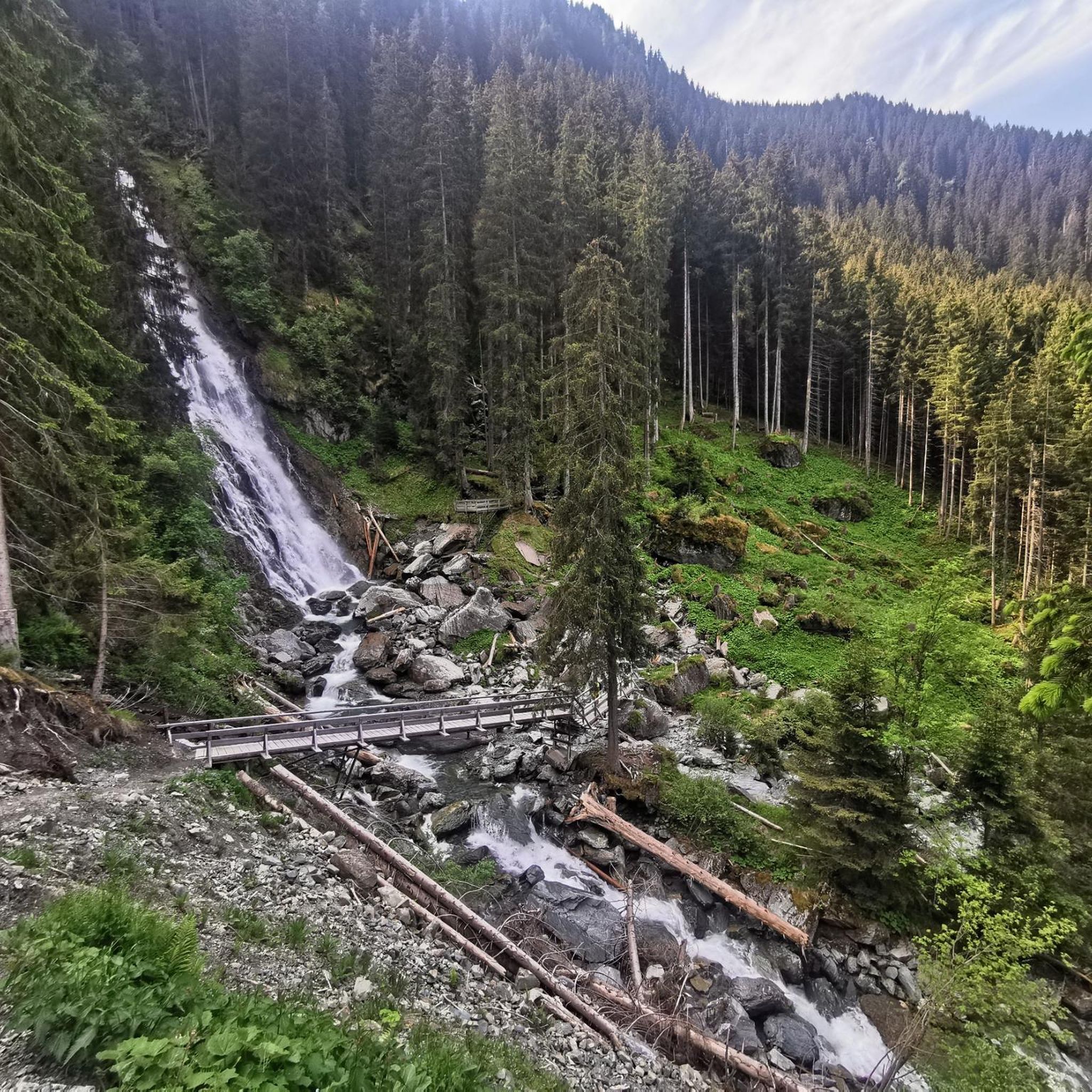
Mountaineering routes in Schutzzone Rothirsch traverse the rugged alpine landscapes of the Kitzbühel Alps in Tyrol, Austria. This region is characterized by significant elevation changes, offering challenging ascents and descents. The terrain features impressive natural landmarks such as the Sintersbacher Waterfall, alongside expansive alpine meadows and mountain huts. It provides a diverse environment for experienced mountaineers seeking demanding alpine paths.
Best mountaineering routes in Schutzzone Rothirsch
- The most popular mountaineering route is View of Sump loop from Aurach bei Kitzbühel…
Last updated: July 8, 2026
5.0
(1)
14
hikers
Hard mountaineering route. Very good fitness required. Easily-accessible paths. Suitable for all skill levels.
6
hikers
20.3km
07:40
1,250m
1,250m
Hard mountaineering route. Very good fitness required. Mostly accessible paths. Sure-footedness required.

Sign up for free
5.0
(1)
34
hikers
14.4km
05:37
1,060m
1,060m
Hard mountaineering route. Very good fitness required. Sure-footedness, sturdy shoes and alpine experience required.
15
hikers
Hard mountaineering route. Good fitness required. Sure-footedness, sturdy shoes and alpine experience required.
7
hikers
16.1km
06:17
1,110m
1,110m
Hard mountaineering route. Very good fitness required. Sure-footedness, sturdy shoes and alpine experience required.
Get access to more routes and recommendations from other explorers.
Sign up for free
Already have an account?
Our route recommendations are based on thousands of hikes, rides, and runs completed by other people on komoot.
Start today with a free account
Your next adventure awaits.
Login or Signup
Tips from the Community

The Teufelssprung at 2,174 meters is a distinctive peak in the Kitzbühel Alps, known for the impressive rock crevice that gives it its name. The ascent is usually made along the ridge from Gamshag or via the "gate" and the Hochtorsee from the valley floor of Saalbach-Hinterglemm. Once at the summit, a spectacular view of the surrounding mountain world opens up – a rewarding, quiet peak for sure-footed hikers.
5
0
The Teufelssprung (Devil's Leap), at 2,174 meters, is a striking peak in the Kitzbühel Alps, known for the impressive rock crevice that gives it its name. The ascent is usually via the ridge from the Gamshag or via the "Tor" and Hochtorsee lake from the head of the Saalbach-Hinterglemm valley. Once at the top, a spectacular view of the surrounding mountains opens up – a rewarding, tranquil summit for sure-footed hikers.
3
0
The Gamshag (2,178 m) is a particularly impressive peak in the Kitzbühel Alps and a true hiking highlight at the head of the Saalbach-Hinterglemm valley. This technically easy tour leads mostly via the Bochumer Hütte and the picturesque "Tor" pass, as well as the idyllic Torsee lake, to the summit, from where spectacular views of the Venediger Group, the Wilder Kaiser, and the Steinernes Meer massif await.
3
0
The Tristkogel, at 2,095 meters, is a striking and challenging peak at the head of the Saalbach-Hinterglemm valley, rewarding experienced hikers with breathtaking panoramic views. The ascent mostly proceeds via the Bochumer Hütte and the Oberkaseralm, passing alpine meadows and rockier passages. The summit offers an impressive panorama of the Hohe Tauern, the Wilder Kaiser, and the Leoganger Steinberge mountains – a worthwhile highlight for sure-footed mountaineers.
3
0
The Saalkogel, at 2,006 meters, is a peaceful and scenic peak at the head of the Saalbach-Hinterglemm valley, making it particularly suitable for long hikes. The ascent leads across rolling alpine meadows and broad ridges and is technically easy but physically demanding. From the summit, there are sweeping views of the Leogang and Lofer Steinberge mountains and as far as the Wilder Kaiser – a tranquil spot for those who enjoy alpine expanse.
3
0


Highly recommended, descent requires experience
1
1

Frequently Asked Questions
What kind of terrain can I expect on mountaineering routes in Schutzzone Rothirsch?
Mountaineering routes in Schutzzone Rothirsch traverse rugged alpine landscapes within the Kitzbühel Alps. You can expect significant elevation changes, challenging ascents and descents, and diverse alpine terrain. The region features impressive natural landmarks, expansive alpine meadows, and mountain huts, offering a demanding environment for experienced mountaineers.
Are there any easier mountaineering routes suitable for beginners in Schutzzone Rothirsch?
While many routes are challenging, there are some moderate options available. For instance, the region offers paths that are less demanding than the highly difficult alpine routes, providing a good starting point for those with some experience looking to explore mountaineering in the area. Overall, there are 13 moderate routes out of 41 total mountaineering tours.
How many mountaineering routes are available in Schutzzone Rothirsch?
There are over 40 distinct mountaineering routes available in Schutzzone Rothirsch, ranging from moderate to difficult. This extensive network ensures a variety of options for different skill levels and preferences.
What do other mountaineers enjoy most about the routes in Schutzzone Rothirsch?
The mountaineering routes in Schutzzone Rothirsch are highly rated by the komoot community, with an average score of 4.9 stars from over 50 reviews. Mountaineers often praise the rugged alpine terrain, impressive waterfalls, and picturesque mountain huts. The breathtaking panoramas and diverse natural features are also frequently highlighted.
Are there any impressive natural landmarks to see along the mountaineering routes?
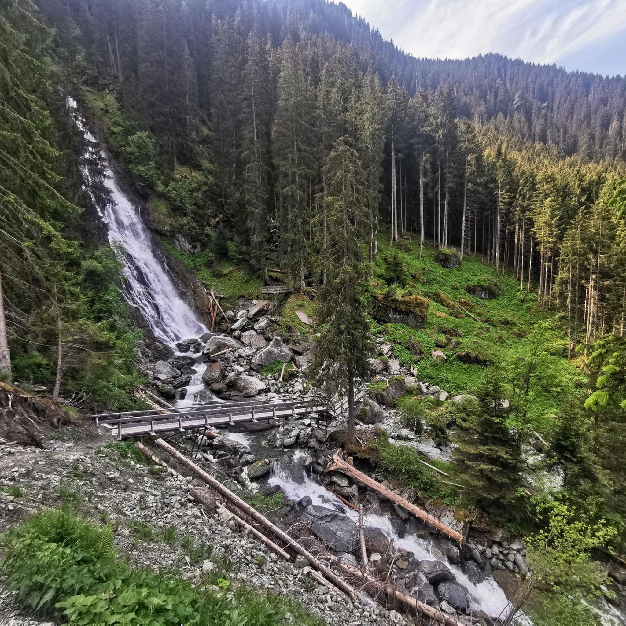
Yes, the region is known for its stunning natural features. A prominent highlight is the Sintersbacher Waterfall, where mountain water cascades over 85 meters into natural pools. Many routes also offer breathtaking panoramic views of the Inn Valley towards Innsbruck, Hall, and Schwaz from elevated points like the Largozalm.
What kind of wildlife might I encounter in Schutzzone Rothirsch?
Schutzzone Rothirsch is a designated protection zone for various wildlife, including red deer (Rothirsch), black grouse, chamois, and ibex. This status ensures a relatively undisturbed natural habitat, allowing visitors to experience a rich biodiversity. Remember to observe wildlife from a distance and respect their natural environment.
Are there circular mountaineering routes available in Schutzzone Rothirsch?
Yes, many mountaineering routes in Schutzzone Rothirsch are designed as circular tours, allowing you to start and end at the same point. An example is the challenging Teufelssprung Summit and Gorge – Gamshag (2,178 m) loop from Schieberstation Sintersbach, which offers a summit ascent and a demanding gorge section.
What is the best time of year to go mountaineering in Schutzzone Rothirsch?
The best time for mountaineering in Schutzzone Rothirsch is typically during the warmer months, from late spring to early autumn, when trails are generally free of snow and weather conditions are more stable. Always check local weather forecasts and trail conditions before heading out, as alpine weather can change rapidly.
Is public transport available to access mountaineering trailheads in Schutzzone Rothirsch?
While specific public transport connections to every trailhead may vary, the Kitzbühel district generally has bus services that can connect to various villages and starting points. It's advisable to research specific routes and their accessibility by public transport in advance to plan your journey effectively.
Are dogs allowed on the mountaineering routes in Schutzzone Rothirsch?
As Schutzzone Rothirsch is a wildlife protection zone, responsible behavior, including keeping dogs on a leash, is strongly encouraged to protect the local species. While dogs are generally allowed on trails, always ensure they are under control and respect any specific signage regarding protected areas or wildlife habitats.
Are there any family-friendly mountaineering options in Schutzzone Rothirsch?
While many routes are quite demanding, some of the moderate hikes can be suitable for families with older children who have some hiking experience and good physical condition. These routes often lead to scenic spots or mountain huts, providing rewarding experiences without the extreme challenges of advanced alpine paths.
Are there mountain huts or places for refreshment along the routes?
Yes, many trails traverse picturesque alpine meadows and lead to charming mountain huts, such as the Wildalm Mountain Hut. The Largozalm, for instance, still operates alpine farming and offers drinks to thirsty hikers, providing excellent opportunities for refreshment and rest amidst scenic surroundings.
What is the longest mountaineering route available in Schutzzone Rothirsch?
One of the longer and more challenging routes is the Teufelssprung Summit and Gorge – Gamshag (2,178 m) loop from Schieberstation Sintersbach, which spans 12.6 miles (20.3 km) and involves significant elevation gain, requiring good physical condition and sure-footedness.
Most popular routes in Schutzzone Rothirsch

Get inspired with the komoot mobile app


Explore more
Browse the best Mountain Hikes & Routes in other regions.
