The best mountain hikes in Wildruhezone Duisitzkar
4.8
(174)
1,335
hikers
30
hikes
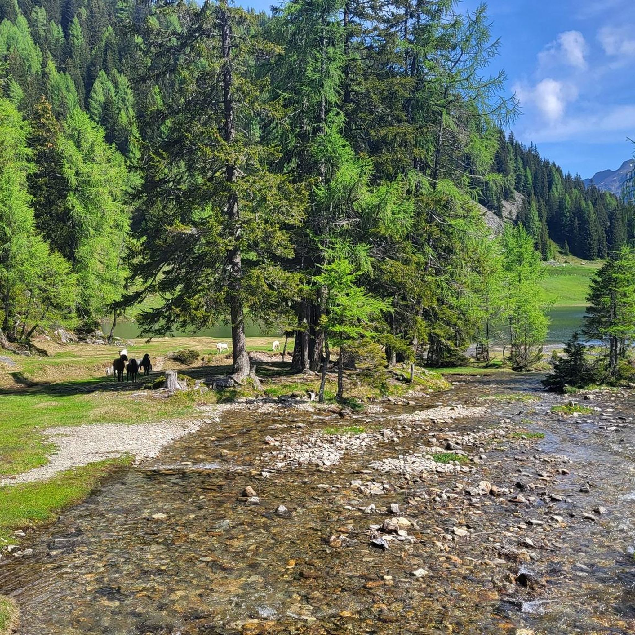
Mountaineering in Wildruhezone Duisitzkar offers routes through alpine landscapes characterized by mountain lakes, peaks, and forested valleys. The region, situated in the mountains around Liezen, features challenging ascents and descents suitable for experienced mountaineers. Terrain often includes rocky paths, alpine meadows, and sections near mountain huts. These routes provide opportunities to explore the natural environment of the Schladminger Tauern.
Best mountaineering routes in Wildruhezone Duisitzkar
- The most popular mountaineering route is Duisitzkarsee – Rotmandlspitze loop from Wildruhezone Duisitzkar, an…
Last updated: October 12, 2026
6
hikers
14.3km
07:15
1,050m
1,060m
Hard mountaineering route. Very good fitness required. Sure-footedness, sturdy shoes and alpine experience required.
4.6
(10)
58
hikers
8.45km
03:47
550m
550m
Hard mountaineering route. Good fitness required. Sure-footedness, sturdy shoes and alpine experience required.

4.8
(5)
41
hikers
7.43km
03:09
470m
470m
Hard mountaineering route. Good fitness required. Sure-footedness, sturdy shoes and alpine experience required.
5.0
(3)
22
hikers
13.0km
05:33
790m
790m
Hard mountaineering route. Very good fitness required. Sure-footedness, sturdy shoes and alpine experience required.
5.0
(1)
19
hikers
6.71km
03:11
490m
490m
Hard mountaineering route. Good fitness required. Sure-footedness, sturdy shoes and alpine experience required.
Get access to more routes and recommendations from other explorers.
Already have an account?
Our route recommendations are based on thousands of hikes, rides, and runs completed by other people on komoot.
Start today with a free account
Your next adventure awaits.
Popular around Wildruhezone Duisitzkar



Tips from the Community

Here there is super delicious Kaiserschmarrn as well as a large selection of very delicious homemade cakes and tortes.
0
0

The Giglachsee Ober und Untersee is a magnificent natural object that you must see.
2
0

Excellent hospitality, unique natural scenery, unfortunately without being able to take a ride = same way back!
0
0

The Rotmandlspitze is a good place to take off with a paraglider as it offers a beautiful meadow area.
0
0

Beautiful but very crowded. The last hiking bus leaves at 5 p.m., and you'll have the lakes almost to yourself.
2
0

Surefootedness is highly recommended as parts are very steep!
0
0

You walk directly past the waterfall on a wooden walkway. Further up, you repeatedly skirt the stream.
1
0
Frequently Asked Questions
What is the typical difficulty level for mountaineering routes in Wildruhezone Duisitzkar?
The routes in Wildruhezone Duisitzkar are primarily for experienced mountaineers. Out of 31 available routes, 21 are classified as difficult, offering challenging ascents and descents through alpine terrain.
Are there any circular mountaineering routes around Duisitzkarsee?
Yes, several popular circular routes explore the area around Duisitzkarsee. For example, the Duisitzkarsee – Duisitzkarsee loop from Eschachalm P1 is a difficult 4.5-mile (7.3 km) path, typically completed in just over 3 hours. Another option is the Duisitzkarsee – Duisitzkarsee loop from Eschachboden, which is 3.9 miles (6.3 km) long and also considered difficult.
What is the best time of year for mountaineering in Wildruhezone Duisitzkar?
The best time for mountaineering in Wildruhezone Duisitzkar is generally from late spring to early autumn (June to September). During these months, trails are typically free of snow, and weather conditions are more stable, making alpine routes safer and more enjoyable. Always check local weather forecasts before heading out.
What should I wear for mountaineering in Wildruhezone Duisitzkar?
Given the alpine environment, it's crucial to dress in layers. Essential gear includes sturdy hiking boots with good ankle support, moisture-wicking base layers, insulating mid-layers, and a waterproof and windproof outer shell. Don't forget sun protection, a hat, gloves, and plenty of water.
Are there any family-friendly mountaineering options in Wildruhezone Duisitzkar?
While most routes are classified as difficult, some sections around Duisitzkarsee might be suitable for families with older, experienced children who are accustomed to alpine hiking. However, there are no routes specifically designated as 'easy' in this guide, so careful assessment of your family's fitness and experience is recommended for any chosen path.
Where can I find parking for mountaineering routes in Wildruhezone Duisitzkar?
Parking is available at various trailheads leading into the Wildruhezone Duisitzkar. For routes around Duisitzkarsee, common starting points with parking include Eschachalm P1 and Hopfriesen Parkplatz. Always check for specific parking regulations or fees at your chosen starting point.
What kind of wildlife and flora can I expect to see in Wildruhezone Duisitzkar?
Wildruhezone Duisitzkar is part of the Schladminger Tauern, an alpine region known for its diverse ecosystem. You might encounter chamois, marmots, and various bird species. The flora includes typical alpine flowers, mountain pines, and larch forests, especially vibrant in spring and autumn.
Are there any mountain huts or places to eat along the routes?
Yes, some routes pass by mountain huts where you can rest and get refreshments. For instance, the Keinprechthütte – Duisitzkarsee loop leads through alpine terrain and past the Keinprechthütte, offering a chance to stop. The area around Duisitzkarsee also features huts like the Duisitzkarseehütte and Fahrlechhütte, which are popular stops.
What do other mountaineers enjoy most about Wildruhezone Duisitzkar?
The area is highly rated by the komoot community, with an average score of 4.8 stars from over 150 reviews. Reviewers often praise the stunning mountain lake scenery, the challenging yet rewarding ascents to peaks like Rotmandlspitze, and the overall immersive alpine experience.
Can I reach the trailheads using public transport?
Public transport options to the more remote trailheads in Wildruhezone Duisitzkar can be limited. It's advisable to research specific bus routes or shuttle services that might operate during peak hiking season to popular starting points like Eschachalm. Many visitors opt for personal vehicles to access the trailheads.
Are there any routes that combine a lake and a peak ascent?
Yes, the Duisitzkarsee – Rotmandlspitze loop from Wildruhezone Duisitzkar is an excellent example. This difficult 8.9-mile (14.3 km) trail combines the scenic beauty of Duisitzkarsee with a challenging ascent to the prominent Rotmandlspitze, offering panoramic views. It typically takes over 7 hours to complete.
Most popular routes in Wildruhezone Duisitzkar

Get inspired with the komoot mobile app


Explore more
Browse the best Mountain Hikes & Routes in other regions.
