The best road cycling routes in Björkön
5.0
(4)
148
riders
7
rides
Road cycling in Björkön, located in Örebro, traverses a landscape characterized by rural roads and varied elevation. The region offers a mix of open countryside and areas with rolling terrain, suitable for different cycling preferences. Routes often feature moderate climbs and descents, providing a dynamic experience for road cyclists. The terrain includes forests and open fields, with some routes passing by lakes.
Best road cycling routes in Björkön
- The most popular road cycling route is Södra Lången – Örebro City…
Last updated: July 5, 2026
5
riders
118km
04:49
540m
540m
Moderate road ride. Good fitness required. Some segments of this route may be unpaved and difficult to ride.
5.0
(2)
47
riders
109km
04:23
560m
560m
Moderate road ride. Good fitness required. Some segments of this route may be unpaved and difficult to ride.

Sign up for free
5.0
(2)
34
riders
39.0km
01:33
170m
170m
Easy road ride. Great for any fitness level. Mostly well-paved surfaces and easy to ride.
30
riders
88.0km
03:31
330m
330m
Moderate road ride. Good fitness required. Some segments of this route may be unpaved and difficult to ride.
3
riders
77.0km
03:02
320m
320m
Moderate road ride. Good fitness required. Mostly well-paved surfaces and easy to ride.
Get access to more routes and recommendations from other explorers.
Sign up for free
Already have an account?
Our route recommendations are based on thousands of hikes, rides, and runs completed by other people on komoot.
Start today with a free account
Your next adventure awaits.
Login or Signup
Popular around Björkön
Tips from the Community

These easy and mostly flat trails are ideal for trail running, a relaxed walk or a gentle bike ride. The wide paths are suitable for all ages, and in summer you can even spot blueberries along the way.
0
0

The central Stortorget (Great Square) was created after the city fire of 1854, which destroyed large parts of the wooden town of Örebro. In 1880, it was expanded to its current size and complemented by Oskarsparken to the east. At 362 meters, Stortorget is one of the longest squares in Sweden. Due to the gently curving ridge of stone that runs through the center of Örebro, the terrain slopes down to the east.
17
0
The Kanslibron bridge connects the northern Svartåstranden near Olaigatan with Slottsparksholmen. It is named after the chancellery that once stood at the southwestern foot of the original wooden bridge. In 1584, Duke Charles (later King Charles IX) decided to build the first wooden bridge, which stood 75 meters east of the current bridge. It was called the Sågkvarnsbron bridge. This bridge was probably not intended for general use, but only for traffic to Örebro Castle. It was demolished in 1766 because the current stone arch bridge had been built in 1765, at the same time as the conversion of Örebro Castle into a Baroque palace.
13
0
Henry Allard Park in the center of Örebro was created in 1913 and was formerly called Centralparken. After the death of former Speaker of Parliament Henry Allard in 1996, the park received its current name.
14
0
Örebro Castle is situated on an island in the Svartån River. It was originally built, presumably in the mid-14th century, by King Magnus Eriksson as a fortified castle. Around 1600, during the reign of Duke Charles, and from 1604 onwards King Charles IX, it was remodeled into a Renaissance castle in the French style. By this time, it had largely lost its function as a defensive structure. The renovations carried out in the 20th century did not alter the exterior of the castle, but none of the interior rooms remain in their original condition. Since 1764, the Governor of Örebro County has resided in the castle's northwest tower.
15
0

Beautiful castle. The old kitchen is interesting.
4
0

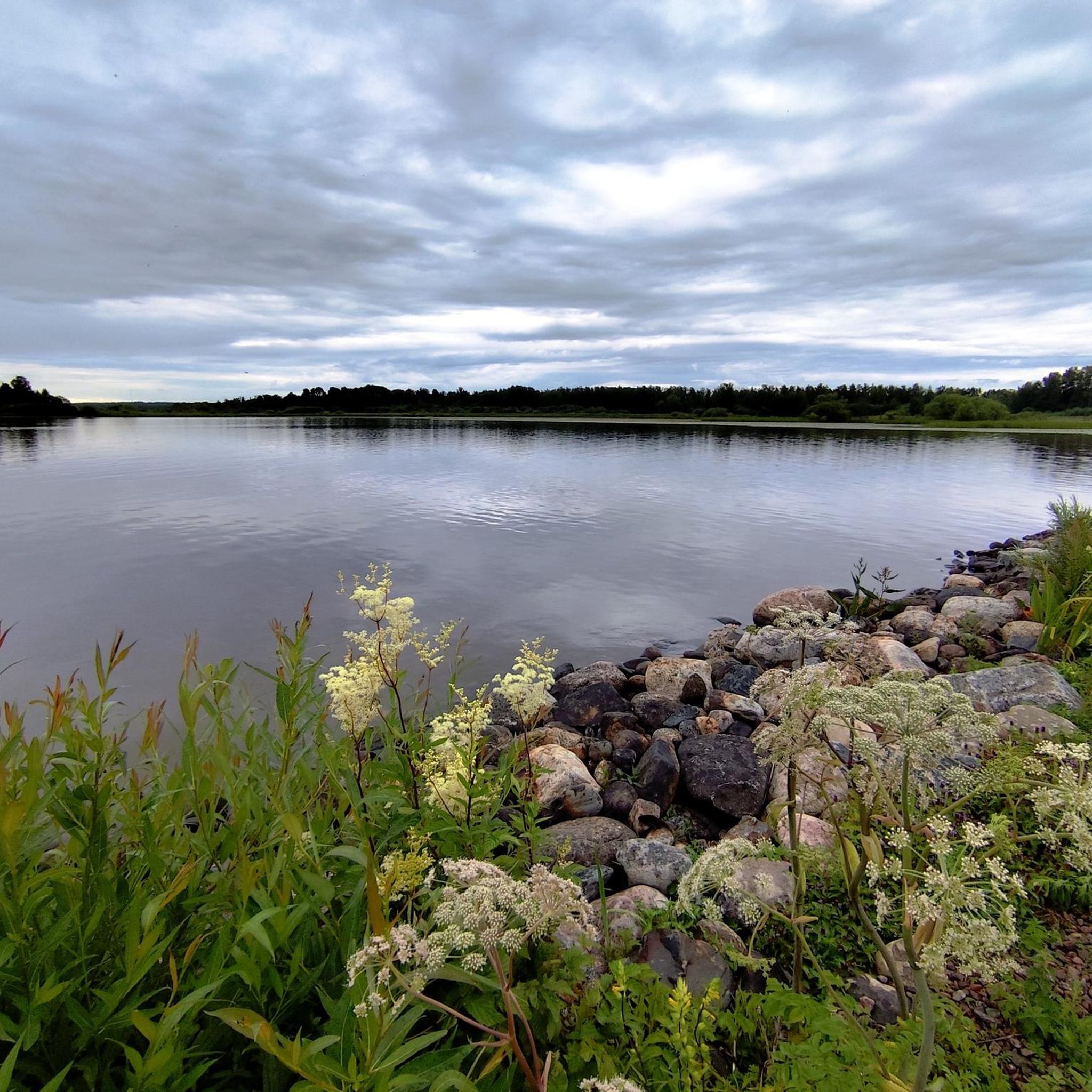
Quiet road running near Södra Lången lake. This stretch is part of a bike route that goes around the Lången lake system. It's called "Lången runt" and it starts in Örebro.
1
0

This medieval castle stands on an island in the Svartån River. Its fortifications were extended during the reign of the House of Vasa. It hosts annual art exhibitions.
2
0
Frequently Asked Questions
What is the typical terrain like for road cycling in Björkön?
Road cycling in Björkön features a varied landscape with rural roads and a mix of open countryside and rolling terrain. You can expect moderate climbs and descents, providing a dynamic experience. The region's routes often wind through forested areas and offer views of serene waters, characteristic of the Swedish countryside.
How many road cycling routes are available in Björkön?
There are over 9 dedicated road cycling routes in Björkön, offering a total tracked distance of more than 1,392 kilometers. These routes cater to various preferences, from shorter loops to longer, more challenging rides.
Are there challenging road cycling routes in Björkön for advanced riders?
Yes, Björkön offers routes with significant elevation changes for advanced riders. For example, the Ice Cream Stop loop from Stora Mellösa is a moderate 105.4 km route with over 550 meters of elevation gain, providing a substantial challenge.
Are there easy road cycling routes suitable for beginners in Björkön?
Absolutely. Björkön has easy routes perfect for beginners or those looking for a more relaxed ride. The Church loop from Stora Mellösa is an easy 39.0 km path, offering a pleasant ride through the local area with less demanding terrain.
What kind of scenery can I expect on road cycling routes in Björkön?
Cyclists in Björkön can expect diverse and picturesque scenery. Routes often feature vast woodlands, numerous lakes, and open countryside. Given its location in Stockholm County, you might also encounter archipelagic views and charming villages, providing a rich visual experience.
Are there circular road cycling routes available in Björkön?
Many of the road cycling routes in Björkön are designed as loops, allowing you to start and end at the same point. Examples include the Old Monastery Ruins loop from Glanshammar, which is a 95.5 km circular trail through rural landscapes.
When is the best time of year for road cycling in Björkön?
The best time for road cycling in Björkön, like much of Sweden, is typically during the warmer months, from late spring to early autumn (May to September). During this period, the weather is generally mild, and the landscapes are at their most vibrant, offering ideal conditions for exploring.
What do other cyclists say about road cycling in Björkön?
The road cycling routes in Björkön are highly rated by the komoot community, with an average score of 5.0 stars from 3 reviews. Over 140 road cyclists have used komoot to explore the varied terrain, often praising the dynamic experience offered by the rural roads and varied elevation.
Are there family-friendly road cycling routes in Björkön?
While specific family-friendly routes are not detailed, the presence of easy and shorter options like the Church loop from Stora Mellösa suggests that families with older children or those looking for a less strenuous ride can find suitable paths. Always check route details for distance and elevation to match your family's ability.
What are the parking options for road cyclists in Björkön?
Specific parking locations for each route are not detailed in the guide. However, for routes starting from towns like Stora Mellösa or Glanshammar, you can generally find public parking facilities within the village centers or near common starting points. It's advisable to check local signage upon arrival.
Is public transport available to access road cycling routes in Björkön?
Information on specific public transport links to trailheads is not provided. Given Björkön's rural character, public transport options might be limited. It's recommended to check local bus schedules or regional train services to nearby towns if you plan to use public transport to reach the starting points of the routes.
Are there cafes or accommodation options along the road cycling routes in Björkön?
While the guide does not list specific cafes or accommodation, routes often pass through or near small villages like Stora Mellösa and Glanshammar. These areas typically offer local amenities where cyclists can find refreshments or overnight stays. Planning your route with potential stops in mind is recommended.
Most popular routes in Björkön

Get inspired with the komoot mobile app


Explore more
Browse the best Road cycling routes in other regions.
