The best walks and hikes in Kleppefjell Naturreservat
4.6
(61)
205
hikers
7
hikes
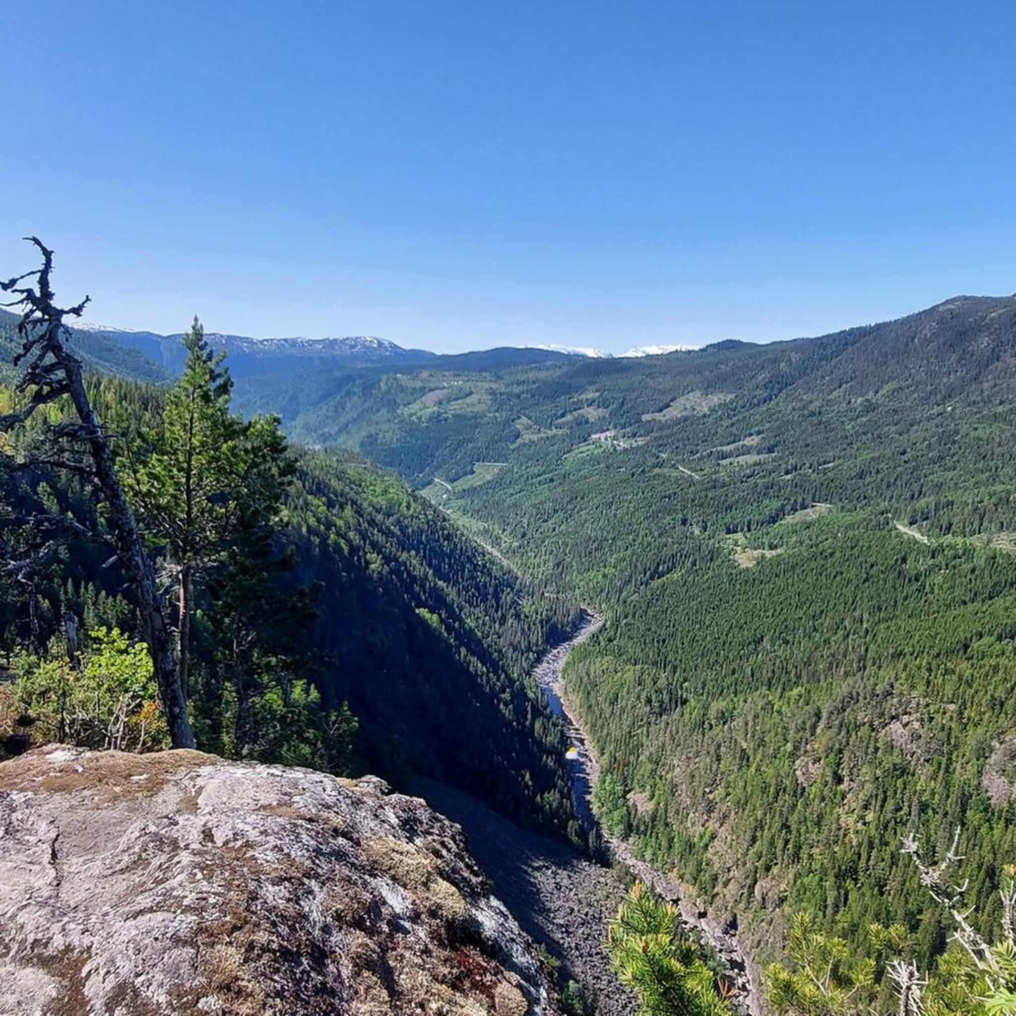
Hiking in Kleppefjell Naturreservat features a diverse network of trails within a rich forest landscape. The reserve is characterized by a distinctive lime pine forest growing on bedrock, supporting a rich vascular plant flora. Lifet, the highest named mountain at 771 meters, is a prominent landmark. Trails often lead around natural features such as Gavlesjå Lake, offering varied terrain for hikers.
Best hiking trails in Kleppefjell Naturreservat
- The most popular hiking route is Himingen Summit (1,066 m) – Himingen Summit…
Last updated: July 10, 2026
2
hikers
15.3km
04:16
280m
280m
Moderate hike. Good fitness required. Easily-accessible paths. Suitable for all skill levels.
4.8
(35)
107
hikers
Moderate hike. Good fitness required. Easily-accessible paths. Suitable for all skill levels.

Sign up for free
4.6
(21)
63
hikers
Easy hike. Great for any fitness level. Easily-accessible paths. Suitable for all skill levels.
8
hikers
Moderate hike. Good fitness required. Easily-accessible paths. Suitable for all skill levels.
5.0
(1)
5
hikers
5.03km
01:42
240m
240m
Easy hike. Great for any fitness level. Easily-accessible paths. Suitable for all skill levels.
Get access to more routes and recommendations from other explorers.
Sign up for free
Already have an account?
Our route recommendations are based on thousands of hikes, rides, and runs completed by other people on komoot.
Start today with a free account
Your next adventure awaits.
Login or Signup
Popular around Kleppefjell Naturreservat
Tips from the Community

This old farmhouse offers overnight accommodation and breakfast the following morning. An idyllic setting for a night’s sleep surrounded by nature.
0
0

There is now a foot-wide beam that you can balance on if the water level is not too high!
0
0


The bridge is broken and you have to go through the water.
0
0

This secluded mountain lake is beautifully situated in the heart of Lifjell.
0
0
Great resting place and campground directly on the Gavlesjå (lake). And in a beautiful, small mountains (Lifjell) in the south of Norway. Tip!
0
0
Rest area near Gavlesjå.
0
0
Bridge over the outlet of Gavlesjå.
1
0
Frequently Asked Questions
What types of hiking trails are available in Kleppefjell Naturreservat?
Kleppefjell Naturreservat offers a diverse network of trails, ranging from easy walks suitable for all fitness levels to more demanding routes. You can find paths that are up to 2 hours long with minimal elevation gain, as well as challenging hikes that can take over 5 hours and involve significant ascents.
Are there easy hiking trails suitable for families or beginners?
Yes, Kleppefjell Naturreservat has several easy trails perfect for families and beginners. For example, the Picnic Area at Gavlesjå Lake – Gavlesjå Lake loop from Blåurlia naturreservat is an easy 4.6-mile path that circles Gavlesjå Lake and provides access to picnic areas. Another easy option is the Rognlifjell loop from Blåurlia naturreservat.
What natural features or landmarks can I expect to see while hiking?
The reserve is characterized by a rich forest landscape, notably a distinctive and species-rich lime pine forest. You can also explore areas around Gavlesjå Lake, which features picnic spots. The highest and most prominent named mountain in the reserve is Lifet, standing at 771 meters.
Are there any circular hiking routes in Kleppefjell Naturreservat?
Yes, many trails in Kleppefjell Naturreservat are designed as loops. Popular circular routes include the Himingen Summit (1,066 m) – Himingen Summit loop from Blåurlia naturreservat and the Picnic Area at Gavlesjå Lake – Rest Area Near Gåviesjåstulen loop from Blåurlia naturreservat, which takes you through forested areas near Gavlesjå Lake.
What is the best time of year to hike in Kleppefjell Naturreservat?
While specific seasonal recommendations can vary, the diverse trail network and natural features make Kleppefjell Naturreservat enjoyable across different seasons. Spring and summer offer lush greenery and vibrant plant life, while autumn brings colorful foliage. Some trails may be suitable for winter hiking, but conditions should always be checked beforehand.
What do other hikers say about Kleppefjell Naturreservat?
The routes in Kleppefjell Naturreservat are highly rated by the komoot community, with an average score of 4.7 stars from over 50 reviews. Hikers often praise the varied terrain, the rich forest landscapes, and the well-defined trails that cater to different ability levels.
Are there any challenging hikes for experienced hikers?
Yes, for those seeking a more demanding experience, there are trails that require good physical condition and sure-footedness. These can extend up to five hours and involve significant elevation gain. An example of a more difficult route is the longer Picnic Area at Gavlesjå Lake – Gavlesjå Lake loop from Blåurlia naturreservat, which covers 11.8 km with considerable elevation.
How many hiking routes are there in Kleppefjell Naturreservat?
There are several hiking routes available in Kleppefjell Naturreservat, offering a variety of distances and difficulties to explore the area's natural beauty.
What kind of flora and fauna can I observe in the reserve?
Kleppefjell Naturreservat is particularly noted for its distinctive and species-rich lime pine forest growing on bedrock. The area boasts a very rich vascular plant flora, including numerous base and heat-demanding species. It also has high potential for heat-demanding insects, contributing to its biological diversity.
Are there any picnic areas along the trails?
Yes, visitors can enjoy picnic areas, such as those found near Gavlesjå Lake. These spots are often integrated into hiking loops, providing pleasant resting points during your walk.
What is the highest point in Kleppefjell Naturreservat?
The highest and most prominent named mountain within the reserve is Lifet, which stands at 771 meters. While not all trails lead directly to its summit, it is a significant landmark in the area.
Most popular routes in Kleppefjell Naturreservat

Get inspired with the komoot mobile app


Explore more
Browse the best Hikes in other regions.
