The best walks and hikes in Finse Biotopvernområde
4.5
(99)
454
hikers
16
hikes
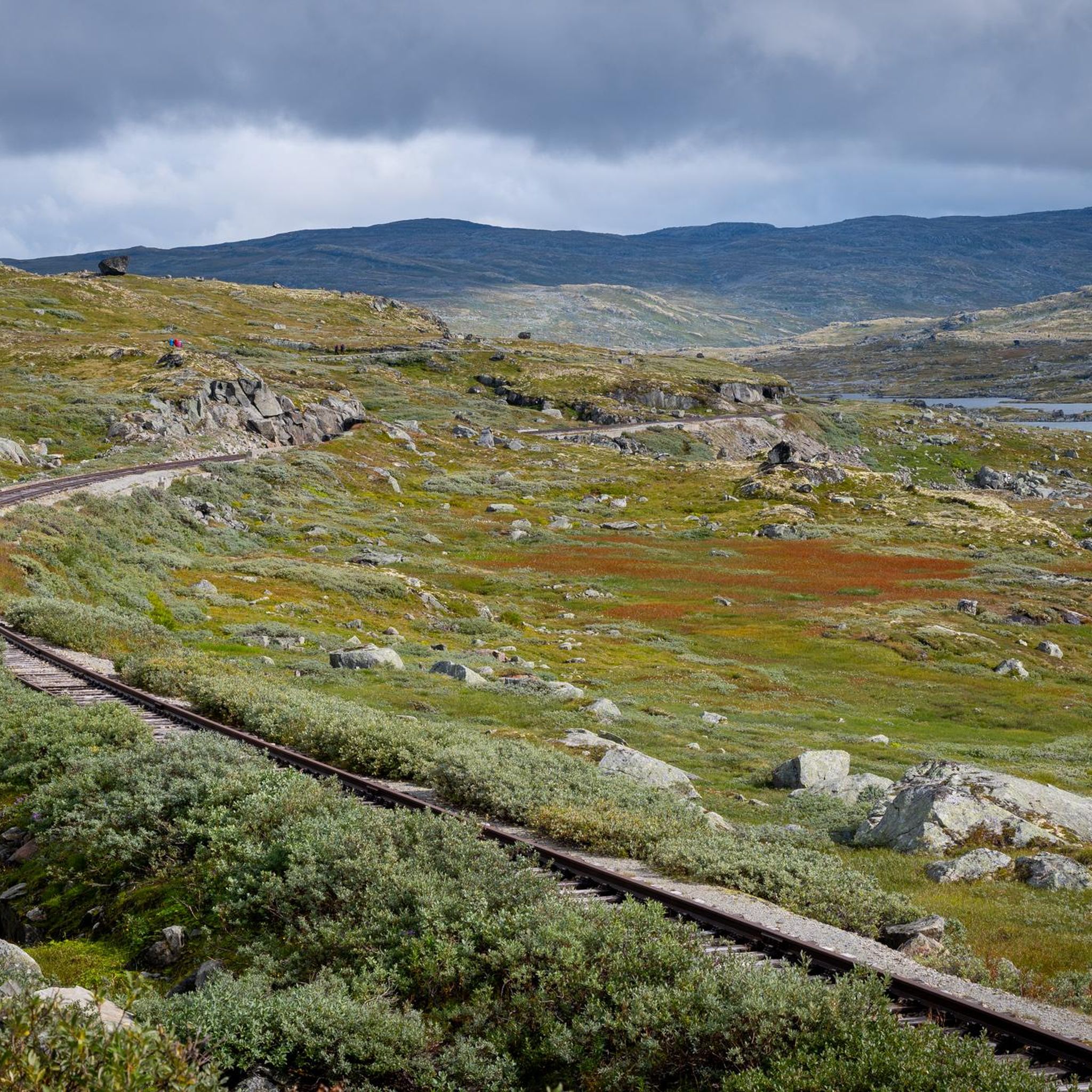
Hiking trails in Finse Biotopvernområde traverse a high-mountain plateau in the Norwegian mountains, offering a unique landscape shaped by glaciers and alpine conditions. The region is characterized by barren highlands, dramatic peaks, and significant natural features like the Hardangerjøkulen Glacier and Finsevatnet Lake. Situated at 1222 meters above sea level, the area provides expansive panoramas and a sense of wilderness, making it a destination for high-mountain excursions.
Best hiking trails in Finse Biotopvernområde
- The most popular hiking route is Trail to Hardangerjøkulen Glacier from Finse, a 7.0 miles (11.2 km) trail that takes 4 hours 10 minutes to complete. This moderate route offers views of one of Norway's largest glaciers.
- Another top favourite among local hikers is Rallarvegen along the Bergen Railway from Finse to Hallingskeid, a difficult 13.3 miles (21.3 km) path. This historic route winds through mountains and valleys, following the Bergen Railway.
- Local hikers also love the Trail to Kyrkjedøri, a 11.2 miles (17.9 km) trail leading through dramatic high-mountain scenery, often completed in about 6 hours 44 minutes.
- Hiking in Finse Biotopvernområde is defined by high-mountain plateaus, glacial landscapes, and rugged terrain. The network offers options for various ability levels, from moderate paths to challenging high-altitude treks.
- The routes in Finse Biotopvernområde are highly rated by the komoot community with an average score of 4.5 stars from over 90 reviews. More than 450 hikers have used komoot to explore Finse Biotopvernområde's varied terrain.
Last updated: June 26, 2026
4.7
(51)
214
hikers
11.2km
04:10
370m
370m
Moderate hike. Good fitness required. Mostly accessible paths. Sure-footedness required.
5.0
(4)
31
hikers
21.3km
05:42
200m
320m
Hard hike. Very good fitness required. Easily-accessible paths. Suitable for all skill levels.

Sign up for free
5
hikers
17.9km
06:44
580m
580m
Hard hike. Very good fitness required. Mostly accessible paths. Sure-footedness required.
4.9
(9)
37
hikers
12.8km
04:57
460m
460m
Hard hike. Good fitness required. Sure-footedness, sturdy shoes and alpine experience required.
11
hikers
19.9km
05:15
170m
170m
Hard hike. Very good fitness required. Easily-accessible paths. Suitable for all skill levels.
Get access to more routes and recommendations from other explorers.
Sign up for free
Already have an account?
Our route recommendations are based on thousands of hikes, rides, and runs completed by other people on komoot.
Start today with a free account
Your next adventure awaits.
Login or Signup
Popular around Finse Biotopvernområde
Tips from the Community

The path from Finse to Geiterygghytta leads several kilometers through scree, snowfields and rocky ground.
0
0
Please note: This hut is not designed for regular overnight stays.
0
0
The natural surroundings of Finse are exceptionally beautiful, making it a great starting point for various one-day and multi-day tours. The connection to the train line from Oslo to Bergen also makes travel to and from the area very convenient.
0
0
The Finse Railway Museum features an exhibition on the construction of the railway line from 1894 to 1909. The museum is located right next to the train station.
0
0
Finse Station is located on the railway line connecting Oslo and Bergen. Finse is the highest station in Scandinavia.
0
0

Don't hike in mid-June! There's massive amounts of snow, so you can't see the trail most of the way, and you have to check the Komoot app to make sure you're not walking over a frozen lake covered in snow. It was snowing everywhere, so we more than doubled our time! Additionally, there were some very dangerous sections where we were forced to hike over steep, avalanche-prone sections over several meters of snow.
1
1

Finsevatnet is a high-altitude lake located right next to the tiny village of Finse, at 1,214 meters above sea level in the heart of southern Norway. From the railway station or nearby trails, you get a sweeping panorama that captures the remote, untouched feel of Norway’s high mountain plateau.
0
0
Finsevatnet is a high-altitude lake located right next to the tiny village of Finse, at 1,214 meters above sea level in the heart of southern Norway. The Bergen Line railway skirts its edge, offering passengers stunning views of this glacial-fed lake framed by snow-dusted peaks and sweeping mountain plateaus.
1
0
Frequently Asked Questions
How many hiking trails are available in Finse Biotopvernområde?
Finse Biotopvernområde offers a diverse network of over 15 hiking trails. These routes cater to various skill levels, from moderate paths to challenging high-altitude treks across the high-mountain plateau.
What are the general difficulty levels for hiking in Finse Biotopvernområde?
The trails in Finse Biotopvernområde range from moderate to difficult. You'll find 9 moderate routes and 5 difficult routes, with a few easier options also available. The terrain is often rugged and high-alpine, requiring appropriate preparation.
What natural features and landmarks can I expect to see while hiking?
Hikers can experience dramatic landscapes shaped by glaciers, including views of the majestic Hardangerjøkulen Glacier. The region also features the picturesque Finsevatnet Lake, and sections of the historic Rallarvegen. Prominent peaks like Lille Finsenut and Sandalsnuten offer panoramic views.
What is the best time of year to go hiking in Finse Biotopvernområde?
Finse is primarily a summer hiking destination. However, due to its high-altitude location, snow can persist into mid-June. The best time to visit for hiking is typically from late June through September, when trails are generally clear and accessible.
Are there any family-friendly hiking options in Finse Biotopvernområde?
While many trails are challenging, some sections of the historic Rallarvegen can be suitable for families, offering relatively flatter terrain and scenic views. Always check the specific route details for distance and elevation to ensure it matches your family's ability.
Can I bring my dog on the hiking trails in Finse Biotopvernområde?
Yes, dogs are generally welcome on trails in Finse Biotopvernområde. However, as the area is a protected biotop for wild reindeer, it's crucial to keep dogs on a leash, especially during sensitive periods, to protect wildlife and adhere to local regulations.
How do I get to Finse Biotopvernområde, and is parking available?
Finse is uniquely accessible only by train, foot, or bike. There is no road access for private cars, meaning no parking facilities. The most common way to arrive is by taking the Bergen Line railway to Finse station, which is Scandinavia's highest railway station.
Are there any circular hiking routes in the area?
Yes, there are circular routes available. For example, the Finse – Train Station – summer bridge loop from Finse offers a challenging 12.9 km circular hike, providing a comprehensive experience of the local landscape.
What do other hikers enjoy most about hiking in Finse Biotopvernområde?
The area is highly rated by the komoot community, with an average score of 4.5 stars from over 90 reviews. Reviewers often praise the stunning high-mountain scenery, the sense of wilderness, and the dramatic views of the Hardangerjøkulen Glacier.
Are there opportunities for multi-day hikes from Finse?
Yes, Finse is an excellent starting point for longer treks. It is integrated into the Norwegian Trekking Association's (DNT) network of trails, offering marked routes further into Hardangervidda or Skarvheimen, with access to various DNT cabins for overnight stays.
What kind of accommodation and facilities are available in Finse?
Finse offers accommodation options such as the historic Hotel Finse 1222 and the DNT cabin Finsehytta. There are also basic facilities like a small shop and a café, providing essential services for hikers and visitors in this remote high-mountain setting.
Is it possible to hike to the Hardangerjøkulen Glacier?
Yes, you can hike towards the Hardangerjøkulen Glacier. A popular route is the Trail to Hardangerjøkulen Glacier from Finse, which is a moderate 11.2 km trail offering impressive views of one of Norway's largest glaciers.
Most popular routes in Finse Biotopvernområde
Most popular attractions in Finse Biotopvernområde

Get inspired with the komoot mobile app


Explore more
Browse the best Hikes in other regions.
