The best road cycling routes in Sagvatnet Naturreservat
3.0
(1)
77
riders
7
rides
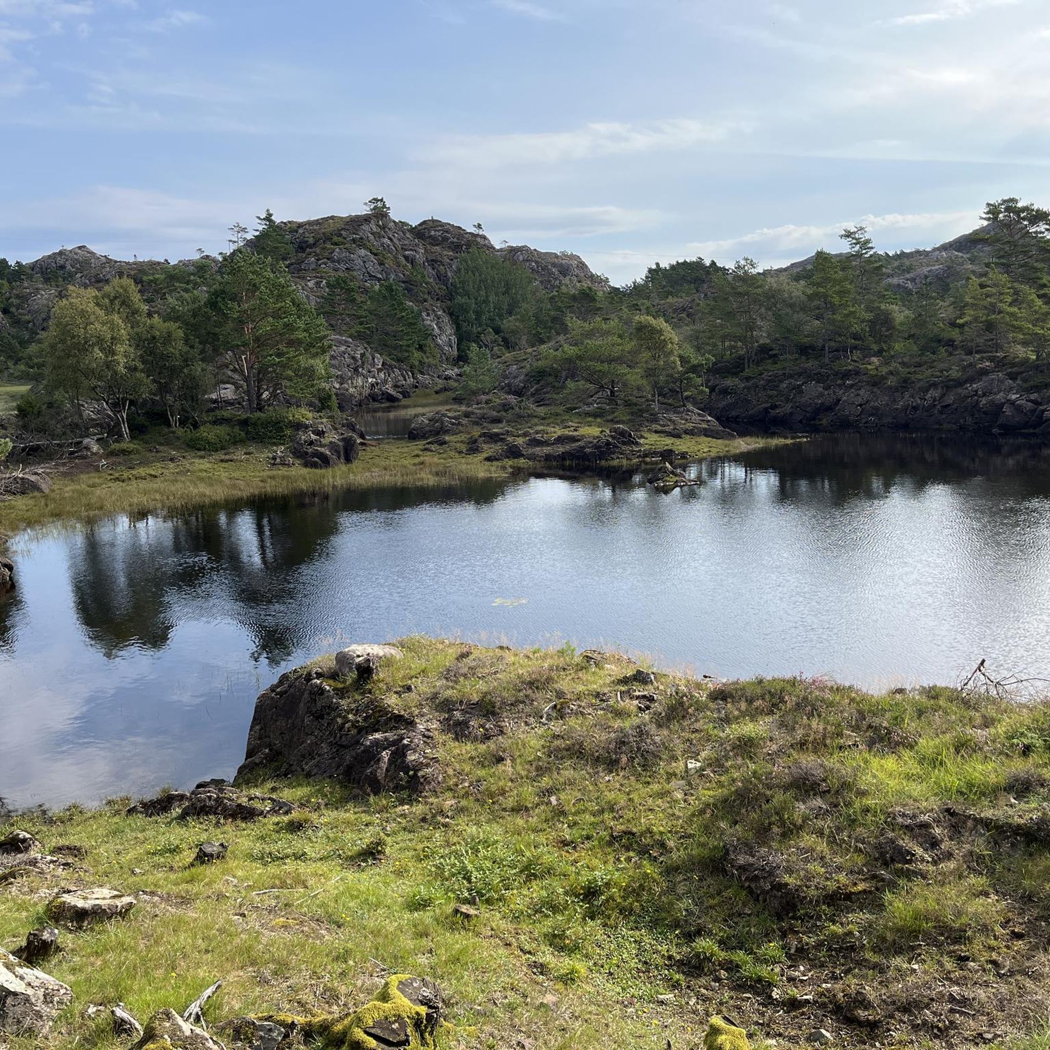
Road cycling in Sagvatnet Naturreservat offers routes through a rugged and diverse landscape. The area is characterized by a mosaic of forests, heather moors, and marshes, with numerous hills and knolls. Road cycling routes typically feature mostly well-paved surfaces, providing access to varied terrain that changes significantly over short distances. The reserve protects one of the largest pine forests in the outer Vestlandet region, supported by diverse bedrock.
Best road cycling routes in Sagvatnet Naturreservat
- The most popular road cycling route is Løvegapet – Old Road Pond loop from Fylkesneset, a 33.4 miles (53.8 km) trail that takes 2 hours 43 minutes to complete. This moderate route explores the area's varied inland and coastal features.
- Another top favourite among local road cyclists is Løvegapet loop from Bømlo kyrkje, a moderate 22.4 miles (36.0 km) path. This route offers a balanced ride through the natural surroundings.
- Local road cyclists also love the Scenic Road Along the Lake – Quiet Coastal Road loop from Svortland, a 32.5 miles (52.2 km) trail leading through scenic lake areas and quiet coastal roads, often completed in about 2 hours 26 minutes.
- Road cycling in Sagvatnet Naturreservat is defined by rugged terrain, diverse forests, and coastal views. The network offers options for moderate and difficult ability levels.
- The routes in Sagvatnet Naturreservat are highly rated by the komoot community with an average score of 3.0 stars from 1 review. More than 100 road cyclists have used komoot to explore Sagvatnet Naturreservat's varied terrain.
Last updated: July 12, 2026
8
riders
36.1km
01:44
480m
480m
Moderate road ride. Good fitness required. Mostly well-paved surfaces and easy to ride.
6
riders
59.4km
03:00
710m
710m
Moderate road ride. Good fitness required. Mostly well-paved surfaces and easy to ride.

Sign up for free
21
riders
Moderate road ride. Good fitness required. Mostly well-paved surfaces and easy to ride.
5
riders
39.5km
01:48
460m
460m
Moderate road ride. Good fitness required. Mostly well-paved surfaces and easy to ride.
3.0
(1)
6
riders
26.7km
01:19
370m
370m
Moderate road ride. Good fitness required. Mostly well-paved surfaces and easy to ride.
Get access to more routes and recommendations from other explorers.
Sign up for free
Already have an account?
Our route recommendations are based on thousands of hikes, rides, and runs completed by other people on komoot.
Start today with a free account
Your next adventure awaits.
Login or Signup
Popular around Sagvatnet Naturreservat
Tips from the Community

Runs every hour. Free for pedestrians and cyclists.
0
1

...over the bridge at 50 km/h
0
0

The ferry runs every hour on the hour when I drove.
0
0

appears to be a new ferry company: https://www.fjord1.no/eng/Routes-and-timetables/Vestland/Langevaag-Buavaag
2
0

Very quiet and well paved track with beautiful views!
0
0

The ferry will take you to the mainland Buavåg. It runs once an hour and the crossing takes about 20 minutes. The exact timetable is available at https://www.norled.no/en/maps-and-schedules/ferry/hordaland/.
3
0

After surprisingly many vertical meters of the hilly island, it goes back to the mainland. The ferry leaves every hour between 6 and 22 o'clock and takes about 20 minutes. You can find the timetable on www.norled.no
0
0
After surprisingly many vertical meters of the hilly island, it goes back to the mainland. The ferry leaves every hour between 6 and 22 o'clock and takes about 20 minutes. Timetable: https://www.norled.no/contentassets/8bd3dbc65f654da8a746d67b64763712/langevag-buavag.pdf
0
0
Frequently Asked Questions
What is the general difficulty level of road cycling routes in Sagvatnet Naturreservat?
The road cycling routes in Sagvatnet Naturreservat are generally classified as moderate, requiring good fitness due to the rugged and diverse terrain. While most surfaces are well-paved, the landscape features numerous hills and knolls, with significant elevation changes over short distances. There are 7 moderate routes and 2 difficult routes available.
Are there any challenging road cycling routes for experienced riders?
Yes, for experienced riders seeking a challenge, Sagvatnet Naturreservat offers 2 routes classified as difficult. These routes will provide a more demanding ride through the area's varied terrain, which includes forests, heather moors, and marshes with notable elevation gains.
What kind of landscapes and natural features can I expect to see while road cycling?
You will cycle through a diverse landscape characterized by a mosaic of forests, heather moors, and marshes. The reserve protects one of the largest pine forests in the outer Vestlandet region. The terrain is rugged with numerous hills and knolls, and you'll find varied plant communities supported by diverse bedrock. Many routes also offer scenic lake areas and quiet coastal roads.
Are there any notable viewpoints or scenic spots along the road cycling routes?
While specific viewpoints are not detailed for every route, the rugged topography and numerous hills, such as Børøyklampen (179 meters above sea level), suggest opportunities for panoramic views. Routes like the Scenic Road Along the Lake – Quiet Coastal Road loop from Svortland are designed to highlight the area's natural beauty, including lake areas and coastal vistas.
Can I spot any wildlife while cycling in Sagvatnet Naturreservat?
Yes, Sagvatnet Naturreservat is home to diverse wildlife. Cyclists might encounter otters, adders, slowworms, common lizards, and toads. The numerous small ponds and lakes within the reserve are also known to have trout. The mild climate supports a rich biodiversity, including various plant species and heat-loving insects like dragonflies.
Are there any loop routes available for road cycling?
Yes, many of the road cycling routes in Sagvatnet Naturreservat are designed as loops, offering a convenient way to explore the area without retracing your path. Examples include the Løvegapet – Old Road Pond loop from Fylkesneset and the Løvegapet loop from Bømlo kyrkje.
What is the best time of year to go road cycling in Sagvatnet Naturreservat?
The Bømlo region experiences mild winters and a warm climate, which contributes to its rich biodiversity. This suggests that spring, summer, and early autumn would be ideal for road cycling, offering pleasant temperatures and vibrant natural scenery. Always check local weather conditions before heading out.
Is there parking available near the road cycling routes?
While specific parking locations are not detailed, routes often start from towns or accessible points like Svortland or Fylkesneset, where public parking options are typically available. It is advisable to check local maps or community information for designated parking areas near your chosen starting point.
What do other road cyclists enjoy most about the routes in Sagvatnet Naturreservat?
The routes in Sagvatnet Naturreservat are highly rated by the komoot community, with an average score of 3.0 stars. Road cyclists often praise the varied terrain, which combines inland exploration with scenic lake areas and quiet coastal roads, providing a diverse and engaging ride through the natural surroundings.
Are there any cafes or places to stop for refreshments along the routes?
The region's routes often pass through or near local communities such as Svortland and Langevåg. These towns typically offer amenities like cafes or small shops where you can stop for refreshments. Planning your route with these potential stops in mind can enhance your cycling experience.
What are the rules regarding cycling within Sagvatnet Naturreservat?
Within Sagvatnet Naturreservat, cycling is generally permitted on existing roads. However, it is important to note that cycling is prohibited off existing roads within the nature reserve to protect the sensitive ecosystems. Please respect all signage and regulations to preserve the natural environment.
Most popular routes in Sagvatnet Naturreservat

Get inspired with the komoot mobile app


Explore more
Browse the best Road cycling routes in other regions.
