The best road cycling routes in Ålfotbreen Landskapsvernområde
5.0
(2)
48
riders
5
rides
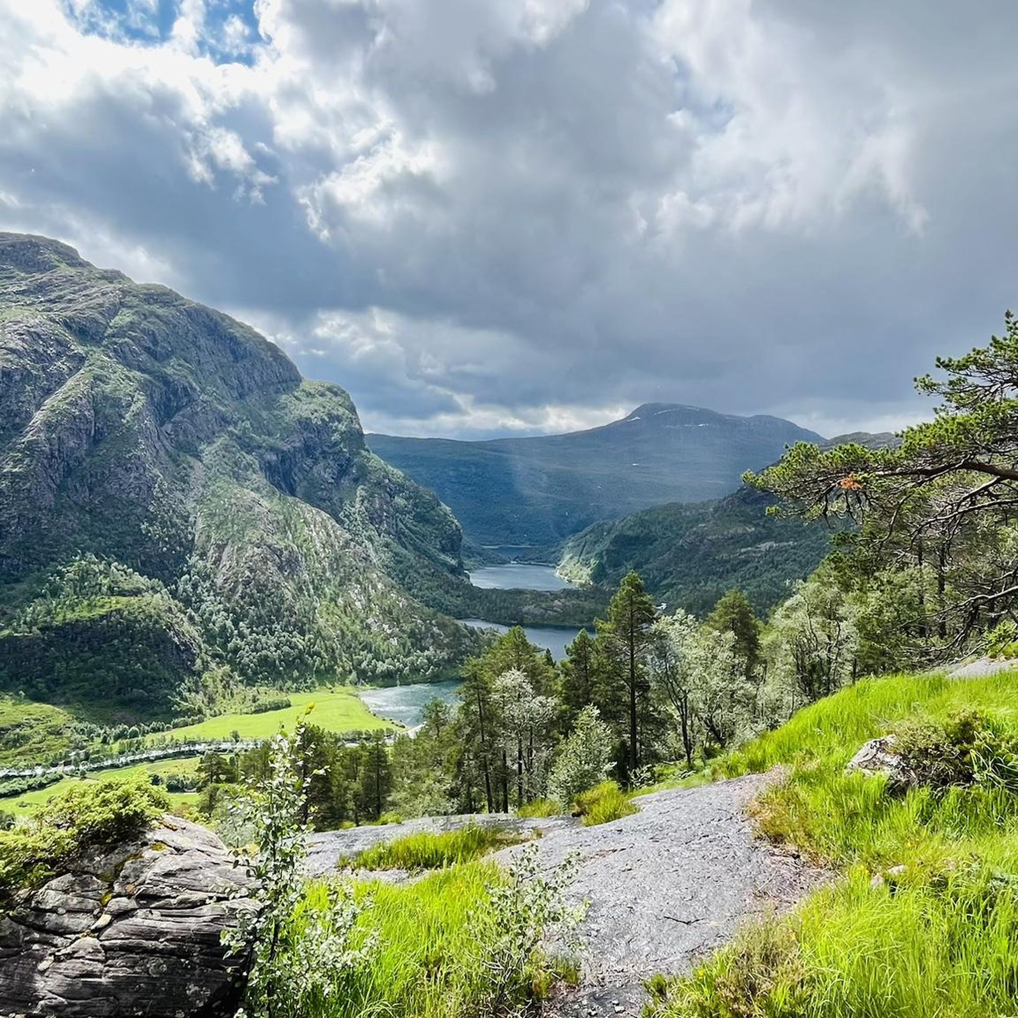
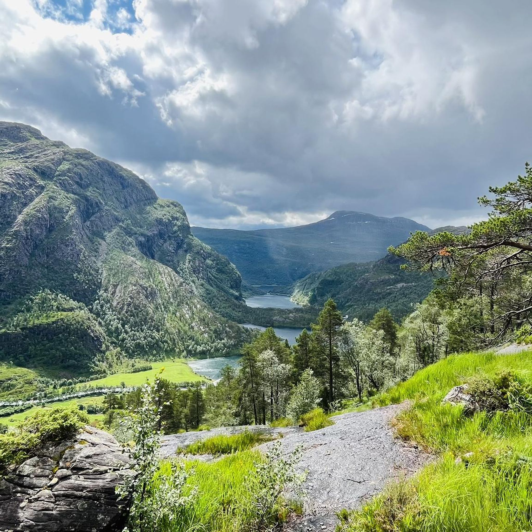
Road cycling in Ålfotbreen Landskapsvernområde offers routes through a landscape shaped by Norway's westernmost glaciers and unique Devonian rock formations. The terrain features "mountain ledges" and rugged geology, providing a distinctive backdrop for cycling. Roads often follow fjords and wind through valleys, presenting a mix of deep blue waters, green countryside, and dark mountains. The area's high precipitation contributes to numerous waterfalls and rivers, adding to the scenic diversity.
Best road cycling routes in Ålfotbreen Landskapsvernområde
- The most popular road…
Last updated: July 12, 2026
24
riders
42.5km
02:07
530m
530m
Moderate road ride. Good fitness required. Mostly well-paved surfaces and easy to ride.
5.0
(2)
11
riders
118km
05:52
1,690m
1,690m
Hard road ride. Very good fitness required. Mostly well-paved surfaces and easy to ride.

Sign up for free
5
riders
28.3km
01:18
270m
270m
Easy road ride. Great for any fitness level. Mostly well-paved surfaces and easy to ride.
4
riders
Moderate road ride. Good fitness required. Mostly well-paved surfaces and easy to ride.
4
riders
65.7km
03:16
810m
810m
Moderate road ride. Good fitness required. Mostly well-paved surfaces and easy to ride.
Our route recommendations are based on thousands of hikes, rides, and runs completed by other people on komoot.
Start today with a free account
Your next adventure awaits.
Login or Signup
Popular around Ålfotbreen Landskapsvernområde
Tips from the Community

Small weir for a walk, but not a major highlight…
0
0

Sagesætra is a charming traditional hamlet consisting of wooden huts. The streams that run through it enhance its natural landscape.
0
0
Bakkesætervatnet is one of a series of lakes fed by water flowing down from the summit of Skardhornet. The surrounding vegetation provides a peaceful setting for a stroll along its eastern shore.
0
0
Storesætervatnet is a beautiful lake. At its southern end, there is a superb view of the surrounding landscape.
0
0

Road biking, running, and walking on a quiet side road with decent asphalt. No sidewalk or bike path!
0
0

Beautiful view of the lake from the perfectly paved road. Enjoy the serenity and the view.
0
0

Take a break here to enjoy the view of this high waterfall.
0
0

Loen Skylift - enjoy the magnificent view of the Nordfjord with the cable car. The Loen Skylift was opened by Queen Sonja herself on May 20, 2017. The steepest cable car in the world takes you to a height of 1000 m in just seven minutes. The cable car has two gondolas with the sonorous names Hugin and Munin. These alternate and carry around 35 people. The end station of the lift is on the Hoven mountain, which rises steeply above the Nordfjord.
1
0
Frequently Asked Questions
How many road cycling routes are available in Ålfotbreen Landskapsvernområde?
There are 6 road cycling routes in Ålfotbreen Landskapsvernområde, offering a range of experiences from easy rides to more challenging tours. These routes allow you to explore the region's unique landscapes.
Are there road cycling routes suitable for beginners in Ålfotbreen Landskapsvernområde?
Yes, there is one easy route perfect for beginners or those seeking a relaxed ride. The Norsvegen – Nordfjordeid Harbor loop from Prestemarka is a 9.9-mile (16.0 km) trail that takes you through coastal areas and local roads, typically completed in under an hour.
What kind of challenging road cycling routes can I find in the area?
For experienced cyclists looking for a challenge, Ålfotbreen Landskapsvernområde offers two difficult routes. One notable option is the View of Lake Loen – Loen Skylift Base Station loop from Eid kyrkje, a substantial 73.5-mile (118.3 km) ride with significant elevation gain, providing extensive views of the fjords and mountainous terrain.
What is the best time of year for road cycling in Ålfotbreen Landskapsvernområde?
The best time for road cycling is typically during the warmer months, from late spring to early autumn. This period offers more stable weather conditions and less precipitation, allowing you to fully enjoy the scenic routes and glacial meltwater features.
Are there any loop road cycling routes in Ålfotbreen Landskapsvernområde?
All the road cycling routes in Ålfotbreen Landskapsvernområde are designed as loops, offering convenient starting and ending points. For example, the Nordfjordeid Harbor – View of Nordfjorden loop from Haugen is a moderate 25.1-mile (40.4 km) loop with scenic views along Nordfjorden.
What scenic viewpoints or natural attractions can I expect along the road cycling routes?
The region is rich in natural beauty. You'll encounter dramatic fjords, ancient Devonian rock formations with their distinctive 'mountain ledges,' and views of Norway's westernmost glaciers. The high precipitation also means numerous waterfalls and rivers add to the dynamic scenery along the routes.
Are there any family-friendly road cycling options in Ålfotbreen Landskapsvernområde?
While some routes are challenging, the area also offers easier sections suitable for families. The lowlands and fjord-side roads provide a mix of flat and undulating terrain. Consider the Norsvegen – Nordfjordeid Harbor loop from Prestemarka for a shorter, less demanding ride.
Where can I find places to eat or stay near the cycling routes?
The towns of Ålfoten and Hyen, as well as the broader Nordfjordeid area, offer various amenities. You can find cafes, pubs, grocery stores, and accommodation options to support your cycling trip. Nordfjordeid also features cultural attractions like the Sagastad Viking Museum.
Can I rent bicycles in the Ålfotbreen region?
Yes, local organizations like Nordfjord Aktiv provide services for visitors, including guided tours and equipment rentals. This often includes bicycles and electric bikes, making it easier to explore the area even if you don't bring your own.
What are the road conditions like on Fv614 and Fv615 for cycling?
The primary access roads, Fv614 and Fv615, traverse the area and its approaches. While specific traffic levels are not detailed, Norway's national cycle routes often utilize low-traffic roads, enhancing safety and enjoyment for cyclists. Expect varied terrain, from flat sections along fjords to undulating climbs.
Are there any cultural points of interest accessible by road bike?
Yes, the surrounding area offers cultural points of interest. Nordfjordeid, for instance, boasts the Sagastad Viking Museum and a well-preserved town center. These can be integrated into your cycling trip, providing a blend of natural beauty and cultural exploration.
What makes the geology of Ålfotbreen Landskapsvernområde unique for cyclists?
The region is known for its globally unique Devonian rock formations, characterized by 'mountain ledges' that create a distinctive and rugged terrain. Cycling through this ancient geology provides spectacular visual interest, with colorful conglomerates and sandstone formations visible along the routes.
Most popular routes in Ålfotbreen Landskapsvernområde

Get inspired with the komoot mobile app


Explore more
Browse the best Road cycling routes in other regions.
