The best walks and hikes in Dryander National Park
4.6
(112)
865
hikers
9
hikes
Hiking in Dryander National Park offers exploration across a landscape defined by mountainous terrain, including Mount Dryander which rises to 790 meters. The park features bulky hills, steep ridges, and granite formations, remnants of ancient volcanic activity. It also encompasses approximately 34 miles (55 km) of pristine coastline, with headlands and critical watersheds feeding into nearby reefs. Lush forests, vine thickets, and old-growth areas contribute to the park's rich biodiversity.
Best hiking trails in Dryander National Park
- The most popular hiking route is Airlie Beach Boardwalk – Airlie Beach Lagoon loop from Airlie Beach, a 4.2 miles (6.8 km) trail that takes 1 hour 46 minutes to complete. This easy route offers views of the coastal area.
- Another top favourite among local hikers is Port of Airlie Marina – Airlie Beach Boardwalk loop from Airlie Beach, an easy 2.8 miles (4.4 km) path. This trail provides a pleasant walk along the marina and boardwalk.
- Local hikers also love the Masked Lapwing – Nomads loop from Airlie Beach, a 2.6 miles (4.2 km) trail leading through urban coastal areas, often completed in about 1 hour 8 minutes.
- Hiking in Dryander National Park is defined by mountainous terrain, lush forests, and coastal paths. The network offers options for various ability levels, including easy and moderate routes.
- The routes in Dryander National Park are highly rated by the komoot community with an average score of 4.5 stars from over 90 reviews. More than 900 hikers have used komoot to explore Dryander National Park's varied terrain.
Last updated: July 10, 2026
4.6
(83)
508
hikers
8.85km
02:54
410m
410m
Moderate hike. Good fitness required. Easily-accessible paths. Suitable for all skill levels.
4.9
(18)
150
hikers
7.44km
01:55
40m
40m
Easy hike. Great for any fitness level. Easily-accessible paths. Suitable for all skill levels.

Sign up for free
4.0
(2)
32
hikers
3.46km
00:54
20m
20m
Easy hike. Great for any fitness level. Easily-accessible paths. Suitable for all skill levels.
5.0
(1)
14
hikers
9.37km
02:27
70m
70m
Moderate hike. Good fitness required. Easily-accessible paths. Suitable for all skill levels.
10
hikers
2.25km
00:35
20m
20m
Easy hike. Great for any fitness level. Easily-accessible paths. Suitable for all skill levels.
Get access to more routes and recommendations from other explorers.
Sign up for free
Already have an account?
Our route recommendations are based on thousands of hikes, rides, and runs completed by other people on komoot.
Start today with a free account
Your next adventure awaits.
Login or Signup
Popular around Dryander National Park
Tips from the Community

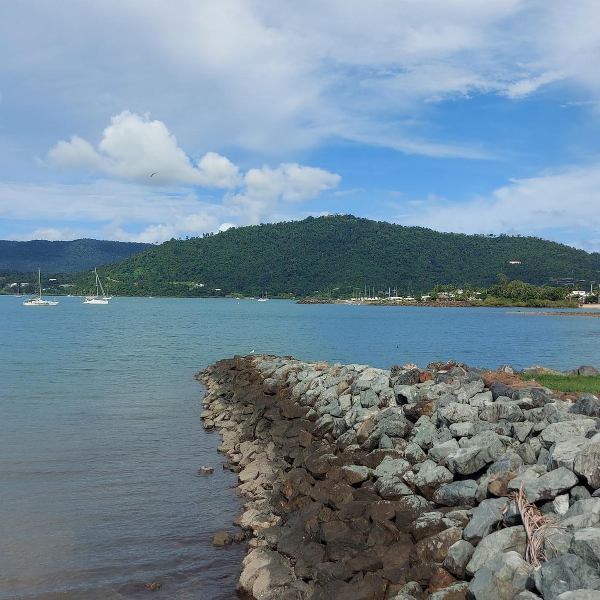
Port of Airlie Marina is a major waterfront transportation hub, serving as a main departure point for ferries and providing easy boating access to the Whitsunday Islands. The marina includes berths, a ferry terminal, and a variety of shops and small cafés, all with stunning views of the Coral Sea. Connected to the town centre and adjacent to scenic walkways, this transportation gateway is a charming spot to visit while exploring the beautiful coastline.
0
0
Bicentennial Walkway is a fantastic multi-use pathway connecting Airlie Beach and Cannonvale, running right along the Coral Sea shoreline. The sealed route passes beaches, parks, and rocky headlands, with continuous ocean views and easy access points along the way. It’s an easy, flat, and well-maintained path, ideal for walking and cycling while exploring this beautiful coastline.
0
0
Airlie Beach Lagoon is a large, artificial swimming facility nestled along the Coral Sea foreshore in the heart of Airlie Beach. There are beautifully landscaped lawns, shaded areas, and shallow entry spots, providing a safe, stinger-free place to swim year-round. Adjacent to the town centre and coastal walkway, it’s an accessible and picturesque spot to relax while exploring the Whitsundays gateway.
0
0

Honeyeater Lookout looks out over Pioneer Bay, with wide views framed by the Whitsunday Islands, along with the bays and peninsulas of Dryander National Park and Mount Rooper. It’s a it's a fantastic spot to take in the scale of the coastline. If you’re here when coastal banksia is in flower, keep an eye out for honeyeaters feeding on the nectar. The lookout is open year round, though access can be closed at times due to weather or park management.
0
0
Stretching behind Airlie Beach, this coastal national park protects one of the largest areas of lowland tropical rainforest in the region. Tracks wind through dense vegetation, ridgelines, and lookout points with views over the Whitsunday Passage. The terrain varies from shaded forest paths to steeper sections with elevation gain. Conditions can be humid, with sections becoming slippery after rain, especially on dirt tracks and steps.
0
0
Located in Conway National Park, this short track leads through dense coastal rainforest to Honeyeater Lookout. The track is well-defined, with a mix of compacted dirt and steps as it climbs gently through shaded forest. Along the way, you’ll pass through thick vegetation with ferns and tall trees, with birdlife often active in the canopy. The lookout at the end opens up to views across the Whitsundays coastline.
0
0

The town of Airlie Beach is the capital of the Whitsundays. Numerous tours to the islands, the famous Whitehaven Beach and the Great Barrier Reef depart from here. Airlie Beach is also the ideal starting point for a sailing tour lasting several days.
1
0

Very worth seeing, you have to see it
0
1
Frequently Asked Questions
What kind of terrain can I expect when hiking in Dryander National Park?
Dryander National Park features a diverse and often rugged landscape. You'll encounter large mountainous terrain, including Mount Dryander which rises to 790 meters, with bulky hills, steep ridges, and granite formations. The park also boasts approximately 55 kilometers of pristine coastline, lush forests, and vine thickets. While some trails offer coastal views, others delve into dense old-growth forests.
Are there hiking trails for all skill levels in Dryander National Park?
Yes, the park offers a range of options. According to komoot data, there are 12 hiking routes available, with 8 rated as easy and 4 as moderate. While there are no routes explicitly classified as 'difficult' in our current selection, the mountainous terrain and remote nature of the park can present a challenge for some hikers.
How do I access Dryander National Park, and is there vehicle access?
Access to Dryander National Park is primarily by boat, as there is no vehicle access into the park itself. This contributes to its secluded nature and enhances the remote outdoor experience. For more detailed information on access, you can refer to the official park website: parks.qld.gov.au.
Are there any family-friendly hiking options in Dryander National Park?
While the park is known for its rugged and remote character, some of the easier routes near the periphery can be suitable for families. For example, the Airlie Beach Boardwalk – Airlie Beach Lagoon loop from Airlie Beach is an easy 6.8 km trail offering coastal views, which could be a pleasant option for a family outing.
Can I bring my dog on hikes in Dryander National Park?
No, domestic animals, including dogs, are generally not permitted in Queensland national parks to protect the native wildlife and natural environment. It's always best to check the official park regulations for the most current information before planning your visit: parks.qld.gov.au.
What are some notable natural features or viewpoints in Dryander National Park?
The park is rich in natural beauty. Mount Dryander, at 790 meters, offers spectacular panoramic views of the surrounding seascape. The deeply incised coastline features six headlands and sheltered seagrass beds. You can also explore lush forests, including vine thickets and old-growth areas, which are home to the rare and endemic rainforest tree Ristantia waterhousei.
Is camping allowed in Dryander National Park?
Yes, camping is permitted at Grimston Point within Dryander National Park. Basic facilities are provided at this location, catering to those seeking an overnight adventure in the remote coastal environment. For booking and specific details, it's advisable to consult the official Queensland Parks and Wildlife Service website.
What kind of wildlife can I expect to see in Dryander National Park?
Dryander National Park is a vital habitat for a variety of species. On land, you might spot endangered and vulnerable animals such as the Proserpine rock-wallaby, ghost bats, coastal sheath-tail bats, and the rare water mouse. The coastal areas and seagrass beds are crucial habitats for significant marine animals like dugongs, humpback whales, and marine turtles.
Are there any circular hiking routes in Dryander National Park?
Yes, several routes in the area are designed as loops. For instance, the Port of Airlie Marina – Airlie Beach Boardwalk loop from Airlie Beach is an easy 4.4 km path that provides a pleasant circular walk. Another option is the Masked Lapwing – Nomads loop from Airlie Beach, a 4.2 km trail through urban coastal areas.
What do other hikers enjoy the most about hiking in Dryander National Park?
The area is highly rated by the komoot community, with an average score of 4.5 stars from over 90 reviews. Hikers often praise the stunning coastal views, the immersive experience of the remote mountainous terrain, and the opportunity to connect with nature in an undisturbed environment. The variety of trails, from easy boardwalks to more challenging ascents, is also frequently appreciated.
What is the best time to visit Dryander National Park for hiking?
The park's tropical climate means it's generally warm year-round. However, the dry season (typically May to October) offers more comfortable hiking conditions with less humidity and lower chances of rain, making it ideal for exploring the rugged landscapes and coastal paths. During the wet season (November to April), trails can be muddy, and some areas might be inaccessible due to heavy rainfall.
Are there any moderate difficulty hikes in the park?
Yes, there are moderate difficulty hikes available. For example, the Nomads – View from the Honeyeater Lookout loop from Airlie Beach is a moderate 9 km route with significant elevation gain, offering a more challenging experience and rewarding views.

Get inspired with the komoot mobile app


Explore more
Browse the best Hikes in other regions.
