The best road cycling routes in Kings Park Botanic Gardens
4.5
(153)
8,593
riders
128
rides
Road cycling in Kings Park Botanic Gardens offers routes through one of the world's largest inner-city parks, covering 400 hectares. The landscape features a blend of manicured gardens and protected bushland, with roads and designated paths accommodating cyclists. Routes provide views of the Swan and Canning Rivers, the Perth city skyline, and the distant Darling Ranges. The park's terrain includes both well-paved, easy sections and more challenging routes with significant elevation gain.
Best road cycling routes in Kings Park Botanic Gardens
- The most popular road cycling route is Zig Zag Scenic Drive – Perth Water Bike Trail loop from West Leederville, a 65.6 miles (105.5 km) trail that takes 5 hours 5 minutes to complete. This difficult route features significant elevation gain and panoramic views of the city and rivers.
- Another top favourite among local road cyclists is Perth Water Bike Trail – Mt Henry Bridge loop from City West, an easy 25.7 miles (41.4 km) path. This route offers views of the Perth Water and includes crossings over notable bridges.
- Local road cyclists also love the Canning Bridge – Perth Water Bike Trail loop from City of Nedlands, a 14.3 miles (23.1 km) trail leading through riverfront areas, often completed in about 56 minutes.
- Road cycling in Kings Park Botanic Gardens is defined by expansive landscapes, manicured gardens, and protected bushland, with routes offering views of the Swan and Canning Rivers and the Perth city skyline. The network offers options for different ability levels, from easy rides to more challenging climbs.
- The routes in Kings Park Botanic Gardens are highly rated by the komoot community with an average score of 4.5 stars from more than 180 reviews. More than 9,000 road cyclists have used komoot to explore Kings Park Botanic Gardens's varied terrain.
Last updated: July 5, 2026
4.5
(4)
739
riders
53.7km
02:31
270m
270m
Moderate road ride. Good fitness required. Mostly well-paved surfaces and easy to ride.
5.0
(1)
274
riders
106km
05:04
990m
990m
Hard road ride. Very good fitness required. Mostly well-paved surfaces and easy to ride.

Sign up for free
4.8
(9)
230
riders
Easy road ride. Great for any fitness level. Mostly well-paved surfaces and easy to ride.
5.0
(7)
233
riders
26.9km
01:12
130m
130m
Easy road ride. Great for any fitness level. Mostly well-paved surfaces and easy to ride.
4.0
(1)
207
riders
42.1km
01:49
130m
130m
Easy road ride. Great for any fitness level. Mostly well-paved surfaces and easy to ride.
Get access to more routes and recommendations from other explorers.
Sign up for free
Already have an account?
Our route recommendations are based on thousands of hikes, rides, and runs completed by other people on komoot.
Start today with a free account
Your next adventure awaits.
Login or Signup
Popular around Kings Park Botanic Gardens
Tips from the Community

Mount Henry Bridge Reserve sits directly in the shadow of the historic Mount Henry Bridge. It's a popular riverside stop for families, fitness enthusiasts, and walkers with public toilets, manicured grassy picnic fields, park benches, and a large car park. The kids' playgrounds here are a stand-out amenity, with modern design including shade sails. For adults, there's free fitness equipment, the Mount Henry Jetty and the Kerbside Café.
0
0

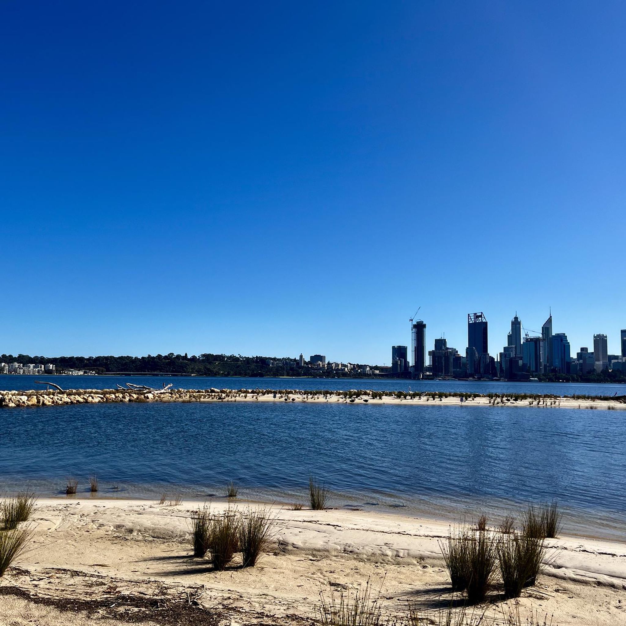
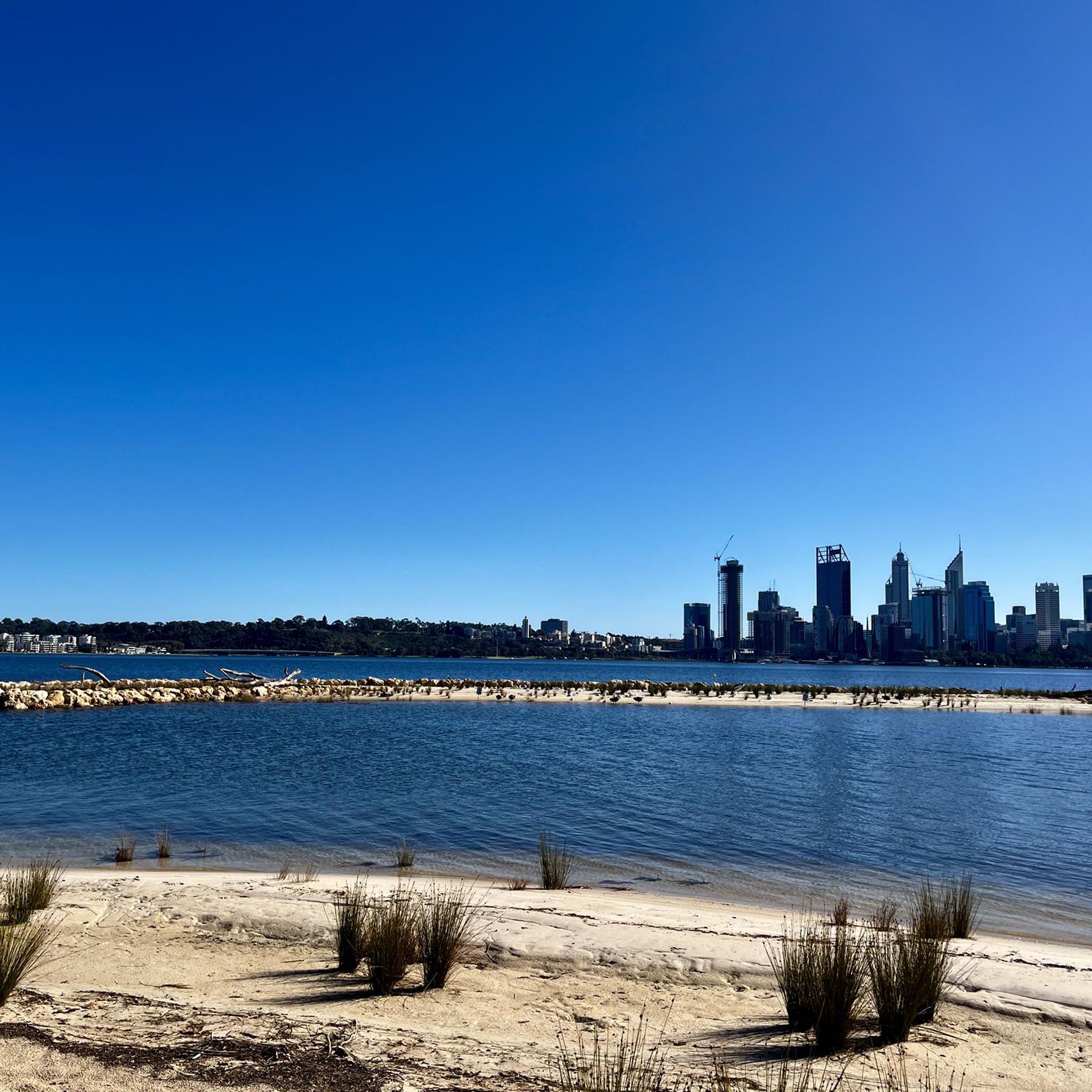
The waterfront path does a little loop at the 'Fragment' sculpture, created by artist Kevin Draper. You can see downtown Perth across the water, and it's possible to follow the trail from here to walk or cycle basically the entire visible coast of the Swan River.
0
0

The Bibbulmun Track northern terminus marks the official beginning of one of Australia’s great long-distance walks, stretching about one thousand kilometres from Kalamunda to Albany on Western Australia’s south coast. The trail is named after the Bibbulmun people of the Noongar Nation, and walkers are guided by the famous yellow Waugal trail markers representing the Rainbow Serpent from Noongar culture. Information boards, track maps, and nearby bushland trails make this a popular starting point for both day walkers and long-distance hikers.
0
0
Kwinana Freeway PSP is a principal shared path running for over 20 kilometres alongside the freeway, designed mainly for cycling and commuting. It’s fully sealed, mostly flat, and direct. However, around the Swan River section, it feels less like a typical commuter route, with open views across the water and towards the city skyline on the western side.
0
0
Matagarup Bridge spans the Swan River in Perth, linking East Perth with Optus Stadium and the Burswood Peninsula. Known for its curved, cable-supported arches, it’s a pedestrian and cycling bridge with wide paths and open views along the river. From the bridge, you can look out towards the city skyline and surrounding foreshore. It’s also used for a guided bridge climb experience.
0
0

Canning Bridge is a major road bridge that carries Canning Highway across the Canning River between the suburbs of Applecross and Como. Originally built in the 1930s, this key bridge has been rebuilt several times over the years. Under the bridge, various walking and cycling paths wind along the river, connecting several of the surrounding foreshore parklands and offering plenty of options for exploring this beautiful area.
0
0
Mount Henry Bridge is a major road bridge that crosses the Canning River as part of Kwinana Freeway. Opened in 1986, the bridge was one of the longest incrementally launched bridges in the world at the time of its construction. Shared walking and cycling paths run along the river under and adjacent to the bridge, connecting several sections of the Canning River foreshore trails.
0
0
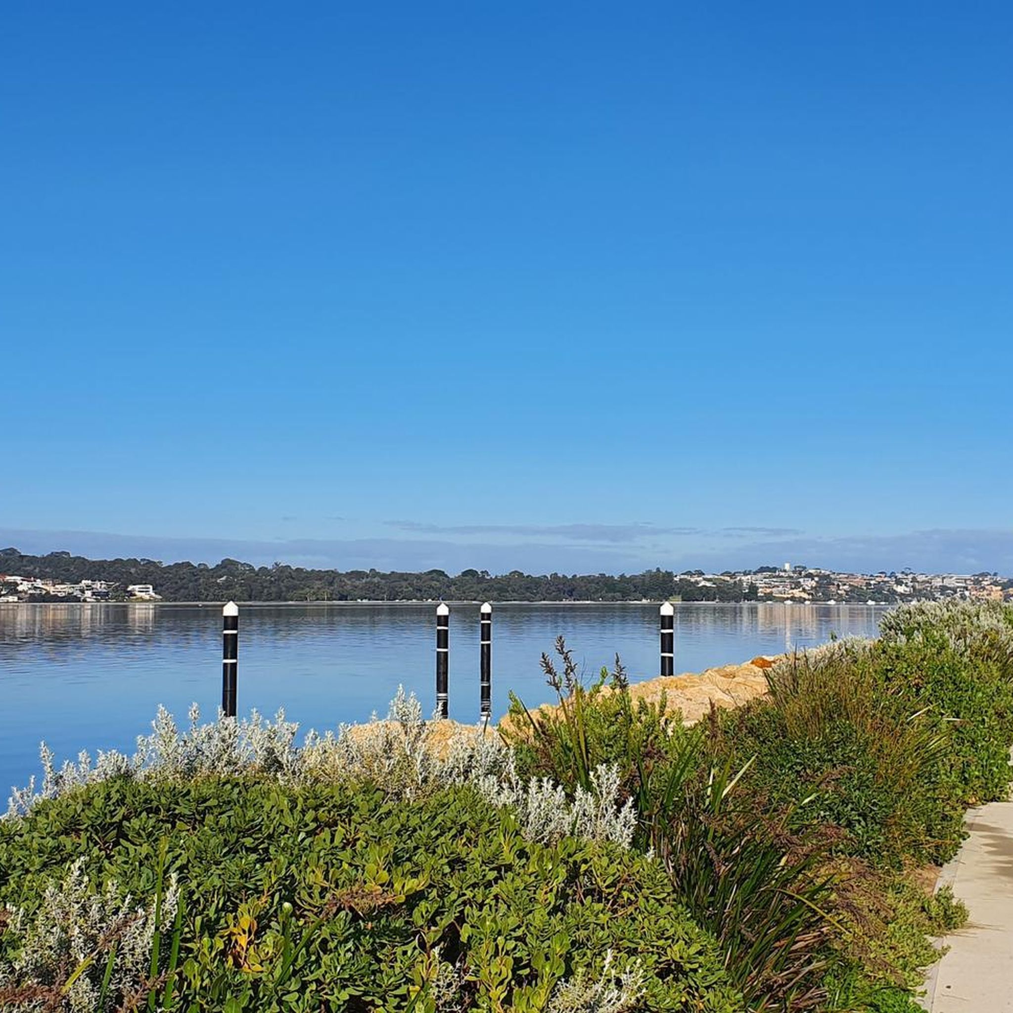
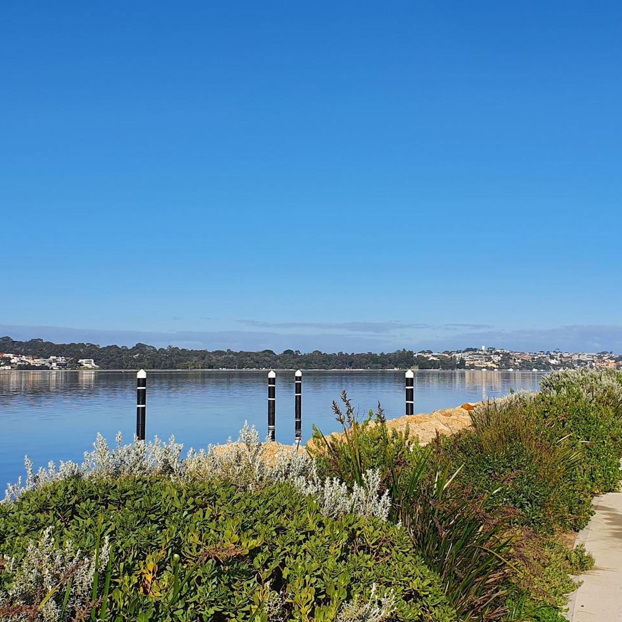
The Esplanade is a riverside road and shared path that runs along the Canning River foreshore in the suburb of Mount Pleasant. The route follows a flat stretch of riverfront with beautiful views across the water and provides access to nearby parks and residential areas. It forms part of the walking and cycling route used in loops around this section of the Canning River, and is a fantastic place to see the sunset if you're lucky enough to be here in the evening.
0
0
Frequently Asked Questions
What types of road cycling routes can I find in Kings Park Botanic Gardens?
Kings Park Botanic Gardens offers a diverse range of road cycling routes, from easy, well-paved paths to more challenging routes with significant elevation gain. The park covers 400 hectares, providing options for various fitness levels and preferences. You'll find routes that traverse manicured gardens, protected bushland, and offer panoramic views of the Swan and Canning Rivers, the Perth city skyline, and the distant Darling Ranges.
How many road cycling routes are available in Kings Park Botanic Gardens?
There are over 140 road cycling routes available in Kings Park Botanic Gardens. This includes a good mix of difficulties, with more than 60 easy routes, around 60 moderate routes, and 15 more challenging options for experienced cyclists.
Are there any easy road cycling routes suitable for beginners or a relaxed ride?
Yes, Kings Park Botanic Gardens has numerous easy road cycling routes. An excellent option is the Perth Water Bike Trail – Mt Henry Bridge loop from City West, an easy 41.4 km path offering scenic views of Perth Water. Another easy choice is the Canning Bridge – Perth Water Bike Trail loop from City of Nedlands, which is 23.1 km and leads through pleasant riverfront areas. For a shorter ride, consider the MSB – Stone Drinking Fountain loop from West Leederville, an easy 12.6 km route.
Where can I find challenging road cycling routes with significant elevation gain?
For a more challenging experience, consider routes like the Matagarup Bridge – Elizabeth Quay Bridge loop from Elizabeth Quay. This difficult route spans over 107 km and features substantial elevation changes, offering a rigorous workout and expansive views.
What natural features and landmarks can I see along the road cycling routes?
Road cycling routes in Kings Park Botanic Gardens offer stunning views of the Swan and Canning Rivers, the Perth city skyline, and the distant Darling Ranges. You can also pass by significant landmarks such as the Western Australian Botanic Garden, which showcases over 3,000 species of the state's unique flora. Other notable sights include the State War Memorial and the DNA Tower, which provides elevated views.
Are there any restrictions on where I can cycle within Kings Park Botanic Gardens?
While cycling is generally permitted on all roads and designated pedestrian and cycle paths, there are specific areas where riding is restricted. These include the Western Australian Botanic Garden, the Fraser Avenue Precinct, May Drive Parkland, and the Saw Avenue Picnic Area. Always observe signage to ensure you are cycling in permitted zones.
What do other road cyclists say about their experience in Kings Park Botanic Gardens?
The road cycling experience in Kings Park Botanic Gardens is highly rated by the komoot community, with an average score of 4.5 stars from over 180 reviews. Cyclists frequently praise the park's expansive landscapes, the blend of manicured gardens and natural bushland, and the stunning panoramic views of the city and rivers.
Is Kings Park Botanic Gardens suitable for family-friendly road cycling?
Yes, Kings Park Botanic Gardens is very family-friendly. Beyond the cycling paths, the park offers facilities like the Rio Tinto Naturescape Kings Park, which provides a natural space for children to connect with the environment, as well as various picnic and play areas. Many of the easy, well-paved routes are suitable for families to enjoy together.
Where can I find maps or more information about cycling in Kings Park?
For detailed maps and additional information regarding cycling paths and restrictions within Kings Park, you can refer to the official resources provided by the Botanic Gardens and Parks Authority. A comprehensive cycling paths map is available at bgpa.wa.gov.au. Further general information about Kings Park and Botanic Garden can be found at dbca.wa.gov.au.
Are there options for bike hire in Kings Park Botanic Gardens?
Yes, Kings Park Botanic Gardens enhances its appeal for cyclists by offering automated cycle hire services. Additionally, conveniently located bike racks are available throughout the park, making it easy to bring your own bicycle.
What is the best time of year to go road cycling in Kings Park Botanic Gardens?
While Kings Park Botanic Gardens is enjoyable year-round, the cooler months from autumn to spring (March to November) generally offer the most comfortable conditions for road cycling, avoiding the peak heat of summer. The park's diverse flora also presents beautiful seasonal displays, particularly during spring when wildflowers are in bloom.
Most popular routes in Kings Park Botanic Gardens
Most popular attractions in Kings Park Botanic Gardens

Get inspired with the komoot mobile app


Explore more
Browse the best Road cycling routes in other regions.
